During this year I shall be posting photographs from places around the UK, many of which have not been published before. Where I have previously blogged about a location I will provide a link to the post, though you won’t be able to comment on it as I restrict comments to six months.
O is for Orford / Orford Ness
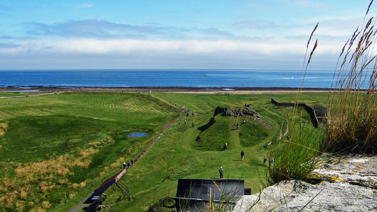
Orford Ness shingle spit
Orford Ness is a shingle spit linked to the mainland at Aldeburgh, stretching along the coast to Orford and divided from the mainland by the River Alde. It is ranked among the most important shingle features in the world, this National Nature Reserve sees rare and fragile wildlife thrive where weapons, including atomic bombs, were tested and perfected.
To reach the shingle spit you need to take a National Trust ferry ‘Octavia’ and once there you can follow trails through a stunning landscape and ex-military testing areas, buildings and displays.
Orford itself is one of the prettiest villages on the Suffolk Coast with a castle, pretty cottages and welcoming pubs to the picturesque quay offering river cruises.
During this year I shall be posting photographs from places around the UK, many of which have not been published before. Where I have previously blogged about a location I will provide a link to the post, though you won’t be able to comment on it as I restrict comments to six months.
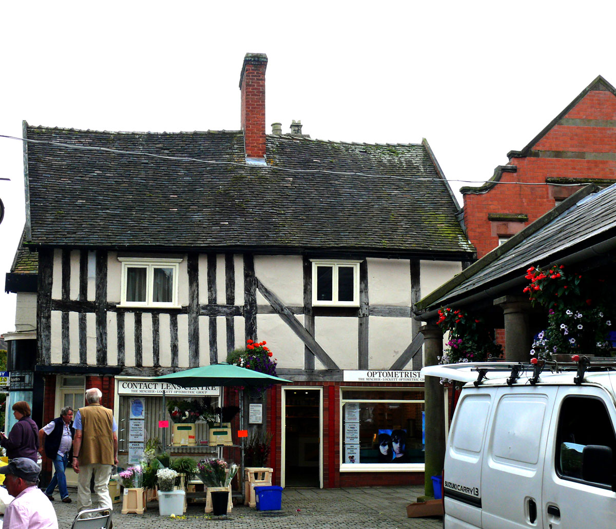
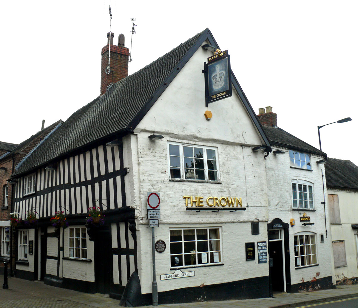
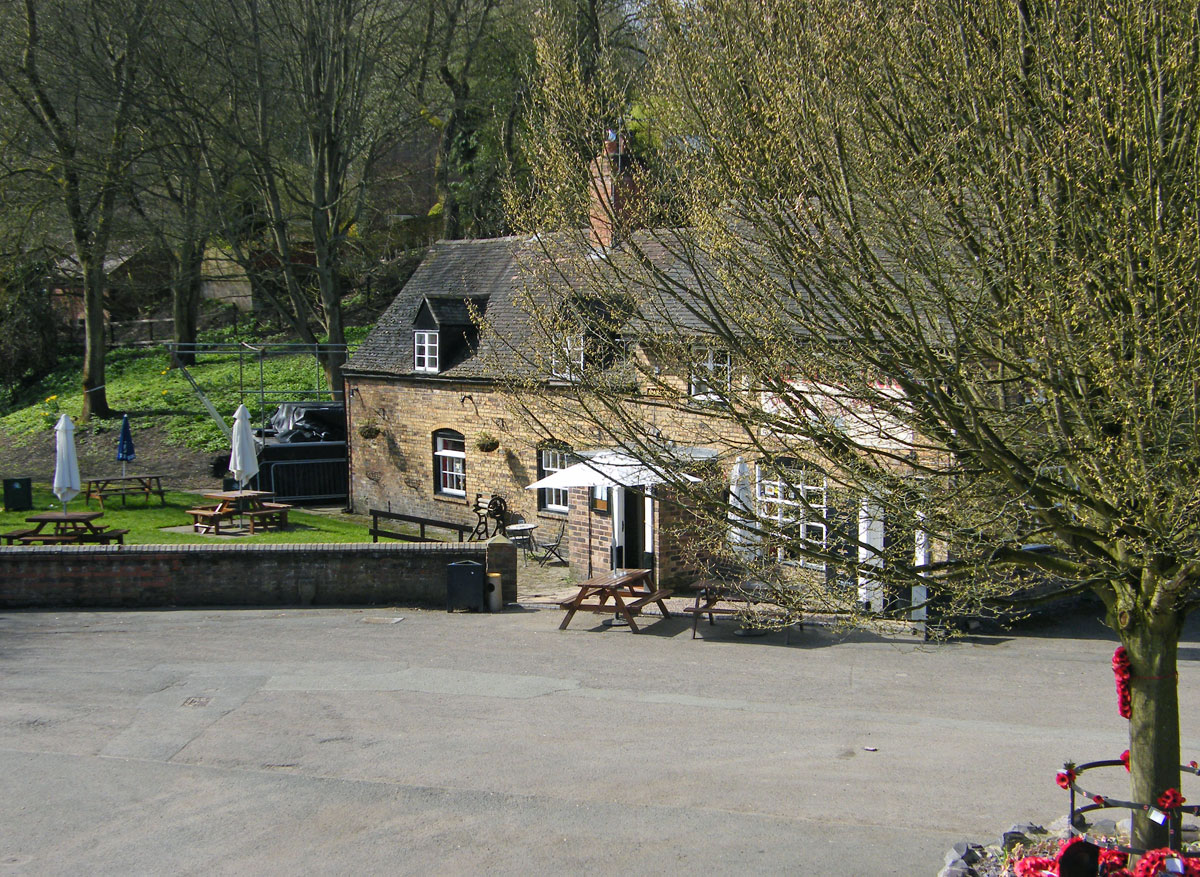
M is for Market Drayton
Market Drayton is a market town in the north of Shropshire, England, close to the Cheshire and Staffordshire borders. It lies on the River Tern. Home to Müller Dairy which produces yoghurts here and a microbrewery. It is also known for its gingerbread, which was first recorded in 1793. Today, the only surviving brand still being made in the town is Billington’s Gingerbread. There is even an annual Ginger and Spice festival.
Buttercross Market
There are a number of listed buildings in the town including several timber-framed, 17th century shops and pubs around the town centre, plus Georgian and Victorian buildings. The streets converge on The Buttercross market shelter and on Wednesdays are filled with market stalls.
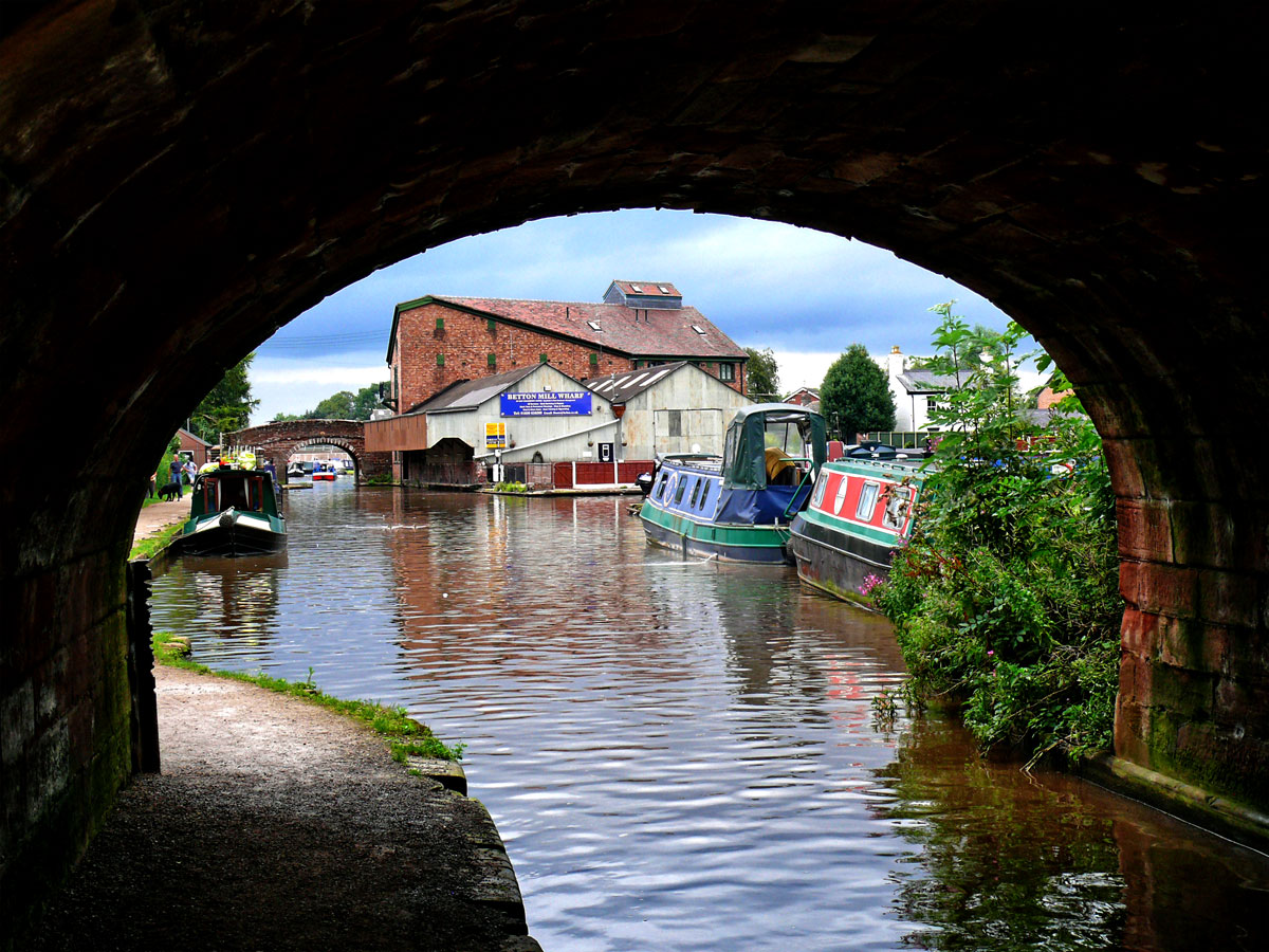
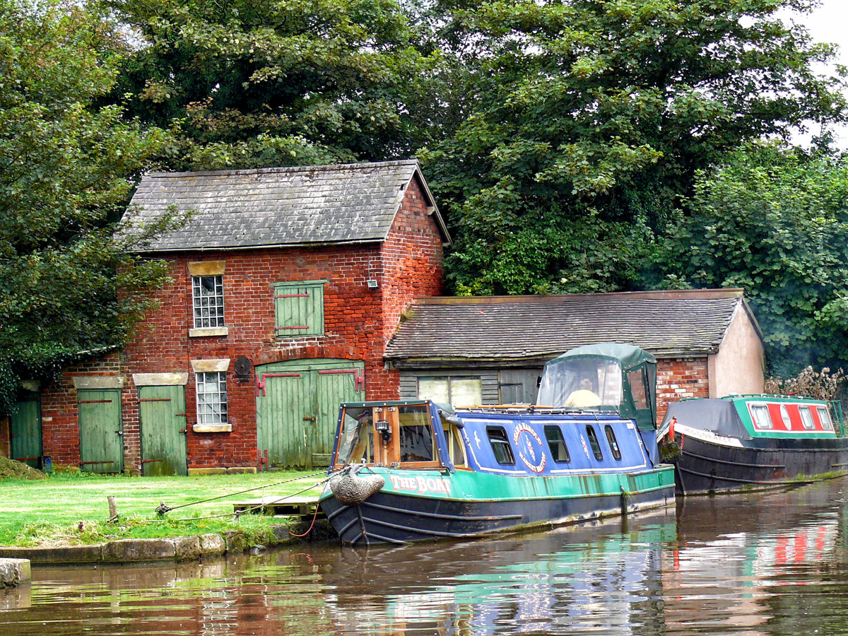
The town sits by the Shropshire Union canal about a mile from Tyrley Locks where a flight of five locks make this one of the most interesting sections of the canal.
(Bridge No 62) View of Betton Mill, now converted into apartments and Betton Bridge (No 63) straight ahead.Shropshire Union Canal at Market Drayton.Shropshire Union Canal at Market Drayton.
During this year I shall be posting photographs from places around the UK, many of which have not been published before. Where I have previously blogged about a location I will provide a link to the post, though you won’t be able to comment on it as I restrict comments to six months.
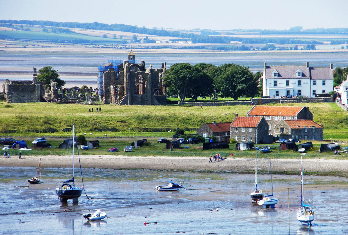
L is for Lindisfarne
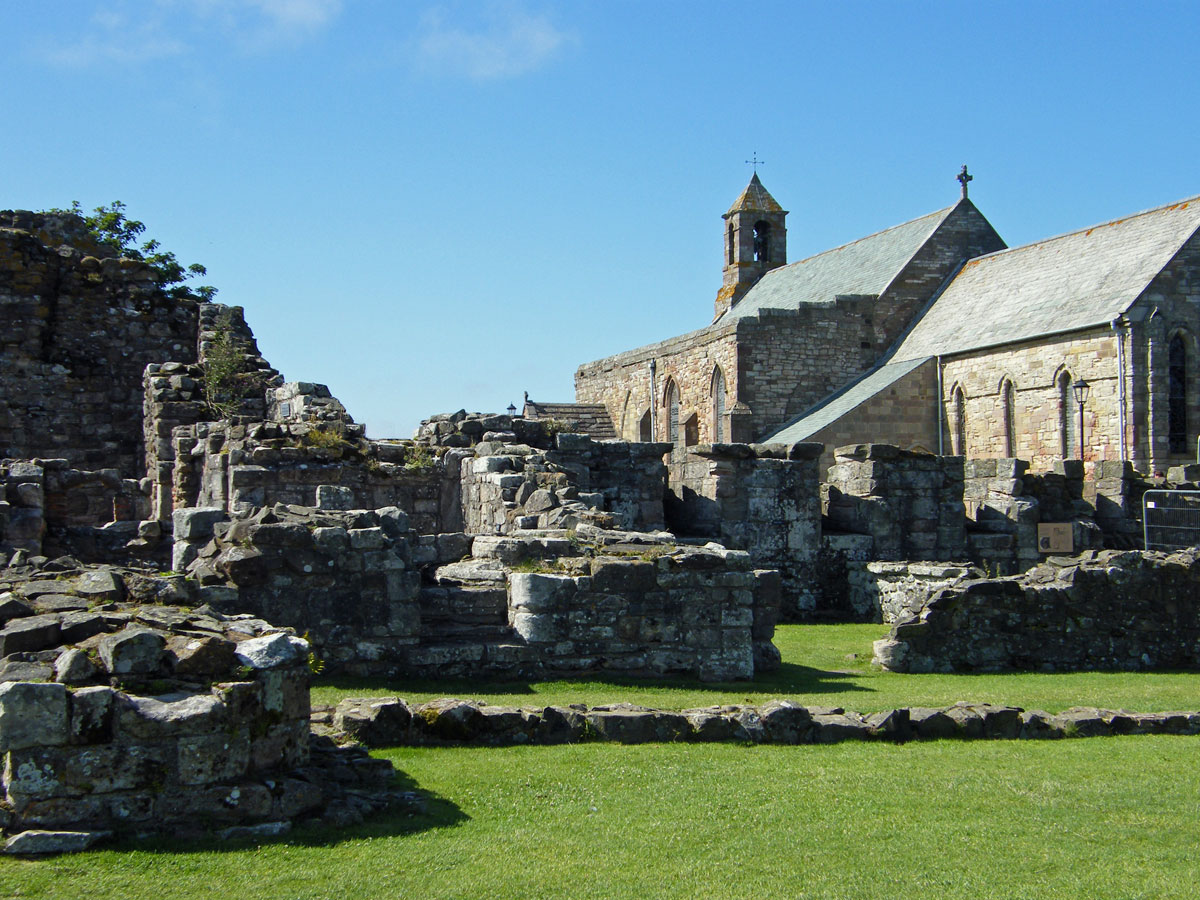
The Holy Island of Lindisfarne is situated off the coast of Northumberland. The island is cut off from the mainland by the tide twice a day. Possibly the holiest site of Anglo-Saxon England, in 685 Lindisfarne was founded by St. Aidan, an Irish monk, who came from Iona, the centre of Christianity in Scotland.
Disused Priory and the fascinating boatsheds in the harbour.
The island is a thriving community, with a busy harbour, shops, hotels and inns and still a place of pilgrimage for many although the priory is now in ruins
Ruins of the Priory and the Parish Church of St Mary the Virgin
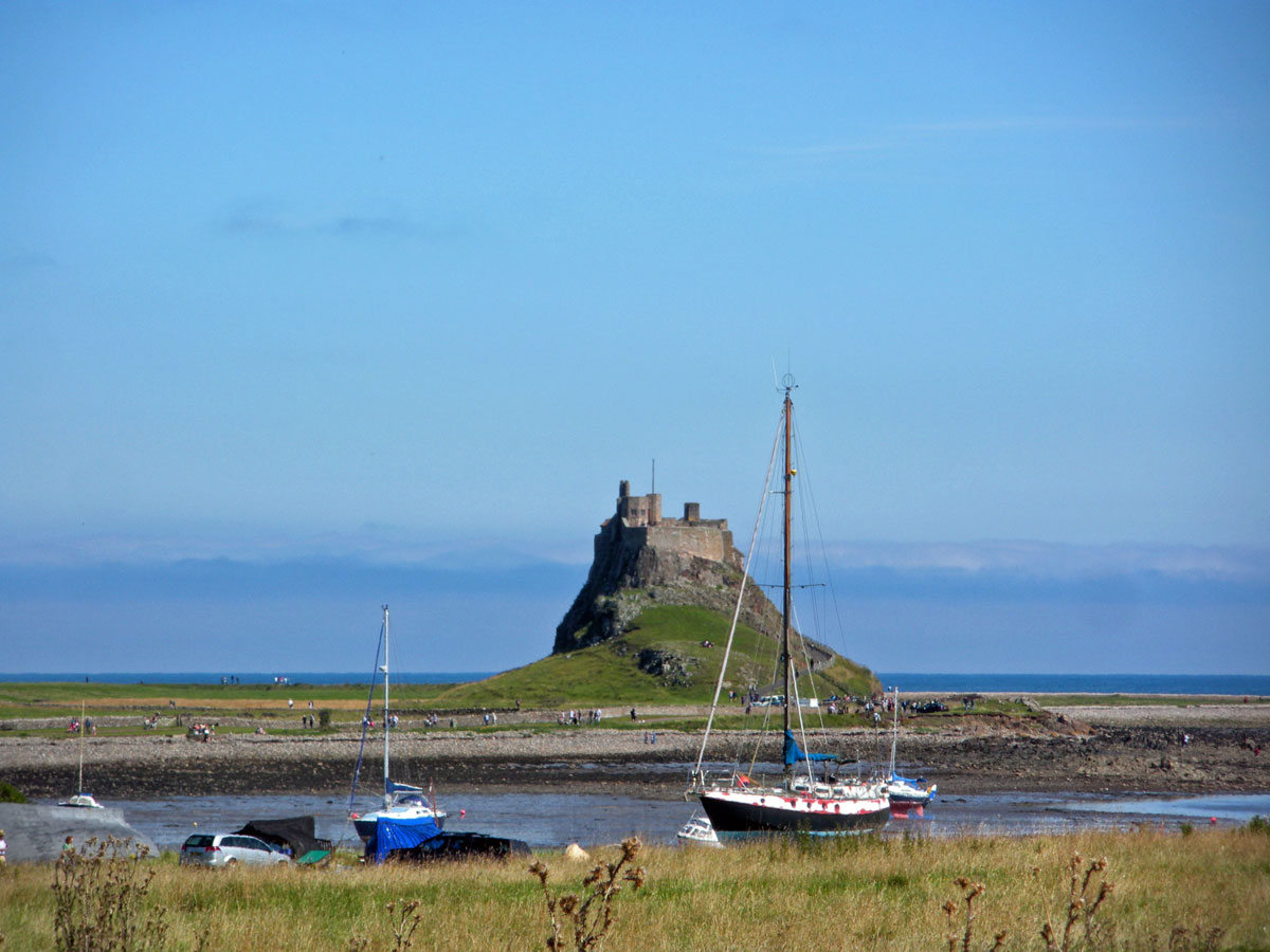
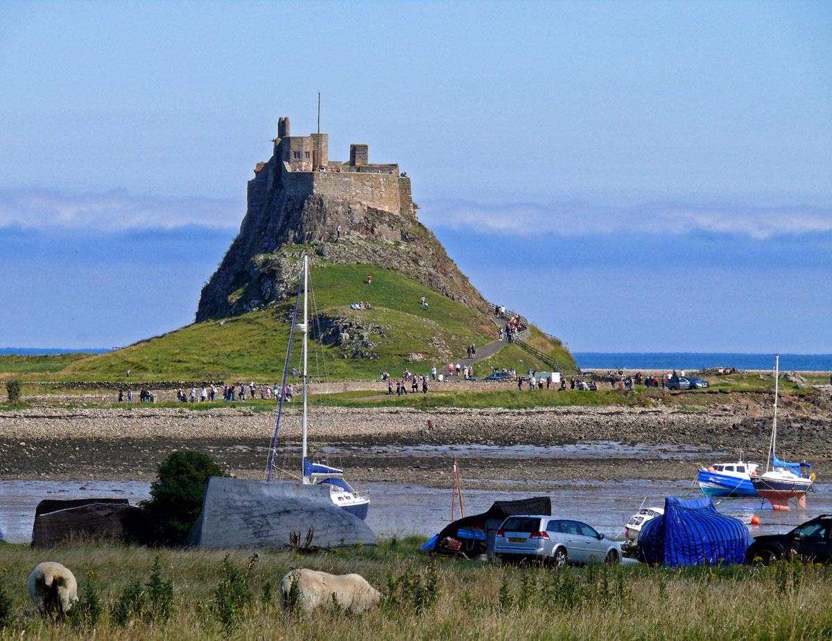
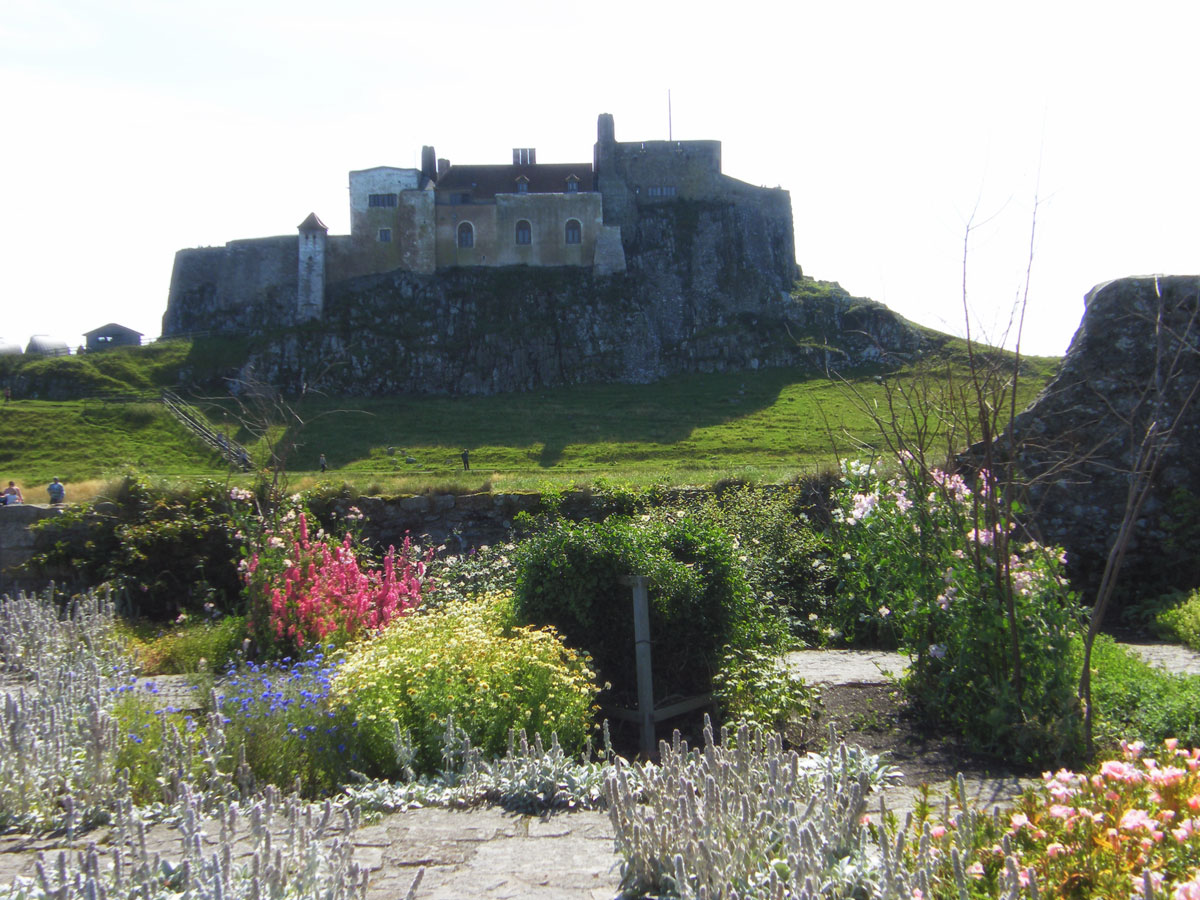
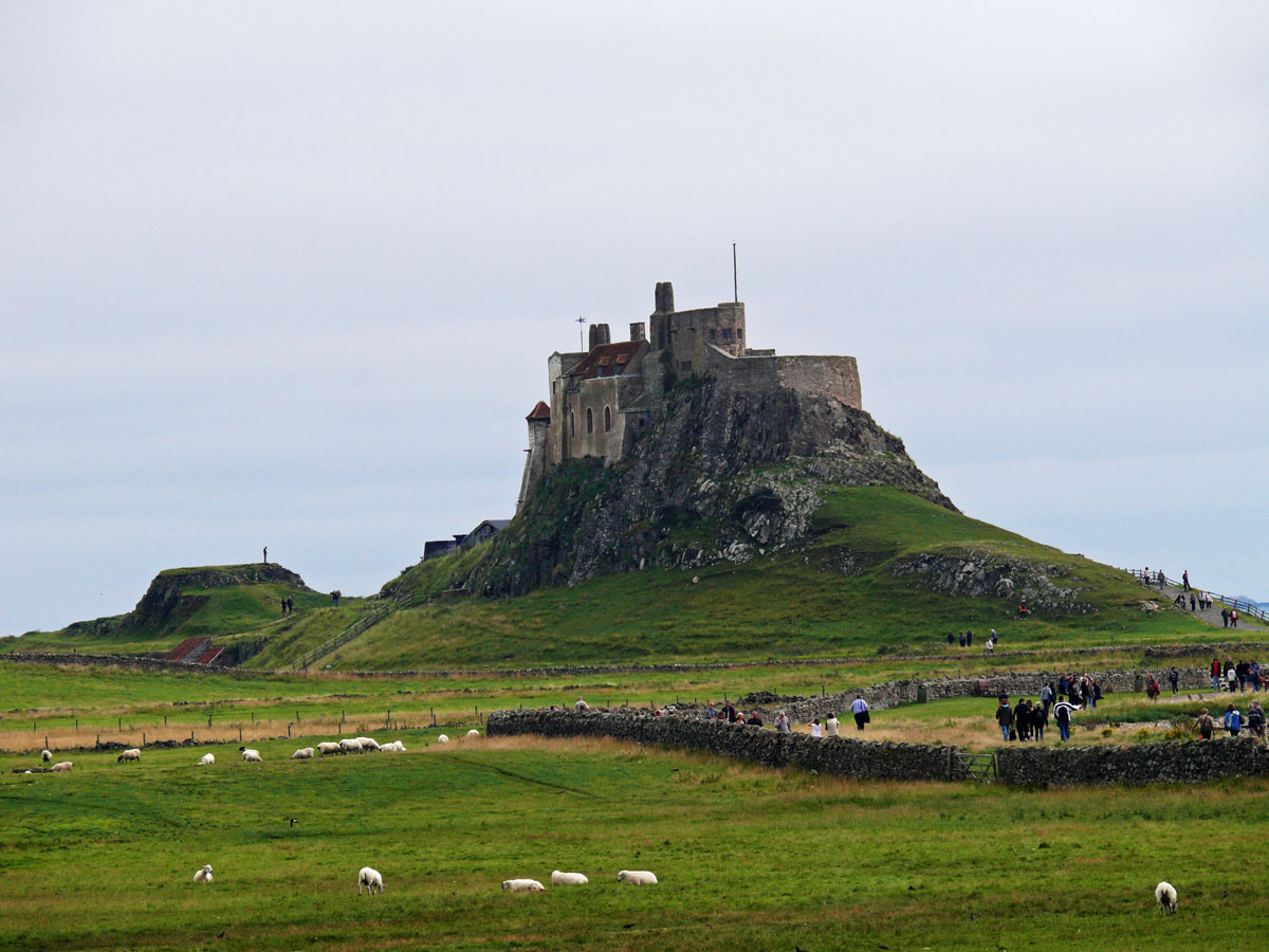
Lindisfarne is also famous for its castle (that’s not a castle) on an island (that’s not an island).
From the 1550s up until 1893 the castle was garrisoned by the government, at one point mounting 21 cannons.
The castle was strategically vital during the Scottish Wars of the mid-1500s and later saw action in the Civil Wars and the Jacobite Rebellion of 1715.
In the first decades of the 20th century, famed architect Sir Edwin Lutyens renovated the castle into a private holiday home for Edward Hudson, founder of Country Life magazine, while Jekyll made a planting plan for the garden and the castle surrounds.
Jekyll’s first plan was for a vegetable garden but it was her second plan – a summer flower garden – that was planted in 1911.
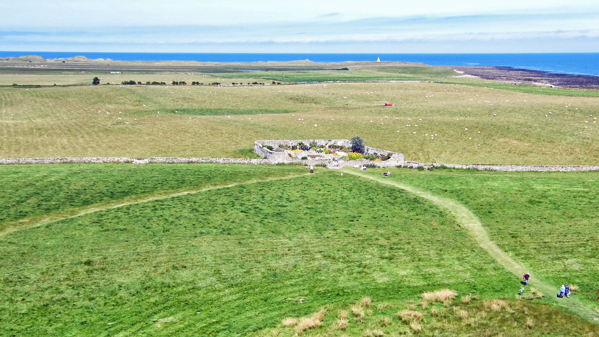
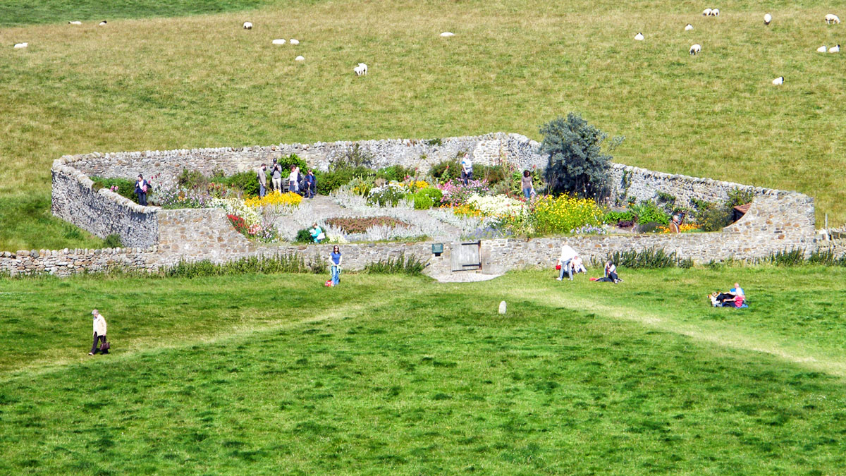
This tranquil garden was created by Gertrude Jekyll on the site of a vegetable patch that once provided the castle’s soldiers with food. Gertrude Jekyll (1843-1932) is well known in the gardening world. A talented painter, photographer, designer and craftswoman; she was much influenced by Arts & Crafts principles and often worked in collaboration with the English architect, Sir Edwin Lutyens.
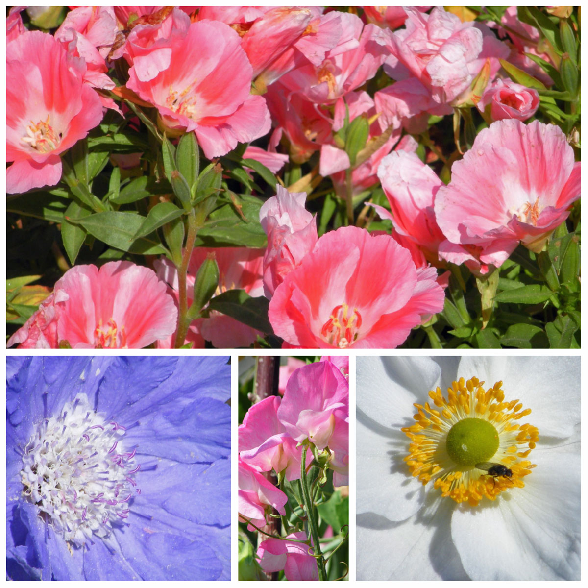
Jekyll designed the garden to have a wealth of colour during the summer months and to be especially prolific in August. Flowers include eight varieties of sweet peas, two of which are the delicate ‘Miss Wilmott’ and the deep crimson ‘Queen Alexander’.Jekyll’s original planting scheme was restored by the Trust in 2003. With its geometric layout of paths and beds, the garden is always interesting to look round.
Outside of the castle, there is a lot to explore. There are walks through the grass fields to the sand dunes where you can fly kites (it is an exposed place) visit the industrial Lime Kilns, look for seals and birdlife and enjoy the quiet beaches on the north side. Most visitors visit the castle and the priory and photograph the unique fisherman’s sheds made from old upturned fishing boats, one of the symbols of Holy Island.
Castle views and Lime KilnsLindisfarne Castle
It’s essential to check the tide times as the island is accessed via a long causeway which is impassable once the tide comes in. Though there is accommodation available on the island if you want to stay a little longer.
During this year I shall be posting photographs from places around the UK, many of which have not been published before. Where I have previously blogged about a location I will provide a link to the post, though you won’t be able to comment on it as I restrict comments to six months.
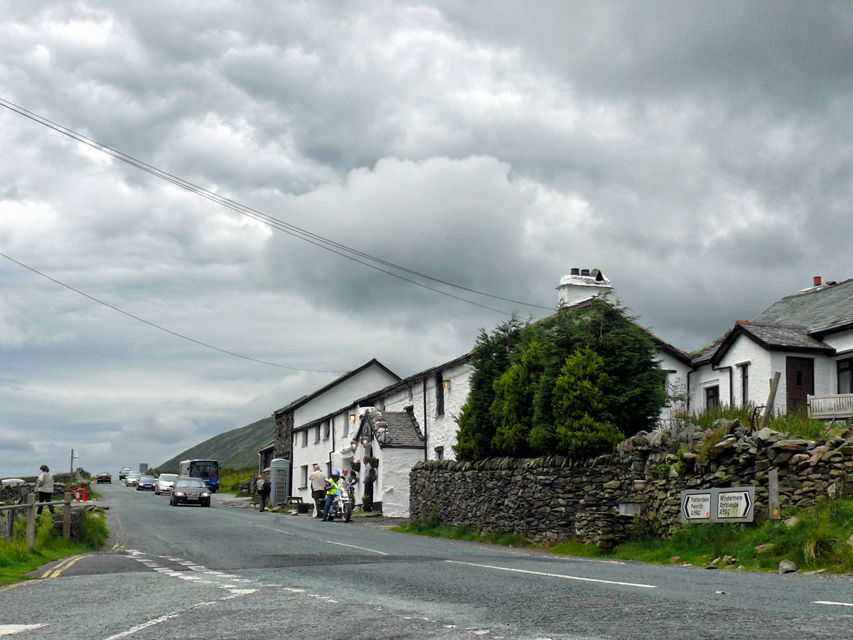
K is for Kirkstone Pass
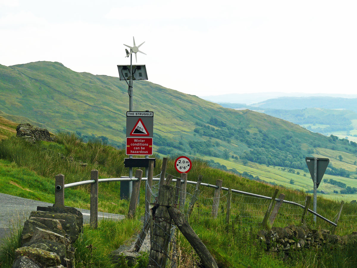
The Kirkstone Pass with an altitude of 1,489 feet is the Lake District’s highest pass that is open to motor traffic. The A592, which follows the route of a drover’s road used by farmers, runs from Windermere to Patterdale, but we took the short three mile winding road from Ambleside through the mountains, known as ‘The Struggle’ which leads to the Kirkstone Pass Inn.
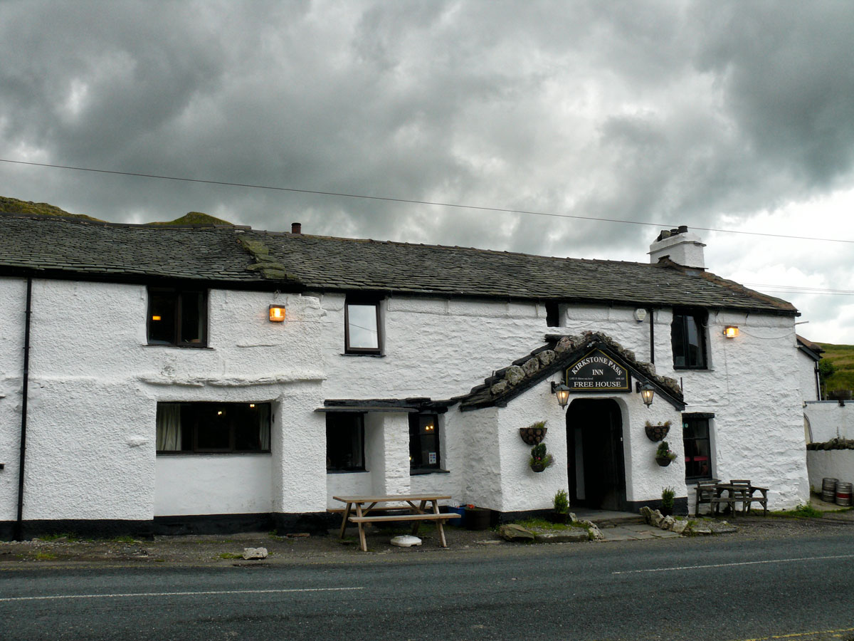
The steep twisty road is totally paved but curvy, narrow and very steep, hitting a harsh 17% of maximum gradient through some of the ramps. Due its steepness it was traditionally known as ‘The Struggle’.The StruggleThe Kirkstone Pass Inn stands close to the summit of the pass. Formerly an important coaching inn, it now caters primarily for tourists. It is the third highest public house in England.
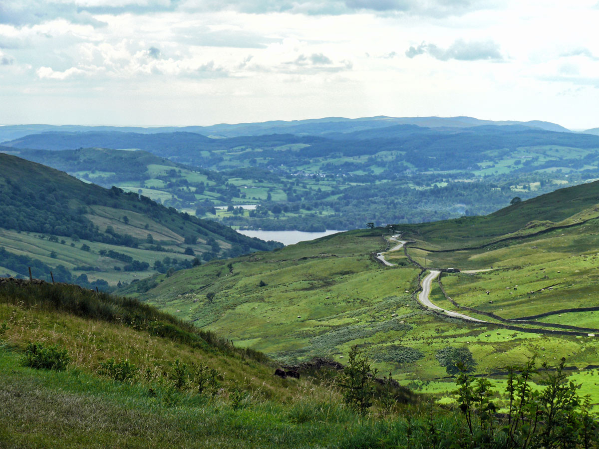
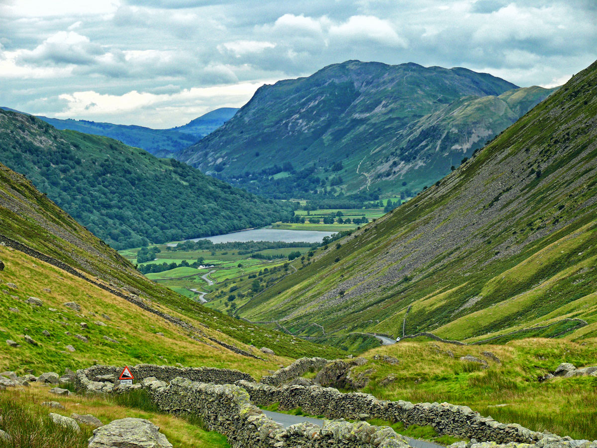
Continuing past the inn towards Ullswater, you find yourself looking at this spectacular view.
Brothers Water is in the Hartsop valley and is a small lake in the eastern region of the Lake District. Once called Broad Water, it lies at the northern end of Kirkstone Pass, affording picturesque views on the descent towards Patterdale.
The Pass is only to be driven in good weather. It can get dangerous in the winter when covered with snow and ice.
During this year I shall be posting photographs from places around the UK, many of which have not been published before. Where I have previously blogged about a location I will provide a link to the post, though you won’t be able to comment on it as I restrict comments to six months.
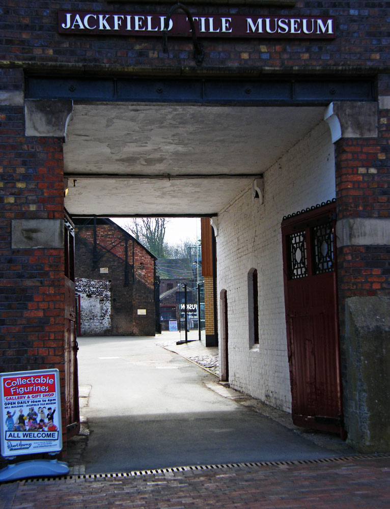
J is for Jackfield
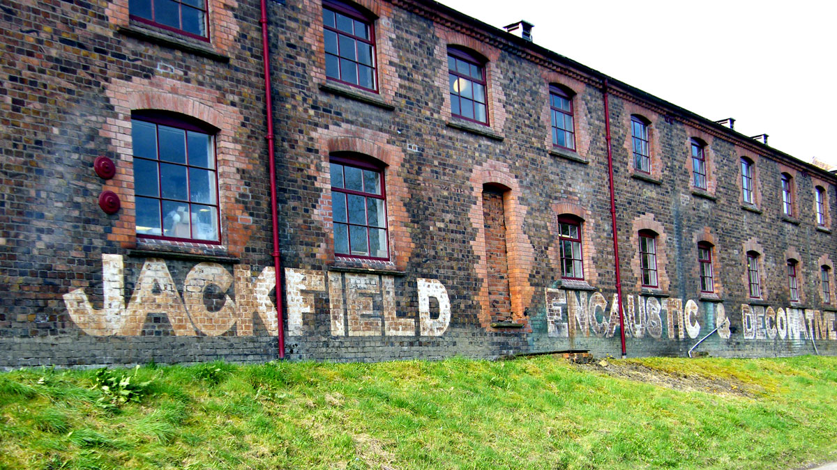
Jackfield is a village in Shropshire on the south bank of the River Severn, in the Ironbridge Gorge. There was a pottery here from at least 1634 and corn mills existed along the stream that flowed into the river. Manufacture of pottery continued throughout the 19th and 20th centuries, with specialism moving on to the production of tiles, including high quality encaustic tiles.
The Jackfield Tile Museum is one of ten museums in the Severn Gorge.
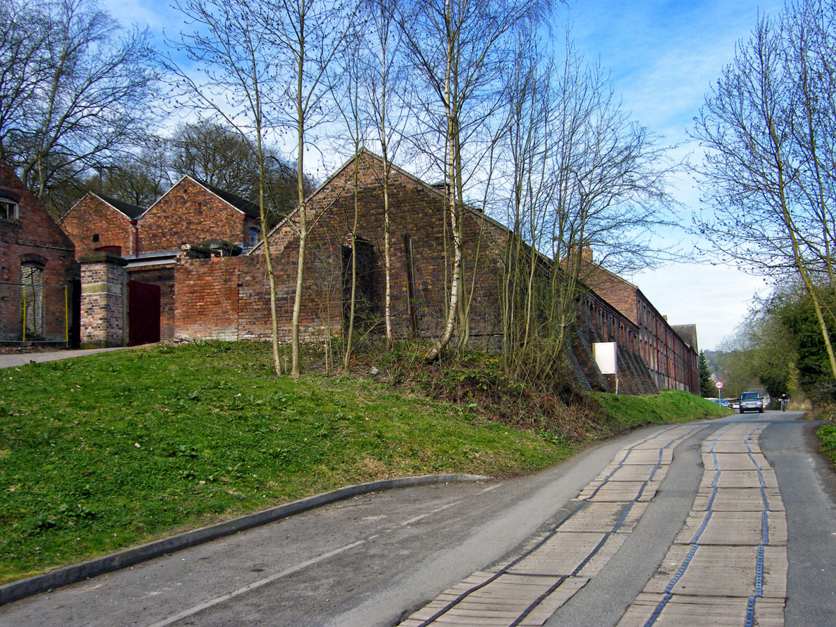
The Jackfield Tile Museum with some lengths of the former Severn Valley Railway trackbed today serve as a vehicle-free route for pedestrians and cyclists.
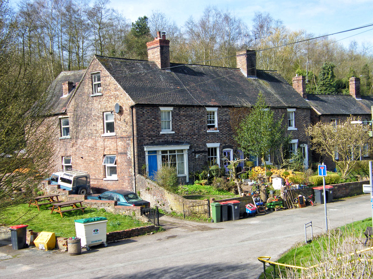
The settlement is mainly linear alongside the steep bank of the river from the Free Bridge to the Memorial Bridge which crosses over to the north bank and onto Coalport.
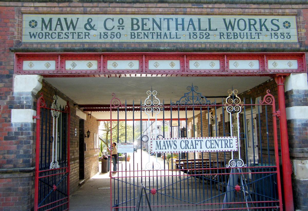
The Maws Craft Centre, formerly a part of the area’s tile works, is located on Salthouse Road between the Tile Museum and the Memorial Bridge and hosts a number of independent shops.The eastern part of the settlement consists of the Tuckies and Salthouses.Flooding badly affects the lower parts of Jackfield from time-to-time, including the Boat House pub which has floods recorded on its front door (the highest recorded at the pub being on 1 November 2000).The Memorial Bridge is a footbridge spanning the River Severn, linking the Tuckies part of Jackfield with Coalport. It was built with funds raised by public subscription in 1922, and is in memorial to the men of Jackfield and Coalport who were killed in the First World War.