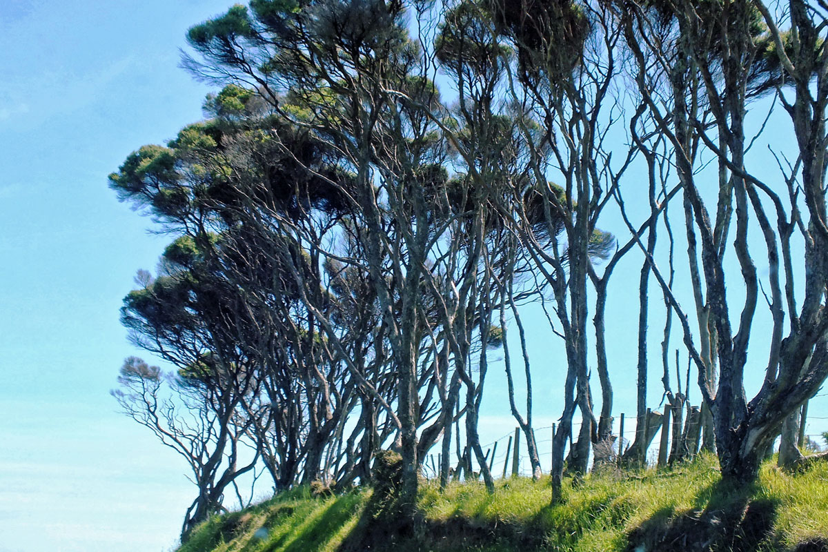
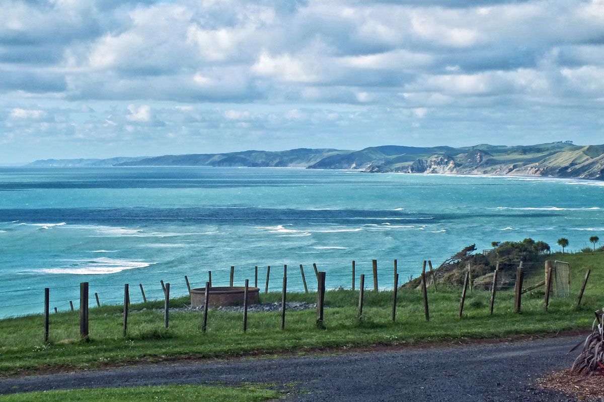
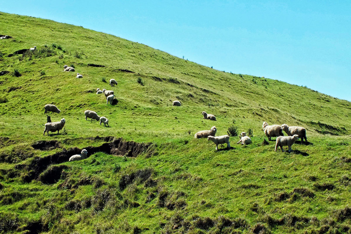
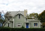
For my final postcards I am going to revisit New Zealand. An all too brief visit almost 10 years ago and one which I had hoped to repeat, but my enthusiasm for long haul travel has very much diminished over the years. My overall impressions were the colours of green and blue, rounded hills in the Waikato region, wonderful trees often bent out of shape by the winds, black sand, tree ferns, the long white clouds and excellent coffee. No words this time, just pictures.
New Zealand Part 2
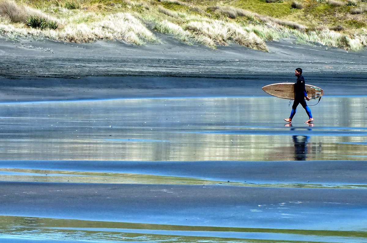
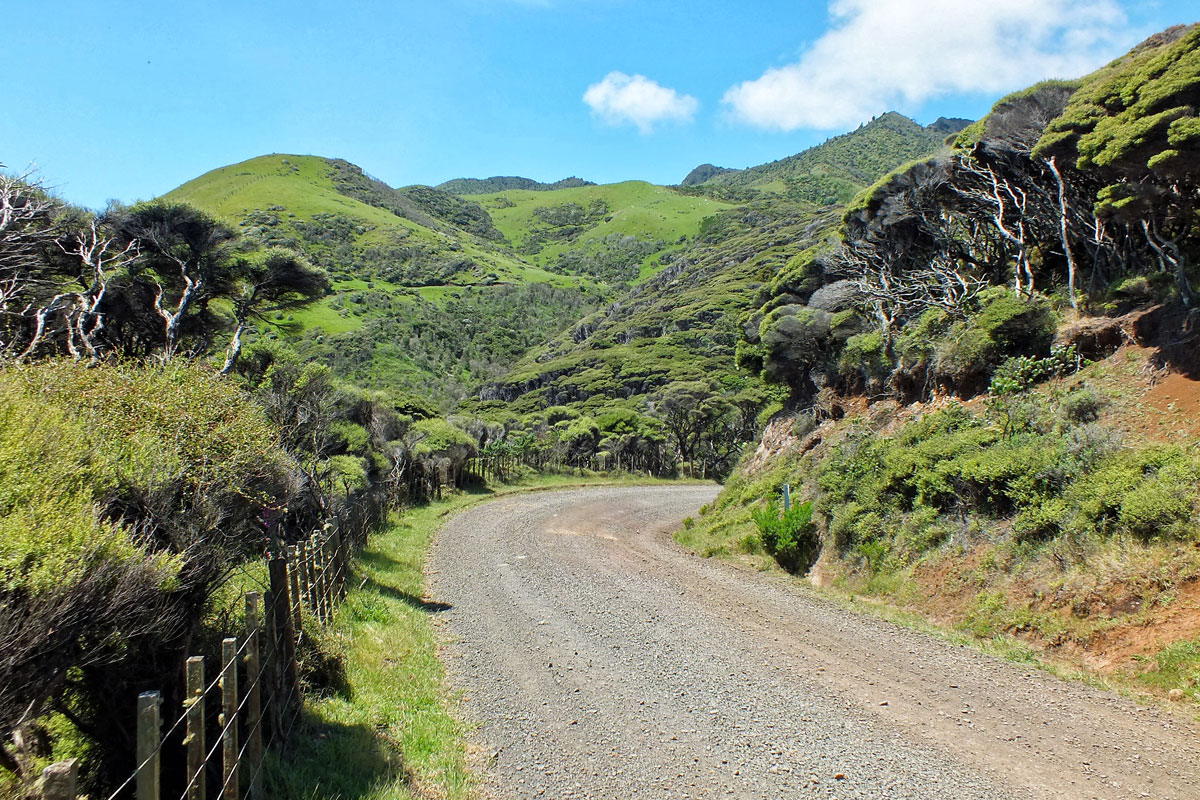
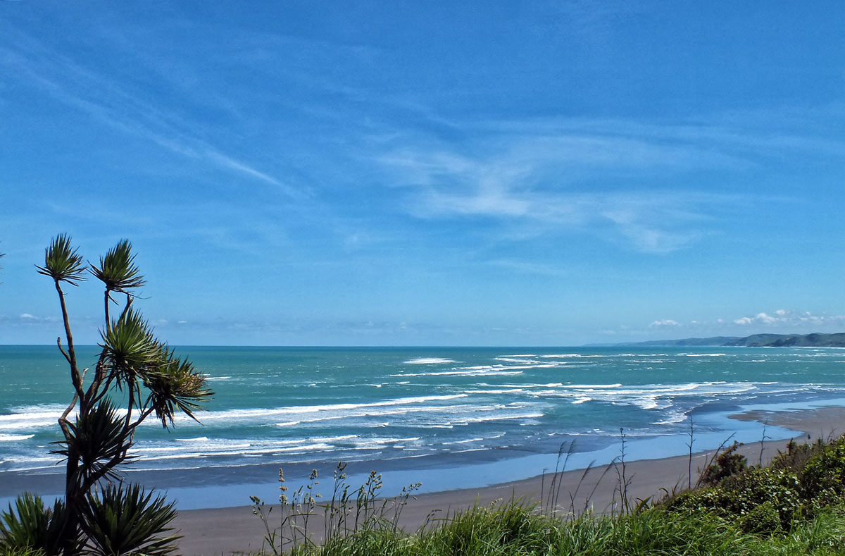
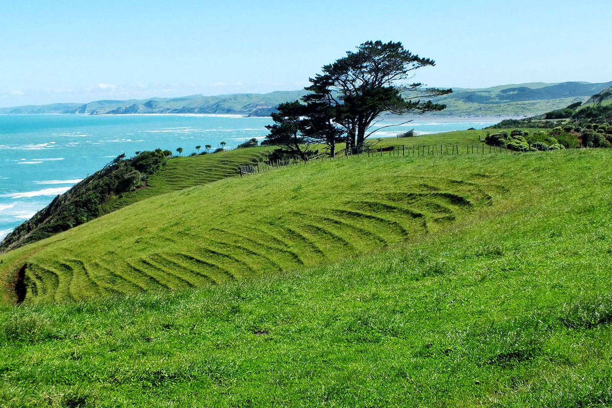
Fabulous treesAnd more sea views from our accommodationSheep. Of courseBlack sand beaches and surfers. This is Ruapuke Beach about 10.5 km from RaglanThe winding gravel track to Ruapuke Beach
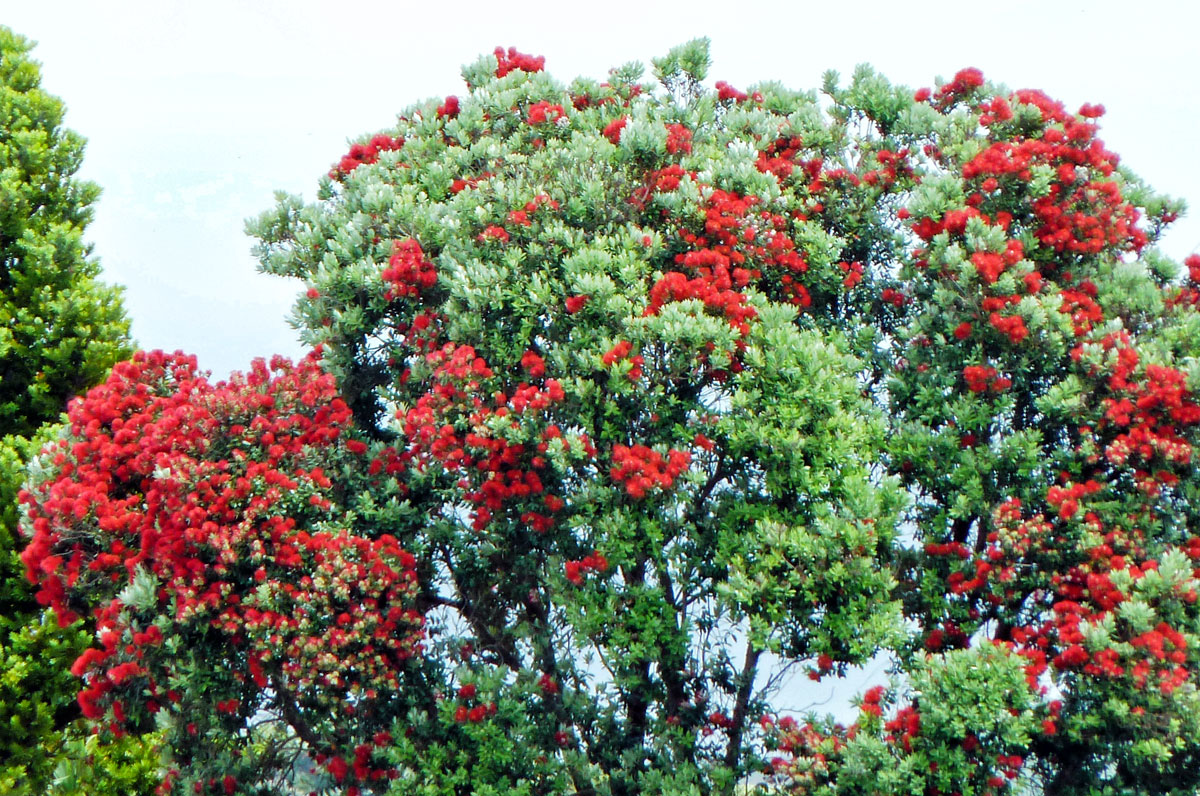
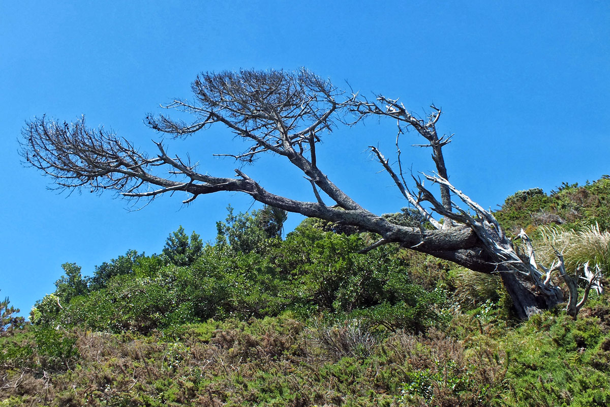
Metrosideros excelsa, commonly known as the pōhutukawa, or New Zealand Christmas tree, produces a brilliant display of red flowers around Christmas time.Distorted tree by the prevailing winds.
This is my last postcard for now. I hope you have enjoyed my catch up with places I have visited but not had time to blog about. And if you want to see more then please look under the destinations or road trips on the menu.
For my final postcards I am going to revisit New Zealand. An all too brief visit almost 10 years ago and one which I had hoped to repeat, but my enthusiasm for long haul travel has very much diminished over the years. My overall impressions were the colours of green and blue, rounded hills in the Waikato region, wonderful trees often bent out of shape by the winds, black sand, tree ferns, the long white clouds and excellent coffee. No words this time, just pictures.
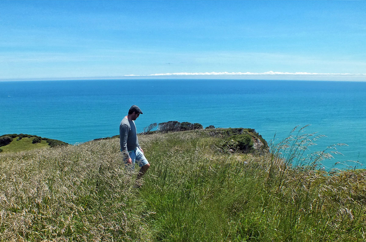
New Zealand Part 1
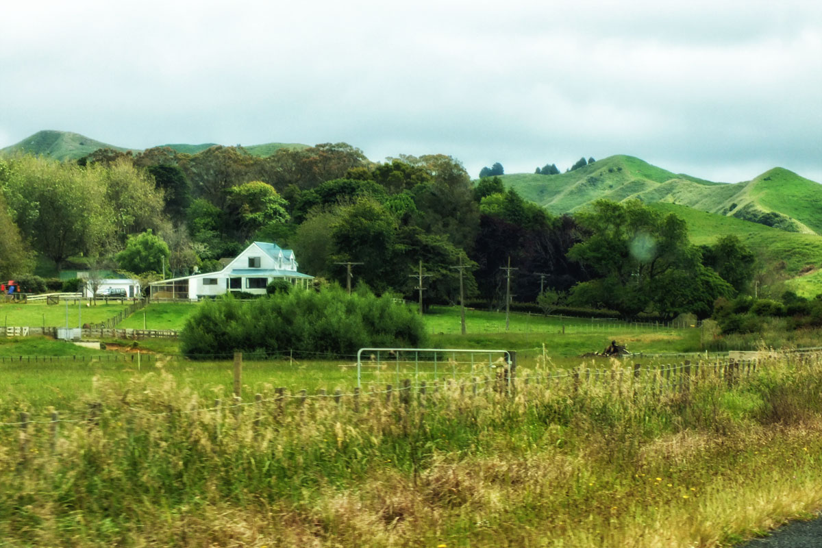
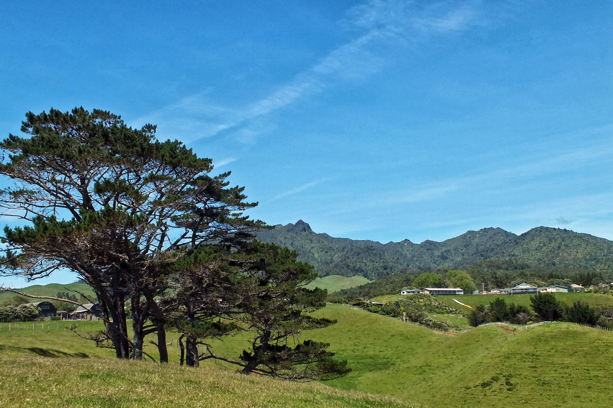
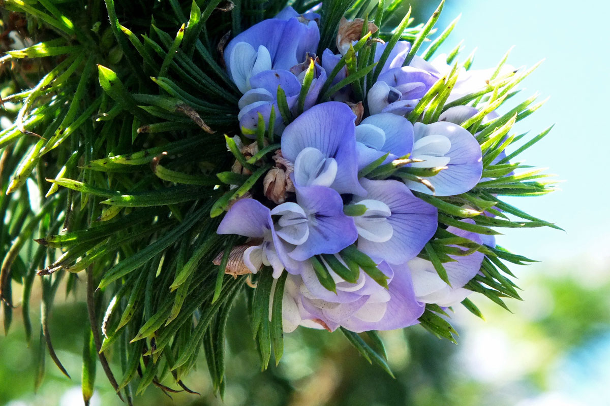
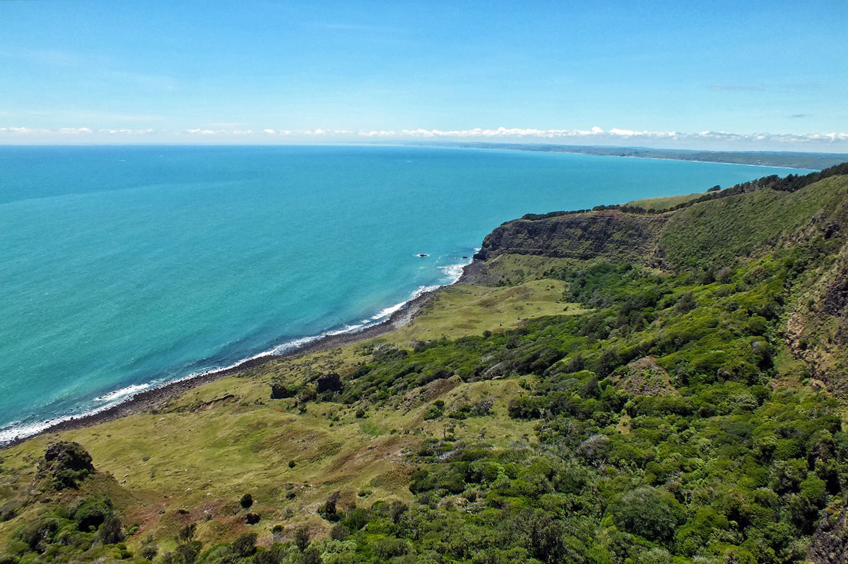
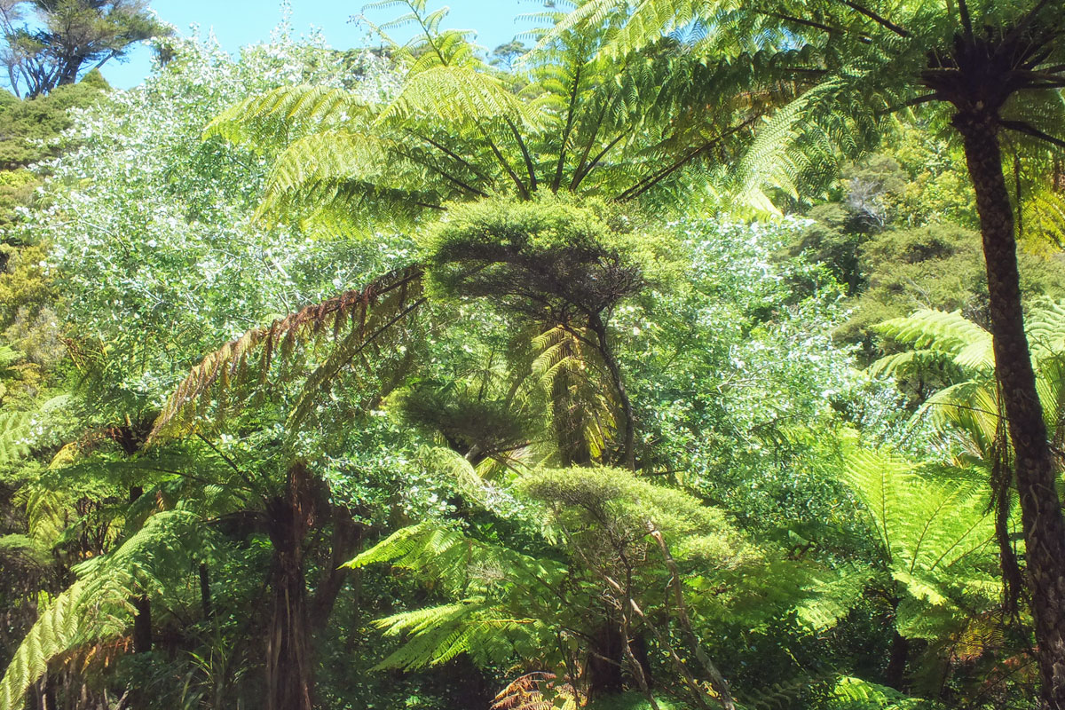
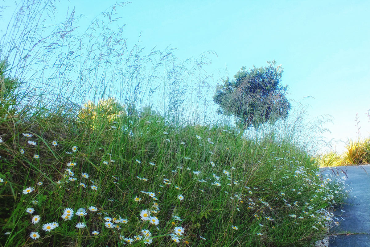
Ngarunui (sometimes called Ocean Beach, Main Beach or Wainui Beach) is the main sandy swimming beach in Raglan. A magnificent black sand surfing beach. We were staying at the far south-western end of the beach about 6km out of Raglan.The wonderful rounded hills of the region. This is on the way to Raglan where we stayed.Mount Karioi is an ancient volcano about 8km SW of RaglanPsoralea pinnata, called fountain bush is an erect shrub or small tree, which grows up to 4 m high, with blue, lilac and white, pea-shaped flowers which bloom in early summer. A south African plant which smells of Kool-Aid!Taken near the Te Toto Gorge Lookout. A beautiful view from a platform, hanging high on the air at the top of sheer cliff – it’s reached by a narrow winding gravel track so take care.View from Te Toto Gorge Lookout up the coast towards Auckland. It is a very long way down!Wonderful greenery provided by the tree fernsThe views from where we were staying situated on a hilltop above Ngarunui BeachLots of pretty wild flowers and grasses along the roadside
[Leaf peepingis an informal term in the United States and Canada for the activity in which people travel to view and photograph the fall foliage in areas where leaves change colours in autumn, particularly in northern New England]
When I was teaching it meant holidays could only be taken during the school holidays when it was more expensive and busy. And I couldn’t tag on to the OH’s conferences either. Which is why during one October half term we decided to do a fly drive holiday to the eastern side of the USA and do a spot of leaf peeping.
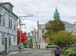
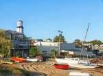
Provincetown
is a New England town located at the extreme tip of Cape Cod in Barnstable County, Massachusetts. When we arrived there the weather had improved and we stopped to take a walk around what is quite a quirky little town, with a lovely harbour. Often called “P-town” or “Ptown”, the locale is known as a vacation destination for its beaches, harbour, artists and tourist industry.
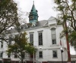
Town Hall
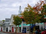
Provincetown Church
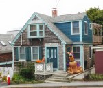
Scooby Doo – Halloween display
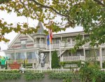
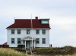
Historic Crowne Point Hotel
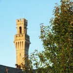
The Pilgrim Monument
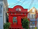
Little Store Commercial Street
Commercial Street
Harbour
Harbour
Harbour
Harbour
Harbour
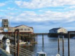
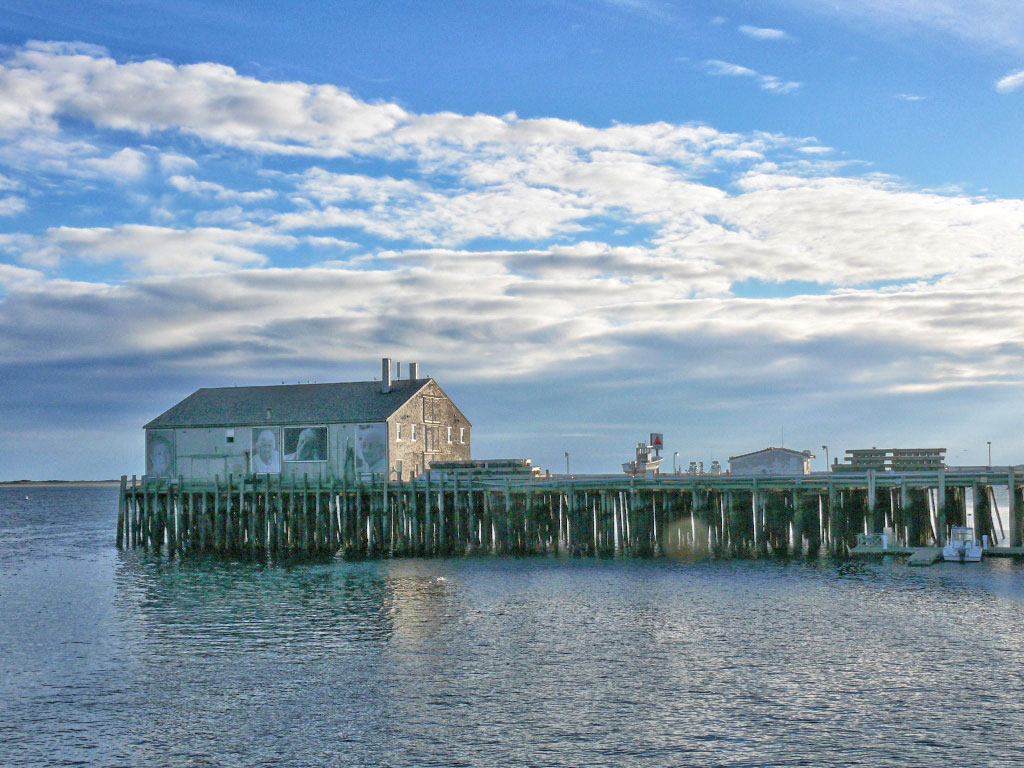
Interestingly there was a strong Portuguese heritage (mainly immigrants from the Azores) whose families fished the waters off Cape Cod for over 200 years, built a major fish packing and distribution industry and made an important contribution to the history and culture of Provincetown. There was an art installation on one of the wharfs when we were there, but I imagine that has long gone due to the weather.
They also faced the sea
Unfortunately we didn’t visit the Pilgrim Monument and Museum which allows you to walk up the tower for spectacular views. I guess we were just all walked out by then.
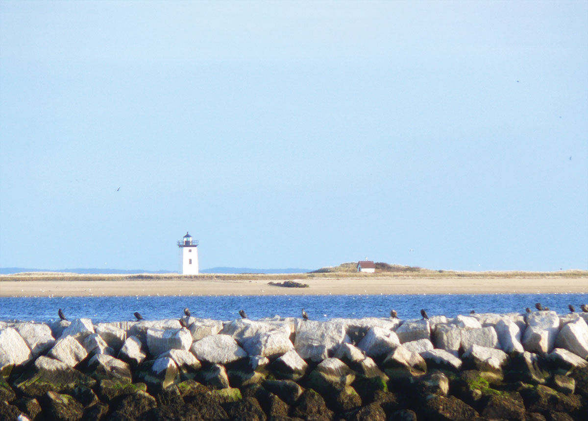
Long Point Lighthouse
We ate fish and chips in a café on Fisherman’s Wharf before setting off back along Route 6¹ to our hotel in Sandwich. It was getting dark as we approached the more urban areas and I couldn’t understand why oncoming cars kept flashing their lights at me, until I finally realised that my car was on full beam! The joys of a hire car.
¹U.S. Route 6 (US 6), also called the Grand Army of the Republic Highway, a name that honours an American Civil War veterans association, runs east-northeast from Bishop, California to PROVINCETOWN, Massachusetts. From 1936 to 1964, it had its western terminus at Long Beach, California. During this time, US 6 was the longest highway in the country!
This is the last of the leaf peeping trip. I hope you enjoyed the scenery as much as I did.
[Leaf peepingis an informal term in the United States and Canada for the activity in which people travel to view and photograph the fall foliage in areas where leaves change colours in autumn, particularly in northern New England]
When I was teaching it meant holidays could only be taken during the school holidays when it was more expensive and busy. And I couldn’t tag on to the OH’s conferences either. Which is why during one October half term we decided to do a fly drive holiday to the eastern side of the USA and do a spot of leaf peeping.
We only had a couple of nights on Cape Cod as I had decided I would rather be closer to the airport on the Friday night for our Saturday flight back to the UK. There were so many building and roadworks around the airport I wasn’t taking any chances.
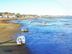
Cape Cod has always fascinated me. I don’t know whether it is the name or the shape of it looking like a scorpion tail, or the quaint villages, seafood shacks, lighthouses, ponds and miles of soft golden sandy ocean beaches and bays. Offshore islands like Nantucket and Martha’s Vineyard just sound so romantic. And of course all those English place names!
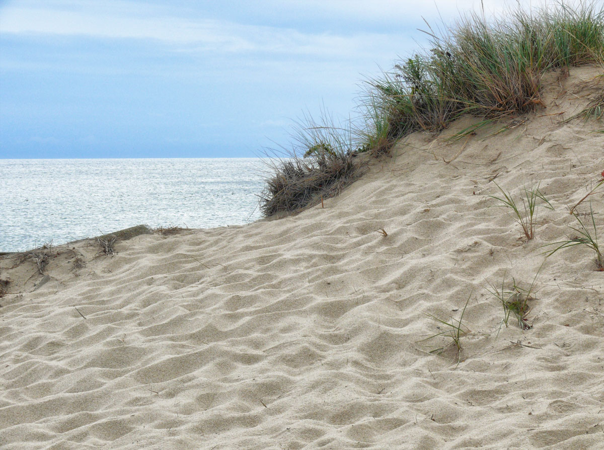
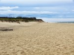
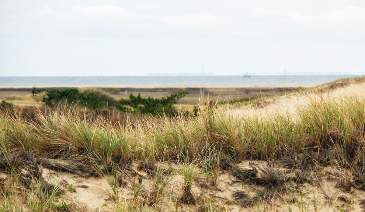
Coast Guard Beach in Eastham. A classic Cape Cod beach with plenty of sand, dunes and gorgeous views of the sea.
So on the first day we simply headed all the way up the State Highway (6) to Provincetown. Stopping off at various landmarks and beaches along the Cape Cod National Seashore. Seeing a lot of the natural beauty of the region disappearing led President Kennedy to sign a bill in August of 1961 protecting forty-three thousand acres of space from Chatham to Provincetown and preserving it as a National Park.
First stop was the boardwalk at Sandwich which leads out to Cape Cod Bay.
Then it was in the car to explore. Coast Guard beach was our first stop and is actually the site of the first landing of the Mayflower! They didn’t hang out here long before realising they were somewhat north of Virginia, so seeking a safe settlement site near the Hudson River they headed back out to sea to set a course southeast. Once the ship became enmeshed in the shoals off the coast of the cape, though, they turned back north and found safe harbour at what is now known as Provincetown where they remained for a month before setting sail for the mainland where they established the Plymouth colony.
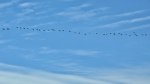
Geese in flight: we saw many of these
Coast Guard Beach
Autumn colours
Beach and sand dunes
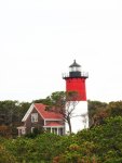
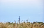
Nauset Lighthouse
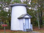
Three Sisters Lighthouses
Three Sisters Lighthouses
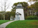
Transatlantic Cable Hut
Pilgrim Monument
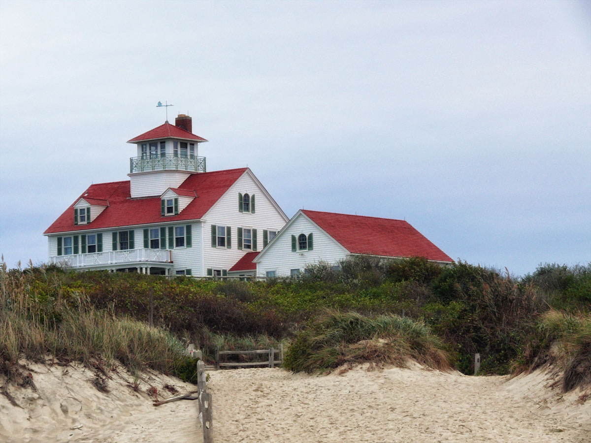
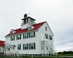
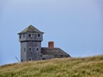
Race Point life saving station
Old harbour life saving station and museum
On the second day we spent it mostly along the Massachusetts Route (28) again stopping off at various points before heading back up to Boston in the late afternoon.
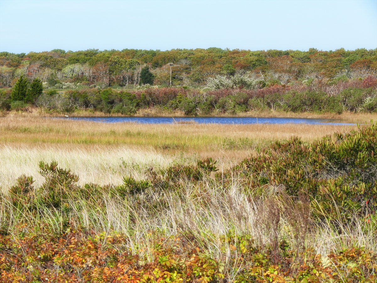
Waquoit Bay is a public national estuary, which is typically used as a research reserve. It is a part of Nantucket Sound and is located on the southern shore of Cape Cod , in the towns of Falmouth and Mashpee.South Cape Beach State Park, Great Oak Rd., Mashpee. This 460-acre park has a beautiful barrier beach sheltering Waquoit Bay to go along with a pair of ponds, Sage Lot and Flat Pond along with many walking trails. The premier trail is the Dead Neck Trail which parallels the barrier beach and runs roughly a mile out to the shores of Waquoit Bay.
The weather wasn’t great on our first day though it improved towards the late afternoon and I think perhaps September would be a better month to visit this region when it’s not so busy with summer holidaymakers, but whilst the weather is still warm.
My final post of Cape Cod will be a look at Provincetown itself.
[Leaf peepingis an informal term in the United States and Canada for the activity in which people travel to view and photograph the fall foliage in areas where leaves change colours in autumn, particularly in northern New England]
When I was teaching it meant holidays could only be taken during the school holidays when it was more expensive and busy. And I couldn’t tag on to the OH’s conferences either. Which is why during one October half term we decided to do a fly drive holiday to the eastern side of the USA and do a spot of leaf peeping.
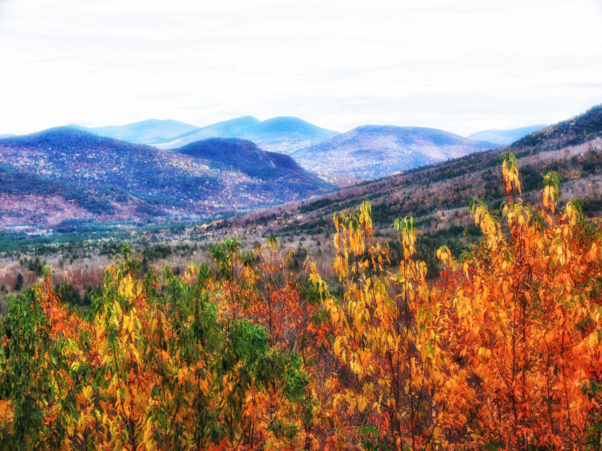
Last views of the White Mountain NP
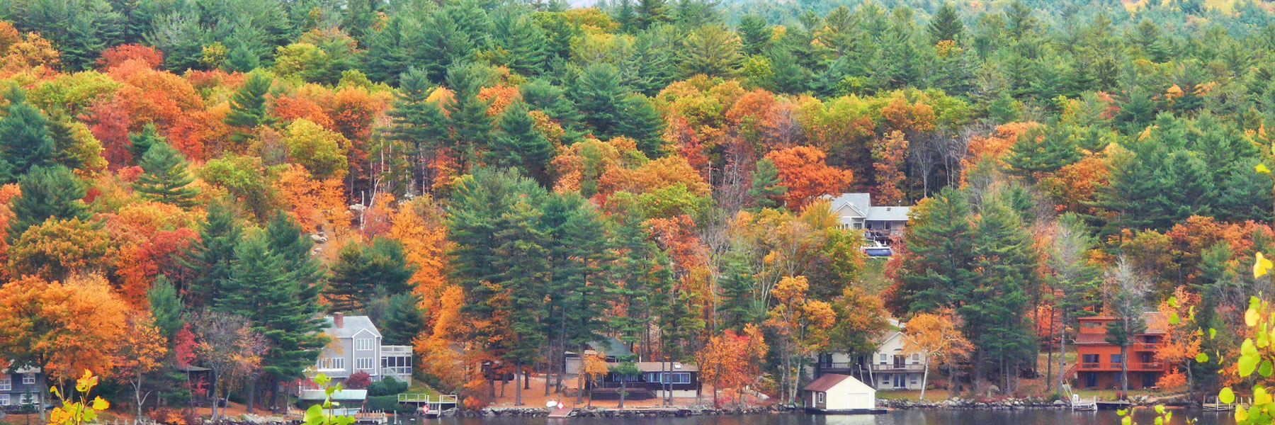
The last part of this autumn trip was to spend a few days on Cape Cod, south of Boston which meant about a 5 hour journey without stops, so pretty much the full day. We set off after breakfast and because I am never fond of doing the same route twice I decided to head down and around Lake Winnipesaukee which is the largest lake in New Hampshire, located in the Lakes Region at the foothills of the White Mountains. It is in a pretty stunning location and I would not say no to a holiday in one of the lakeside resorts there. Unfortunately the weather was much the same as yesterday with dark clouds and rain.
Colour around Lake Winnipesaukee
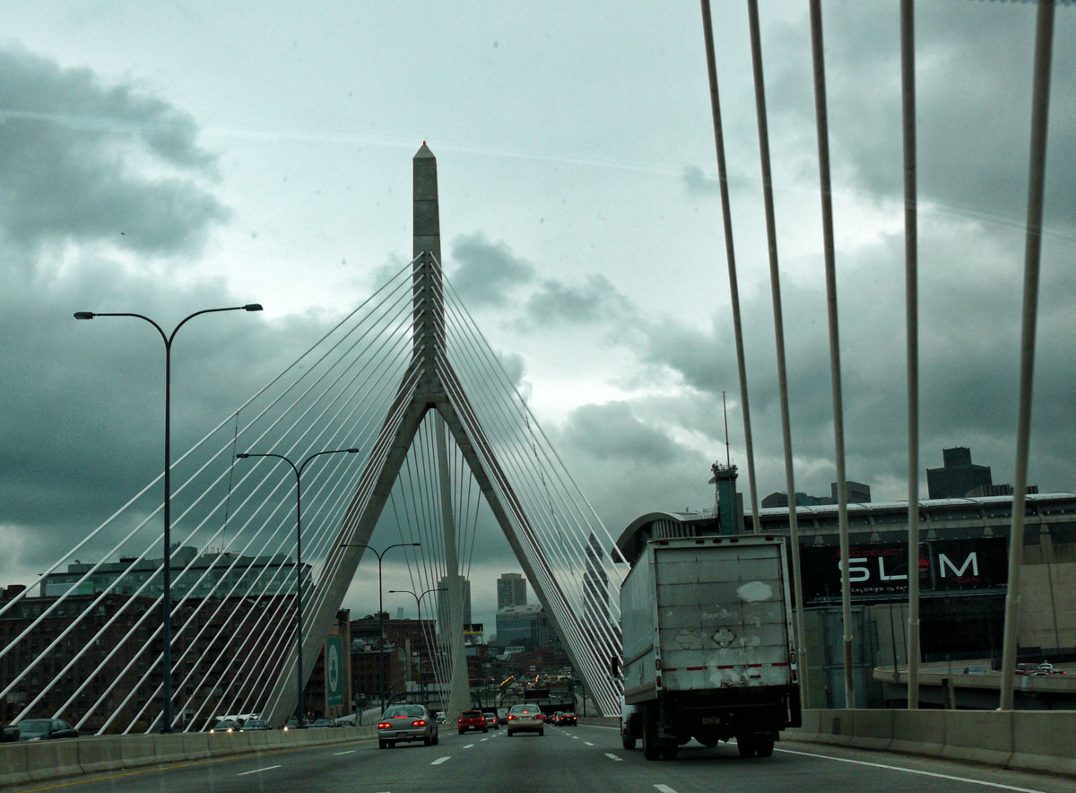
After briefly stopping to look at the lake views we continued south and joined the I93 at Tilton. As I mentioned earlier, Cape Cod is to the south of Boston, which means of course having to traverse the city. And that meant entering the tunnels. Where you have to keep your wits about you so that you don’t miss the turn off. Traffic speeds through these tunnels (though it is supposed to be restricted to 45mph) and having seen one car bounce off the central reservation just before entering them I was already a little nervous! Afterwards I’m not sure why I didn’t take alternative routes around the city!
Tunnels ahead
Leaving the interstate at Quincy we joined the Pilgrims Highway (3) which later becomes the Grand Army of the Republic Highway (6) leading to Sandwich where we had booked the The Dan’l Webster Inn & Spa for the next three nights. Sound familiar? Yes. It was the same Daniel Webster that the highway was named after which we took en route to Mount Washington.
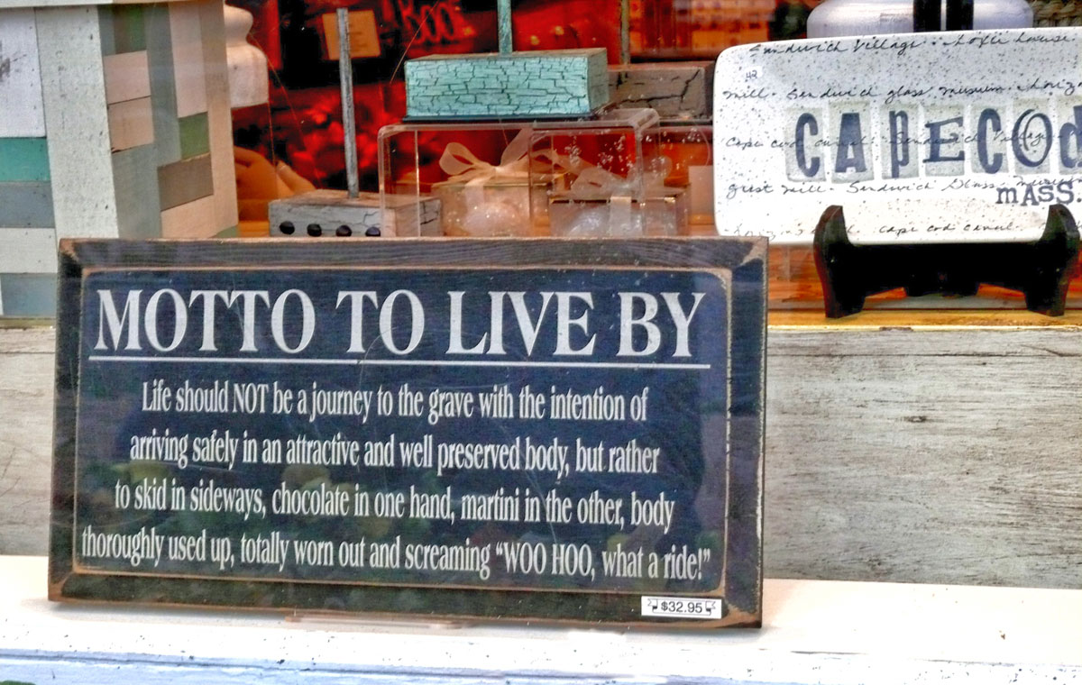
Incorporated in 1639, Sandwich is the oldest town on Cape Cod and one of the oldest towns in the United States, settled by European immigrants nearly 150 years before the American Revolution. Another historic hotel this one dates from the 18th century, previously known as the Fessenden Tavern. Daniel Webster was a highly successful Boston lawyer who had a room booked at this Tavern from 1815 to 1851.
Duck Pond
Dexter Gristmill
Pumpkin display
To stretch our legs after the long drive we had a wander around the town admiring the architecture but as the light began to fade on a very dull day we headed back to the hotel for dinner and a well earned Margarita cocktail in the bar where I got into a lively conversation about a Red Sox game that was on the TV. The OH ushered me out before there was any blood shed.


")
")
")
")
 On the second day we spent it mostly along the Massachusetts Route (28) again stopping off at various points before heading back up to Boston in the late afternoon.
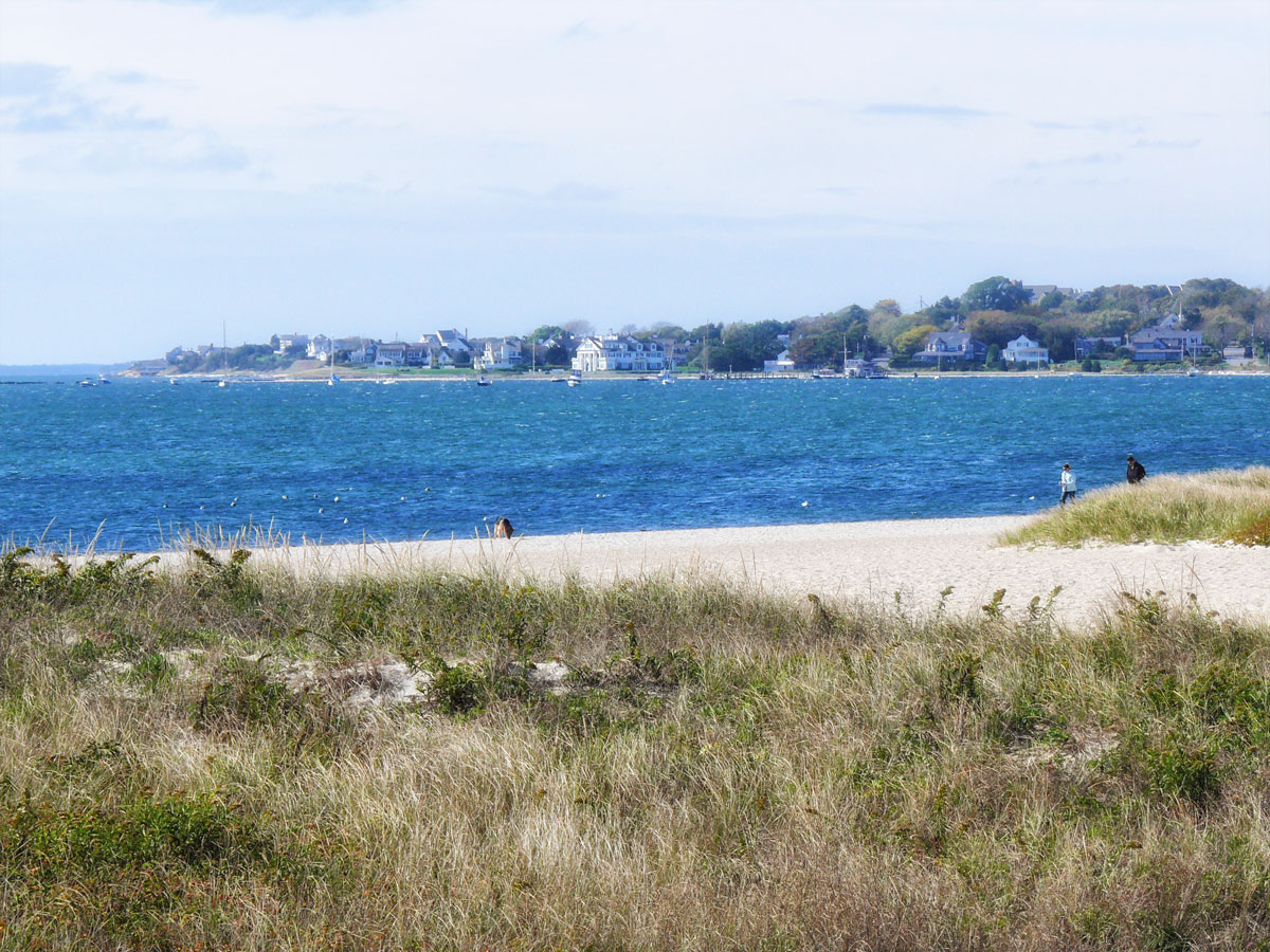

")
")
")
")
")
")
")
")
")
")
")