Long ago, in a university far away – well, North Wales – there was a loose accumulation of musicians that sometimes performed under a name that rather cheekily parodied that of a local Silver Band. Some 50 years on, Dave Higgen and David Harley somehow got back in touch, swapped some recordings, and eventually fell into recording and even occasionally writing together, through the wonders of internet communication. It seemed appropriate to relaunch as the New Prize Silver Jug Band. Other silver bands and jug bands are available.
“David Harley originally recorded this in a solo country blues style (not released commercially), but Dave pointed out that it would lend itself to a treatment closer to urban blues, and did most of the heavy lifting on the recording. David used his Gretsch resonator guitar for the slide part, but it does sound less country blues and more as if he’d washed his hands in Muddy Waters… To get that hybrid sound, Dave mixed the input from the internal transducer and from an external mic..”
(Note to anyone looking at this post in the Reader or on a phone you may need to visit the actual site to be able to view and listen to the music track)
Lyrics
Who Do You Think You Are
I came home last night, just about the break of day
She’s got her suitcase packed, just about to make her getaway
(ch) She said, well now baby, who do you think you are You stayed out all night, don’t know what you came back for
Five long years my baby walked the line
Now she’s gone, long gone, since she found out I was playing double time
Down at the courthouse, fell down on my knees
Said I love you babe, won’t you forgive me please?
Wrote her a letter, wrote it on my knees
Babe I learned my lesson, won’t you come back please?
She wrote back, well now baby, who do you think you are Got my eyes wide open, don’t know what I’d come back for
credits
from Farewell Reunion, released January 7, 2025
Words, music, and vocal by David Harley.
“The first version of the lyric vanished during the breakup with an ex-girlfriend. The second vanished during my first marriage. (My wife hated it, so I don’t suppose she stole it.) This is number three – the lyric, that is. I have an ex-rated musical career.”
(Note to anyone looking at this post in the Reader or on a phone you may need to visit the actual site to be able to view and listen to the music track)
Lyrics
Let Me Lie Easy
I don’t want to hear that the show must go on
I know that the world keeps on turning
But how can you ask me to rise with the lark
With this pain in my heart still burning?
(ch) Let me lie easy, let me lie late/Let me lie low, let the world wait Let me lie easy, let me lie late/Please let me sleep till it’s over
The sheep’s in the meadow, the cow’s in the corn
The dogs call in vain for their master
Just give me a while to untangle my threads
And Little Boy Blue will come after
The summer’s near gone and the year’s on the wane
The harvest stands ripened and wasting
Just give me an hour to unscramble my head
And I promise I’ll not keep you waiting
credits
from Kitsch and Canoodle, released August 22, 2021
Words & music by David A. Harley.
Several people commented last week that they would love to hear about my life as an au pair in Geneva. Sadly there isn’t much to tell. I only lasted until Easter and I didn’t keep a diary. I found it a lonely life. My family were pretty good, an English woman married to an Italian man and both working for United Nations in Geneva. I worked long hours from 7am until 7pm with Saturday afternoon and Sunday off for £7 a week. Two young boys aged three and seven. Unfortunately the seven year old was showing signs of distress and bad behaviour. I guess that having different au pairs each year to whom you get attached and then they disappear is not good for a young child.
I was expected to provide a cooked lunch for the family each day, a list of ingredients and a recipe would be left for me and I would walk to the nearest shops for the food. I learned to cook many things that I had never done before including stuffed hearts, artichokes and oxtail. Not your normal Yorkshire grub. I cleaned and I did the laundry. The three-year old was at nursery in the morning and home during the afternoon and I would take him out for a walk, often to collect eggs from a farm close by. Did I mention it was winter? The ground was often covered in snow and it was cold, but a dry cold unlike the damp of an English winter.
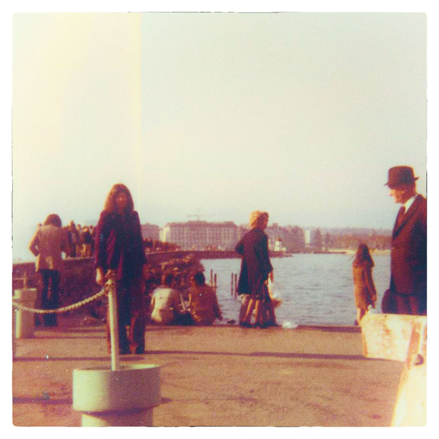
Me by the Jet d’eau where the hippies used to meet up. I was wearing my favourite purple velvet jacket and loons
I would make tea for the children around 5 pm then bath them and get them ready for bed. I don’t recall any TV. Once a week in the evening I went out for French lessons. And I became friendly with a young English girl in the next block of flats, Lorraine, and I used to go out with her on a Saturday. Sometimes we would visit a live music bar in a cavern in the old town which was pretty good. (Unlike the very few photos I have from that time)
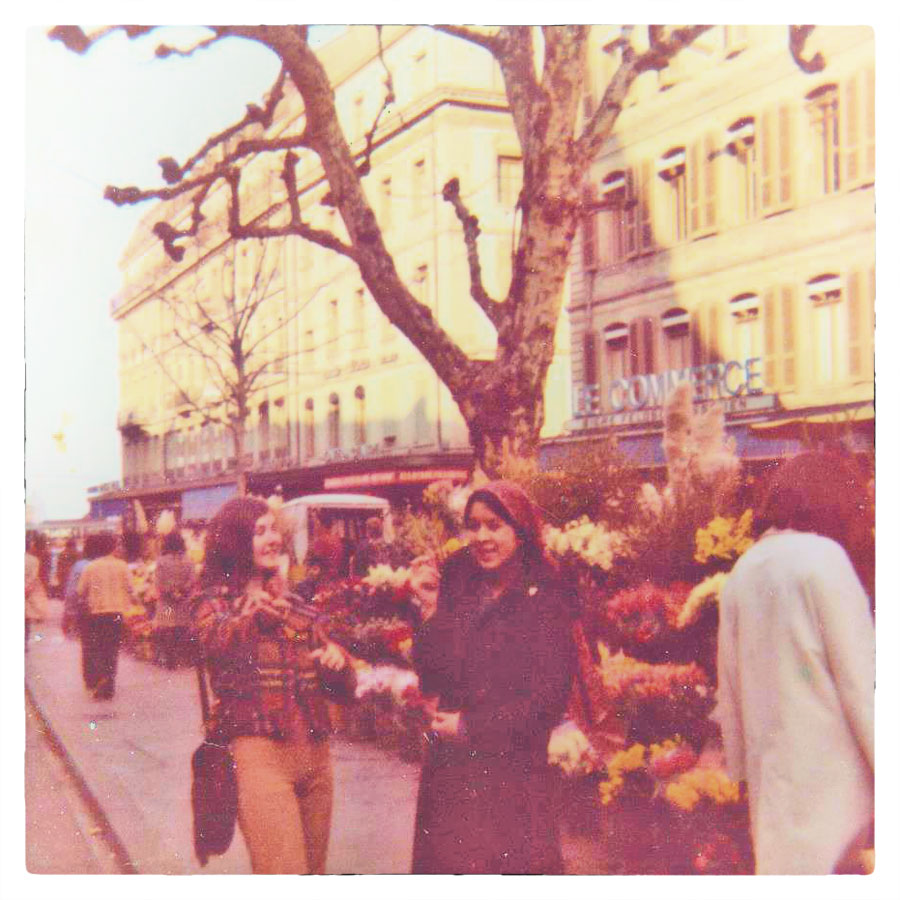
Lorraine and Suzanne outside the flower market and Café du Commerce, Geneva, March 1972
I had a small room to myself in the high rise apartment not too far from the airport and with easy transport links into the city. With a view out to the Alps it was better than my box room in Yorkshire. Saturday mornings would involve an intense cleaning session where dining room chairs were upturned and dusted. Usually it involved a trip to a supermarket and a drive into France (passports at the ready) to buy bottled Avian water.
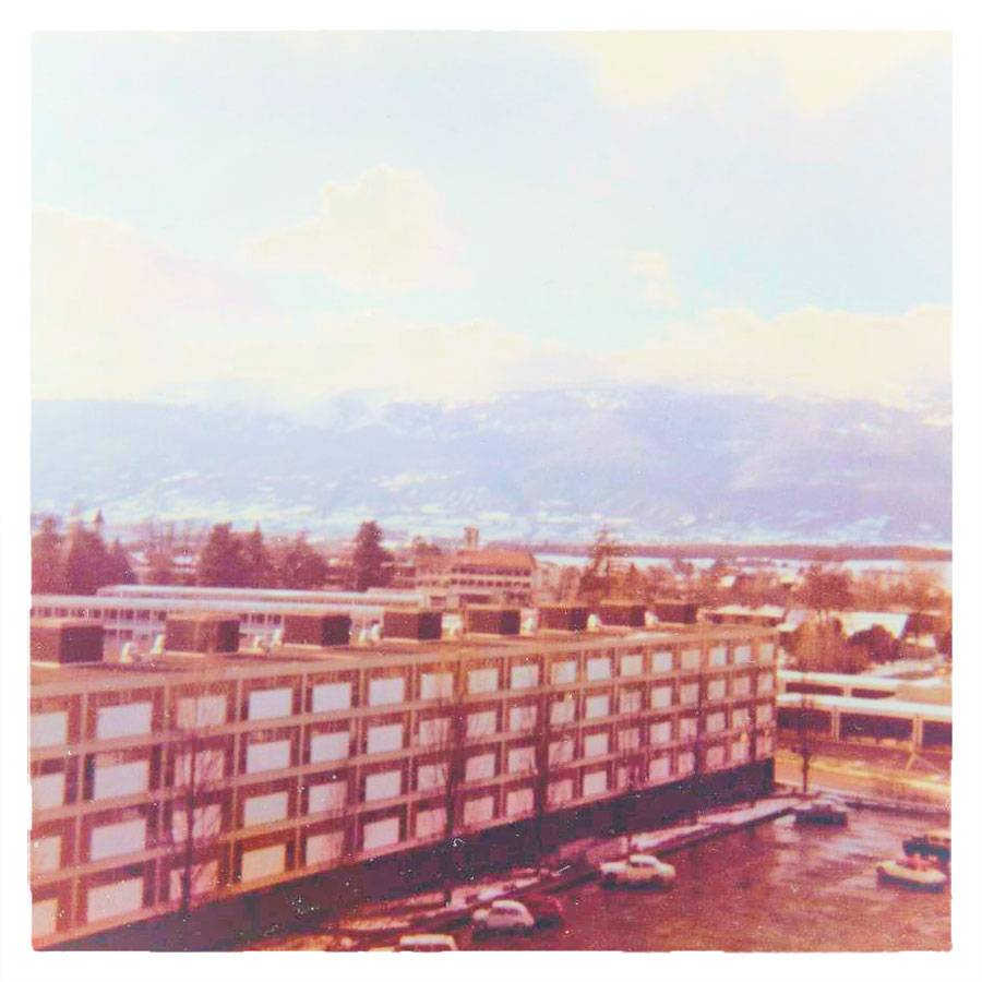
View from my window in Meyrin, Geneva towards the French Alps
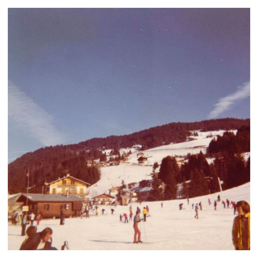
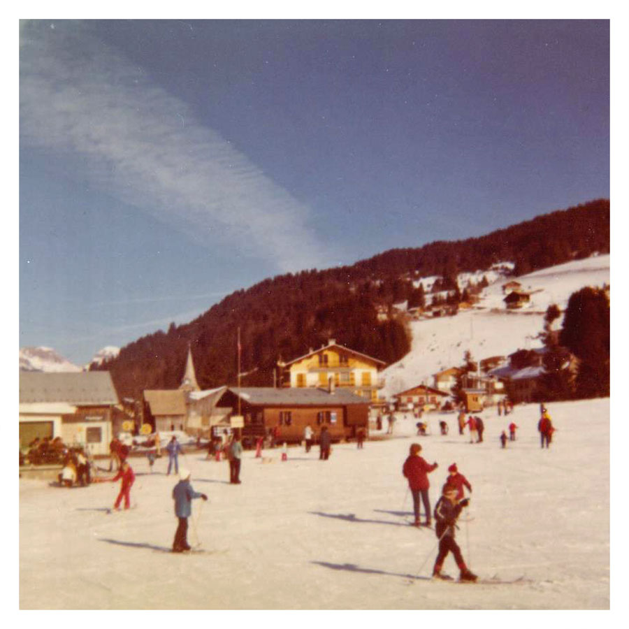
Some Sundays I accompanied the family to a ski resort in the French Alps where I was left in charge of the little one. I do recall once stepping into snow up to my thighs whilst pulling him along on a sled!
French Alps
Once I had a weekend away when I visited a girl I had met on my European travels who was working in a ski resort in Les Diablerets at the far end of Lake Geneva. It was an interesting journey there, the last part on a cogwheel train. She also worked long hours, but at least didn’t have to look after young children.
French Alps
My job came to an end when the mother decided to take a break from work and stay home with her children. So I contacted the son of a friend of my father’s who was teaching in Lyon and happy to give me a lift home as he was going home for the Easter holidays. It was quite funny though, as I was sneaked into his room in the boarding school overnight (most of the pupils had already gone home).
After that I took a job as a white collar worker in a factory in Bradford, living in a minute bed-sit before hitch-hiking to Zurich in September to fill in for another au pair friend whilst she went on holiday. I desperately tried to find work there without success so had to return to England until I could find another job, preferably abroad.
The most surprising thing about living in Geneva? Seeing cockroaches in the kitchen when I came home at night and switched the light on. Apparently they come up though the air vents.
“One for all of us who’ve been hampered by nervousness, clumsiness and much else in the race for success, whatever that is.”
(Note to anyone looking at this post in the Reader or on a phone you may need to visit the actual site to be able to view and listen to the music track)
Lyrics
Before I Fall
I know I can be clumsy / I’m hamfisted as they come
I’m blessed with two left feet / And my fingers are all thumbs
But I can tie my own bootlaces / I can use a knife and fork
I get there in my own time / And if I can’t run I’ll walk
I don’t need a nanny or a minder and if I can’t cope, I’ll call But please don’t pick me up (x3) before I fall
I know I tend to stammer / And my tongue gets tied in knots
I get confused and nervous / Tripping over my own thoughts
But I’ll make up my own mind / If I’m wrong I’ll take the blame
And I can finish my own sentences / Thank you all the same
I don’t need an interpreter and if I ever do, I’ll call Only please don’t pick me up (x3) Before I fall
I’m defensive and I’m obstinate / When things I say and do
Turn out upside down and in reverse / I may get mad at you
As well as me, but I’m sorry / And I hope you understand
I appreciate your putting up / With me the way I am
I’m trying to do better, for you, most of all Only please don’t pick me up (x3) before I fall
credits
from The Old Man Laughs, released February 7, 2022
Words & music, guitar and vocal by David A. Harley.
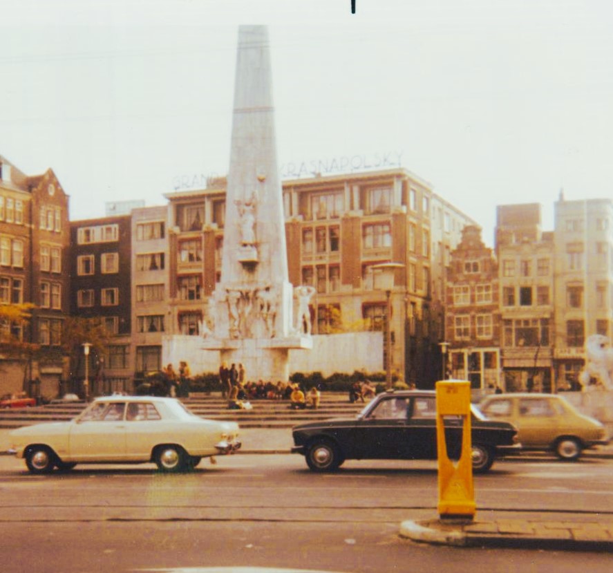
What can I say about Amsterdam? It was very different to home. Drugs for a start. Lots of drugs. The red light district. Hippies. The emperor of Japan – I kid you not – loud demonstrations, museums, canals, so many bikes. We spent three hours in the Ryksmuseum, it was fascinating.
Dam Square in Amsterdam, Netherlands, featuring the National Monument. Anantara Grand Hotel Krasnapolsky: The historical hotel, established by Wilhelm Krasnapolsky in the 19th century, is visible in the background.
The Student Bar was a popular hang out and as we were kicked out of the hostel at 9:30am we spent another day wandering around the capital city. There were no shortage of young men vying for our attention with suggestions of accompaning them to Switzerland, Morocco, Afghanistan. All of which we turned down, of course. Finally we needed to move, the youth hostel was full and so we had to leave, we went to the nearest town of Harlem where we spent a couple of rainy days before setting off for the coast.
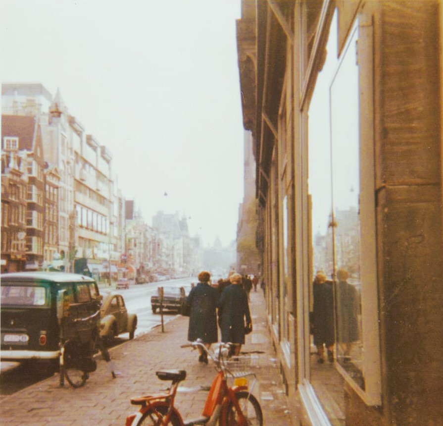
A street scene in Amsterdam – A classic Volkswagen Type 2 transporter and older model cars are parked on the side of the road.
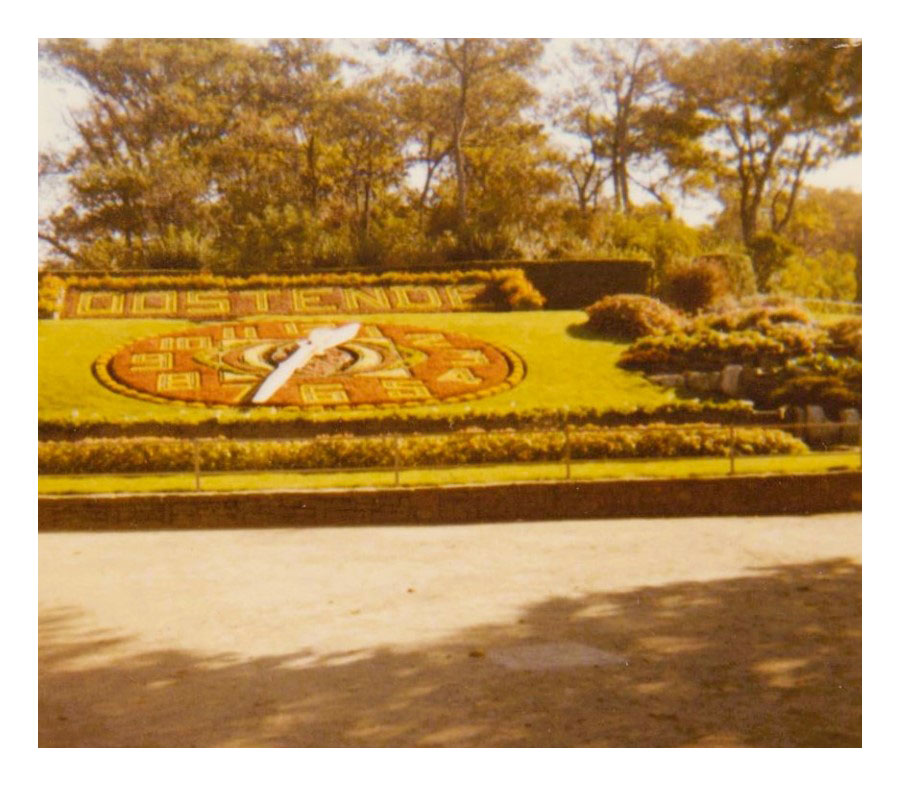
We reached Oostende at 12:30pm this time successfully avoiding Antwerp. It did take a while though with many short lifts, one amusingly crammed into a two-seater Triumph Spitfire. Still raining we found the youth hostel for one last night. It was very clean and also expensive, but dry. We had an enjoyable evening chatting to a couple of Americans and some Canadians who were heading for India.
the Floral Clock (Bloemenuurwerk) located in the city of Oostende, Belgium.
The following day we walked around the city, telephoned home and used up the last of the camera film as the ferry wasn’t until 7pm. On board we got talking to Kim who was from Watford and a folk singer! He apparently had written a poem which had been used by The Incredible String Band on one of their early albums and whether that was true or not he did entertain us with his hilarious tales of travelling in France. He even offered us a lift but his car was full of gear – guitars, amps etc. Plus we were so tired when we reached Dover – the sea was so rough that it took several attempts to dock and by then it was 1:30am. We stayed in the waiting room until daylight before setting off for London.
Not the best of days. It was raining, there weren’t many lorries about and lifts were scarce. It took us all day to get through to the north of London. Calamity stuck when the lift we were in broke down and we were stuck at the side of the motorway waiting for a breakdown truck. Obviously we weren’t in a good location to hitchhike. At Leicester Forest East we finally got a lift by a lorry driver going all the way to Leeds. The relief! By now we were soaked though, cold and miserable. Our time on the Greek islands seemed like a dream.
Total time away: 10 weeks.
Within weeks I was desperate to travel abroad again, but Cathy had met a boy and reluctant to leave him and without any savings this meant finding work. So it was that on 1st January 1972 I was flying for the first time, to Switzerland, to begin my job as an au pair in Geneva.