During this year I shall be posting photographs from places around the UK, many of which have not been published before. Where I have previously blogged about a location I will provide a link to the post, though you won’t be able to comment on it as I restrict comments to six months.
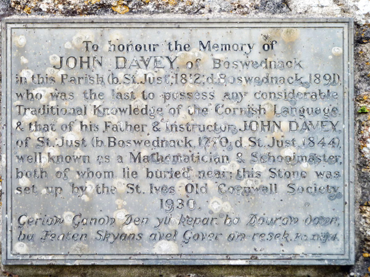
Z is for Zennor
The last letter in the alphabet just happens to be only six miles away from where I live. It is on West Penwith, a sparsely populated peninsula, ringed by high cliffs and rising to high, rocky moorland at its centre. It is surrounded on three sides by the pounding waves of the Atlantic Ocean.
The ancient landscape includes Zennor Head and Gurnard Head, granite moorland hills such as Carn Galver and Zennor Carn. Wonderful hiking country for those who are fit enough.
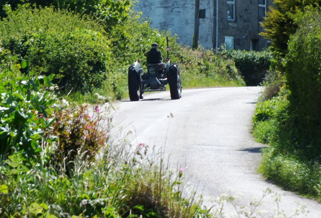
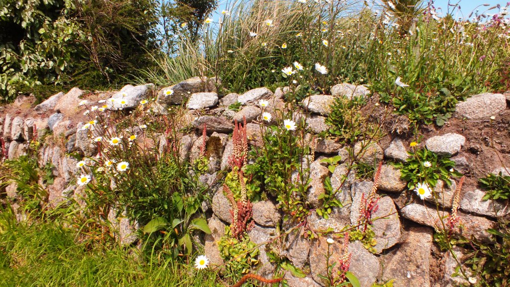
Access to most of the landscape is by narrow ancient lanes bounded by Cornish hedges.
Typical Cornish LanesA Cornish Hedge
In Zennor you will find the wonderful Tinners Arms, built in 1271, for good food and drink and a popular place for people who walk the South West Coastal path from St Ives to find well needed refreshments. Up on the main road is a bus route either back to St Ives or on towards Land’s End.
The Tinners Arms, Zennor
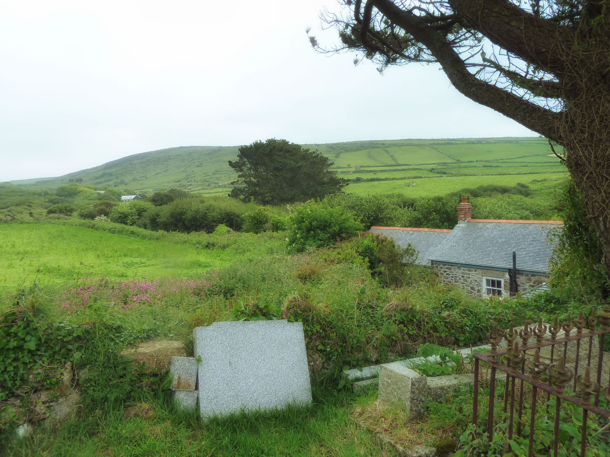
Also in Zennor is St Senara’s church, home to the famous mermaid chair.
Views from Zennor churchyard
I hope that you have enjoyed my tour around the UK and hopefully I have introduced you to some places that are not necessarily on the tourist trail. There are a lot of wonderful towns, cities, villages and countryside to explore throughout England, Scotland and Wales. I’m sorry that I haven’t been able to include Northern Ireland too. We are not short of history, interesting architecture, great walks and incredible landscapes so I hope that this series has whetted your appetite to discover new places to enjoy.
During this year I shall be posting photographs from places around the UK, many of which have not been published before. Where I have previously blogged about a location I will provide a link to the post, though you won’t be able to comment on it as I restrict comments to six months.
Y is for York
I couldn’t miss out York seeing that I am a Yorkshire lass and spent a good part of my childhood growing up in and around the county and then moved back to South Yorkshire for almost 19 years. York was a city I visited fairly often as a child. My dad loved horse-racing so we would all go to the York races most years and my brothers and I would walk around the city walls, or go to the fair that was always there at the same time.
The City Walls form a walkway on both sides of the River Ouse.
York still has most of the medieval walls that surrounded the city 700 years ago. The tops of these walls were partly rebuilt about 150 years ago so the public could walk along most of them –and feel safer by having a tall parapet on one side of them. There is a guided trail walk for those of you that fancy it.
Later on I would take my own children to the city for a day out as it was easy to reach by train and the museums were fun. (Jorvik Viking Centre – all about the Viking era and complete with smells and my favourite the Castle Museum with its world renowned Victorian street Kirkgate. For the trainspotters amongst you the National Railway Museum is extremely interesting and there is even a chocolate museum now).
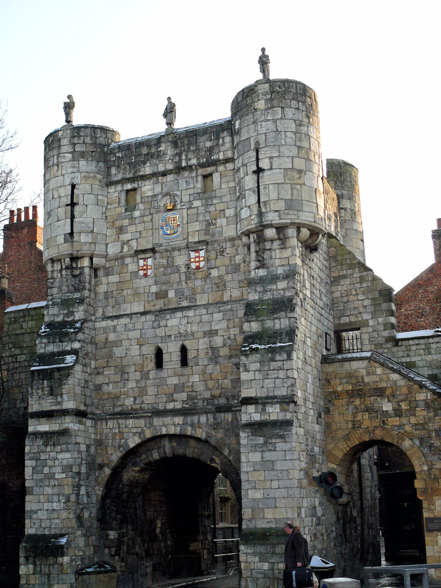
There is so much history to be found in this compact city including these wonderful gateways. Bootham is a continuation of Petergate outside the city walls. There has been a gateway here for nearly 2000 years and Bootham Bar stands on the site of the western entrance to the Roman fortress.
Bootham bar is topped by three statues which were added in 1894 to replace the rather weathered medieval originals. From left to right there is a stone mason holding a model of the bar, 14th Century Mayor Nicholas Langton and a Knight carrying a sword and shield.
Another beautifully preserved gateway is Micklegate Bar, famous for displaying the skewered heads of rebels and traitors above the gate as a warning to others. These were a regular fixture with the longest being up there for 9 year. The last one to be displayed was removed in 1754.
Taking its name from Mykill (Great) and Gata (Street) Micklegate Bar is the prestigious entrance to within the City Walls at which important guests from London and the Monarchy would be met and welcomed into the city.
The best way to explore York is on foot. I love simply wandering around the centre of the city, within the city walls, walking alongside the river and on the walls themselves.
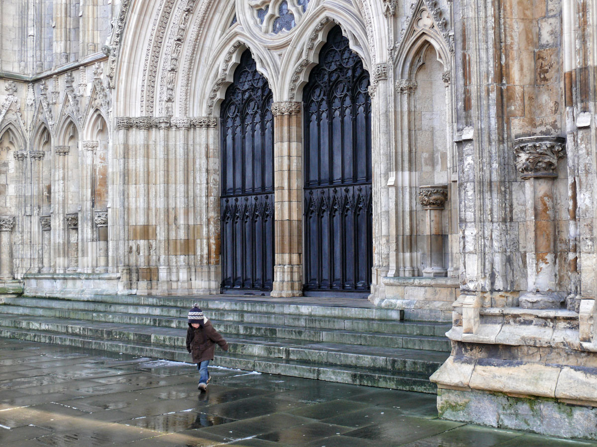
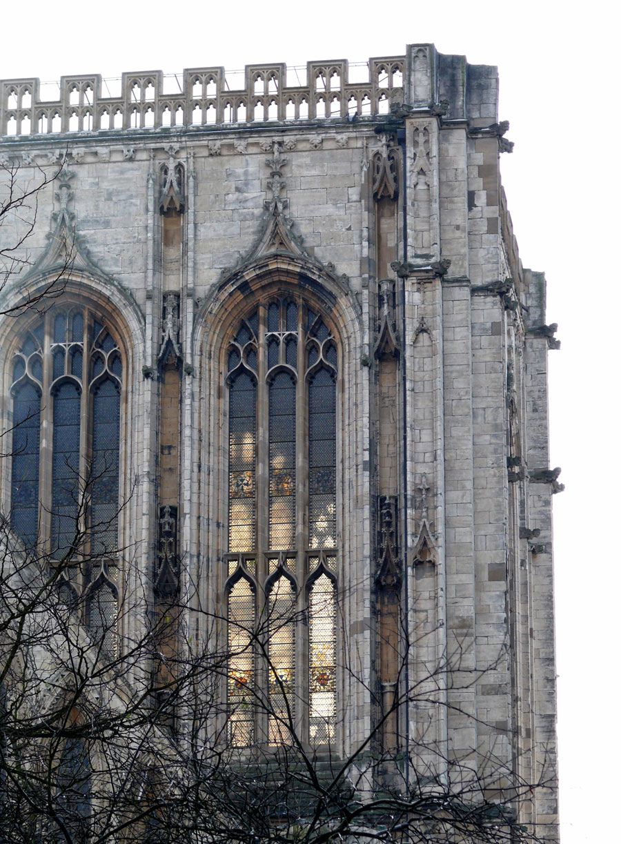
The majestic York Minster is very difficult to get a good photo of as it is hidden behind trees, even in winter they obscure the view. It is quite expensive to visit so we didn’t actually go in (plus there was a service on at the time), but it is an impressive building and I hope one day to actually have a look around inside.
York Minster in evening light. The huge 13th-century Gothic cathedral has medieval stained glass and 2 functioning bell towers. The south transept contains a rose window, while the West Window contains a heart-shaped design colloquially known as The Heart of Yorkshire.West doors of York Minster – not the entrance to the cathedralBronze statue of Constantine the Great (274 – 337 A.D.) Commissioned by York Civic Trust to commemorate his accession as Roman Emperor in York (then Eboracum) in 306.The Cathedral and Metropolitical Church of Saint Peter in York, commonly known as York Minster, is the cathedral of York, North Yorkshire, England, and is one of the largest of its kind in Northern Europe.
Tucked behind York Minster, Treasurer’s House is not as it first appears. In 1897 it was bought by Frank Green, the grandson of a wealthy industrialist, and by 1900 he had transformed it at great speed into an elaborately decorated town house, ready for the visit of Edward VII.
Treasurer’s House. An example of Dutch stepped gables. A classic architectural feature.
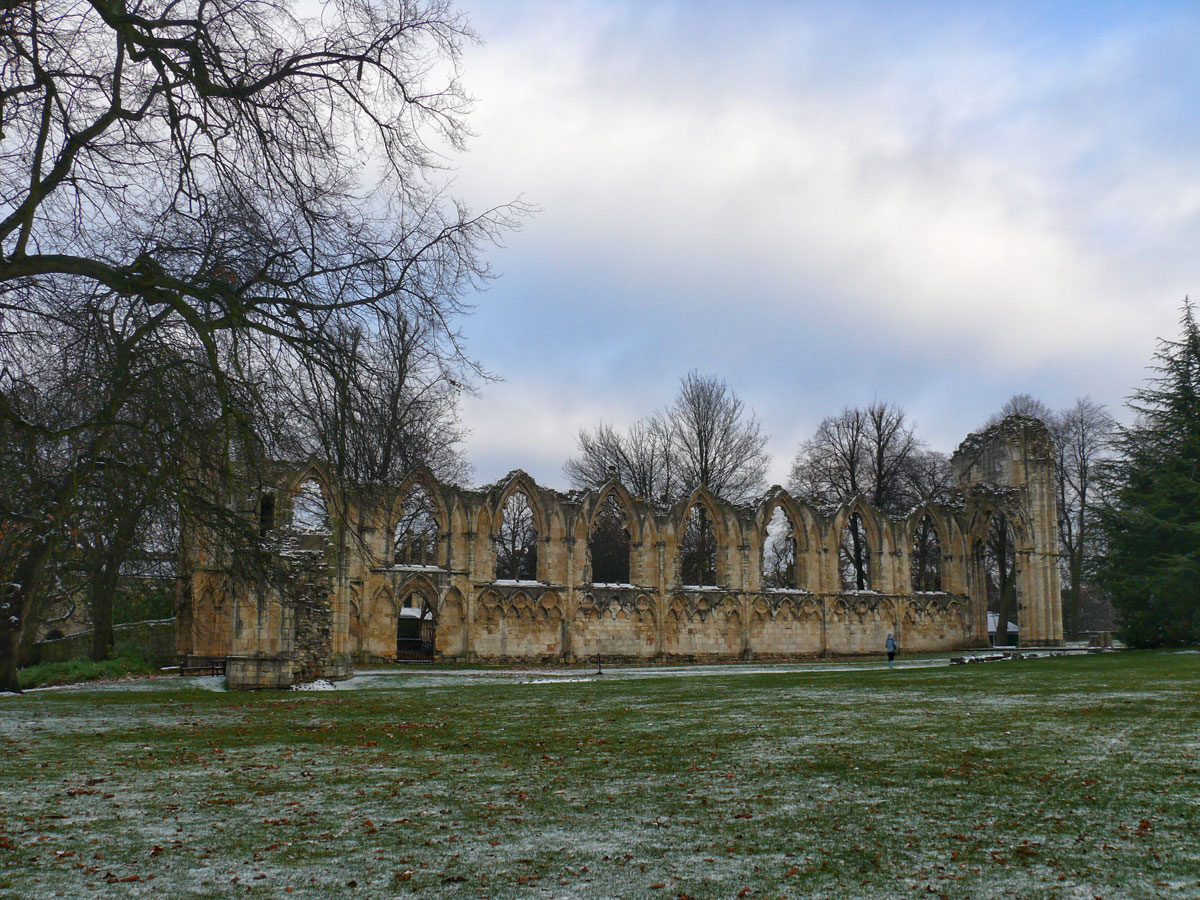
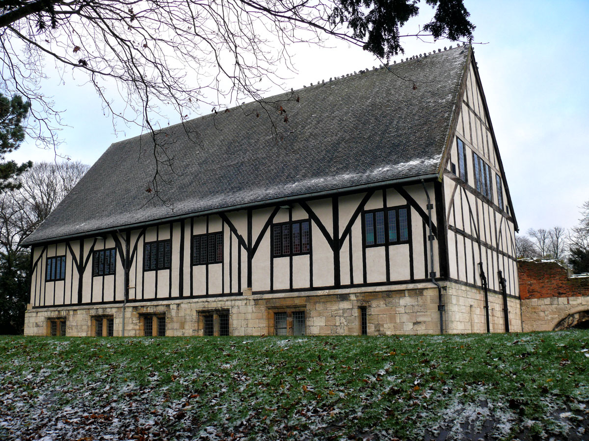
In November 2008 I was in the city for a few days when it happened to snow. Although rather cold, the place was decorated for the coming Christmas holidays so looked rather cheerful. We stayed in a typical terraced guest house (the type with brown linoleum in the hallway and heavily patterned carpets in the rooms) just outside the city walls which was convenient for us to walk along the riverside and through the museum gardens and into the city.
River OuseRuins of St Mary’s Abbey in the Museum Park. Built in 1088 this was one of one of the wealthiest and most powerful Benedictine monasteries in England.The Hospitium was built as part of St Mary’s Abbey. The name Hospitium (related to hospitality) suggests that the building was used for housing guests. These would have been people such as merchants who were not allowed to stay in the main abbey with the monks.
There is so much to say about York and Yorkshire (we also took a trip out to the North York Moors and to Whitby Abbey whilst there) but this would turn into a very long post. If you haven’t discovered the pleasure of this lovely city then I urge you to find out about it for yourself. Shops ✔ Restaurants.✔ Great Pubs. ✔
During this year I shall be posting photographs from places around the UK, many of which have not been published before. Where I have previously blogged about a location I will provide a link to the post, though you won’t be able to comment on it as I restrict comments to six months.
X is for EXmoor (I know, a bit of a cheat, but I don’t think there are any places in the UK beginning with X – maybe Cross could be used? I have been to Cross Houses near Shrewsbury, but it’s not a very interesting place and I certainly haven’t got any photos!)
EXmoor is a National Park in the south-west of England covering both parts of Somerset and Devon. A beautiful landscape of moorland, woodland, coast and rivers. We’ve had a couple of holidays around this region, once staying in the pretty medieval town of Dunster (Somerset) which we used as a base to explore the moor, its towns and villages and the north coast.
Iconic Yarn Market
Dunster itself is well worth visiting with a lovely castle and a working Water Mill and a pretty 15th-century stone Gallox bridge as well as unique shops, a Yarn Market and a hidden secret garden.
Gallox Bridge. This ancient stone bridge – originally ‘gallows bridge’ – once carried packhorses bringing fleeces to Dunster market.A view towards the Valley of the Rocks on the North Devon coast.
A walk to the Dunkery Beacon at the summit of Dunkery Hill which is the highest point on Exmoor and in Somerset, England is a must from where you have views over the Bristol Channel to south Wales. Just make sure you use the correct track unlike us (we had to double back when we couldn’t find a route through the thick gorse and bracken).
Make your way to the village of Winsford which might be the prettiest in Exmoor Park and does indeed have a ford. With its thatched cottages, two medieval packhorse bridges, a Grade II listed telephone kiosk, a medieval parish church and a picturesque thatched country pub it is a village well worth stopping off in to explore. West of the village is The Punchbowl, a geological hollow created by glaciation during the last Ice Age.
One of the fords over the River ExeThe Royal Oak in Winsford
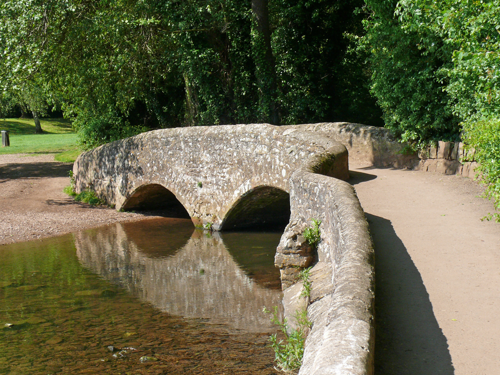
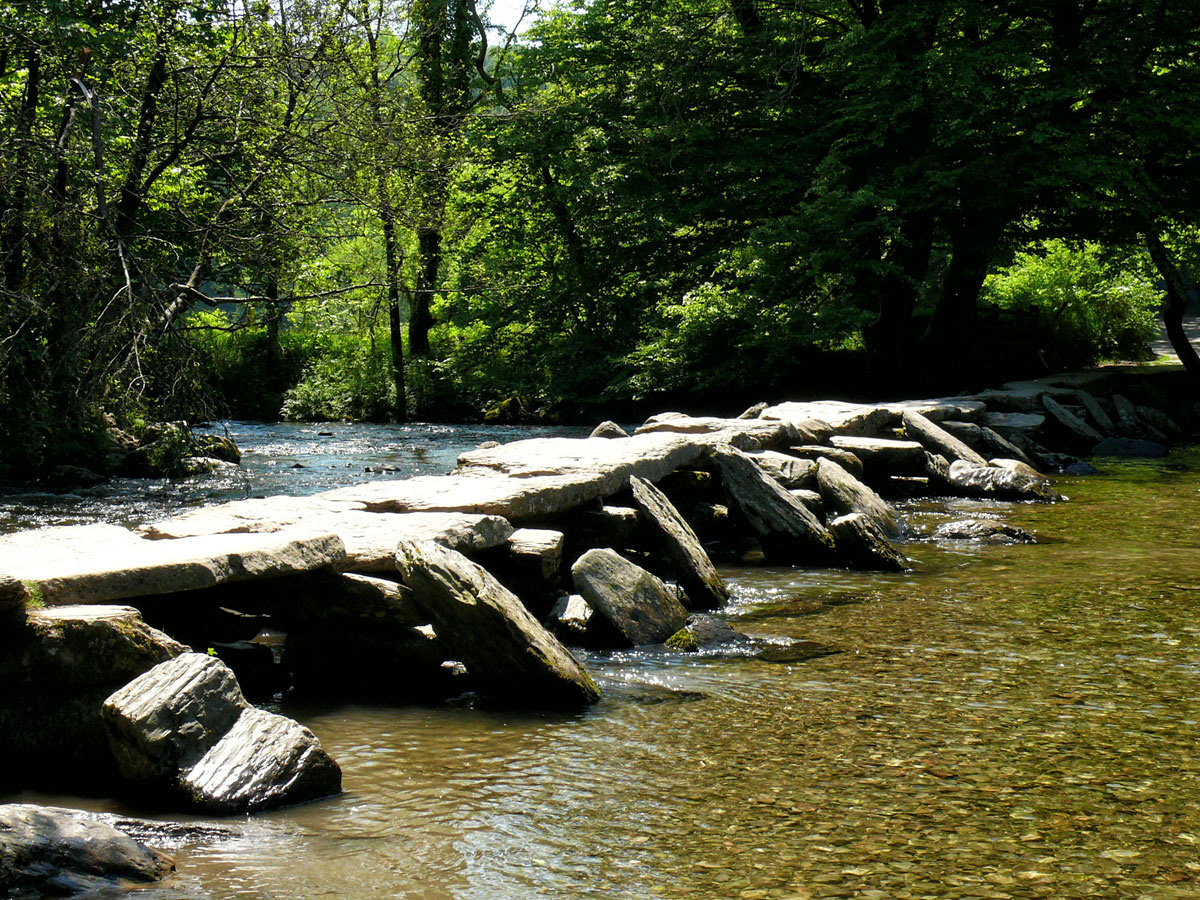
Tarr Steps is another great place to go when looking to explore Exmoor National Park. You can head straight there, utilising the on site car park and toilet facilities, with just a gentle walk down to the ancient clapper bridge.
The Tarr Farm Inn
Or there are several walks in the surrounding countryside including a circular walk from Dulverton.
Tarr Steps is a 17 span clapper bridge (Tarr Steps is an example of a ‘clapper’ bridge (the term being derived from the Latin ‘claperius’, meaning ‘pile of stones’) and is constructed entirely from large stone slabs and boulders.), the longest of its kind in Britain.
The coastal region is very beautiful too, with extraordinary views.
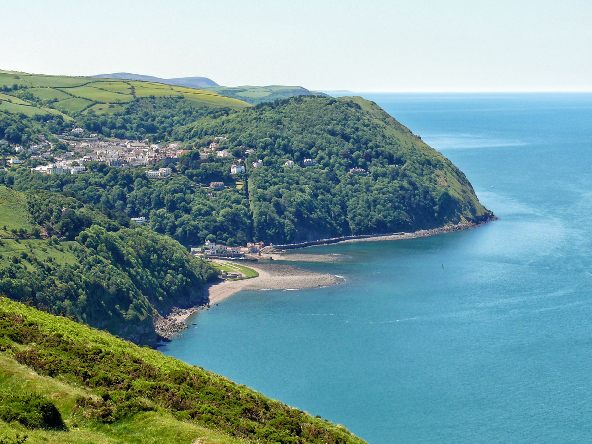
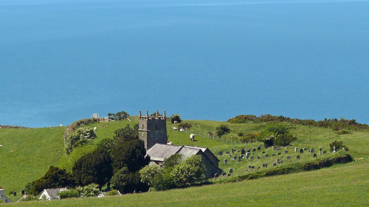
Porlock BayPorlock WeirLynmouth and LyntonThe Parish of Saint John the Evangelist Countisbury (between Lynmouth and Porlock)
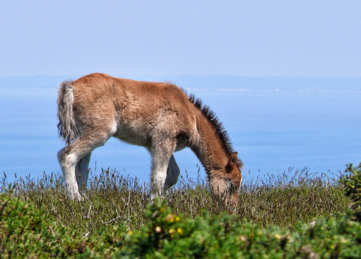
And sheep and Exmoor ponies.
Exmoor foalA very woolly sheep
If you would like to read more about North Devon then please click here.
During this year I shall be posting photographs from places around the UK, many of which have not been published before. Where I have previously blogged about a location I will provide a link to the post, though you won’t be able to comment on it as I restrict comments to six months.
W is for Wingham
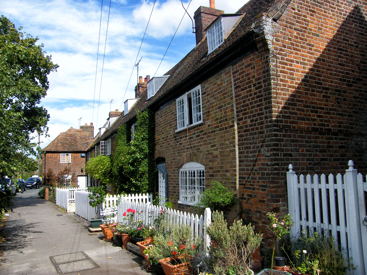
High Street
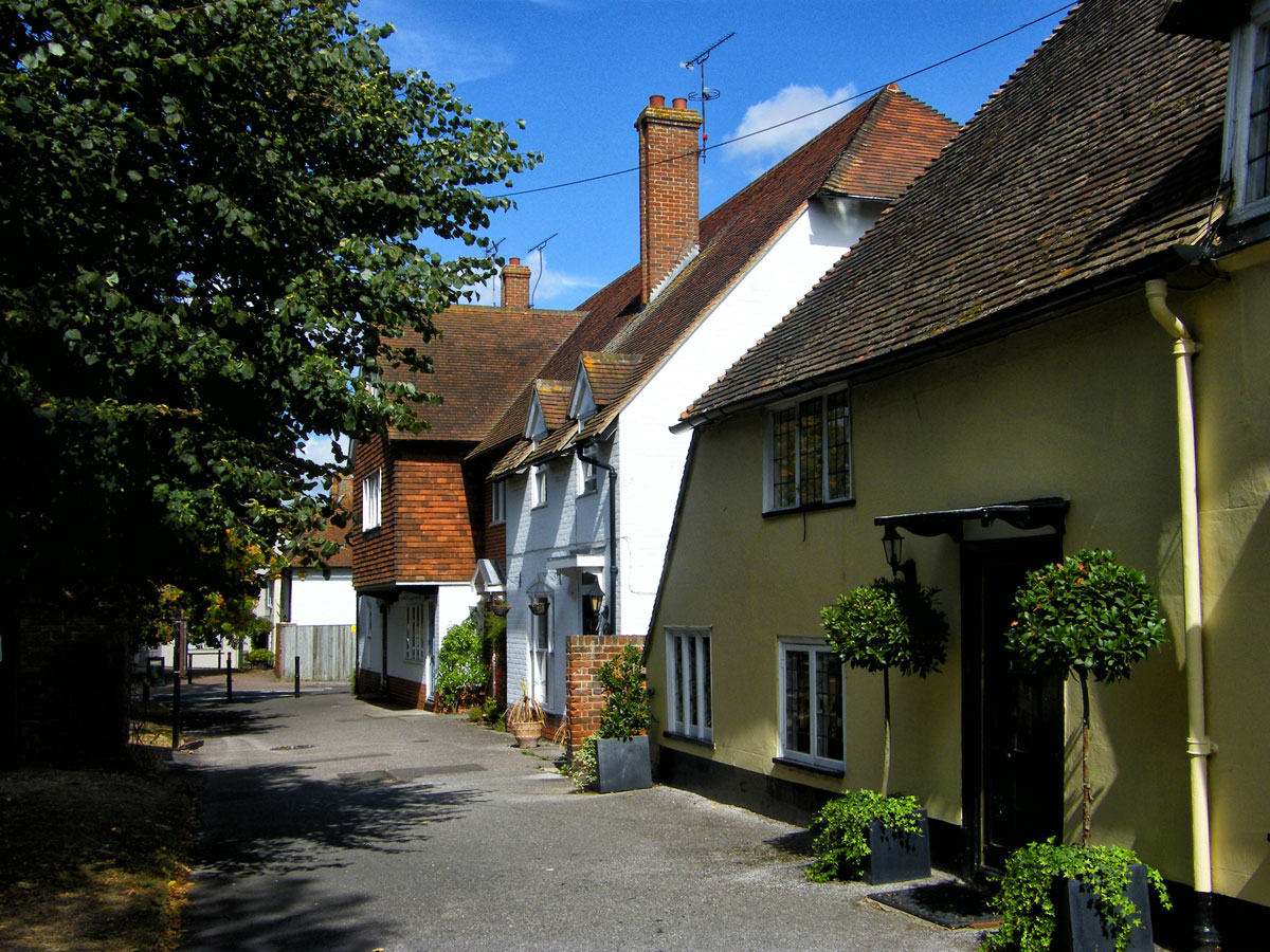
I’m sure there will be a lot of scratching of heads with this one. Where is Wingham? Even people who live in Kent may not be familiar with this small historic village on the outskirts of Canterbury.
High Street
I have been fortunate to visit Canterbury several times when my OH went there on business. Once we stayed in the city itself, but usually we stayed in a delightful B&B place between the villages of Staple and Wingham. I would drop him off in the city and then go off to explore the Kent coast, inland villages and gardens.
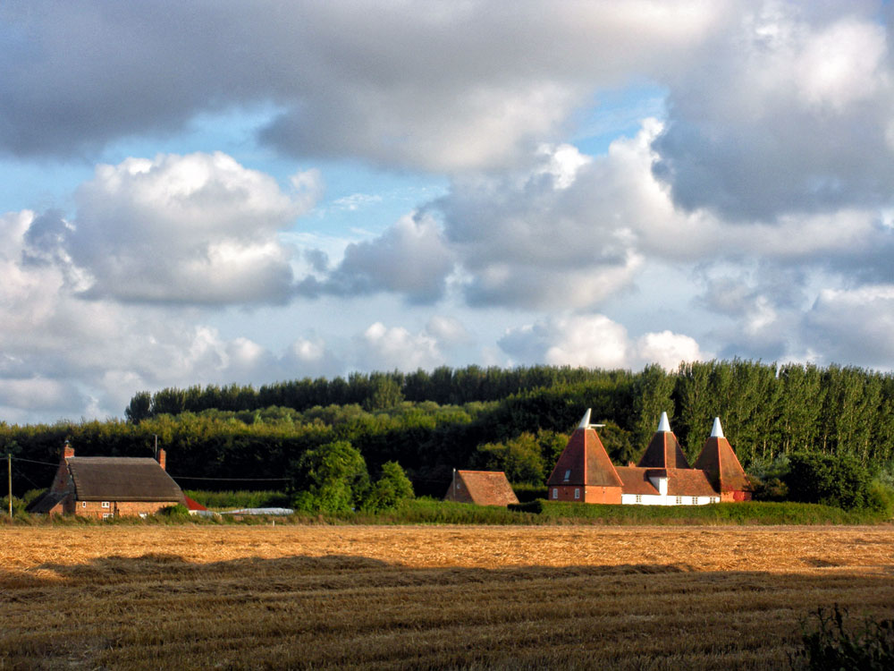
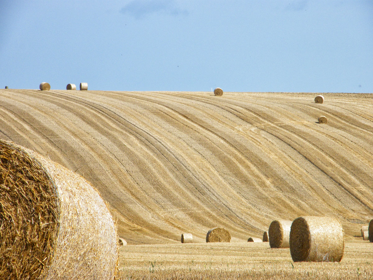
A familiar sight in Kent are these iconic Oast Houses (where hops were dried and stored for the brewing process)As we always visited in early September there were many fields like this where these wonderful round hay bales have been harvested.
By the 12th century Wingham was a prosperous village with a weekly market. The people of Wingham were involved in many popular protests including the Peasant’s Revolt of 1381 and the Swing Riots of 1830 when threshing machines were destroyed.
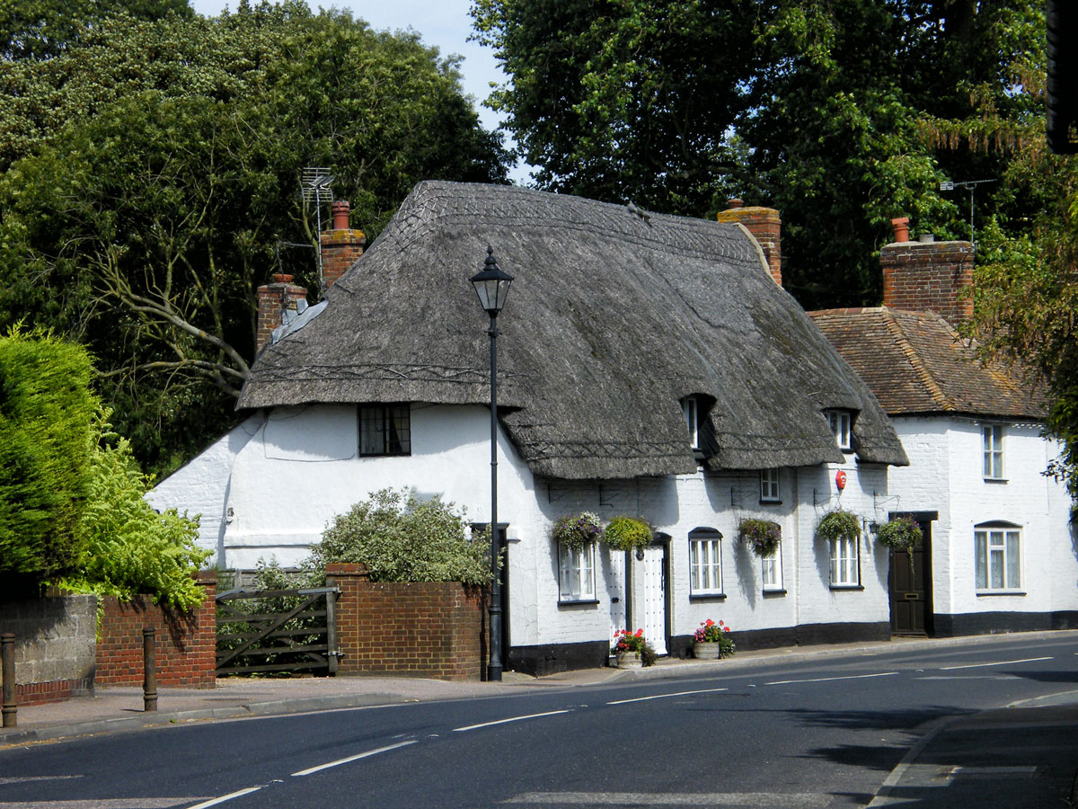
Pretty thatched cottage
At the end of the 19th century coal was discovered close by and plans were made for a mine and a railway – neither came to pass so the village remains small with a wealth of historic buildings.
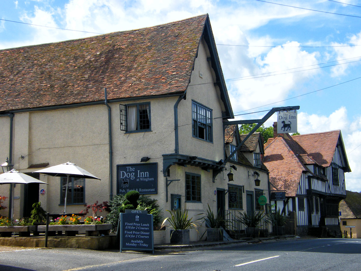
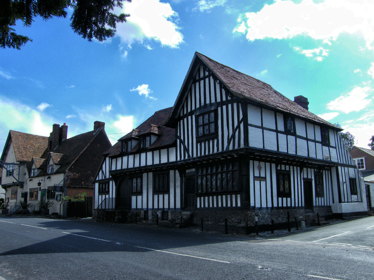
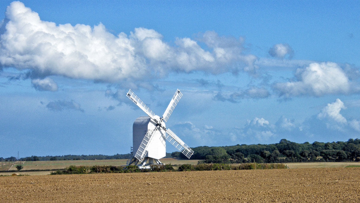
The Dog Inn c.1890The Old Canonry and Canon Cottage, Canterbury Road, Wingham opposite the medieval church. The lower left hand wing is a survival of the row of canons’ houses for Wingham College burnt down in 1660. The undercroft, the jetty and the sans-purlin roof are all of about 1285 soon after the college was founded in 1283. The rest of the building is late 15th century in origin.Chillenden windmill is a grade II* listed open-trestle post mill north of Chillenden, Kent, England. It is the last post mill built in Kent abut 10 mins drive from Wingham.
Reasons to visit Wingham? Well apparently there is a Wildlife Park nearby, but one of the reasons that I liked staying nearby was the easy access to the east coast (Sandwich, Broadstairs), the city of Canterbury and the north Kent coast (Herne Bay and Whitstable) and south to Dover.
During this year I shall be posting photographs from places around the UK, many of which have not been published before. Where I have previously blogged about a location I will provide a link to the post, though you won’t be able to comment on it as I restrict comments to six months.
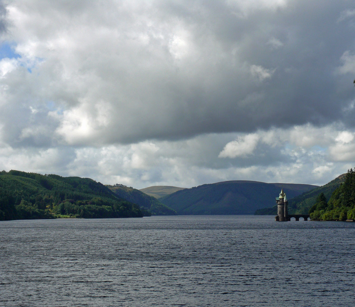
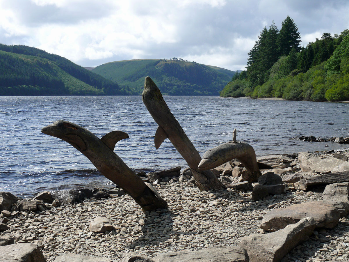
V is for Vrynwy (Lake)
Lake Vyrnwy (pronounced Vernwee) is a reservoir in Powys, Wales, built in the 1880s for Liverpool Corporation Waterworks to supply Liverpool with fresh water. Just on the edge of the Snowdonia National Park and south of Lake Bala, Lake Vyrnwy is set amidst the remote and beautiful Berwyn Mountains. It’s a short drive from the Shropshire border (The Welsh Marches).
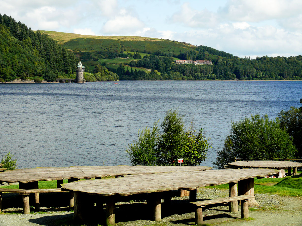
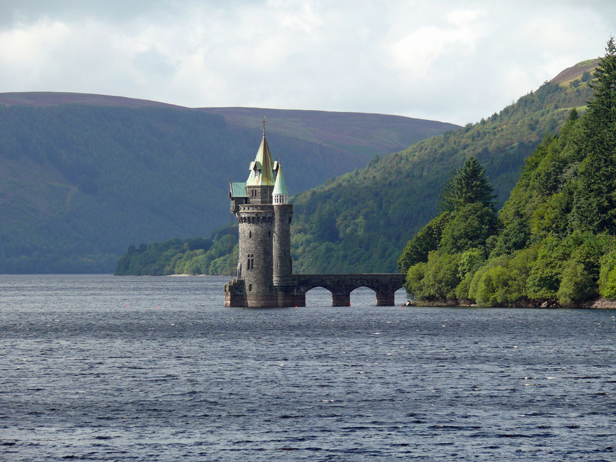
View of the lake from the dam bridge.Picnic TablesThe Straining Tower at Lake Vyrnwy is an intake tower built to extract water from the lake.
There are lots of trails and walks around the 5 mile long lake with several picnic spots and viewpoints and bird hides from which to watch the variety of birdlife in the area.
Dolphins carved from driftwood
There are many other activities too including sailing, fishing and mountain biking. Visitors can embark on a relatively easy 12-mile bike ride around the lake or hike one of the many walking trails, such as the Rhiwagor Trail or the Craig Garth Bwlch Trail.


 Also in Zennor is St Senara’s church, home to the famous mermaid chair.
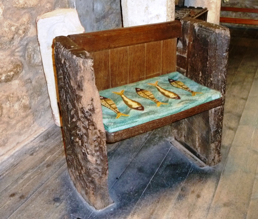

")
")