Description: Every Tuesday I offer the “A to Z challenge”, walking step by step through the alphabet.
If you would like to join in then please click here
or National and University Library, Ljubljana, Slovenia.
It is located in the centre of Ljubljana, between Turjak Street (Turjaška ulica), Gentry Street (Gosposka ulica), and Vega Street (Vegova ulica), in a building designed by the architect Jože Plečnik in the years 1930–31 and constructed between 1936–41. The building is considered one of the greatest achievements by Plečnik. Wikipedia
“From the twilight of ignorance to the light of knowledge and enlightenment”
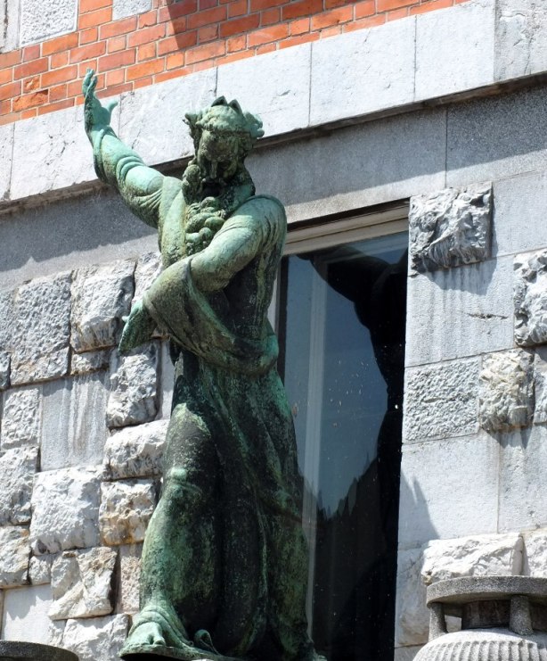
The building has a square ground plan and is a massive block with a court. The front façade, oriented toward Turjak Street, was designed as a combination of brick and stone embeddings, some of them archaeological remains from the place. It was modelled in the manner of the Italian palazzo and the handles of the main door end with a little head of Pegasus. The side entrance from the Lord Street is decorated with a sculpture of Moses, created by Lojze Dolinar.
Unfortunately we were being guided through the town by a friend so didn’t have a chance to get up close to this unusual building, nor go inside. So if you have seen the interior I’d love to know what it is like.
On Monday we left Page to drive to Bryce Canyon and our next stop. First we had a look at the Glen Canyon Dam which was the reason for the town of Page as it originated from housing the workers of the dam when construction started in 1957.
Bridge over the Glen Canyon Dam
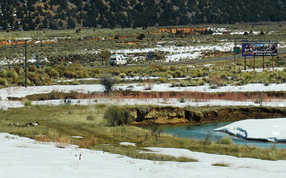
Then we stopped at Lake Powell which is the largest lake in Arizona/Utah and famed for its water sports, fishing, hiking and boat trips to Rainbow Bridge (the world’s largest natural stone bridge).
Lake Powell with Tower Butte and Navajo Mountain in the background
Lake Powell is arguably the most scenic lake in America, situated in some of Southern Utah’s finest red-rock desert country.
The River runs through us
Above: The Hydroelectric Project (Glen Canyon) and the Navajo Generating Station. Why are two power stations so close? The reason is the river. The availability of water at lake Powell, the proximity of a source of coal and a worker base in the city of Page determined the location.
Lake Powell
Sparkling clear, blue water laps against towering, sheer, red-rock canyon walls and sandy beaches. Lake Powell has more coastline than the entire west coast and you need a water craft to access the majority of the canyons as access is limited because there are few roads.
Highway 89
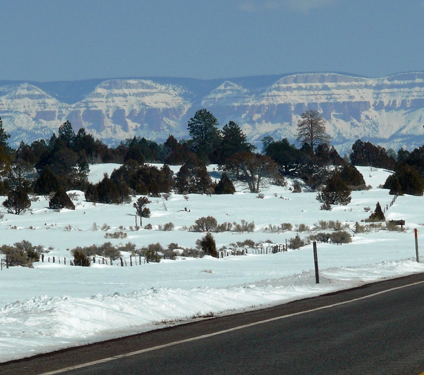
Moving on we crossed the border into Utah which is only about ten miles from Page. Utah’s southwest corner is often called “Colour Country” and has a dry, hot climate and Highway 89 is a Heritage Highway because of the wealth of history along its route.
Cockscomb
Driving past Paria Canyon and the Vermilion Cliffs Wilderness you then pass Cottonwood Canyon Scenic Backway with rugged peaks called the Cockscomb. Next is an area called Telegraph Flat named in 1876 when Western Telegraph opened an office here. It is now a ghost town.
Driving to Kanab
The biggest town along the route is Kanab, famous for the Western Legends Roundup and Western Film Festival an annual event that is a tribute to the area’s rich movie history. Nearby is the Coral Pink Sand Dunes State Park (covered in snow as we passed ) where the rare plant, Welsh’s Milkweed, grows.
Coral Pink Sand Dunes
The United Order experiment was instituted in 1874 for a communal lifestyle at the direction of Brigham Young. Eighty families moved here from Mount Carmel where the co-operative had failed.
It existed until the 1880s when it started to fall apart, though it had grown to more than 700. The families lived in apartments which were identical, they all ate in a common dining hall and wore uniforms. Private property did not exist.
The next town is Mount Carmel Junction where Highway 9 to Zion National Park intersects with the 89 (and which we would be taking tomorrow as we retraced the next stage of our trip), a few miles on we drove through the unusually named Orderville.
Mount Carmel Junction was first settled by Dr Priddy Meeks in 1864 as part of Brigham Young’s plan to settle all of Utah’s territory. It was later named after a mountain in Israel.
John Wesley Powell first visited in 1872; he was the first white man to descend the East Fork of the Virgin River and who named the canyon “Parunuweap” from the Paiute word meaning roaring water canyon.
(source: wikipedia)
Coral Pink Sand DunesOn to Highway 12Heading to Bryce Canyon
Just before Panguitch (another town with an interesting tale, which I will tell you about in my next post) you take a turn to the right on State Route 12, another of the All American Roads, which winds 124 miles through some of the most unique geology on earth. Almost immediately you hit Red Canyon, a section of the Dixie National Forest, with red hillsides dotted with ponderosa pines and hoodoos.
The Red Canyon Tunnels
(Click an image to enlarge and for further information)
Red Canyon
Tunnel
Ponderosa Pines cling to Cap Rock
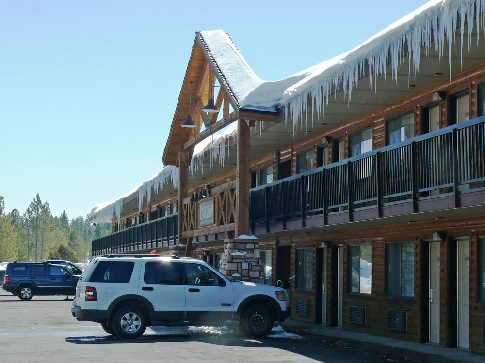
After 14 miles we took another right turn and headed back south on Highway 63 to Bryce Canyon National Park, so named after Ebenezer Bryce a Mormon pioneer. We were staying in the Best Western Ruby’s Inn which is a short distance from the park entrance.
Ruby’s Lakeview Lodge
“Before there were any Indians the Legend people, To-When-an-ung-wa, lived in that place. There were so many of them. They were of many kinds – birds, animals, lizards and such things – but they looked like people…
For some reason the Legend People in that place were bad. Because they were bad Coyote turned them into rocks; some standing in rows, some sitting down, some holding onto others. You can see their faces with paint on them just as they were before they became rocks…”
~ a Paiute Indian Legend
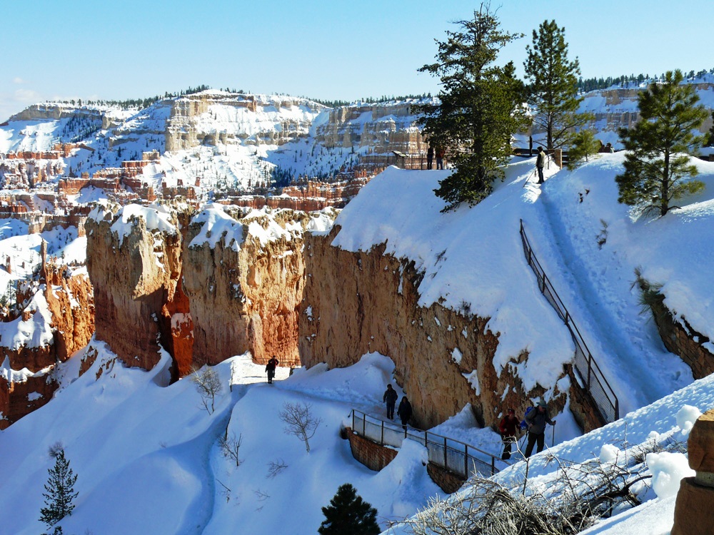
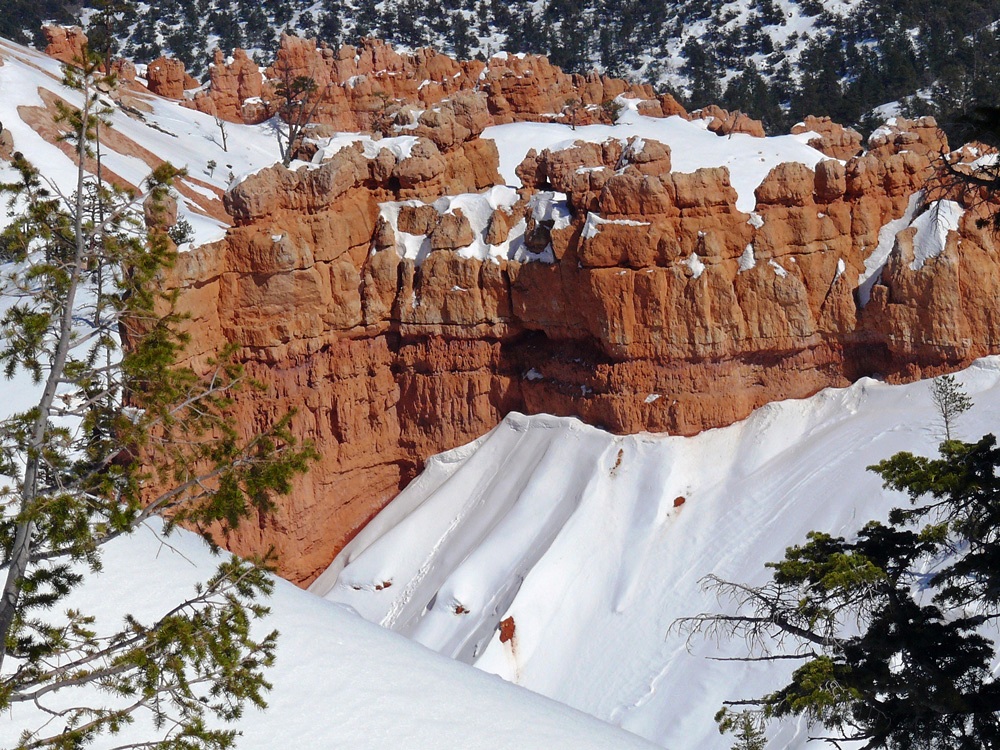
After checking in and dropping our luggage in the Lakeview Lodge we headed off into the park to have a look at the incredible hoodoos that are concentrated in a horse-shoe shaped amphitheatres that provide amazing spots to watch the sun rise and set.
A perfect spot for star-gazing as there is no light pollution.
AmphitheatreViews
The 3 feet of snow that had fallen over the weekend meant that several of the pathways were under snow and walking was quite treacherous. It didn’t seem to put off some people though as we saw them climbing over fences to approach the end of a lookout point – oblivious to the fact that you couldn’t see the edge. I even saw two lads carrying a mate in a wheelchair to the edge of one viewpoint.
Snow in BryceA lone coneNavajo Loop note the steep, icy trail
From Sunset Point this trail takes you down onto the floor of the canyon and amongst the hoodoos. Not to be ventured on except by people in stout boots with walking poles, or idiots in fashion boots complete with high heels!!
Hoodoos
We ate at Ruby’s that night, there isn’t really a lot of choice, but the food was reasonable – I can’t say that we’ve eaten any remarkable meals during this trip so far. It had been a long day with lots of interesting scenery along the way. There was a lot of snow all around and it was very cold, but thank goodness the roads were cleared and driving was a breeze. Tomorrow should be another interesting day.
Description: Every Tuesday I offer the “A to Z challenge”, walking step by step through the alphabet.
If you would like to join in then please click here
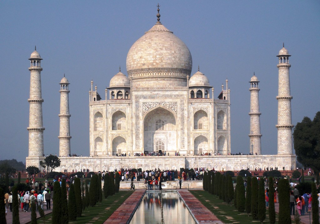
The five principal elements of the Taj Mahal complex—main gateway, garden, mosque, jawab and mausoleum (including its four minarets)—were conceived and designed as a unified entity.
A couple of weeks ago I used the Jawabto illustrate architecture for the letter J so this week I am going to show you the Mosque, Minarets and Mausoleum which were mentioned in that post. Remember, the Jawab is simply a building mirroring the Mosque for symmetry in the design.
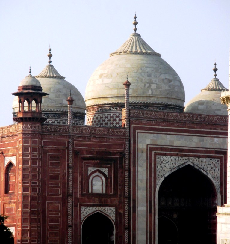
Mausoleum and Minarets
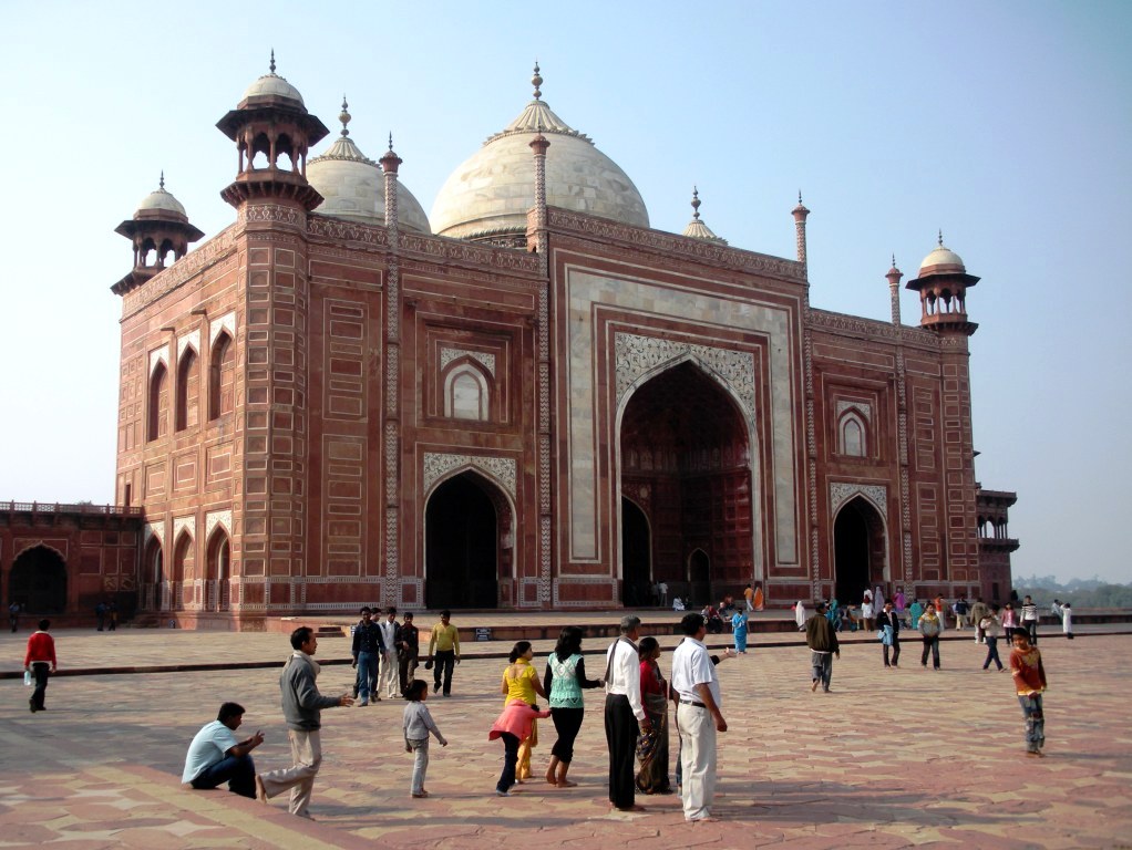
At the western side is the mosque (masjid) facing east, reported to have been built by Isa Muhammed 1631-1648. It is built of red sandstone and has one dominant portal known as an iwan.
Mosque
Either side of the major iwan are two smaller arches sandwiched between four towering pinnacles. The spandrels above the arches are studded with coloured marble inlay and the mosque dados feature naturalistic floral designs.
On the roof and complementing the arches below are three marble-coated domes. Inverted lotus shaped designs cloak the top of the domes, surmounted by gilded finials. On the four corners of the mosque are chattris, or domed kiosks, which have a marble coated veneer.
Mosque
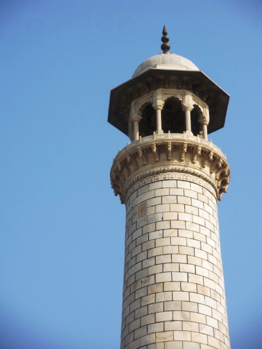
I will also include a minaret, four of these form part of the mausoleum, which have the same chattris as on the corners of the mosque and jawab.
Minaret and Chattri
One of the most beautiful structural compositions in the world, the Taj Mahal was designated a UNESCO World Heritage site in 1983.
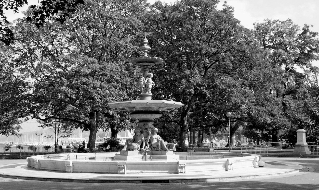
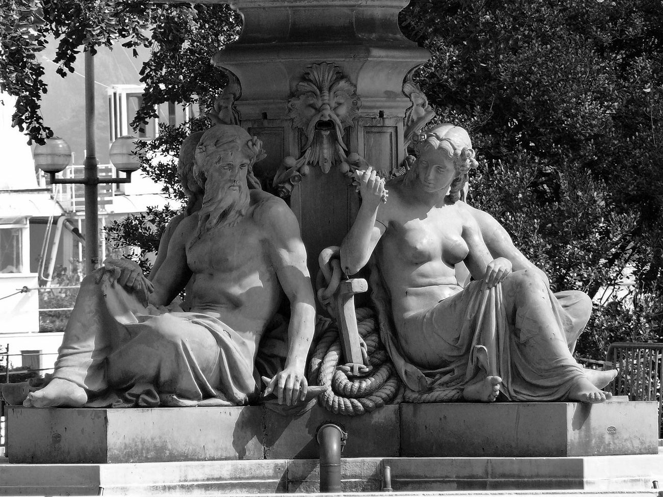
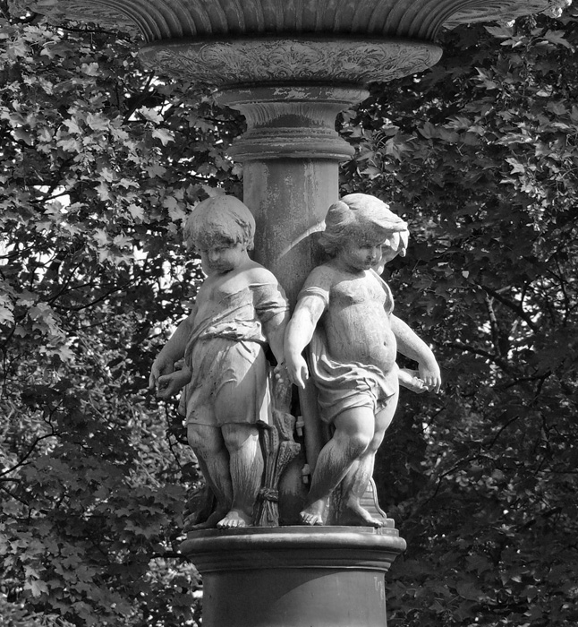
So I thought I’d take the opportunity to feature one of my favourite fountains in the Jardin Anglais in Geneva, Switzerland.
This large bronze fountain with its superposed basins borne by naiads was the work of the Parisian sculptor Alexis André in 1862.
KRINAIAI, the Naiads of fountains
THE NAIADES were fresh-water Nymphs who inhabited the rivers, streams, lakes, marshes, fountains and springs of the earth. They were immortal, minor divinities who were invited to attend the assemblies of the gods on Mount Olympos.
KRINAIAI, the Naiads of fountains
KRINAIAI, the Naiads of fountains
I am combining this post with this week’s Travel Theme challenge from Ailsa of “Where’s My Backpack?” who has written an interesting article about statues in Rome and is now urging everyone to find some suitable STATUES to join her this week. If you would like to join in with her challenge then please do. Everyone is welcome.
Description: Every Tuesday I offer the “A to Z challenge”, walking step by step through the alphabet.
If you would like to join in then please click here.
The Lotus Temple, located in New Delhi, India, is a Bahá’í House of Worship completed in 1986. Notable for its flowerlike shape, it serves as the Mother Temple of the Indian subcontinent and has become a prominent attraction in the city. Wikipedia
Delhi in winter is unfortunately plagued by fog and pollution caused by the many open fires in the city. Hence the rather hazy photographs.
Before you reach the House of Worship you need to deposit your shoes at the shoe room. You can then enter the Prayer Hall, which is a place for silent prayer and meditation for people of all religious backgrounds. Photographs are not allowed inside, but it is very plain with rows of chairs although the roof structure is quite interesting.
The lotus has been used as a unifying symbol for all Indian religions. The most basic idea in the design is that light and water are used as its two fundamental elements, and that these two elements alone are responsible for the ornamentation of the House of Worship in place of the thousands of statues and carvings to be found in other temples.