
Today I decided to spend walking around Stanley Park which covers 1,000 acres at the tip of downtown Vancouver. There is so much to see in the park from the seawall walk (8.8 km), several beaches, Beaver Lake and the Lost lagoon, ‘monument’ trees and many trails amongst cedar, hemlock, and fir trees which lead you away from the madding crowds into the cool quiet forest. Continue reading Vancouver: Stanley Park
Category: travel

Vancouver: Art, History and Nature
On my own today, so I walked along the seawall down to Canada Place along Coal Harbour where the Harbour Air Seaplanes are based with stunning views across Burrard Inlet. Vancouver is filled with hundreds of pieces of public art; everywhere you go you find odd sculptures or examples of Chinook phrases, and since 1998 they have the International Sculpture Biennale with temporary exhibits from all over the world.
At Harbour Green Park you will see the “Light Shed” which imitates the simple boat-sheds that stood along the harbour over a century ago. Poised on log stilts, this aluminium-coated shed is particularly lustrous after dark when a dim, moving light shines from within. The park itself is a lovely shady area which seems to float at the edge of the harbour and it has plenty of benches from where you look at the appealing views and watch the float planes arrive and take off. It contains a variety of European Beech, Northern Red Oak and London Plane trees. This was going to be a long, slow walk….
Further along I came to the Vancouver Convention Centre West. A fascinating building as it appears to lean out over the harbour and resembles the prow of a ship. It has huge glass windows that reflect the view (on this day lovely clouds over the North Vancouver Mountains). Also along the seawall are railings similar to those you find on a ship and there are lots of interesting information plaques telling you the stories of different people who came to BC and what they did. What a wonderful way to learn history. All the photos come from the BC Museum in Victoria. (Another must-see museum).
Finally you come to an impressive blue bulbous sculpture “The Drop” by Inges Idee. The west building has a 6 acre living roof with 400, 000 indigenous plants and 4 beehives and 40% of the building juts out over the water. An impressive building. You then arrive at the distinctive Canada Place with the five sails that dominate the Vancouver Downtown skyline and which is home to the Vancouver Convention Centre East and the cruise ships terminal, and if you look up West Hastings Street you will see an impressive example of art deco, the Marine Building, which was built during the great Depression and was the tallest building in the British Empire in 1930.


Road Trip: USA California – The Road to Hell and Beyond
On a visit to California, a few years ago, we had to travel to San Diego from San Francisco and decided that it might be fun to drive down the coast using the PCH rather than fly between the two cities. So from that decision a little road trip was born.
This is the final section between Santa Barbara and San Diego broken up with an overnight stay on the Queen Mary ship in Long Beach.
Distance: 221 miles
Time: 4 hours 20 minutes without stopping
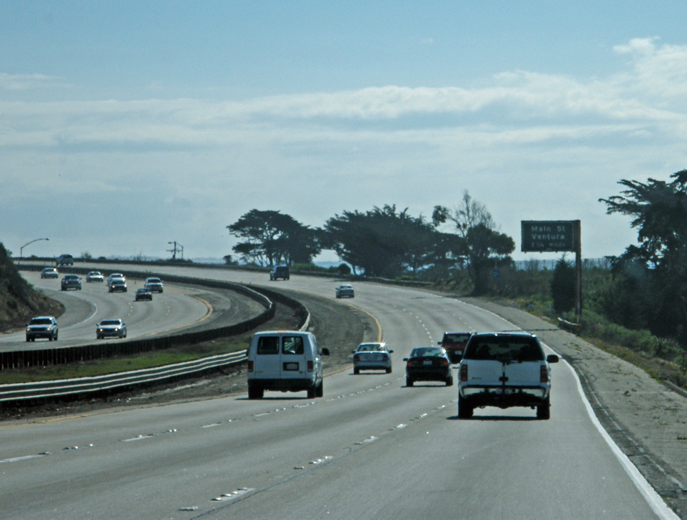
 Next day we set off for our final stop in Long Beach about 100 miles south. I was not looking forward to the final stretch of the journey – the free for all freeways of Los Angeles are notorious and to say I was nervous of driving there is no exaggeration. PCH merges with US Route 101 at this point for the next 54 miles and the traffic was intense.
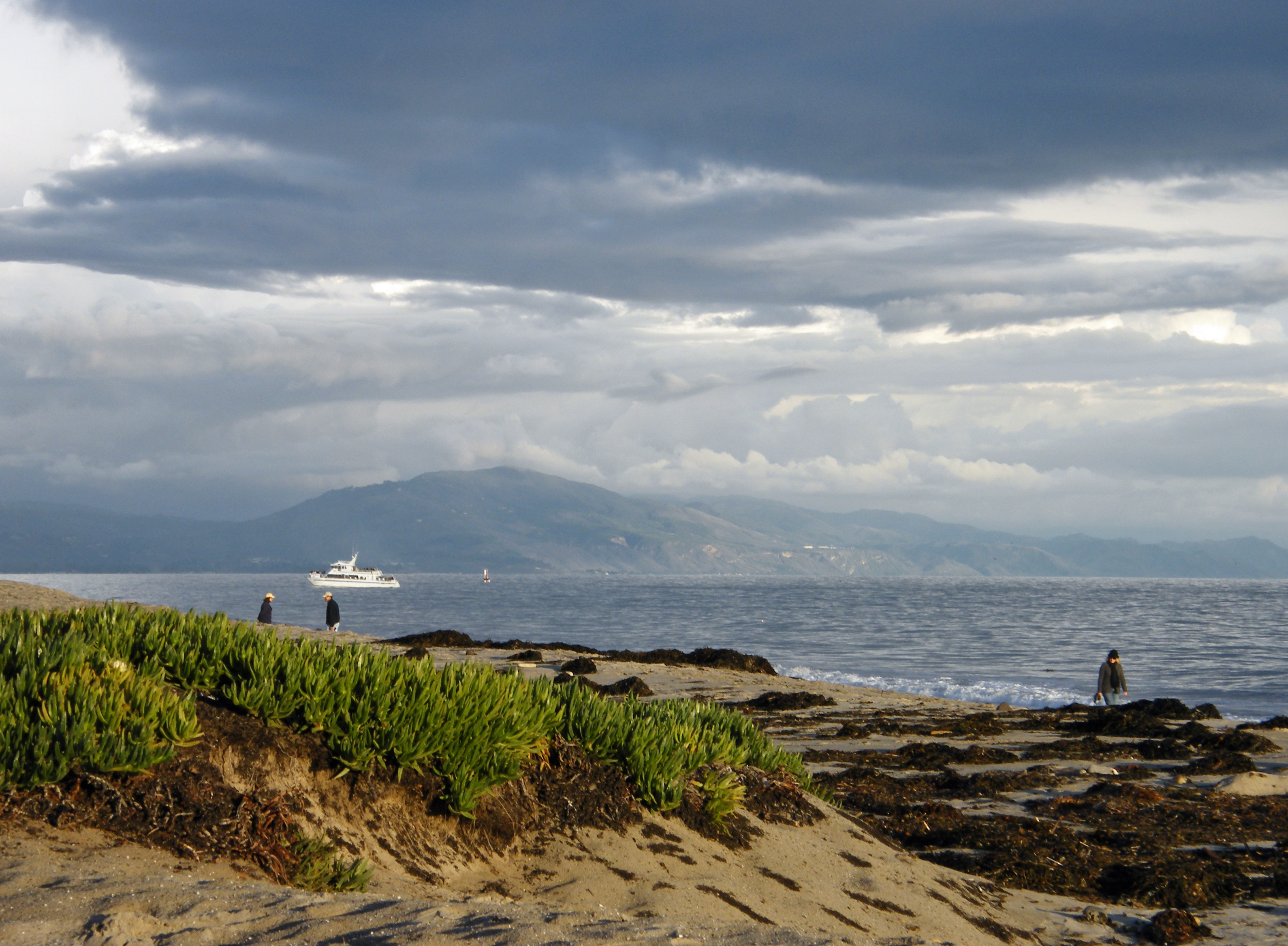
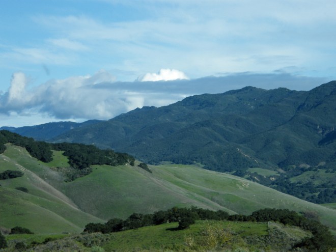
 Driving along the ‘Screaming Eagles Highway’ and then ‘Ventura Freeway’ we hugged the coast with great views of the ocean to the right and the Ventura Hills to the left with the lyrics of America’s “Ventura Highway” buzzing around our brains. Just after Ventura is Oxnard where the 101 and PCH part company again and passing a huge naval base we were back on the coast. Seeing islands close to the mainland we subsequently found out about the Channel Islands Park that lies in the Santa Barbara Channel and Santa Monica Basin – the park encompasses five of the eight California Channel Islands (Anacapa, Santa Cruz, Santa Rosa, San Miguel, and Santa Barbara). You can get there by boat from Oxnard harbour and spend time hiking, kayaking, camping, photography, painting, bird-watching and snorkelling as well as looking for wildlife. I had never heard of these islands before this trip, but they look more than worthy of a visit if you are in the area.
Two sunny hours later and we reached Santa Monica on the outskirts of Los Angeles where the traffic was heavy on a late Sunday morning and somehow we missed the turnoff for the PCH which would have taken us through Santa Monica to Venice Beach and Redondo Beach (and also under the runways at LA International Airport), instead we found ourselves on the Santa Monica Freeway and the stuff of nightmares – 12 lane freeways with cars overtaking from the left and the right.
 Fortunately we managed to weave our way through the spaghetti onto Interstate 405 (the San Diego freeway) and then Interstate 710 (Long Beach freeway) to our destination in Long Beach harbour where the Queen Mary is berthed.
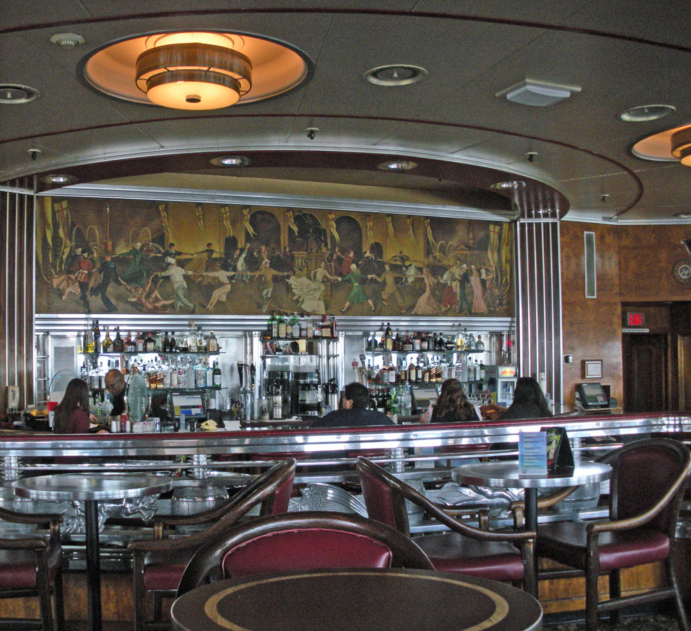
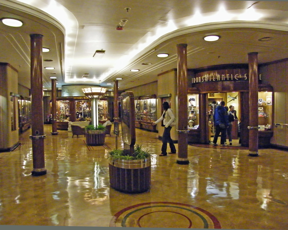
This lovely grand ocean liner with its memories of old Atlantic crossings is a timeless art-deco masterpiece and a wonderful place for an overnight stay in staterooms with original wood panelling and artwork (and plumbing) and half the price of the motel in Santa Barbara!
The following day we reluctantly said goodbye to the Queen Mary thinking we really must try a cruise some time and carried on our journey southwards. Locating the PCH we skirted across the north of Long Beach before plunging south to the coast again. I heaved a sigh of relief. Much as I love driving I no longer enjoy big towns and cities and LA is one huge mother of a city!
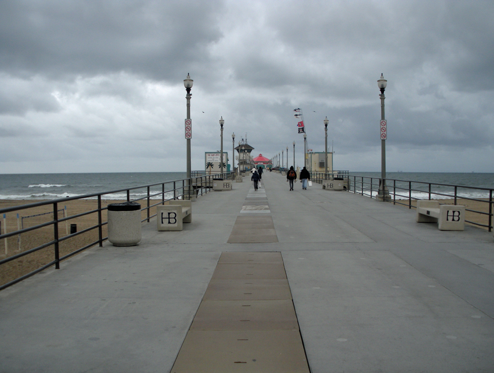
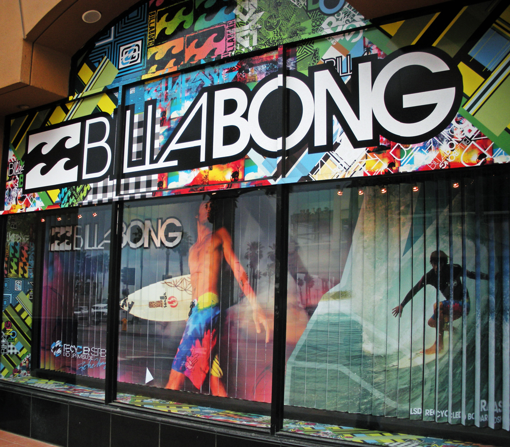 We abandoned the car at Huntington Beach, a pretty surfer town just south of LA, to meet up with a friend for breakfast. I had a half stack of pancakes with maple syrup – the first time I had tried the pancake option and I can only say how glad I was not to have ordered a full stack! Coffee was plentiful and the aroma of crisp bacon filled the air.
 The name of this café? Sugar Shack on Main Street. Owned by the same family since the 1967 it is a place where you can dine with surfers coming back from “catching the waves”. Go there if you can for mammoth portions of the best breakfasts in California along with interesting surfing posters and surf boards in 1960s splendour and old family memorabilia.
After a brief walk around the pier and promenade in the much warmer (though still cloudy) SoCal climate to try to burn off some of those calories we continued along the coast to Capistrano beach near Dana Point in Orange County where the PCH ends becoming Interstate 5, the San Diego freeway. Shortly after lunchtime we drifted into the car rental place in downtown San Diego with only fumes left in the tank.
Our journey ended with a sigh, ‘Surfin’ USA’ rattling around our heads and a reluctance to return to normality.
This journey can be done in a couple of days, but if you aren’t in a rush I recommend taking your time. The Pacific Coast Highway is an excuse for a long, lazy trip in the sunshine and if you drive from north to south as we did, you are all but in the ocean for most of the time – though choosing a less inclement time of the year would be an improvement.
NB: Also check the route before setting off as there can often be road closures along the coastal roads from landslips.

Road Trip: USA California – The American Riviera
On a visit to California, a few years ago, we had to travel to San Diego from San Francisco and decided that it might be fun to drive down the coast using the PCH rather than fly between the two cities. So from that decision a little road trip was born.
This is the third section between San Simeon and Santa Barbara
Distance: 151 miles
Time: 2 hours 48 minutes without stopping
A new day dawned with no rain, the sun was shining and there was a soft wind and all was good. We almost felt like abandoning our drive south and turn around to do the Big Sur again! But we had to be in San Diego in two days time so south it was. We set off without breakfast as we planned on stopping in Cambria a small town further south to try and find these Olallieberry* pies we kept hearing about.
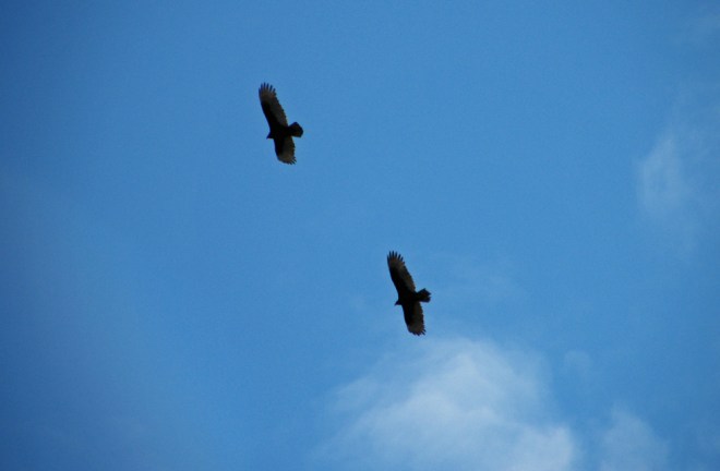
We stopped off briefly at Moonstone Beach (San Simeon State Beach Park) to watch what looked like California Condors swirling high above us, before slipping off the Cabrillo Highway into Main Street Cambria where we found a small bakery and had our olallieberry* pies and coffees sitting on an outside terrace in the sunshine people watching. What could be better?
*(Olallieberries are a cross between a loganberry and a youngberry, which themselves are hybrids of raspberry, blackberry and dewberry). Indeed. Trying working that one out!
 Continuing south in the sunshine our spirits lifted. The coastal route was lovely and the views great, though the landscape is not as impressive as the Big Sur. A large rock loomed in the ocean to our right which turned out to be Morro Rock a volcanic plug attached to the shore by a causeway making it a ‘tied’ island.
The rock was named “El Morro” (Spanish for crown-shaped hill) by Juan Rodriguez Cabrillo and is the last of a line of long-extinct volcanoes from San Luis Obispo to Morro Bay, known as the nine sisters.
Whilst there it began to rain heavily again so our walk around the base of this huge rock was cut short. Not many miles further on lies San Luis Obispo, the end of the scenic central coast road and where I had aimed to stop off at the mission, but completely missed any signed directions to it and ended up in the middle of a rather lovely looking, if somewhat damp, town.
The rain was now falling heavily again, so much so that on reaching the three lane freeway 101 the wipers couldn’t keep up with the torrential rain and I was concerned that we’d rear end someone! The road here skirts past Shell beach and is virtually in the ocean, which is where I thought we might end up. Miraculously as we parted from the 101 back onto PCH at Pismo Beach, the deluge stopped as suddenly as it had begun.
Here the road wanders through Guadalupe and Lompoc before joining the 101 again into Santa Barbara.
Santa Barbara is known as the ‘American Riviera’. Lush, sun drenched and nestled in the gently rolling hills above the Pacific Ocean, Santa Barbara is known for its Moorish architecture, colourful history and beauty. In one direction lie the Santa Ynez Mountains and in the other the Pacific Ocean, barely five minutes from downtown. It is a very popular place with holidaying Americans with its permanent summer and consequently is not a cheap place to stay. We found a vacancy at the Inn by the Harbor, a motel about three blocks from the palm-lined beach. The motel was clean and basic, but not very attractive and being on the ground floor it didn’t feel very secure either, though far away from the notorious train station area to walk safely to the marina.
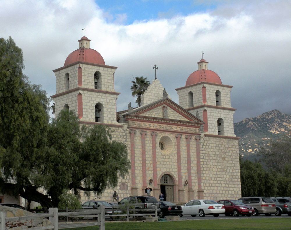 First we visited the Santa Barbara Mission, which is the 10th mission and founded in 1786 although the current building was rebuilt in 1925 after an earthquake destroyed the church. The mission with its twin bell towers and Doric façade is located on a hilltop overlooking the city and providing a spectacular view of the ocean.
Unfortunately the missionaries who brought religion and trousers to the local Chumash Indians also brought influenza and smallpox that killed the 4,000 Indians who are buried in the mission cemetery.
 Later after a stroll along the Shoreline Park and Ledbetter Beach accompanied by a pretty sunset we headed for Chuck’s Waterfront Grill on the marina where we had one of the most delicious steaks we have ever had in California along with a couple of respectable Mai Tai cocktails.

Just Back From… the Cotswolds
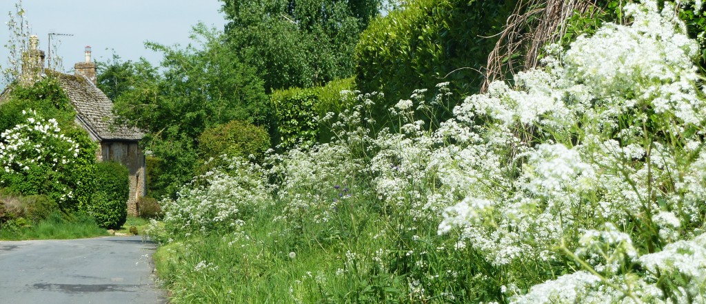
 When you think of the Cotswolds it is the warm honey-coloured limestone and cute thatched cottages inviting romance and tranquillity that spring to mind and where market towns (formerly centres of the wool trade) have wide squares and streets and are the centres of activity. Brooks and rivers bridged by tiny stone arches meander through the hidden villages in the rolling hills and farmland where country pubs have flagstone floors, beamed ceilings and inglenook fireplaces with log fires.
You may also think of crowds of tourists and visitors from London up for the day, often on large touring coaches, ancient churches and manor houses, picture-book tea-rooms, expensive antique, retro and vintage shops. You’d be right about all of these things, but there is another side to the Cotswolds to be explored.


The Cotswolds district is mainly in the counties of Oxfordshire and Gloucestershire with parts of Warwickshire, Wiltshire, Worcestershire and Somerset at the edge. It is an area filled with hundreds of small towns and villages that don’t appear on the calendars and book covers or hog the limelight, but are equally attractive. Discover them by driving along the plethora of narrow, winding roads which often provide the most amazing views over the Wolds and the valleys. There are public footpaths, national trails and bridleways galore. Find yourself in a charming and unspoilt village away from the main tourist spots and walk around listening to the birdsong and admiring the chocolate box cottages and striking parish church. In the late spring sunshine, with so many shades of green it is impossible to count, you may stumble across a woodland carpeted with bluebells.
 In the north of the region take a romantic circular drive from Moreton-in-Marsh to Stow-on-the-Wold stopping at Broadway Tower and Country Park for a picnic with a view, Broadway village with its wide main street , Snowshill Manor with its collection by the eccentric Charles Paget Wade, Snowshill Lavender farm in the summer, and Hailes Cistercian Abbey ruins, a most peaceful spot on the Cotswolds Way. Continue through Guiting Power with the ‘Hollow Bottom Inn’ and the picturesque Lower Slaughter with the tiny River Eye running through it.


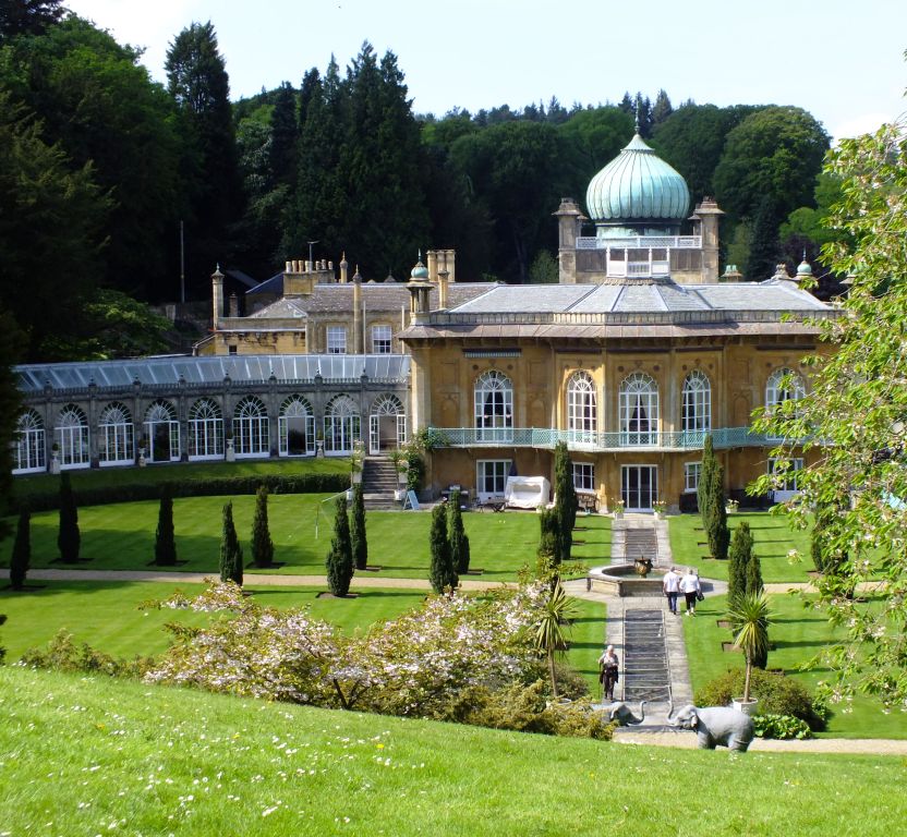
There are dozens of lovely homes and gardens for you to visit, some owned by the National Trust, others in private ownership. Some are large estates such as Sezincote or Hidcote and attract the coach parties, others are smaller and often quieter. All are worth a visit.
The Cotswolds is a vast region and requires several days to explore it thoroughly. We only touched on a small part in four days; there is a lot more to discover.
