A – Z of Locations: Z is for Zennor

During this year I shall be posting photographs from places around the UK, many of which have not been published before. Where I have previously blogged about a location I will provide a link to the post, though you won’t be able to comment on it as I restrict comments to six months.

Z is for Zennor

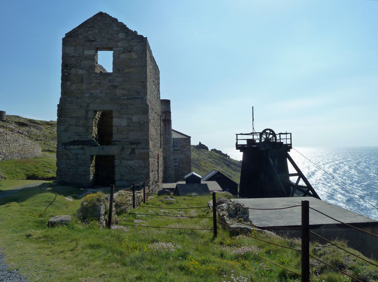
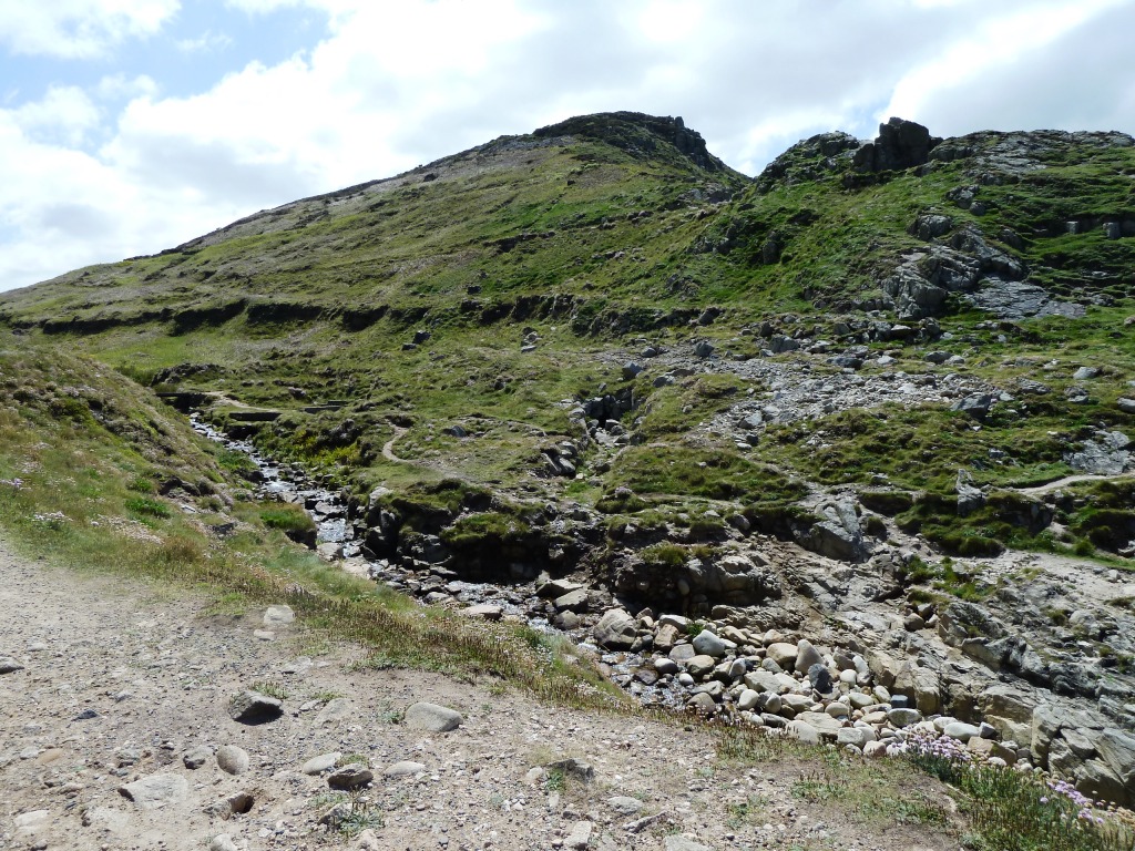
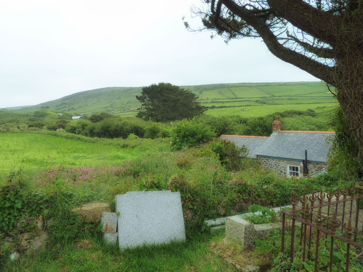
The last letter in the alphabet just happens to be only six miles away from where I live. It is on West Penwith, a sparsely populated peninsula, ringed by high cliffs and rising to high, rocky moorland at its centre. It is surrounded on three sides by the pounding waves of the Atlantic Ocean.

The ancient landscape includes Zennor Head and Gurnard Head, granite moorland hills such as Carn Galver and Zennor Carn. Wonderful hiking country for those who are fit enough.

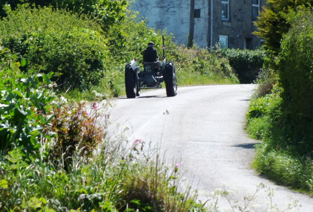
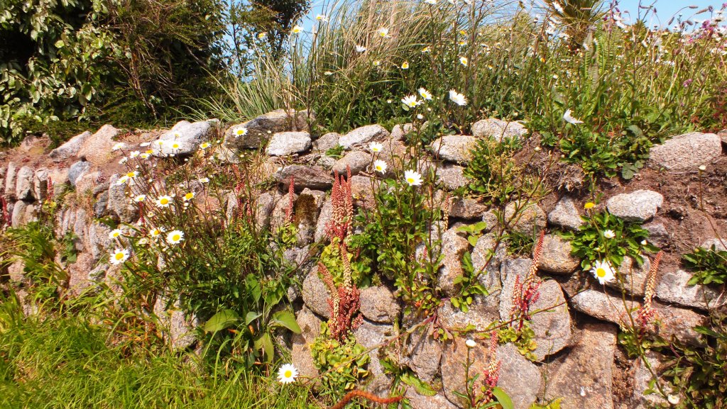
Access to most of the landscape is by narrow ancient lanes bounded by Cornish hedges.

Typical Cornish Lanes
A Cornish Hedge

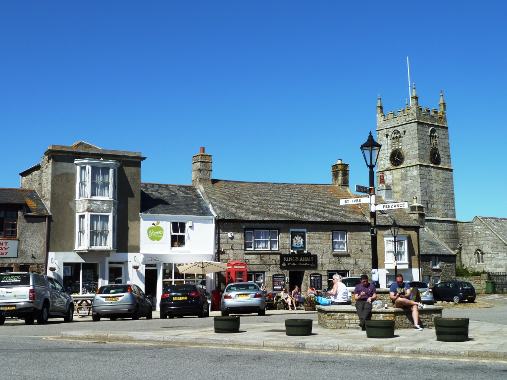
In Zennor you will find the wonderful Tinners Arms, built in 1271, for good food and drink and a popular place for people who walk the South West Coastal path from St Ives to find well needed refreshments.  Up on the main road is a bus route either back to St Ives or on towards Land’s End.

The Tinners Arms, Zennor

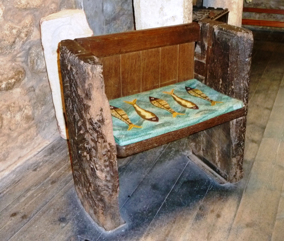
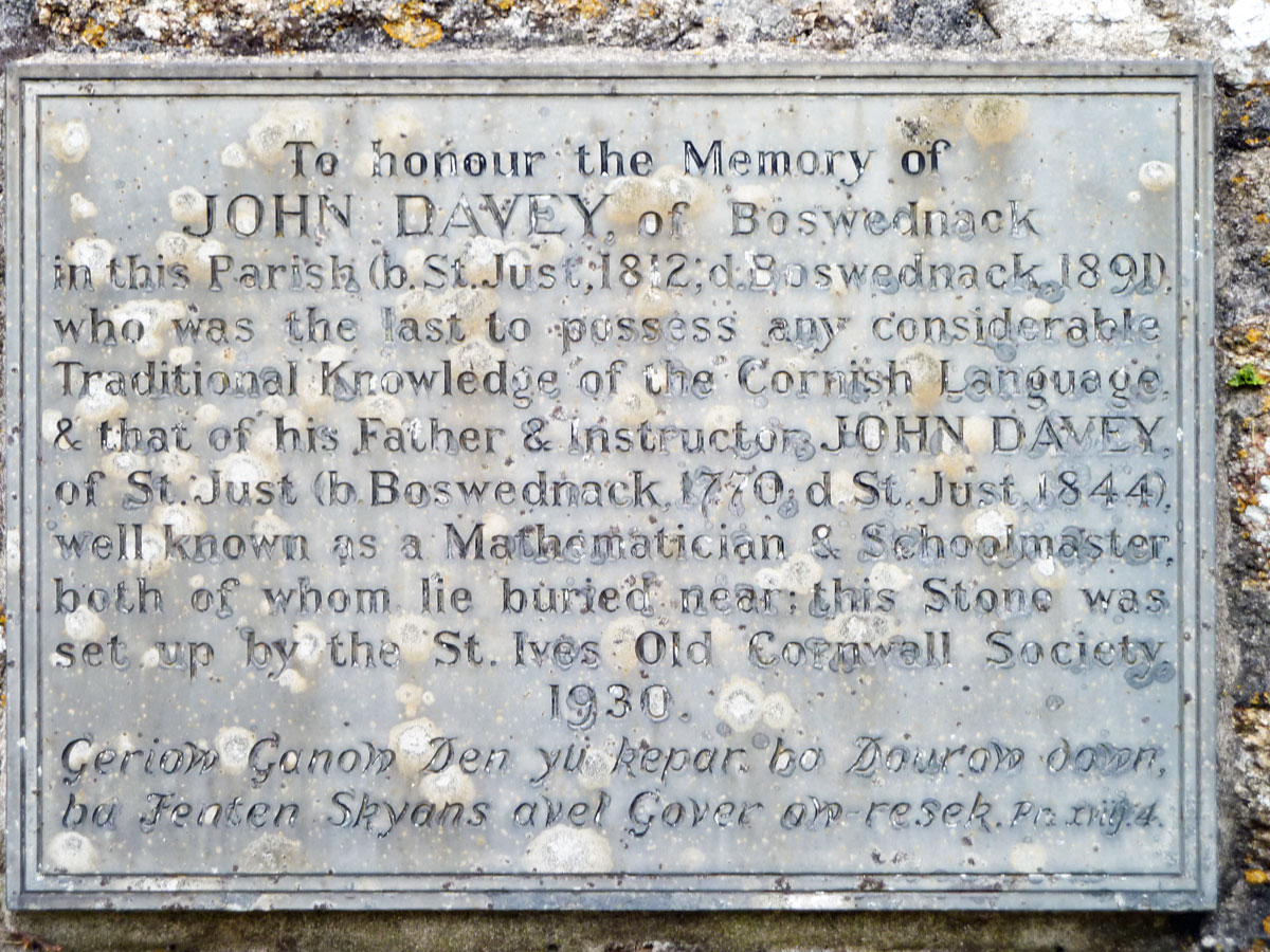
Also in Zennor is St Senara’s church, home to the famous mermaid chair.

Views from Zennor churchyard

I hope that you have enjoyed my tour around the UK and hopefully I have introduced you to some places that are not necessarily on the tourist trail. There are a lot of wonderful towns, cities, villages and countryside to explore throughout England, Scotland and Wales. I’m sorry that I haven’t been able to include Northern Ireland too. We are not short of history, interesting architecture, great walks and incredible landscapes so I hope that this series has whetted your appetite to discover new places to enjoy.

The Levant Mine

The site of the Levant Mine is truly splendid, perched as it is on the edge of the Atlantic coast in the south-west. Man has mined here since the Bronze Age. A copper mine was around in 1670 followed by the profitable tin mine in 1850. It was one of the top ten mines in Cornwall and shafts were sunk deeper and further under the sea. It was finally closed in 1930 partially brought about through the Man Engine* disaster in 1919.

P1210634

The Levant Beam Engine is still steamed up on selected days from April to October and guided tours of the site are available or you can do a self-guided trail. The site is under the control of the National Trust.

The Miner’s Dry is the site of the former washrooms and the tunnel to the Man Engine is at the bottom of the spiral staircase in the corner. It was here that a man ran in 1919 crying out “the engine’s gone!” Continue reading The Levant Mine

St Just in Penwith

St Just in Penwith, shaped by its industrial mining past, is the most westerly town in England and began as a medieval settlement called Lafrowda. It is surrounded by dramatic landscapes of wild moorland, wind-shaped carns and Bronze Age remains. The town made its fortune from tin and the marks left by the boom of the mid-1800s still dominate. There are two squares – Bank (with its 1931 clock tower) which was the business centre (and where the miners would have collected their wages) and Market where the shops and pubs are located (and where the miners would have spent their wages).

Market Square
Bank Square

The grass amphitheatre behind the clock tower is Plen-an-Gwary (Old Cornish for ‘playing place’) where Miracle plays would have been performed 500 years ago. In more recent times it has been used to stage the full cycle again in 2004 and also to hold the Gorsedd, an important Cornish festival. Continue reading St Just in Penwith

On the Edge

Cape Cornwall

Cape Cornwall is the only Cape in England and is so-called because until the 19th century it was thought to overlook the meeting of the English Channel and St George’s Channel (they actually meet at Gwennap Head, near Land’s End). A climb up the Cape headland to the stack offers panoramic views of Lands End, Sennen Cove, the Brisons rocks, the Isles of Scilly and the Wolf Rock lighthouse. You can either walk here from St Just or via the south-coastal path, or drive down to the National Trust car park, from where you can walk down to the former Count House and holiday cottage Brisons Vean (the dark facing house with the two round windows)  and around to the lookout, or take one of the routes behind the house up to the summit.

The Summit

Continue reading On the Edge

Down the Cot Valley

Another drive (or walk if you are so inclined) from St Just is down the Cot Valley following the Cot stream to the shore at Porth Nanven. Once this area was crowded with tin-dressing floors, stamps, settling tanks, reservoirs and wheel-pits. Now long abandoned and overgrown, it can make walking off track somewhat dangerous. The road is very narrow so take it slowly and there is a small car-park at the end.

P1210457

Porth Nanven is unusual in that the cliffs are formed from rounded boulders of an ancient raised beach, formed in the last ice-age. It is illegal to remove any stone from this location, though many might crave a few for their rockery. Continue reading Down the Cot Valley