Wednesday and our last day. Our flight home was from Las Vegas airport at 17:35 so we had time for a last drive into Zion after a leisurely breakfast (as we also gained an hour crossing into Nevada).
Sunrise in Springdale
Again we drove along the Valley Floor road where you can appreciate the wonderful views of the rock formations towering above you.
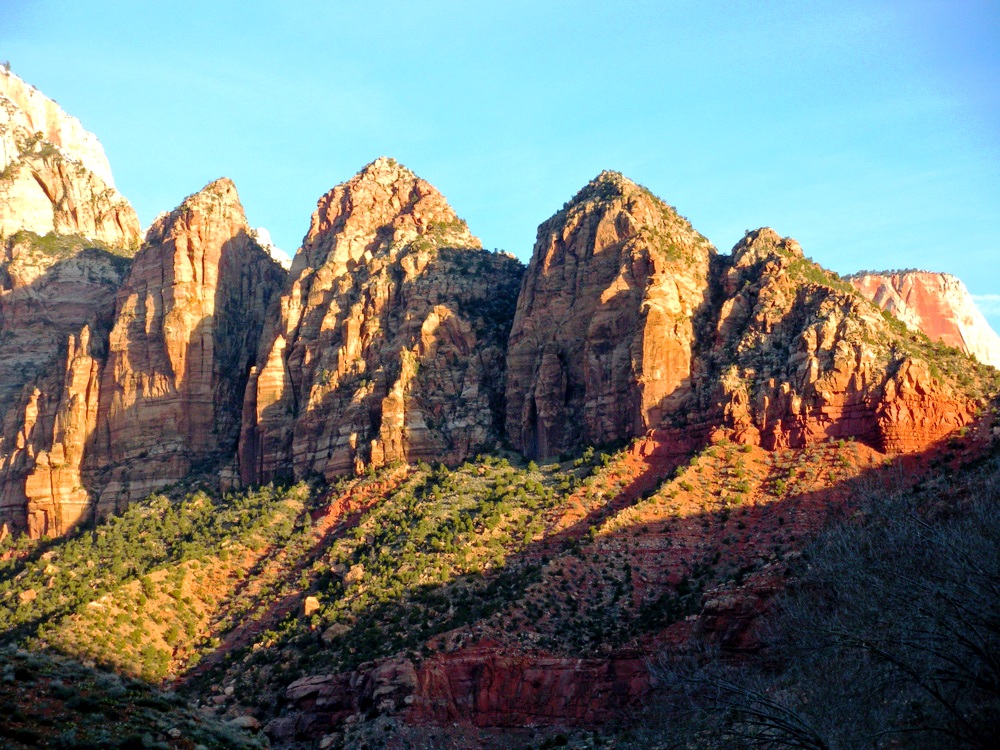
Great White Throne – Named by Methodist Minister Frederick Vining Fisher who was noted as saying
“ I have looked for this mountain all my life but never expected to see it in this world. This is the Great White Throne.“
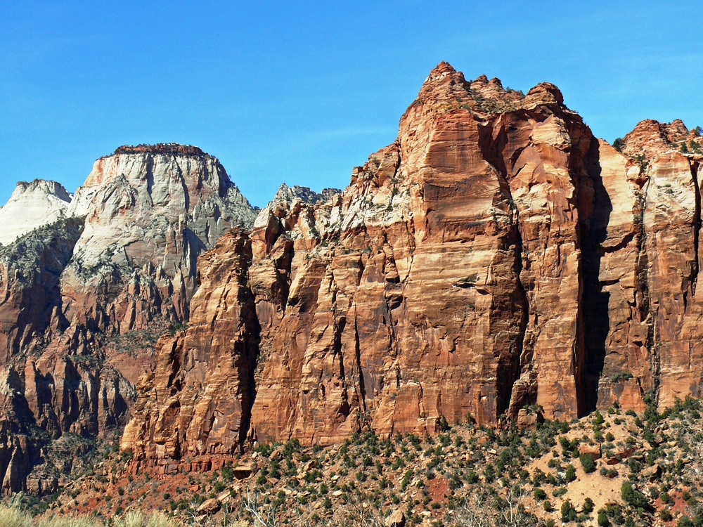
Climbing Angels Landing
After Fisher praised the striking presence of the Great White Throne he turned toward what would become Angels Landing and stated
“The Angels would never land on the throne, but would reverently pause at the foot [of Angels Landing].“
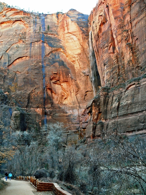
Temple of Sinawava
At the end of the Valley Floor road is the Temple of Sinawava with high sheer cliffs streaked black on the red iron oxide by waterfalls, many of which are dry in the winter months. A riverside walk runs alongside the North Fork of the Virgin River which leads in to the Narrows, named for the narrowest section of the canyon. This 16 mile narrow canyon is where hikers splash up or down the shallow waters. Parallel cliffs soar 2,000 feet overhead, only 30 feet apart in places.
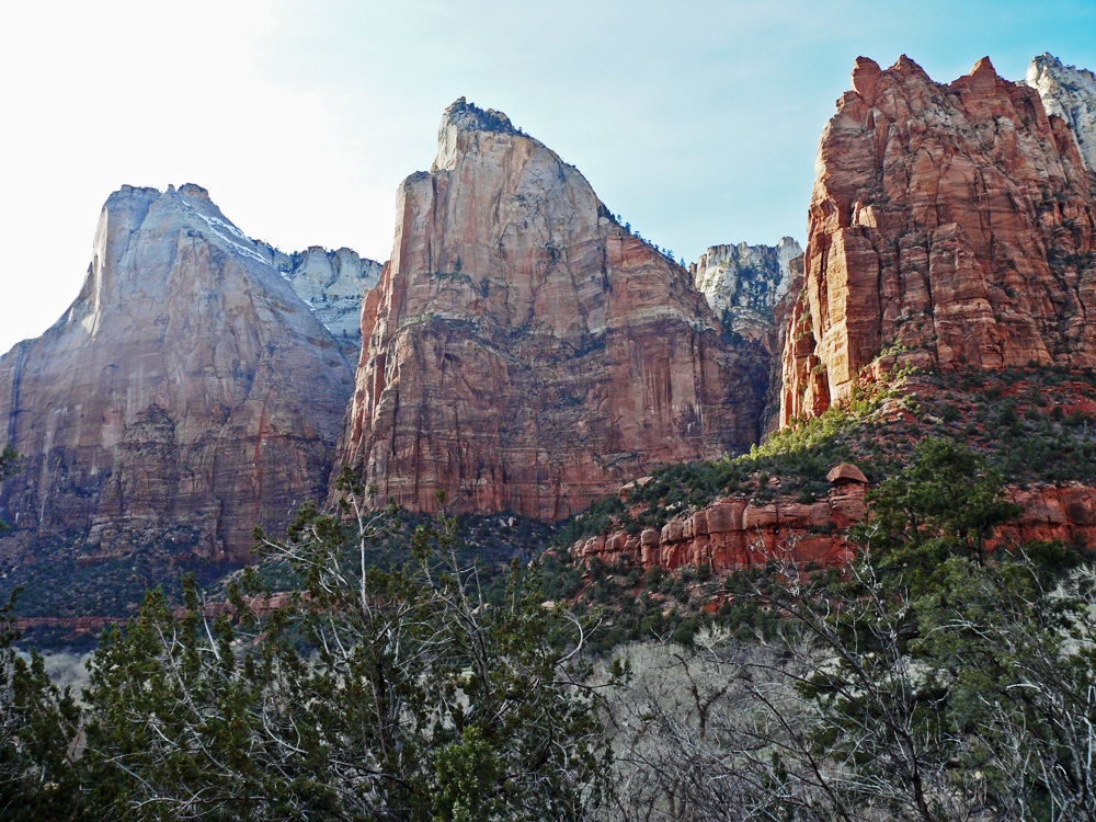
Aspens along the Valley RoadCourt of the Patriarchs
Court of the Patriarchs was named for three towering figures of the Old Testament, these sandstone cliffs hold court over Birch Creek Canyon and this section of the Virgin River. In 1916 Fisher gave the religious names to the peaks; Abraham, Isaac and Jacob.
Leaving Springdale
Finally we left the park and headed west out of Springdale along Highway 9 following the Virgin River to Virgin and Hurricane and on to the Interstate 15 to Las Vegas, Nevada. Our final state of the trip.
Virgin – film set by the side of the raod
In Virgin there is a turn-off to hike down the left fork of North Creek which leads to a geological feature called the Subway. Over time water rushing through a hole in the rock has formed a rounded out tunnel.
Hurricane
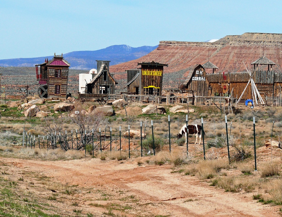
Near Hurricane you find the Quail Creek reservoir and the ghost town of Grafton where scenes from Butch Cassidy and the Sundance Kid were filmed.
Mountain Pass
Nevada – almost at Las Vegas
We had no intention of spending any time in Las Vegas other than reaching the airport and dropping off the hire car. As we neared the city the air above was yellow with pollution and the Interstate became much busier, so much so that we missed our turn-off and had to circle round which was a bit worrying as the fuel gauge was getting close to empty. I always find driving in strange cities quite stressful and even more so after days of being out in the vast open spaces with hardly any vehicles on the road.
Slots at the airport
So “Goodbye Las Vegas”.
It has been the most wonderful road trip and despite the overnight snowfalls, we have experienced lovely weather, cold, but dry. The Canyon Circle is fascinating – so many geological features to gaze at in wonder. We have nothing like it here on such a scale. I only wish we’d made more time and incorporated Monument Valley, Four Corners Monument, Arches National Park and The Valley of Fire State Park in Nevada. Who knows whether we will ever come this way again?
When a man is away from Nature
His heart becomes hard
~ a Native American proverb
I have seen many sights on this road-trip to take my breath away, Sedona, the Red Rock Canyon, the Vermilion Cliffs, Balanced Rocks, Grand Canyon’s depths, Bryce’s hoodoos, Lake Powell’s stillness and Zion’s peace. A journey of over 1,000 miles in little over 6 days and every day even more amazing than the last.
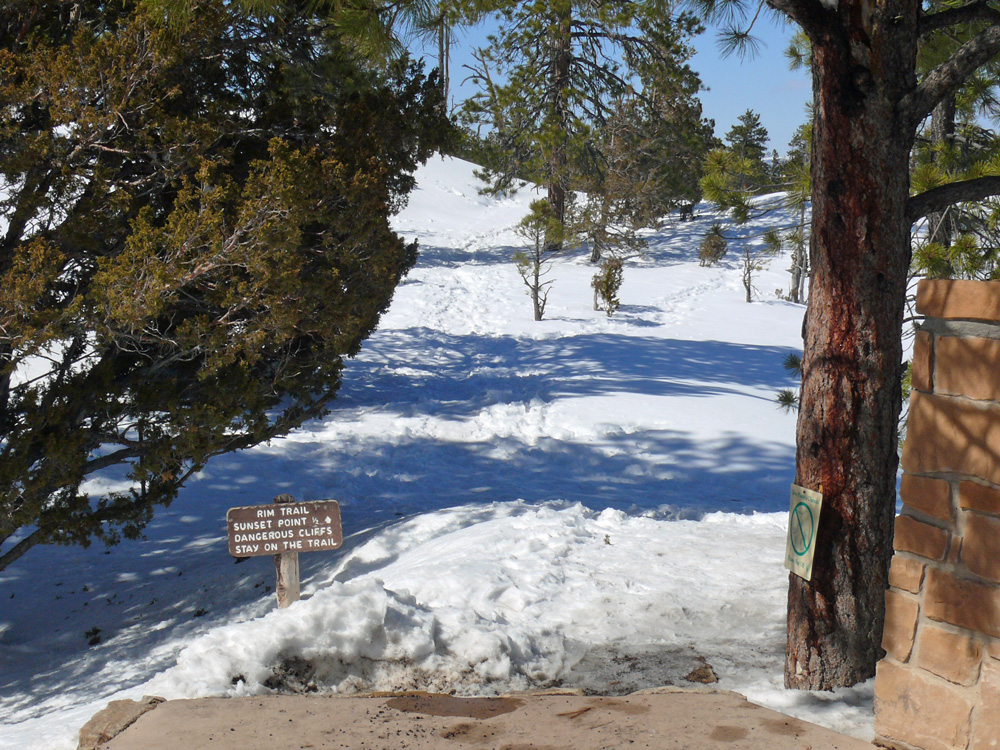
After breakfast at Ruby’s we took a couple of hours to revisit Bryce canyon, this time stopping at different viewpoints within the Amphitheatre Region. In winter you cannot travel to the south of the park and because of the heavy snowfall over the weekend even some of the usually accessible points were only open to cross-country skiers, not vehicles, and the delightfully named Fairyland Point was closed. No matter. We got all the views we could hope to see from Inspiration Point, Sunset Point and Sunrise Point. It must be wonderful to be able to hike the trails among the hoodoos in the spring/summer months. Queen’s Garden Trail, Navajo Loop and Peekaboo Loop are just a few.
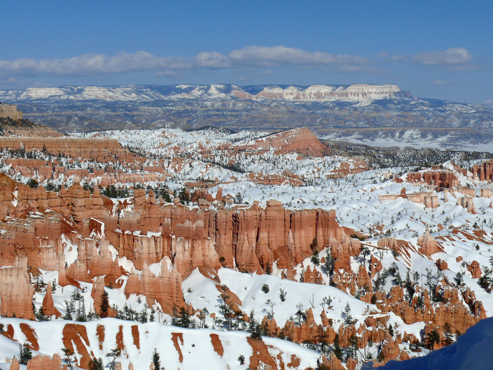
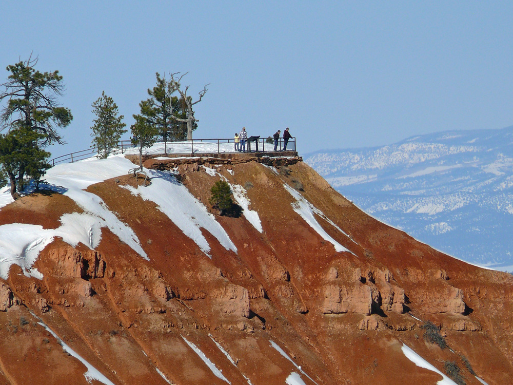
Bryce Canyon Amphitheatre
Bryce Amphitheatre is the largest natural amphitheatre in the park. Vast panoramas can be seen from Inspiration Point and Sunrise Point which feature the Black Mountains in the northeast and Navajo Mountain in the south.
A tricky trailSinking Ship and The Table Cliff Plateau
Technically Bryce is not a canyon because canyons are primarily carved by flowing water – a stream or river. Naturally acidic rainwater dissolves limestone, making the rounded edges of hoodoos, but the freezing and thawing of water does most of the sculpting at Bryce.
Sunset Point – a good viewpoint
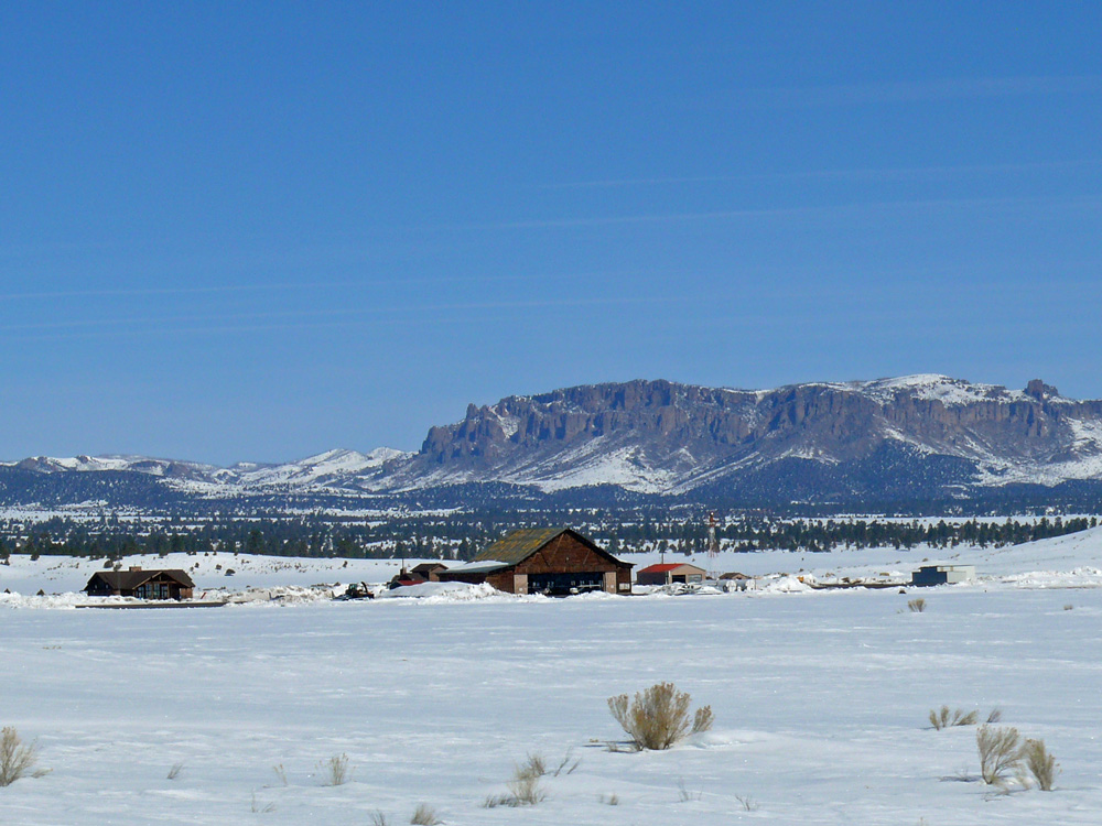
Bryce airport
Back on the road we stopped again in Red Canyon, to get a few more photos. There are several trails here too: Hoodoo Trail, Pink Ledges trail and Bird’s Eye Trail all moderate terrain and where you can see the rare plant species of the region and perhaps some of the wildlife too (mule deer, bobcats, eagles).
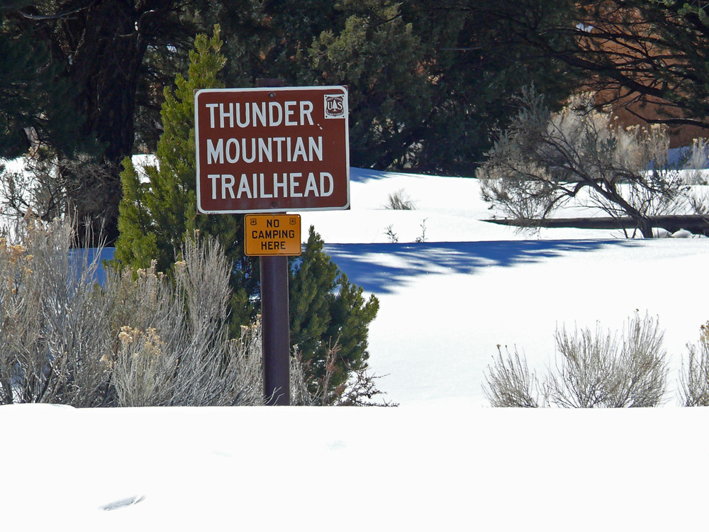
TrailheadsRed Canyon
We were not shod for the snow, but managed to wander around a little to read the useful information plaques dotted around (and which are the source of information for this post). The most interesting is the legend of Butch Cassidy. There is even a 9 mile Cassidy Trail close by, believed to have been used by the outlaw. North on Highway 89 towards Circleville is the cabin where Cassidy was raised, born Robert Leroy Parker, he was the oldest of 13 children of Mormon immigrants and formed a gang, the Wild Bunch, in his teens.
Butch Cassidy Draw
Turning south onto the 89 the Sevier River winds it way alongside, like a black snake in all the snow. Around nearby Duck Creek modern ranches stand alongside decaying remains of ancient buildings. Horses’ breath steaming in the cold. At Hatch there were loads of antique shops, and any other time we’d have stopped for a browse, but we wanted to move on to the final destination on our itinerary. Pretty stands of Aspens lined the road, pink, white and yellow twiggy branches in the air.
If you turned north at the 89 / 12 junction you would reach the town of Panguitch – a name from a Native American word meaning big fish where there is year-round fishing. The most interesting story about the town though is the annual Panguitch Quilt Walk, celebrated in June every year when locally made quilts are on display.
The town was settled in 1864. The first winter was very tough. Frost killed all the crops before harvesting. A few men tried to get to a nearby town for supplies but they kept falling through the several feet of snow. They discovered that if they lay down a quilt, walked over it, lay down another in front and retrieved the last one, they could walk over the frozen landscape. This ‘Quilt Walking’ enabled them to get to the nearby town and back and helped the settlers of Panguitch to survive.
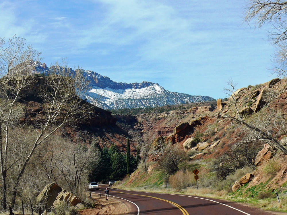
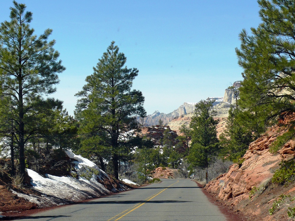
Back at Mount Carmel Junction we turned right onto Highway 9 the east highway that leads into Zion National Park via tunnels and a switchback to the canyon floor. It was created to allow tourists to make their way round the Grand Circle of parks (Zion, Bryce and the Grand Canyon).
Bison outside Zion CanyonEast entranceMount Carmel Hwy
On entering the park at the eastern end you notice two things – the road is red to blend in with nature around it and the geology is spectacular.
Red Road
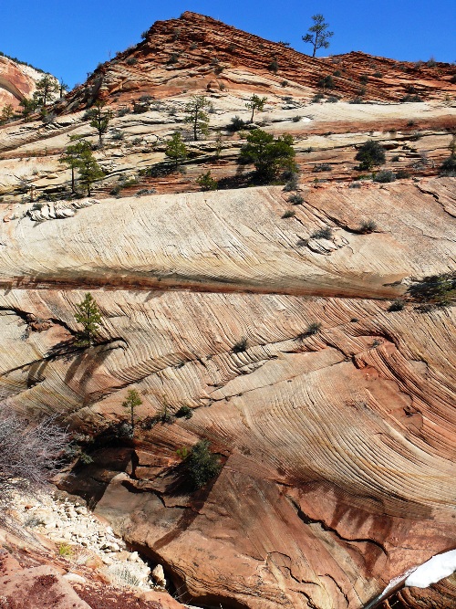
Found near the east entrance is the Checkerboard Mesa. The name stems from the cliff’s distinctive chequerboard pattern. The horizontal lines are caused by cross-bedding, a remnant of ancient sand-dunes. The vertical lines formed because of the contraction and expansion of the sandstone.
Checkerboard MesaGeologyGeology
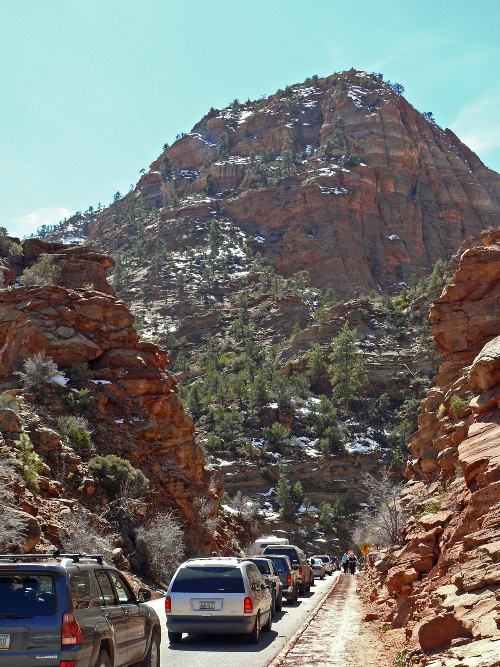
The road loops and winds alongside Pine Creek until the tunnels where we waited in a queue to get through – larger vehicles need to be accompanied which is why there is a waiting time.
entering the tunnel
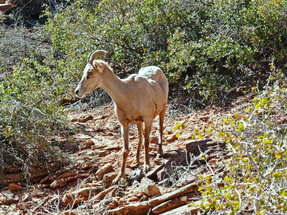
Some people had parked up to walk out to the Canyon Overlook Trail. It is very steep and narrow though so not suitable for everyone and can be extremely icy in winter. I walked a little way, before turning back, but did get to see some bighorn sheep on the way.
Bighorn Sheep
The tunnels were blasted through 1,000 feet high sandstone cliffs, the second one being over a mile long. Exiting the tunnel you get a good view of the Canyon and some of its most famous formations including the Great White Throne. There is a steep, 10 mile drive down switchbacks to the valley floor.
Window in the blasted tunnel above the valley floor
We drove through to the park’s southwest entrance and in to Springdale where we had booked a night in the Zion Canyon B&B only 1/2 mile from the entrance and close to park shuttle buses (summer months only). A bit early to check in we found a lovely little deli and gift shop where we had good freshly made sandwiches and coffee for lunch. The best food so far.
Springdale
The Canyon was once home to the Anasazi (a Native Indian word meaning Ancient Ones) whom historians believed lived here 2000 years ago and up to the 13th century. The Paiutes discovered the canyon next and were living here when the first white people (Spanish Padres Silvestre Vélez de Escalante and Francisco Dominguez and the fur trapper Jedediah Smith) came through in the 1700s.) The first Mormon settler was Isaac Behunin who is credited with giving the Canyon its biblical name of Zion. Meaning a place of rest and refuge (Ancient Hebrew = sanctuary). Many of the rock formations have biblical names too.
In the afternoon we returned to the park and drove along the Scenic Floor of the Valley Road stopping at various places along the route, including the Emerald Pools Loop, Angels Landing and Temple of Sinawava. The Emerald Pool was very disappointing, after following a rather icy trail I reached the first pool (puddle) which was a muddy brown. The trail continued underneath a dismal waterfall onto even more uneven ground at which point I turned back.
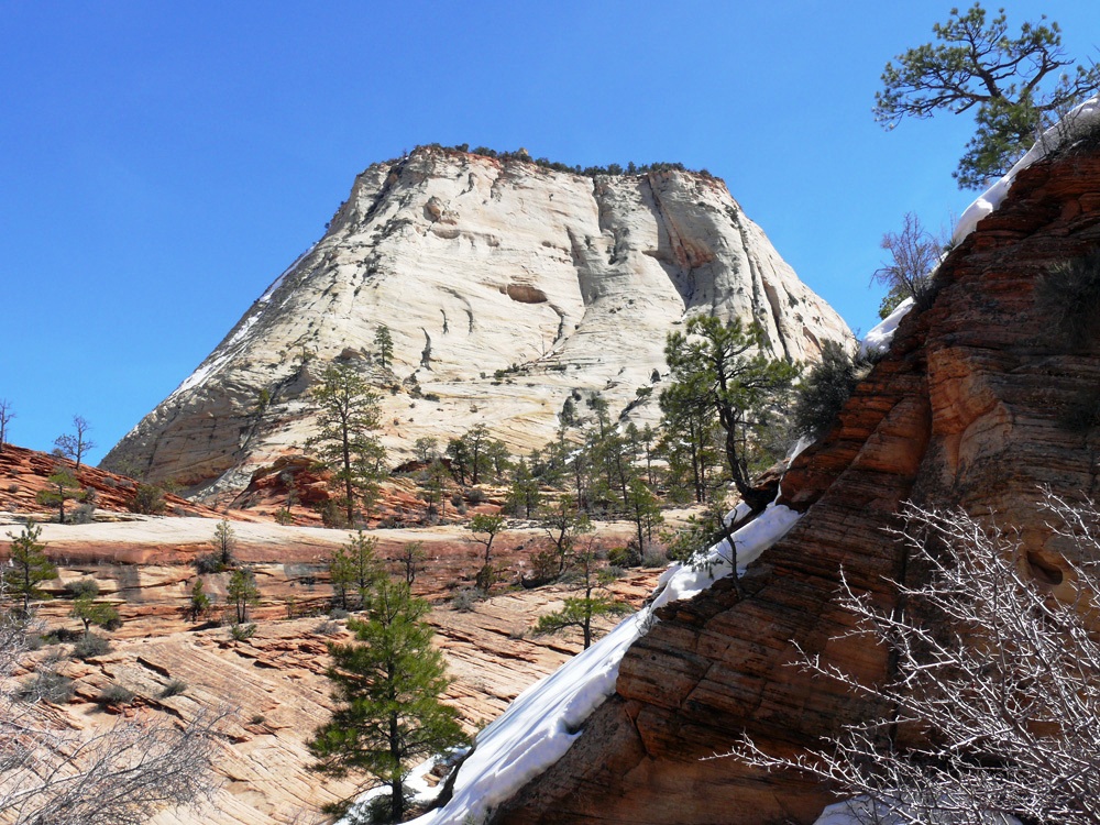
The Great White Throne
We were going to eat at the Whiptail Grill near the gas station on the edge of Springdale, but it closed at 7:30 p.m so we were too late. Most of Springdale’s restaurants were closed in March, but we finally found Blondies open where we had a decent burger and fries. Unfortunately much of Utah is dry so I opted for an ice-tea (thinking it would be one of those lemony sweet drinks) only to find it tasted just like bitter cold tea, and I do not like tea! Major fail. By now I was getting withdrawal symptoms for a good bottle of red wine.