This post was published on this day in 2014 for Cee’s Black & White Challenge: ‘Found in Nature’. And yes, the photos were influenced greatly by Ansel Adams.
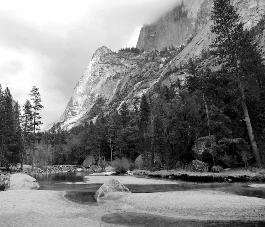
One of the most amazing places that I have been to is Yosemite Valley. The incomparable scenery, soaring cliffs, spectacular views and cascading waterfalls moved me so much that I wrote this piece about my feelings.
(click any image to enlarge and see the details)
Valley View.
Here are a few photos from that natural wonder. I hope they make as much an impression on you as they did on me.
Awiyah-PointRiver Merced in the SnowMount Watkins Reflection at Mirror LakeThe Swinging Bridge in Snow
This post is a contribution to Fandango’s Flashback Friday. Have you got a post you wrote in the past on this particular day? The world might be glad to see it – either for the first time – or again if they’re long-time loyal readers.
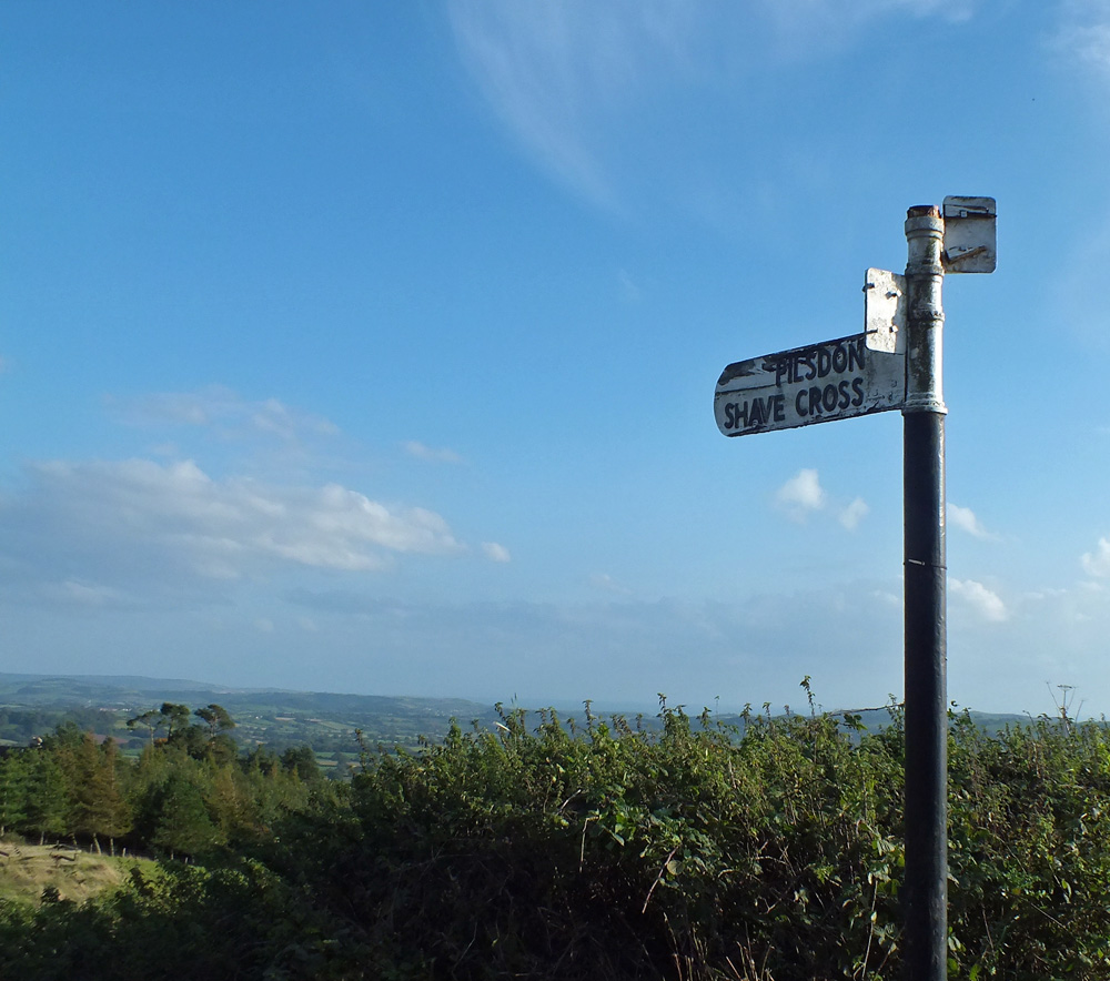
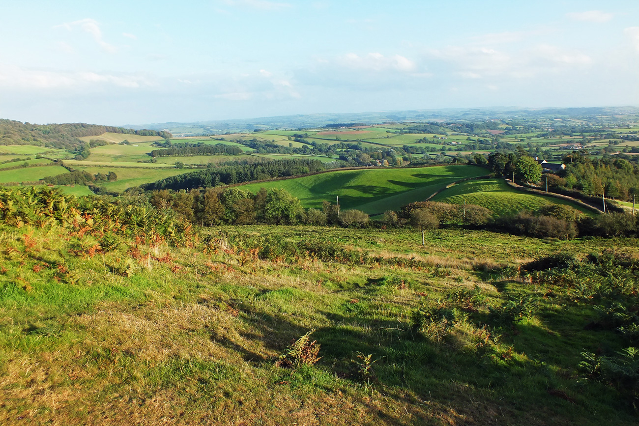
Like a lot of things in life finding Pilsdon Pen was a fluke. We were driving back to Bridport in Dorset after visiting Lyme Regis and me being, well, me, decided to return via the country roads instead of the direct route. Admiring the views surreptitiously as I was driving along the narrow winding road, it was a relief to find a layby to pull into. Obviously a spot with a view as there were already a couple of cars parked there.
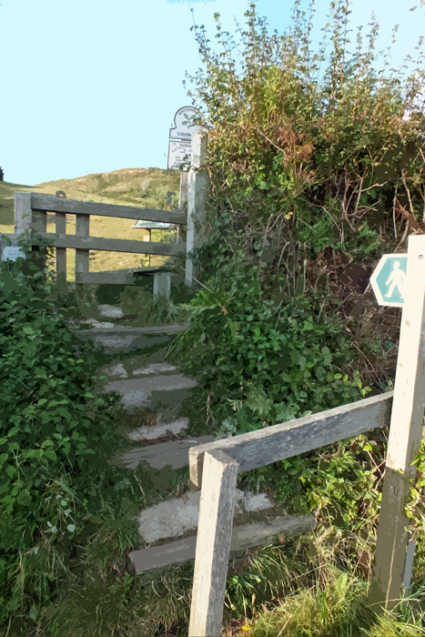
The panorama was spectacular, rolling hills, cliffs and in the distance, the sea. After taking a few photos, I headed across the road to a stile that I had spied which led to a path up a hill. Thinking that I might get even better views from the hill, I hopped over the stile.
And found that I was on Pilsdon Pen, the highest point in Dorset.
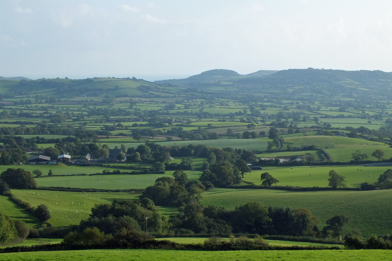
So of course I had to climb to the top, and after a bit of huffing and puffing and a stop or two at a conveniently placed bench, I got to see the 360 degree views.
Steeper than they look
Nearly there
Views to the east
On the top
The Beacon
View to the south
And I was particularly fascinated by the late afternoon shadows of the trees bordering that field.
Serendipity 🙂
If you enjoy a walk, short or long, then you may enjoy visiting Jo’s Monday Walk where you are in for a treat.
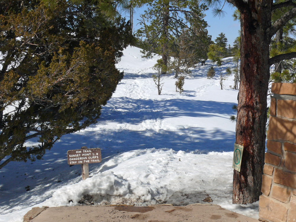
After breakfast at Ruby’s we took a couple of hours to revisit Bryce canyon, this time stopping at different viewpoints within the Amphitheatre Region. In winter you cannot travel to the south of the park and because of the heavy snowfall over the weekend even some of the usually accessible points were only open to cross-country skiers, not vehicles, and the delightfully named Fairyland Point was closed. No matter. We got all the views we could hope to see from Inspiration Point, Sunset Point and Sunrise Point. It must be wonderful to be able to hike the trails among the hoodoos in the spring/summer months. Queen’s Garden Trail, Navajo Loop and Peekaboo Loop are just a few.
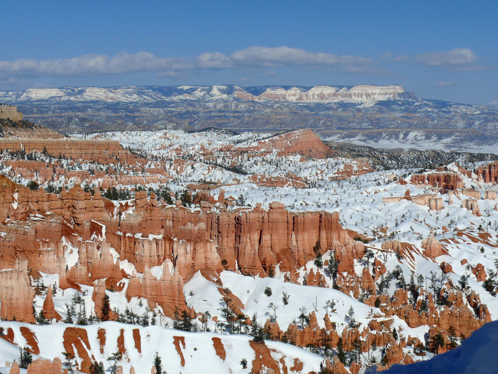
Bryce Canyon Amphitheatre
Bryce Amphitheatre is the largest natural amphitheatre in the park. Vast panoramas can be seen from Inspiration Point and Sunrise Point which feature the Black Mountains in the northeast and Navajo Mountain in the south.
A tricky trailSinking Ship and The Table Cliff Plateau
Technically Bryce is not a canyon because canyons are primarily carved by flowing water – a stream or river. Naturally acidic rainwater dissolves limestone, making the rounded edges of hoodoos, but the freezing and thawing of water does most of the sculpting at Bryce.
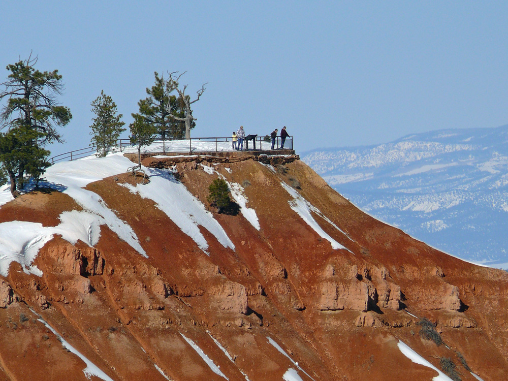
Sunset Point – a good viewpoint
Bryce airport
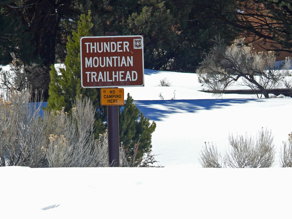
Back on the road we stopped again in Red Canyon, to get a few more photos. There are several trails here too: Hoodoo Trail, Pink Ledges trail and Bird’s Eye Trail all moderate terrain and where you can see the rare plant species of the region and perhaps some of the wildlife too (mule deer, bobcats, eagles).
TrailheadsRed Canyon
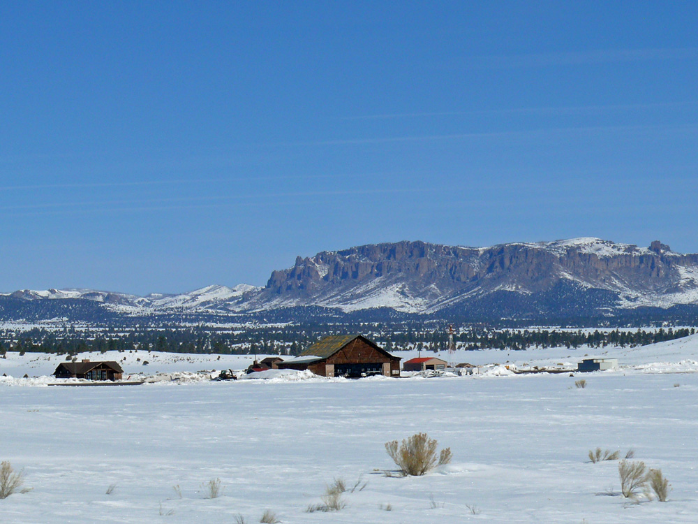
We were not shod for the snow, but managed to wander around a little to read the useful information plaques dotted around (and which are the source of information for this post). The most interesting is the legend of Butch Cassidy. There is even a 9 mile Cassidy Trail close by, believed to have been used by the outlaw. North on Highway 89 towards Circleville is the cabin where Cassidy was raised, born Robert Leroy Parker, he was the oldest of 13 children of Mormon immigrants and formed a gang, the Wild Bunch, in his teens.
Butch Cassidy Draw
Turning south onto the 89 the Sevier River winds it way alongside, like a black snake in all the snow. Around nearby Duck Creek modern ranches stand alongside decaying remains of ancient buildings. Horses’ breath steaming in the cold. At Hatch there were loads of antique shops, and any other time we’d have stopped for a browse, but we wanted to move on to the final destination on our itinerary. Pretty stands of Aspens lined the road, pink, white and yellow twiggy branches in the air.
If you turned north at the 89 / 12 junction you would reach the town of Panguitch – a name from a Native American word meaning big fish where there is year-round fishing. The most interesting story about the town though is the annual Panguitch Quilt Walk, celebrated in June every year when locally made quilts are on display.
The town was settled in 1864. The first winter was very tough. Frost killed all the crops before harvesting. A few men tried to get to a nearby town for supplies but they kept falling through the several feet of snow. They discovered that if they lay down a quilt, walked over it, lay down another in front and retrieved the last one, they could walk over the frozen landscape. This ‘Quilt Walking’ enabled them to get to the nearby town and back and helped the settlers of Panguitch to survive.
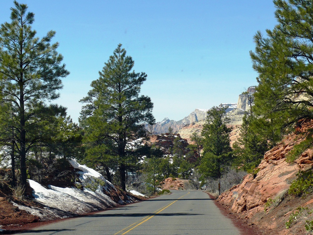
Back at Mount Carmel Junction we turned right onto Highway 9 the east highway that leads into Zion National Park via tunnels and a switchback to the canyon floor. It was created to allow tourists to make their way round the Grand Circle of parks (Zion, Bryce and the Grand Canyon).
Bison outside Zion CanyonEast entranceMount Carmel Hwy
On entering the park at the eastern end you notice two things – the road is red to blend in with nature around it and the geology is spectacular.
Red Road
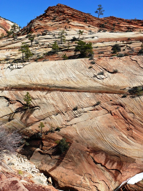
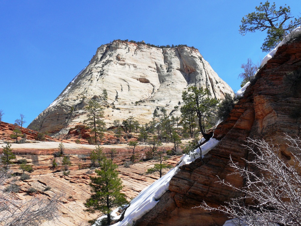
Found near the east entrance is the Checkerboard Mesa. The name stems from the cliff’s distinctive chequerboard pattern. The horizontal lines are caused by cross-bedding, a remnant of ancient sand-dunes. The vertical lines formed because of the contraction and expansion of the sandstone.
Checkerboard MesaGeologyGeology
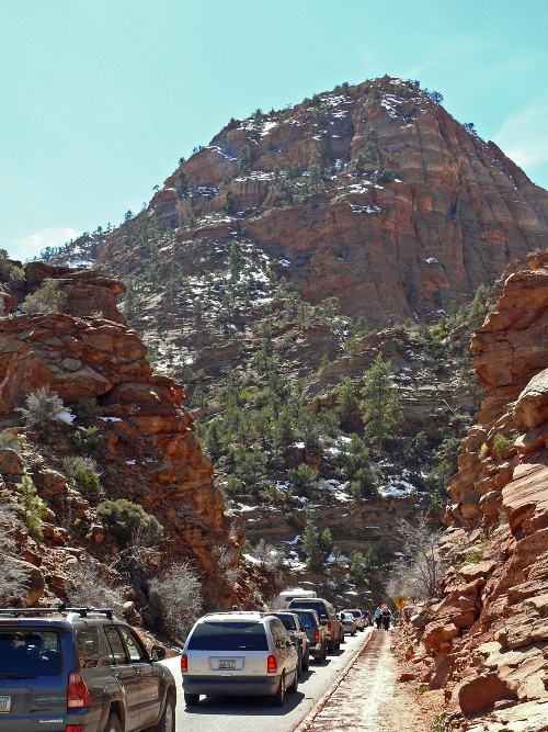
The road loops and winds alongside Pine Creek until the tunnels where we waited in a queue to get through – larger vehicles need to be accompanied which is why there is a waiting time.
entering the tunnel
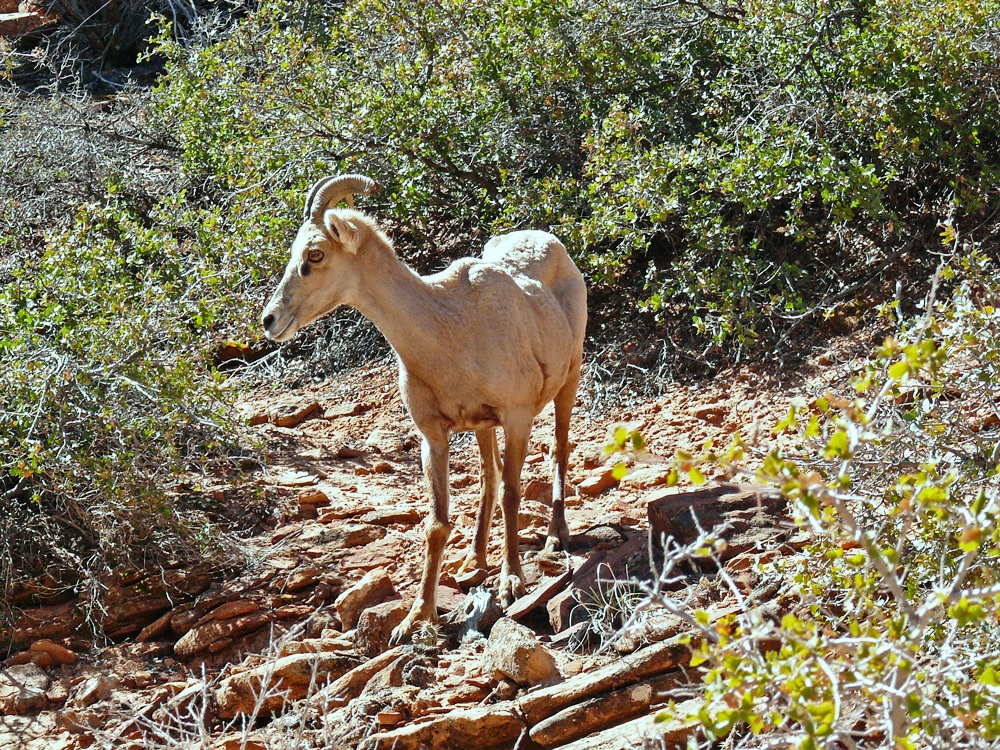
Some people had parked up to walk out to the Canyon Overlook Trail. It is very steep and narrow though so not suitable for everyone and can be extremely icy in winter. I walked a little way, before turning back, but did get to see some bighorn sheep on the way.
Bighorn Sheep
The tunnels were blasted through 1,000 feet high sandstone cliffs, the second one being over a mile long. Exiting the tunnel you get a good view of the Canyon and some of its most famous formations including the Great White Throne. There is a steep, 10 mile drive down switchbacks to the valley floor.
Window in the blasted tunnel above the valley floor
We drove through to the park’s southwest entrance and in to Springdale where we had booked a night in the Zion Canyon B&B only 1/2 mile from the entrance and close to park shuttle buses (summer months only). A bit early to check in we found a lovely little deli and gift shop where we had good freshly made sandwiches and coffee for lunch. The best food so far.
Springdale
The Canyon was once home to the Anasazi (a Native Indian word meaning Ancient Ones) whom historians believed lived here 2000 years ago and up to the 13th century. The Paiutes discovered the canyon next and were living here when the first white people (Spanish Padres Silvestre Vélez de Escalante and Francisco Dominguez and the fur trapper Jedediah Smith) came through in the 1700s.) The first Mormon settler was Isaac Behunin who is credited with giving the Canyon its biblical name of Zion. Meaning a place of rest and refuge (Ancient Hebrew = sanctuary). Many of the rock formations have biblical names too.
In the afternoon we returned to the park and drove along the Scenic Floor of the Valley Road stopping at various places along the route, including the Emerald Pools Loop, Angels Landing and Temple of Sinawava. The Emerald Pool was very disappointing, after following a rather icy trail I reached the first pool (puddle) which was a muddy brown. The trail continued underneath a dismal waterfall onto even more uneven ground at which point I turned back.
The Great White Throne
We were going to eat at the Whiptail Grill near the gas station on the edge of Springdale, but it closed at 7:30 p.m so we were too late. Most of Springdale’s restaurants were closed in March, but we finally found Blondies open where we had a decent burger and fries. Unfortunately much of Utah is dry so I opted for an ice-tea (thinking it would be one of those lemony sweet drinks) only to find it tasted just like bitter cold tea, and I do not like tea! Major fail. By now I was getting withdrawal symptoms for a good bottle of red wine.
Today was a much shorter drive, though very different from yesterday as we were driving through the snow that had fallen overnight. After a lovely breakfast and snapping a few shots of Steller Jays and Dark Eyed Juncos who were breakfasting outside on monkey nuts we were on our way to the Grand Canyon. Would it live up to the hype I wondered? Or would the reality fall flat.
(please click on an image to enlarge)
Black Eyed Junco
Steller Jay
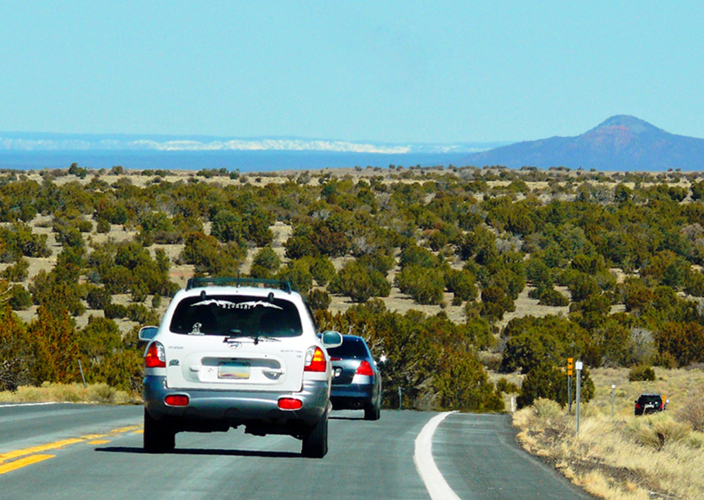
We continued along 89A through Oak Creek Canyon weaving its way up and around the mountains. At the top we pulled into a viewing place to take a few photos of the canyon and the road on which we had just driven. I am so glad that they clear the roads in this part of the world!
A winding road
By noon we’d arrived at Tusayan the town just before the south entrance to the park and we stopped to visit the IMAX theatre to watch a film about the Canyon which is well worth doing if you haven’t been there before. Though I must be the only person on earth who suffers travel sickness whilst watching these films! I have to close my eyes to stop myself from feeling dizzy.
On the road to the Canyon, North Rim in the distance
The Grand Canyon fills me with awe. It is beyond comparison – beyond description, absolutely unparalleled throughout the wide world. Let this great wonder of nature remain as it is now. Do nothing to mar its grandeur, sublimity and loveliness. You cannot improve on it. But what you can do is keep it for your children, your children’s’ children and all who come after you, as the one great sight which every American should see. Don’t let them skin this wonderful country – as they will try to do” ~ Theodore Roosevelt, May 6, 1903
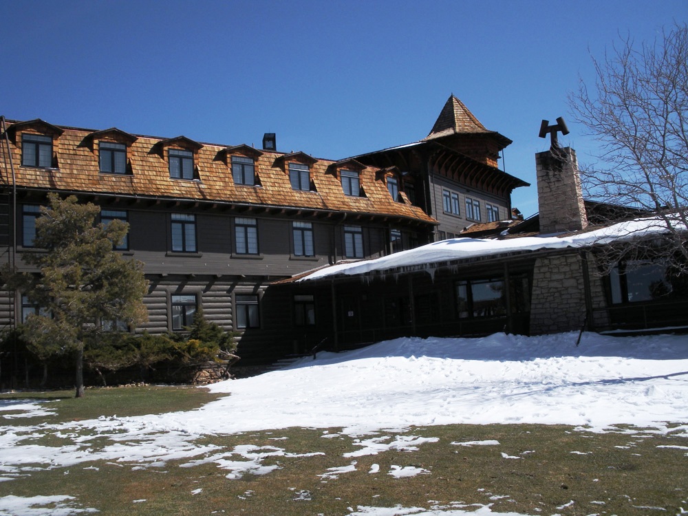
Now we were in the park and following the one-way system to our hotel – El Tovar – where we had booked for the night. It is a National Historic Landmark and is right on the South Rim with views of the canyon from rooms on the northern wing.
The hotel is made from native stone and Oregon pine and the design is based on European hunting lodges and has a world-renowned restaurant along with canyon views.
After settling in to our room, we went to have our first look at the view and then find the shuttle bus which would take us to Hermits Rest which is closed to private vehicles.
El TovarHopi HouseIcicles
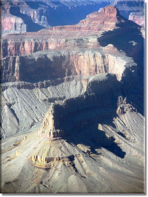
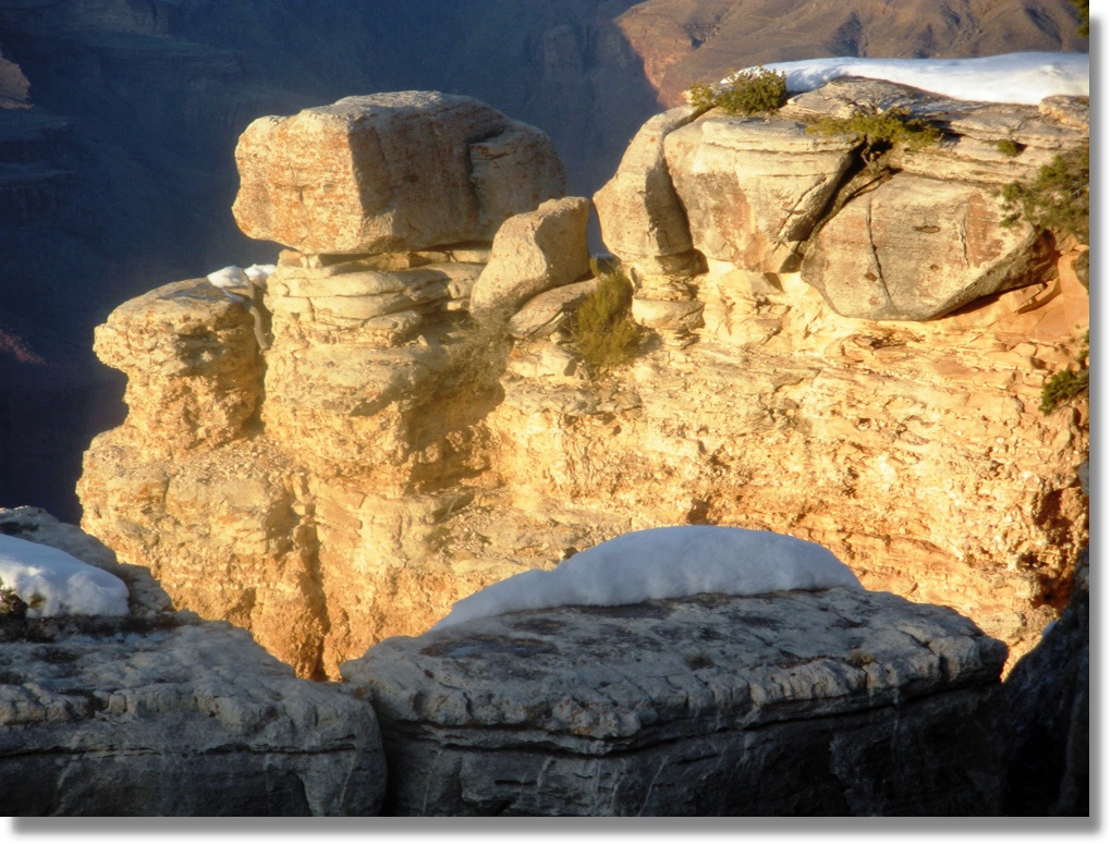
There are no words to describe your first view of the grand Canyon. Photographs do not do it justice, you cannot capture the multiple layers and colours and the sheer scale of the size and form. It overwhelms the senses and all you can do is stand and stare. Take time to pause on the rim and take in Earth’s history.
Hindu AmpitheatreView from Hermit’s rest
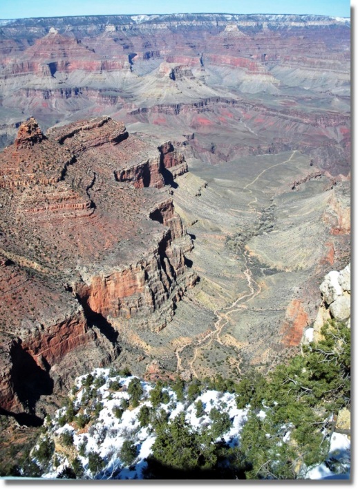
Don’t rush your visit to the Canyon. I know some people do a half day trip from Las Vegas, but it is worth spending at least one night there. During the afternoon we used the shuttle bus along the 7 miles to Hermits Rest and stopped off at different viewpoints along the way. You can of course walk the trail along the rim, but there are unpaved sections and while we were there it was very icy and snow covered so unless you have adequate walking boots I would advise using the bus.
The Colorado River Runs Through It
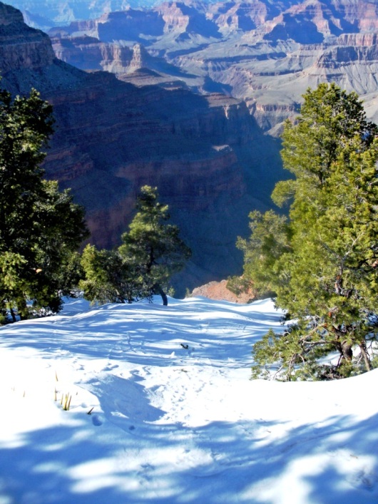
Visit the Kolb Studio, perched on the edge of the rim, the Victorian home of the Kolb Brothers who created a lasting legacy of adventure, exploration, family love, and amazing Grand Canyon photography or hike down Bright Angel Trail, if only to the first tunnel, if you are brave and it is not covered in snow!
The Bright Angel TrailPinyon Pines cling to the edge
And if time allows the genuine artistry of Native American jewellery deserves a look in the better gift shops at the Hopi House or the Watchtower. Check for a genuine silver hallmark and the quality of stones in the lovely silver and turquoise jewellery. Hopi rugs, pottery and Kachina dolls are also good souvenirs. Finally we returned to the Village just before sunset around 6:30 before heading off into the El Tovar restaurant for a well-deserved steak.
Cee’s Black & White Challenge: This black and white challenge is topic related and this week the theme is Found in Nature.
One of the most amazing places that I have been to is Yosemite Valley. The incomparable scenery, soaring cliffs, spectacular views and cascading waterfalls moved me so much that I wrote this piece about my feelings.
(click any image to enlarge and see the details)
Valley View.
Here are a few photos from that natural wonder. I hope they make as much an impression on you as they did on me.
awiyah-pointRiver Merced in the SnowMount Watkins Reflection at Mirror LakeThe Swinging Bridge in Snow