Cee’s Which Way Challenge: Those Blue Remembered Hills

Fortunate to have a lovely sunny day on Sunday (Mother’s Day in the UK) and an extra hour of daylight (the start of British Summer time  so clocks went forward an hour) I was determined to get out of the house and go for a walk.

Cardingmill Valley lies on the edge of Church Stretton, a little Shropshire town that I still need to explore.  Church Stretton is a small town and civil parish in Shropshire, England. The town lies entirely in the Shropshire Hills AONB, on the A49 road approximately 13 miles south of Shrewsbury, the county town, and 15 miles north of Ludlow. Wikipedia

c21

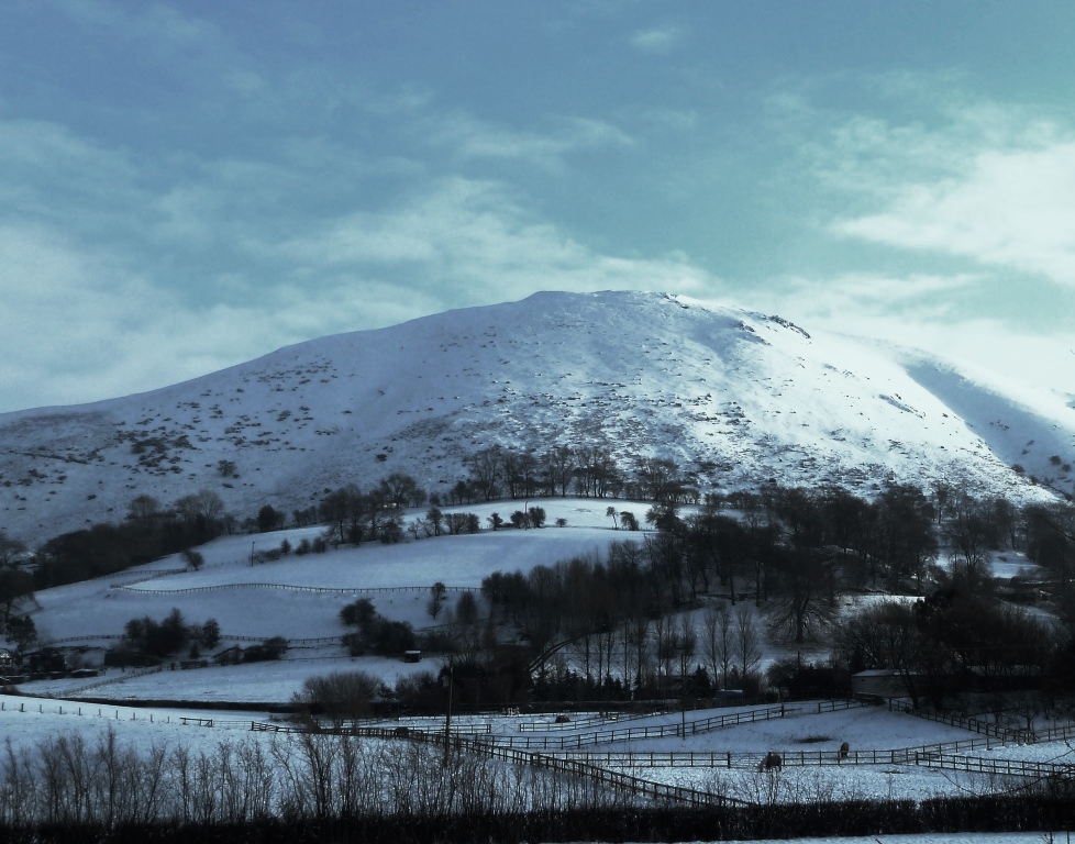
Just as Ludlow is the gastronomic capital of Shropshire, Church Stretton is the walking capital of the Shropshire Hills Area of Outstanding Natural Beauty. I have been here many times, it is my favourite part of Shropshire and has been called ‘Little Switzerland’ on account of its hills.  And when coated in snow it is very pretty.

Shropshire Hills

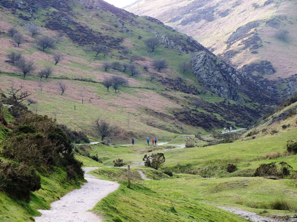
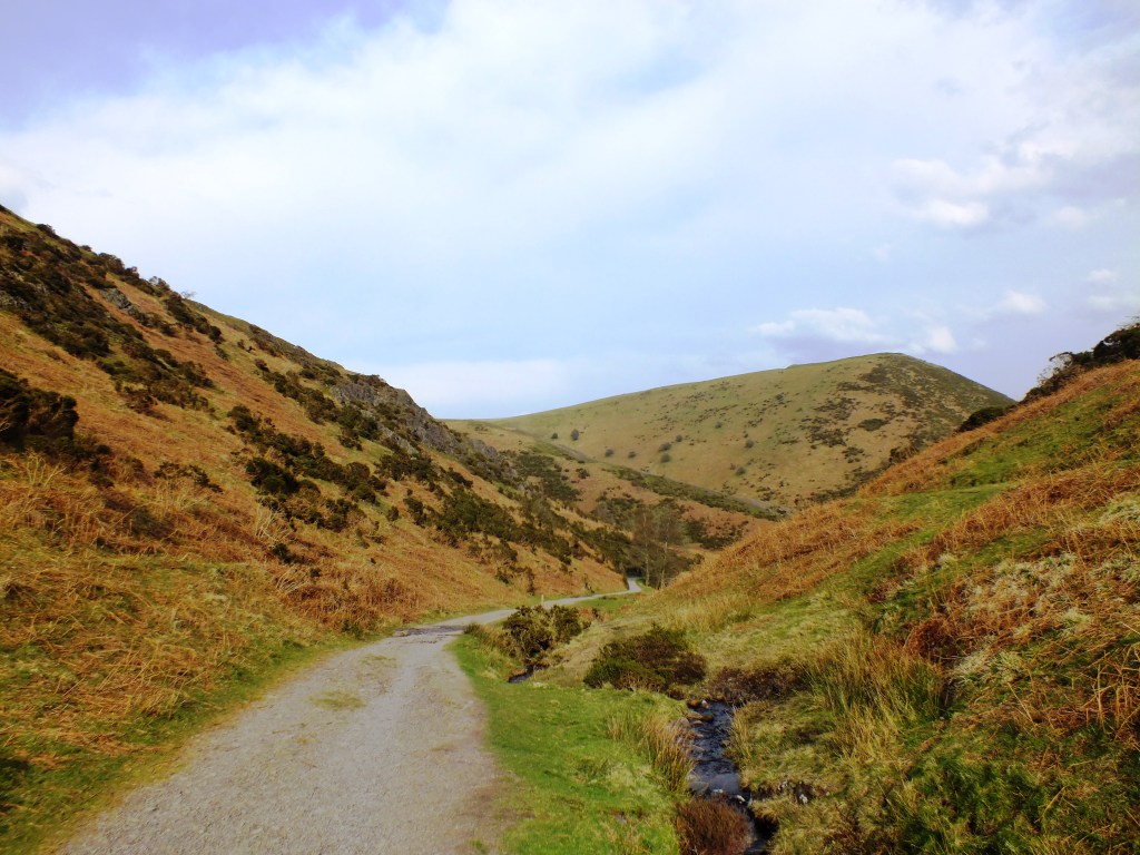
But on Sunday it was sunny and spring was springing. We could have taken any number of trails, but decided that we’d return to the Reservoir as it is a wide path and fairly flat.

c1
Turn right onto the orange trail

c4

This trail is quite gentle and soon you are hidden amongst the hills with only the sound of birdsong and a burbling brook. A hidden lost world.

c5

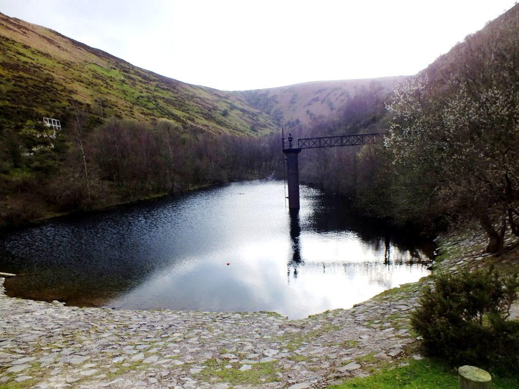
At the reservoir you do have to climb up quite a steep hill to reach the water, and the trail continues should you wish to head further onto the Long Mynd (Long Mountain).

You can swim in the reservoir, though the water probably isn’t all that warm today.

c11

Before heading back to the car park I nipped over a stile to have a closer look at the reservoir and found this pair of Common Toads at the side of the path.  I spared them their blushes and swiftly moved on.

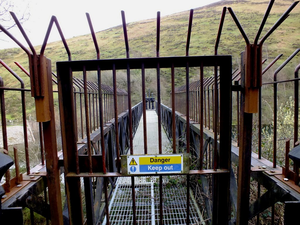
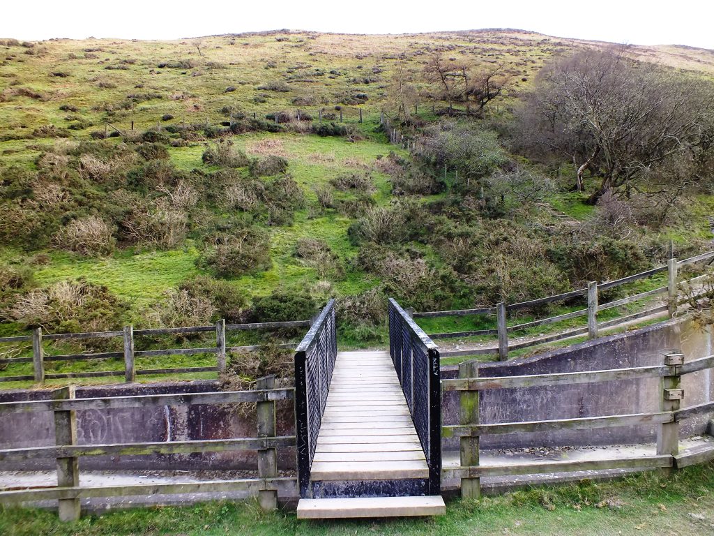
Doesn’t look as though we can go this way, so head back down the hill.

c12

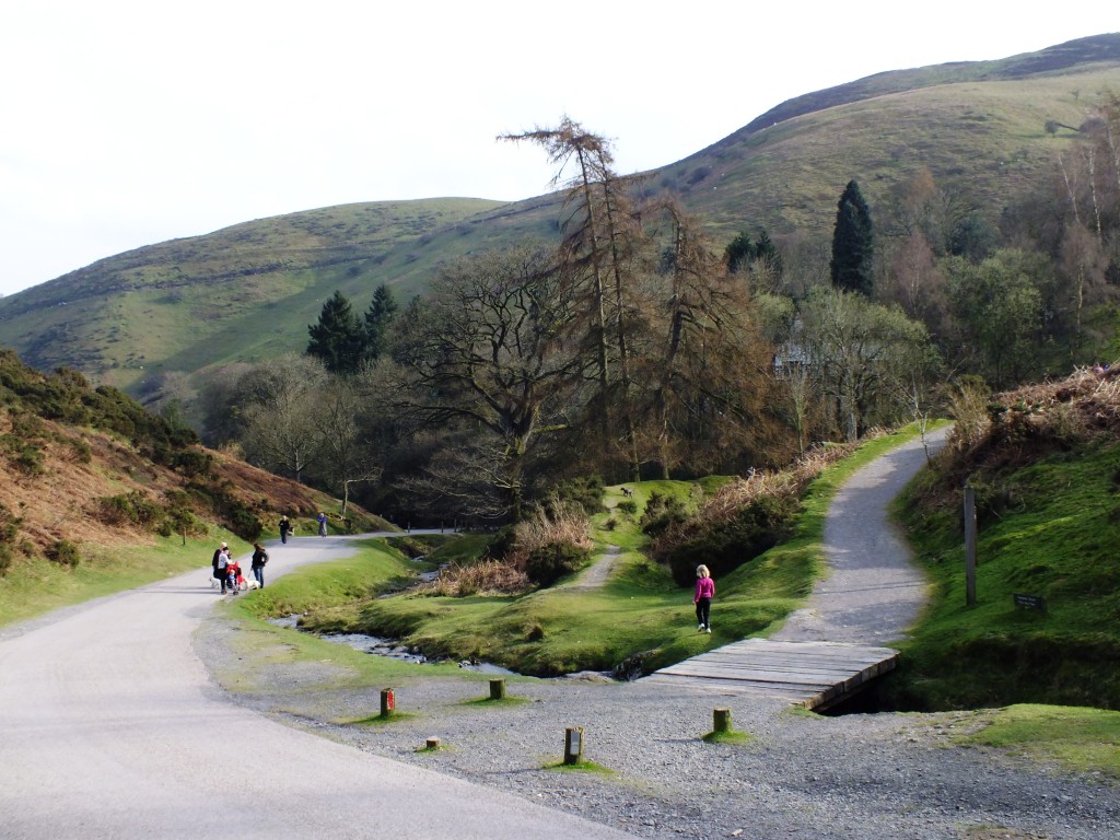
A choice of routes, but I’m going to stick to the one I came along, the other one looks as though it might end in a sheep trail and I’ve been there before and it didn’t end well.

c14

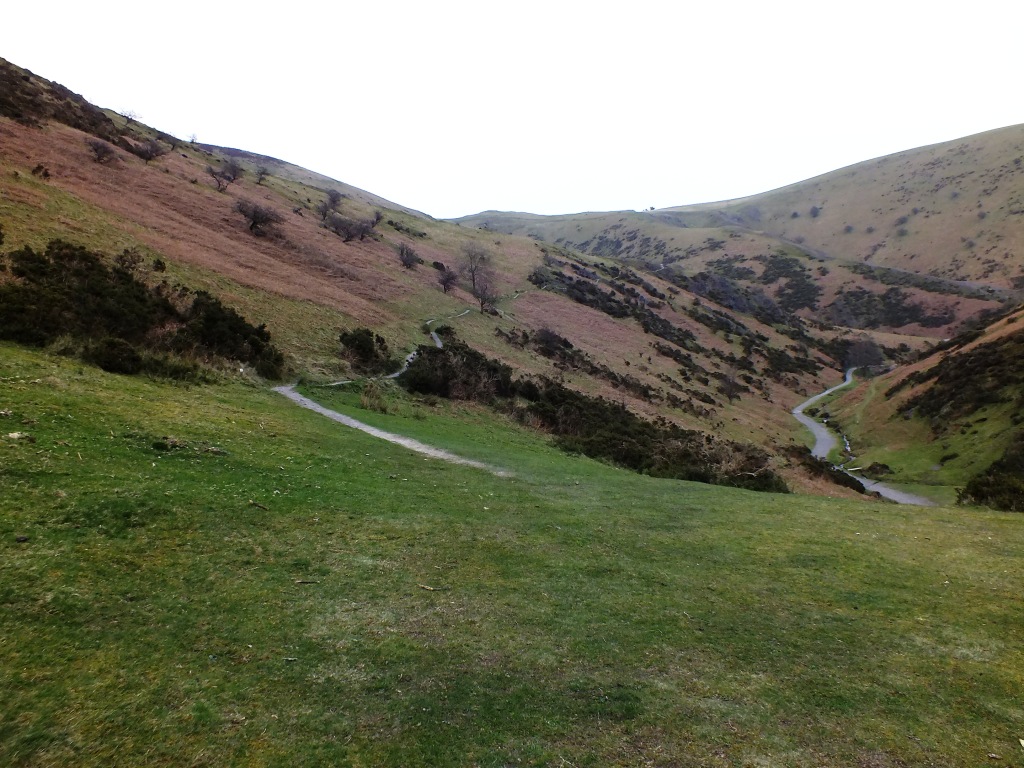
Or you could go over the stream and head for a path on the other side.

c9

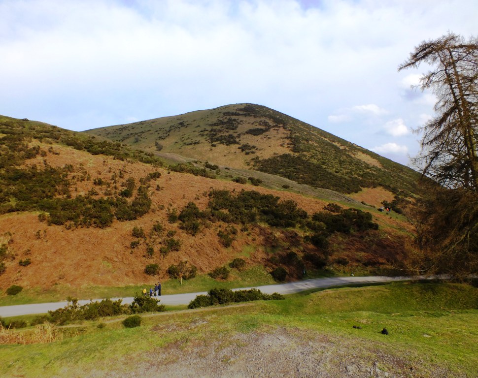
Returning on the orange route there are caves up on the left, and ahead on the top of that hill in front are the remains of an Iron Age Hill Fort.

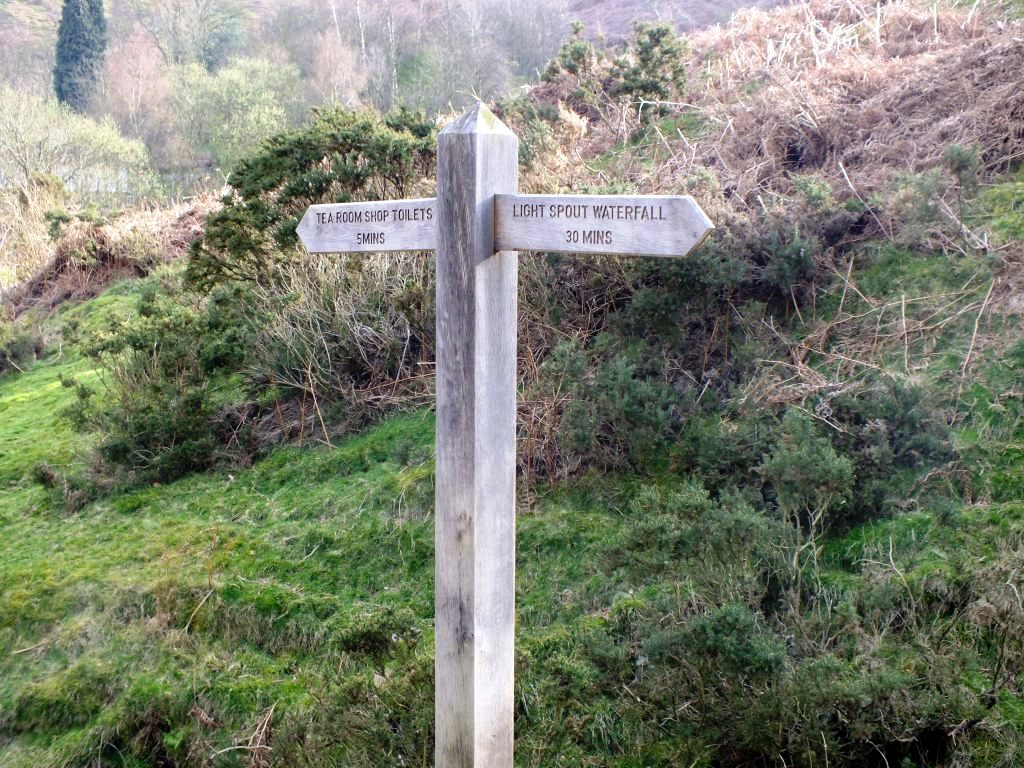
Back at the road we could turn right and walk to the tea-room, but as it is now after 5 p.m. it will be closed.

c3
A typical “Which Way” fingerpost

c17

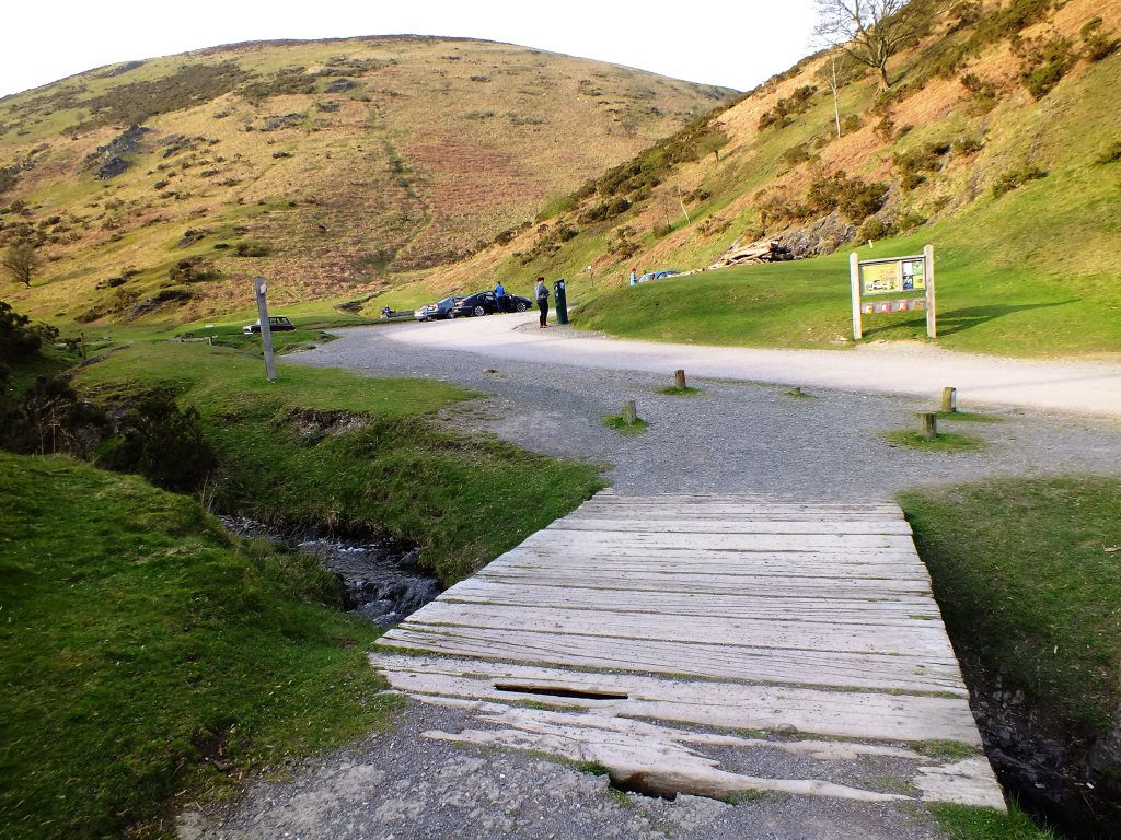
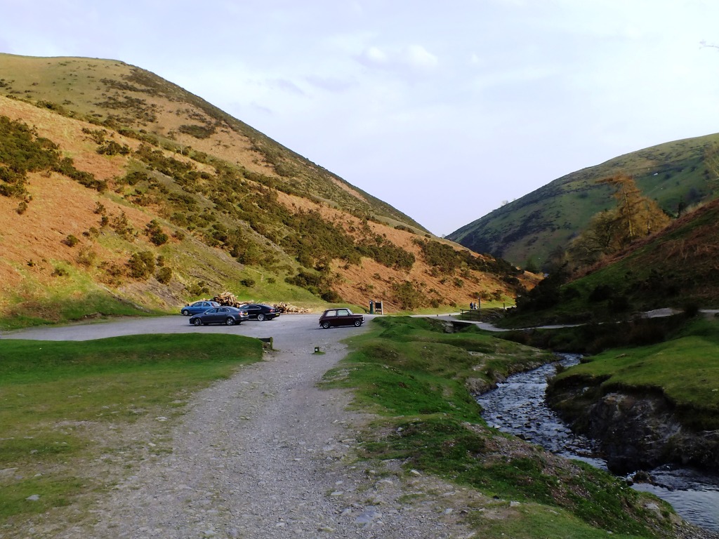
We’ll head back to the car, after one last look around and go home for a well-deserved glass of red wine. If you decide to come for a walk here, please take note of the signs. Some people seem to think their dogs are much better controlled than they actually are around sheep, and watching a sheep being chased is not amusing for me or the sheep.

c20
The Most Scenic Carpark?

Next time I’ll take you up the red route and see if we can find the waterfall.

Cee’s Which Way Challenge: There is no specific theme given.  It just needs to be some sort of  ‘Which Way’. The possibilities are endless.

 Join in with the challenge or view other ‘Which Ways’.
and you may like to have a look at Jo’s Monday Walks over on Restlessjo’s blog where you are in for a treat.

M for Mosque, Minarets and Mausoleum

frizztext hosts a weekly A – Z Challenge

A_Z logo

Event Type: General Blogging

Start Date: Tuesdays, recurring weekly

Description: Every Tuesday I offer the “A to Z challenge”, walking step by step through the alphabet.

If you would like to join in then please click here

The five principal elements of the Taj Mahal complex—main gateway, garden, mosque, jawab  and mausoleum (including its four minarets)—were conceived and designed as a unified entity.

A couple of weeks ago I used the Jawab to illustrate architecture for the letter J  so this week I am going to show you the Mosque, Minarets and Mausoleum which were mentioned in that post. Remember, the Jawab is simply a building mirroring  the Mosque for symmetry in the design.

Mausoleum and Minarets

At the western side is the mosque (masjid) facing east, reported to have been built by Isa Muhammed 1631-1648. It is built of red sandstone and has one dominant portal known as an iwan.

Mosque
Mosque

Either side of the major iwan are two smaller arches sandwiched between four towering pinnacles. The spandrels above the arches are studded with coloured marble inlay and the mosque dados feature naturalistic floral designs.

mosque

On the roof and complementing the arches below are three marble-coated domes. Inverted lotus shaped designs cloak the top of the domes, surmounted by gilded finials. On the four corners of the mosque are chattris, or domed kiosks, which have a marble coated veneer.

Mosque
Mosque

I will also include a minaret, four of these form part of the mausoleum, which have the same chattris as on the corners of the mosque and jawab.

Minaret and Chattri
Minaret and Chattri

One of the most beautiful structural compositions in the world, the Taj Mahal was designated a UNESCO World Heritage site in 1983.

The Canyon Circle Road Trip: Part IV

A Day in and Around Page


Sunday dawned cold and grey. But the photo trip was still on and we spent a couple of hours in the company of Charley from Overland Canyon Tours in the Antelope Canyon which is a few miles outside of Page where the slot canyons are majestic narrow passages with just enough space for a small group to walk the sandy floor – and for the occasional shafts of sunlight to shine down from above. [1]

Antelope-183

The best time to visit is when the sun is overhead so you get those super shots of sunlight on the sand particles shimmering in the oranges, reds and yellows of the naturally carved sandstone. Unfortunately for us there was no sun, but that did not spoil our enjoyment of this incredible place. Even light flares added an interesting purple hue to the rocks. For those of you who are fitter than us you might like to visit the Lower Antelope Canyon which is reached by a series of ladders. All I can say that climbing the steps up into the cab of the Ute was hard enough!

Antelope-021

In the afternoon we took a drive back down to Bitter Springs and turned right on to the 89A across the Navajo Bridge to visit Lees Ferry where you can get down to the edge of the Colorado and watch groups preparing to raft down the river.  [2]

(click on an image to enlarge)

Over the ten miles or so south of the Navajo bridge, the Colorado has several fascinating narrow tributary canyons including  Seven-mile Draw, Soap Canyon, Jackass Creek and Badger Canyon. The layers of sandstone and shale that form the vermilion cliffs once extended five miles to connect to the same layers in the Echo cliffs. The Colorado River cut a canyon through the Navajo sandstone. 

We stopped to marvel at the balanced rocks on the way back to Marble Canyon. Thousands of years ago a huge boulder of conglomerate broke from the cliff above and rolled to a stop here. Since then at least 6 feet of this slope has eroded away.

Balanced Rocks
Balanced Rocks
Balanced Rocks

Ultimately the softer rock, now protected by the umbrella of harder conglomerate will erode, and the boulder will topple to the ground again.

Balanced Rocks
Balanced Rocks

Several fallen boulders at the foot of the desolate Vermilion Cliffs on the Arizona Strip north of the Grand Canyon.

Hard upper layer - Shinarump Conglomerate - forms the cliff top.
Hard upper layer – Shinarump Conglomerate – forms the cliff top.

At the 89a junction we turned right and drove to the  Cliff Dwellers Lodge about nine miles further east to have an early dinner at the diner there.

Cliff Dwellers Lodge

During the Great Depression, a few white settlers built a small town of wooden structures with shingle roofs that still cling to gigantic boulders in a moon-like setting at the foot of Vermilion Cliffs.

Through the window of a cliff dweller's home
Through the window of a cliff dweller’s home
Tough living
Tough living

Returning to Page after a very interesting day we managed to catch the sun setting on Echo Cliffs on the land of the Navajo Nation.

MC-David-302

[1] When we did this trip it was OK to have any type of camera but now you need to have a SLR – point and shoot, IPads and IPhones are  not accepted, if you have one of these you may find yourself on a normal tour. We had bridge cameras.

[2] There was a landslip in 2013 which meant that this route was not accessible for quite some time. It is advisable to check routes in this region before setting out.

Weekly Photo Challenge: Street Scenes

In a post created specifically for this challenge, share a photo that brings a street to life.

Document the movement (or stillness) of a street: tell a story with your snapshot, capture a scene that reveals a bit about a place, or simply show us where you live — or a path you often take.

~ Cheri

We are going to take a gentle stroll along the bank of the River Ljubljanica in Ljubljana, Slovenia on a lovely hot summer’s day. From being a former dull, grey town in a communist country, Ljubljana is now a hip  small capital city with a vibrant café culture and beautiful Viennese Secessionist Architecture.

In the Market
In the Market
market 2
Market Stalls
along the Ljubljanica
Love Locks
Love Locks
Café Culture
Café Culture
Café Culture
Café Culture

If you would like to see what others have come up with for this challenge then go to the Daily Post @ WordPress Weekly Photo Challenge 

Read my previous posts on Ljubljana: Here and here.

KRINAIAI, the Naiads of fountains

Cee’s Black & White ChallengeThis black and white challenge is topic related but this week there is no theme.

So I thought I’d take the opportunity to feature one of my favourite fountains  in the Jardin Anglais in Geneva, Switzerland.

fountain-1

This large bronze fountain with its superposed basins borne by naiads was the work of the Parisian sculptor Alexis André in 1862.

KRINAIAI, the Naiads of fountains

THE NAIADES were fresh-water Nymphs who inhabited the rivers, streams, lakes, marshes, fountains and springs of the earth. They were immortal, minor divinities who were invited to attend the assemblies of the gods on Mount Olympos.

fountain-3fountain-2I am combining this post with this week’s Travel Theme challenge from Ailsa of “Where’s My Backpack?” who has written an interesting article about statues in Rome and is now urging everyone to find some suitable STATUES to join her this week. If you would like to join in with her challenge then please do.  Everyone is welcome.