I have lived in the UK for most of my life, but when young I definitely had wanderlust and even ended up living in South Africa for several years which was a wonderful experience. I now look forward to a long and leisurely retirement doing what I like most - gardening, photography, walking and travelling.
Ash has asked us to respond to this week’s challenge by showing you signs of spring.
“Nothing is so beautiful as Spring”
~ Gerard Manley Hopkins
If you would like to see what others have come up with for this challenge then go to the Daily Post @ WordPress Weekly Photo Challenge
PrimulasPeonyTulipSnakes Head Fritillary (Fritillaria meleagris)AzaleasBluebells
These are just a tiny few of the spring flowers I have had the joy to see and photograph over the past two weeks in the south-west and south-east. More spring beauties can be found on my Earth Laughs in Flowers blog as I begin a month of magnolias, camellias, peonies and azaleas and rhododendrons.
Lisa of the blog NorthWest Frame of Mind has decided to run a different project over the next 24 weeks. To try to show what is happening in different parts of the world (if you all join in) at a particular time of day. This week is the start of the project and photos are required taken between 12 noon and 1:00 pm (1200 – 1300).
So, being as I am quite curious to see what everyone else is doing around the globe I decided to contribute a photo or two from Ludlow where, as it so happens, the May Fair is taking place. Each year the Castle Square and Mill Street are taken over by a travelling fun fair. Lots of noise and screams and smells of hot dogs, burgers and candy floss – well, no actually that last bit isn’t true – the candy floss is pre-made and sold in sealed plastic bags 😦
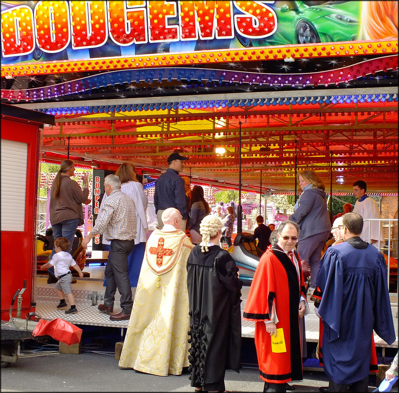
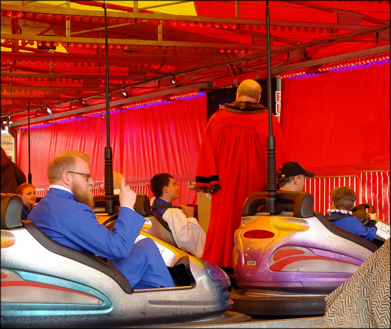
A note was posted through our letterbox last week:
“On Sunday 4th May 2014 at 11:30 am, the Mayor of Ludlow, Cllr Jim Smithers and members of the Ludlow Town Council will attend the May Fair Service lead by the Venerable Colin Williams accompanied by the Choir of St Laurence. This special service will take place with the congregation assembled in the Dodgem Cars and around the exterior of the ride.”
Now this I had to see. So I duly popped up the street, camera in hand to see what was going on and these are the results of what was taking place in Ludlow at 12:00 on Sunday 4th May 2014. Everyone having a jolly good time it seems!
If you would like to participate you have until next Saturday midnight to post a photo or write about what is happening in your part of the world between 12:00 – 13:00 this week. I hope you’ll join in! See links above for more details.
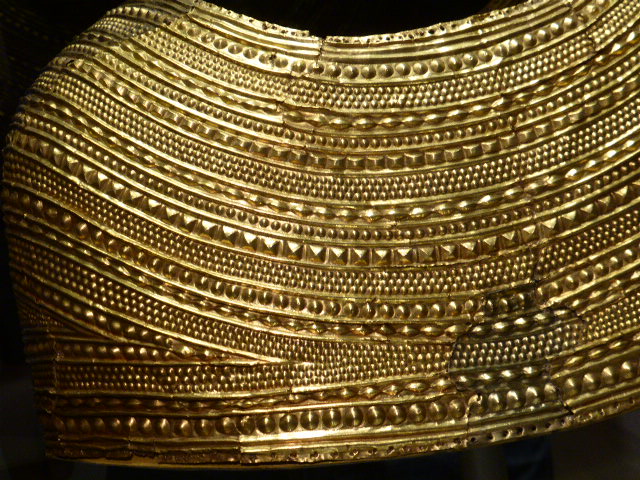
Ailsa of “Where’s My Backpack?” is looking at things in detail this week. Getting CLOSE-UP. If you would like to join in with her challenge then please do. Everyone is welcome.
On a visit this week to the British Museum I was thrilled to get close up to some very interesting objects.
(click on collage to enlarge)
Hieroglyphics from the Egyptian Rooms and Enlightenment Gallery. Excessive Zimbabwean currency notes from the Money Room, an Anglo-Saxon helmet from Early Medieval Europe, a beautiful ceramic bowl from Algeria and colourful painted decoration which was once painted above the column capitals of the Parthenon.
(Above) Man’s Cloth – recycled foil bottle-neck wrappers, copper wire by El Anatsui, Ghana, 1988 – 2001 (A traditional narrow-strip woven silk kente cloth of Ghana)
(Above) A close-up of a gold cape from Mold, Wales made from a single sheet of gold (c 1900 – 1600 BC)
I can’t believe that it has taken me until now to visit this astonishing museum and can’t wait to return to London and continue exploring the range of cultures, periods and objects it contains.
Description: Every Tuesday I offer the “A to Z challenge”, walking step by step through the alphabet.
If you would like to join in then please click here
(A special post today as this is the 200th on this blog!)
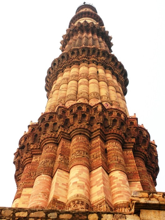
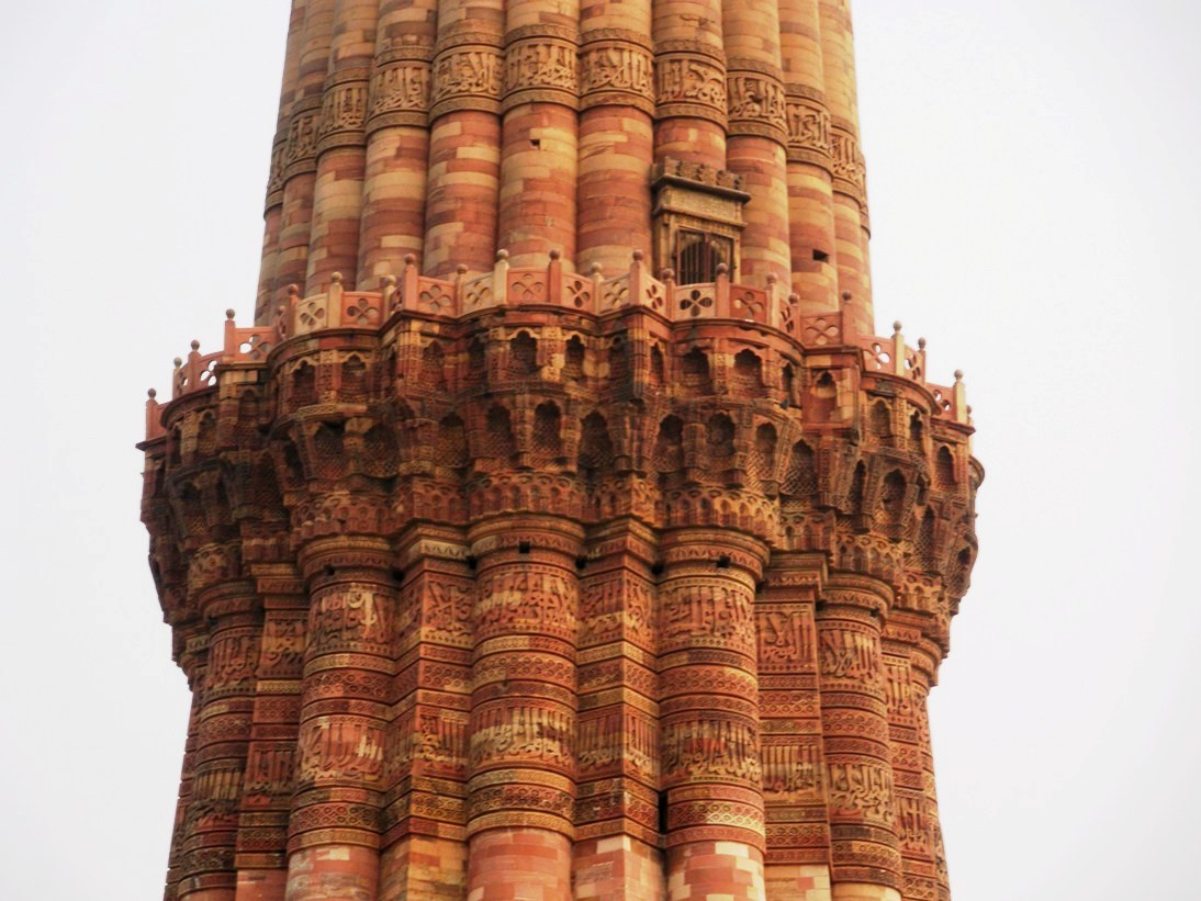
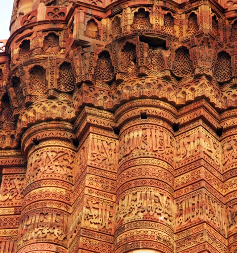
The Qutb Minar is in Delhi, India.
Originally the minar had only 4 storeys, faced with red and buff sandstone. The uppermost storey which was damaged in 1368 during Firuz Tughluq’s reign was replaced by him by 2 storeys, using marble but leaving the lower portion of the 4th storey in original red sandstone.
The minar narrows from the bottom to the top. It has a diameter of 14.3 meters at the bottom, while at the top it is only 2.7 meters
With a height of 72.5 m and 379 steps, it is the highest stone tower in India and a perfect example of minar known to exist anywhere.
Verses of the holy Quran in Naskh style on the walls of Qutb Minar
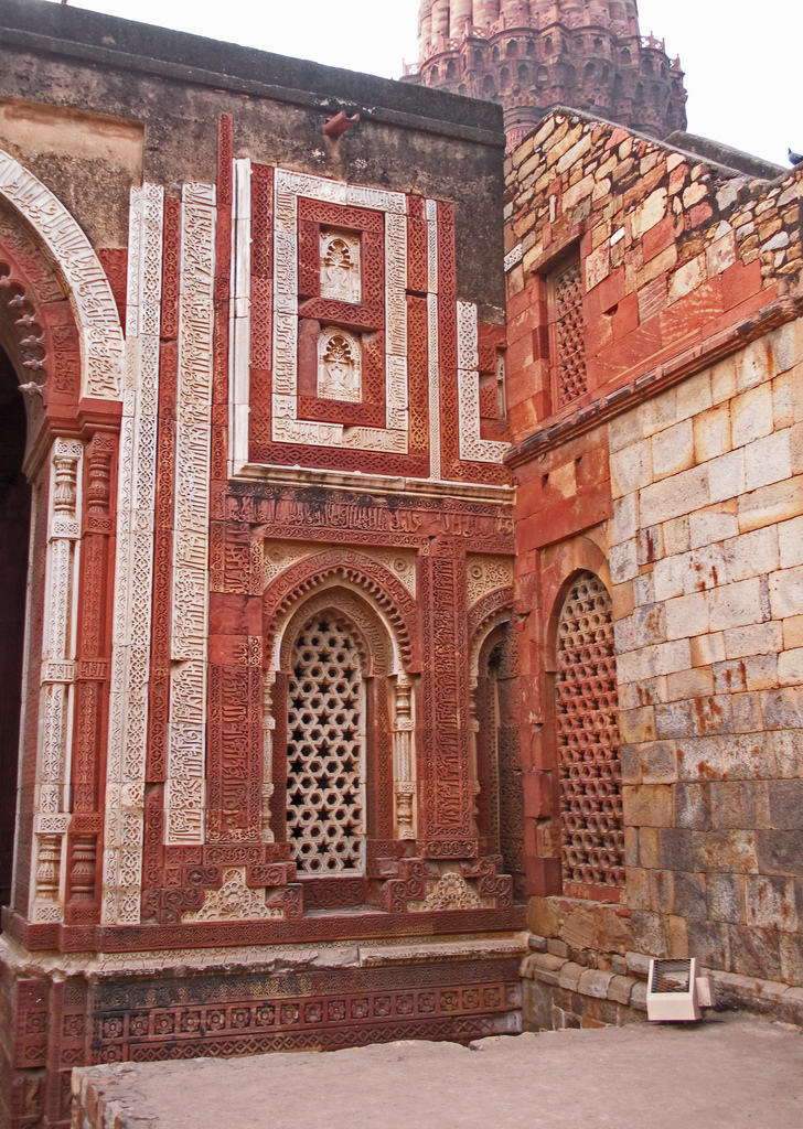
The mosque is in ruins today but indigenous corbelled arches, floral motifs, and geometric patterns can be seen among the Islamic architectural structures. Quwwat-ul-Islam Mosque, constructed by Qutub-ud-Din Aibak, dates back to the year 1198. (below and header photo)
Alai Gate
Alai Darwaza is the name given to the southern gateway of the Quwwat-ul-Islam mosque. Ala-ud-Din Khalji got the gateway constructed in the year 1311. It boasts of being the first gateway with a horseshoe arch and true dome. Along with that, it was also the first structure, which employed Islamic principles of construction and decoration.
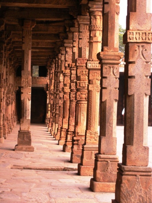
Jain Temple Pillars
All the artisans employed for the construction of Qutb Minar were Hindus and even the raw material for the monument was obtained from existing Hindu and Jain temples. Since human and animal figures are not allowed in Islam, the motifs illustrating them were later disfigured.
For this week’s challenge, share a photo with letters — no matter the alphabet. As you look through your lens, think about how your image might convey something bigger: a snapshot of how we communicate with one another, even if we don’t speak the same language.
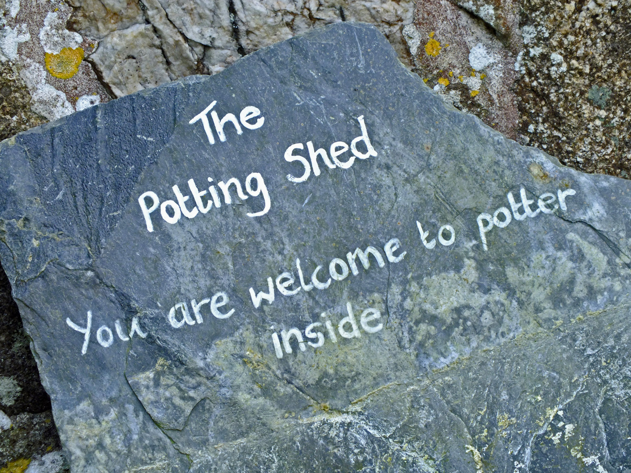
The Potting Shed
Do I need any more encouragement? Well, the open door invites you in even if you don’t read the language.
Words and pictures describe the history of the estate.
Words on slate
Most gardeners refer to plants by their Latin name, so everyone knows what it is. Common names can differ between countries and be quite confusing.
Pots in the potting shed
Every gardener needs pots and where better to keep them than in the potting shed.
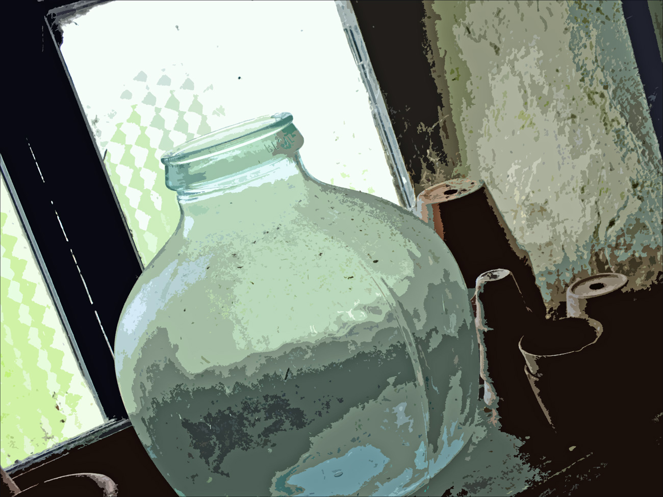
A bottle garden?
And possibly a garden in a bottle? I once tried this, but wasn’t very successful. It is difficult to keep the temperature and moisture level to suit the plants, or in my case, they grow too big!
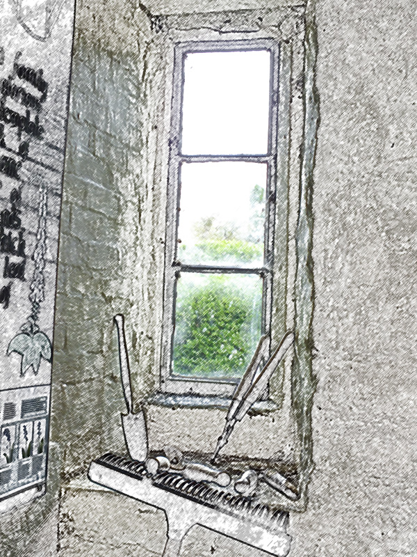
And what every gardener needs – tools!
If you would like to see what others have come up with for this challenge then go to the Daily Post @ WordPress Weekly Photo Challenge
(This post really should feature on Earth Laughs in Flowers, but I’m coming to the end of the April a to Z challenge on there so didn’t want to interrupt the flow. If you’d like to see more flowers then please pop over to see what’s happening there.)