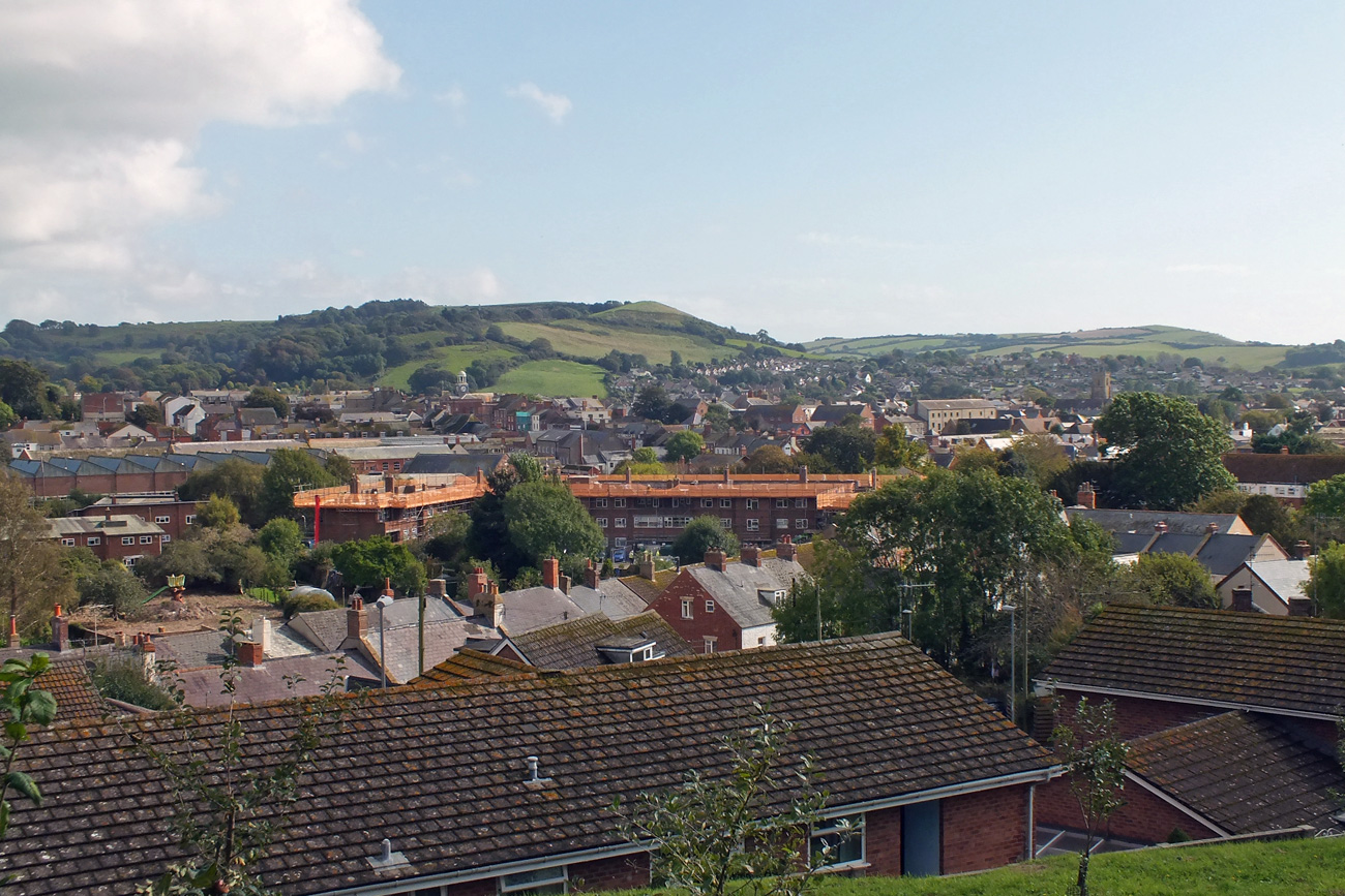
A quick weekend visit to Wiltshire to visit family gave me the opportunity to finally revisit Stonehenge after many, many years. I was one of the fortunate people who was able to run around the stones back in the 1960s. Since 1978 the stones have been fenced off and the experience of viewing them through wire did not appeal to me, even though I have passed the site often on my way to the South-West.
The whole site has been much improved by the removal of the old A344, a major road that ran up the north edge of the stones. You now approach from the west, either on foot or using the shuttle bus, and make your way clockwise around the monument which allows you to see all the stones above ground.
What you see probably originates from around 2500 BC and took 800 years to build. Obviously the site has changed over the centuries, but it seems that the larger sarsen stones were constructed then and do not appear to have been moved, whereas the smaller bluestones may have been rearranged several times.
Stonehenge has an ‘axis’ – an alignment that runs north-east to south-west up the final straight line of the Avenue. This alignment works for the summer and winter solstices and there is growing evidence that the winter solstice was the most important.
It was a cold, raw windy winter’s day, but at least the sun shone casting black shadows over the bright-green grass and providing a striking contrast to the darkening clouds forming overhead.
I’ll let the pictures speak for themselves and if you are ever in the area I do recommend a visit to this extraordinary site. Barrows and monuments in the landscape can be explored on foot over the uneven grass.
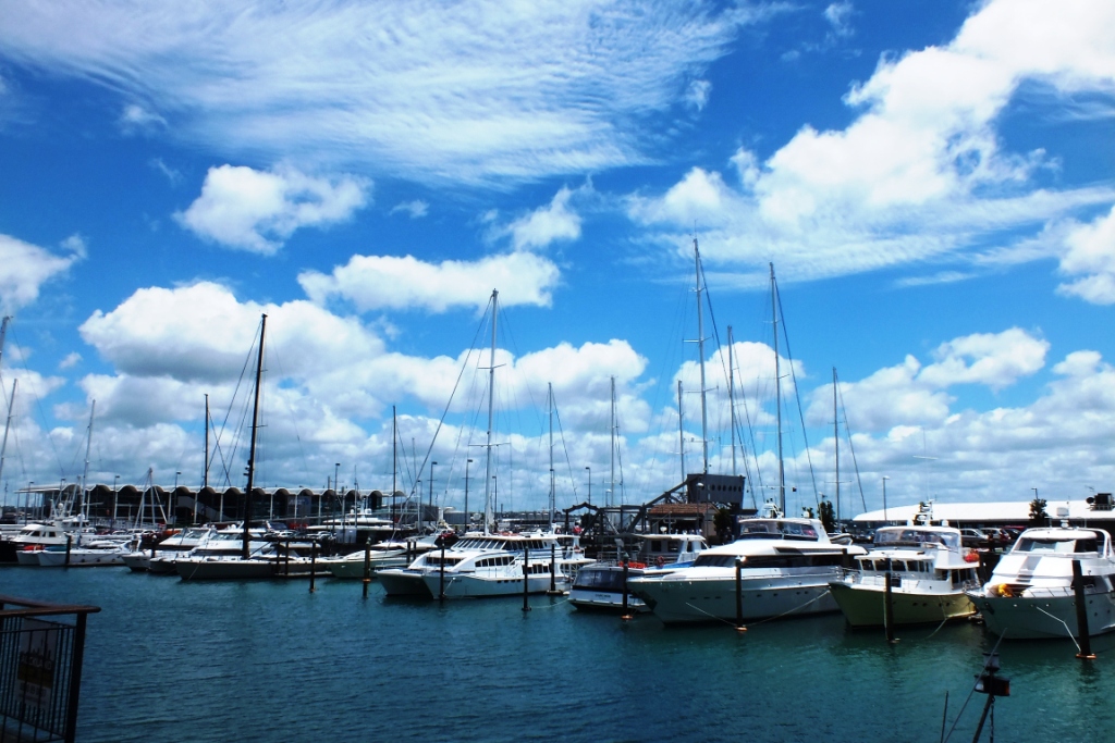
Auckland is the largest city in New Zealand with a population of 1.4 million and the greatest concentration of Polynesians in the Pacific. It is known as the ‘City of Sails’ and it is thought that 1 in 3 people own some form of watercraft.
“Latin skies upon Chinese lagoons
tousled, sunny-mouthed, sandy-legged coast”
~ Poet Allen Curnow
Ultimate Holiday
Ruapuke Beach is reached via a winding dirt-road that snakes its way through native New Zealand bush and lush green rolling hills beneath the foothills of Mount Karioi, an extinct volcano that watches over the town of Raglan.
The black volcanic sand is so hot that when the waves come in steam rises! Surfers ride the waves. the only ones we have seen along the coast today. Rock pools are a rich source of photographic inspiration; tiny crabs scurrying one way then another in the shallow pools, a red crab hiding under a rock, green and shiny mussels, black barnacles, starfish waiting for the tide to turn, shiny seaweed drying on the rocks. Black sand.
In the Country
Unusual mailbox
Daisies
Waikato is dairy country. The green rolling hills are home to cattle and wild flowers. And views.
Arts and Crafts
Left-hand waves at Manu Beach
Raglan is home to many artists who produce original art, carvings, jewellery and other handicrafts. Shopping here can be an expensive pastime!
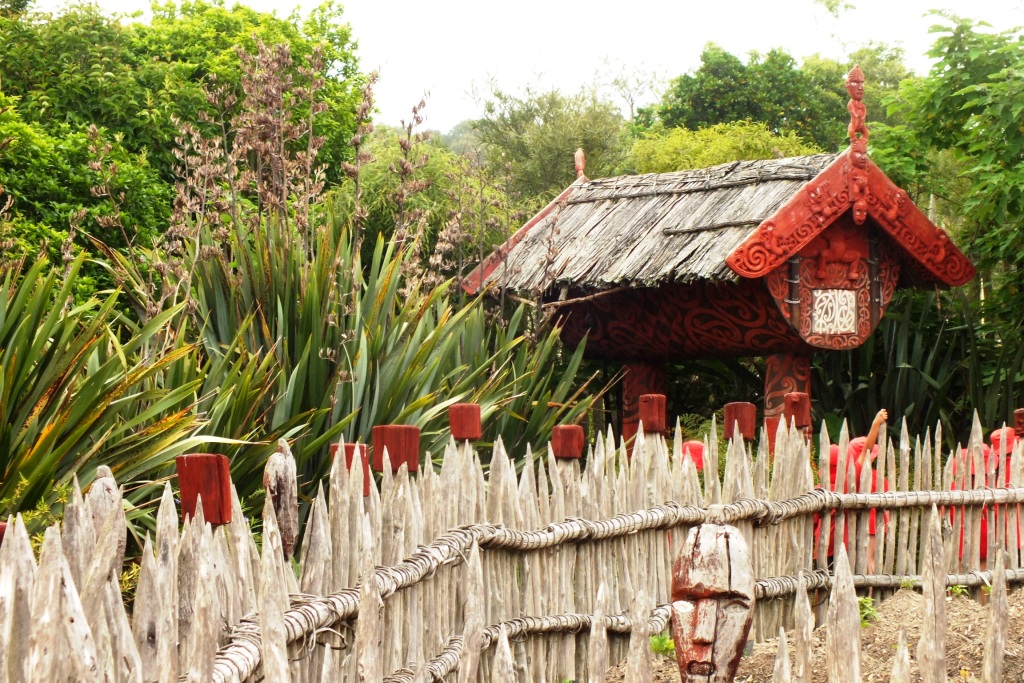
Te Parapara Garden
In pre-European times there were many gardens on the banks of the Waikato River. Te Parapara takes its name from a pa that was located on the site of Hamilton Gardens. This garden illustrates Maori horticultural traditions and technologies.
Maori horticulture is closely connected to spiritual beliefs. Gardens and gardening practices have ritual aspects. The carved figures on the palisades (pouwhakarae) represent specific ancestral figures.
This brings me to the end of my New Zealand adventures. I have only seen a tiny portion of these amazing islands, but what I have seen has impressed me. A lot. I will be back…
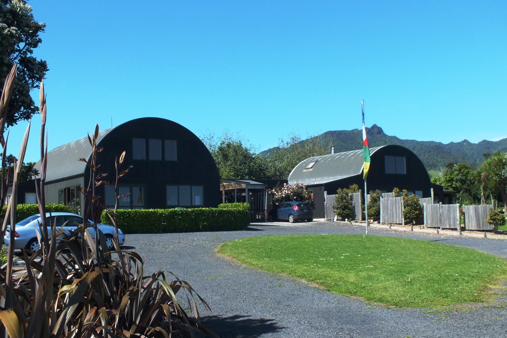
A new week, a new country and a totally new destination for me. For 10 days I will be in the ‘Land of the Long White Cloud’, and several smaller rounder ones. Staying near my son’s partner’s parents in the Waikato home to some of New Zealand’s most stunning landscapes. I may get to explore a little further, but I’m actually quite content to soak in the views from where we are staying and chill out with my new grandson.
Home Sweet Home
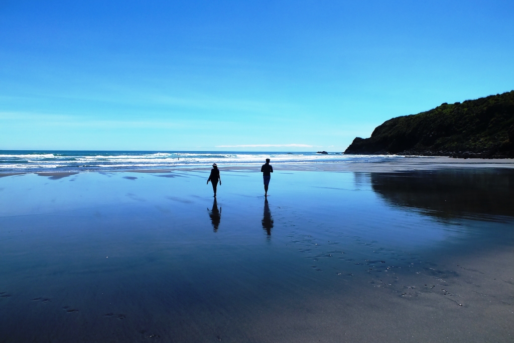
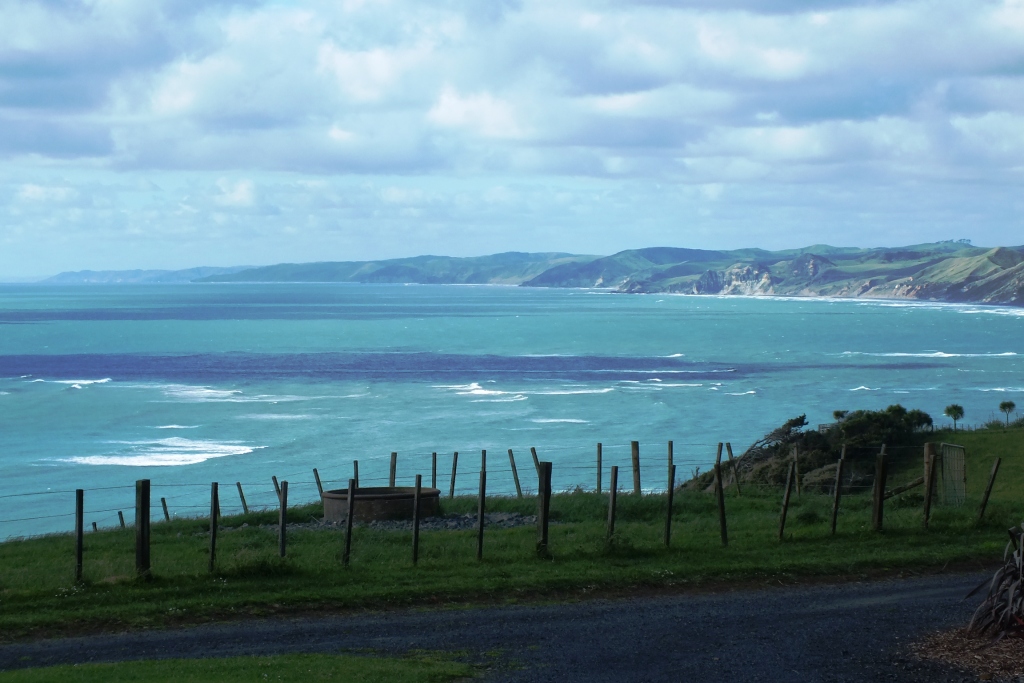
We are staying high above Ngarunui (Ocean) Beach. Located 5km west of town this wide expanse of black sand beach lends itself to lazy beach walks and picnics in the sand. It’s also a popular spot for surfing, bodyboarding and swimming.
Aqua
Views from the Barn
What transfixes me the most is the colour of the water – a cloudy, milky turquoise, possibly because of the black sand, which is the finest powder sand I have come across and glitters in the sun.
Surfing
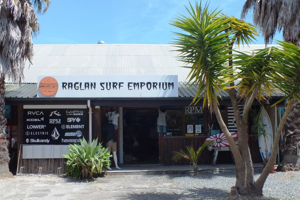
Raglan is a small surfer town on the coast and boasts the world-famous surf break Manu Bay. The long, peeling left-hand break, said to offer one of the longest rides in the world, featured in the 1966 surfing film Endless Summer. Situated on the West Coast of New Zealand’s North Island, just a 45-minute drive west of Hamilton or a two-hour drive south of Auckland, Raglan offers stunning scenery, beautiful beaches, inspiring arts or simply a good old cup of coffee.
Surf Shop
Typical weatherboard house
Te Kopua Beach
Raglan Roast Coffee
Shops
Aqua Water in the Harbour
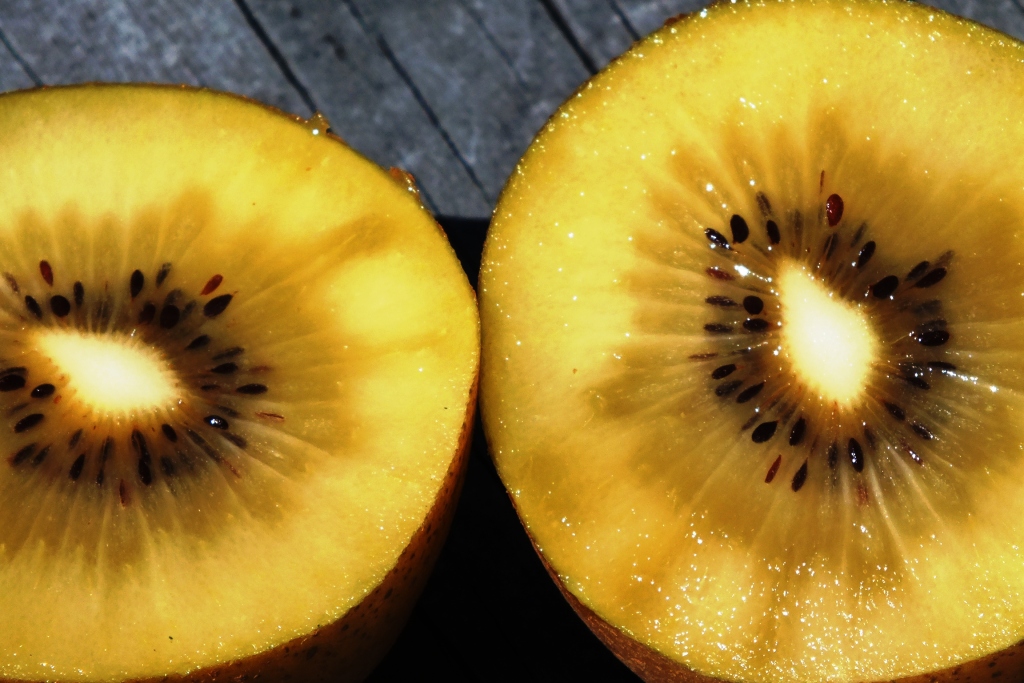
Golden
You may have eaten Kiwi fruit, but these are golden kiwi fruit and taste SO much better. Sweeter and without that odd chemical reaction that I and many others have when eating the green fruit. I am becoming addicted!
Christmas Trees
Pohutukawa Tree
The pohutukawa tree (Metrosideros excelsa) with its crimson flower has become an established part of the New Zealand Christmas tradition. This iconic Kiwi Christmas tree, which often features on greeting cards and in poems and songs, has become an important symbol for New Zealanders at home and abroad. It is just about to flower so I hope to capture some good shots of trees in full bloom before I leave.
A last minute booking to Bridport in Dorset for a birthday and wedding anniversary celebration was made in lieu of the proposed trip to Seattle. After a gorgeous sunny September, autumn also decided to come along too, so it was a mixed week of sunshine and showers and even a few dramatic thunderstorms with lightning and thundering waves.
Bridport
Bridport is a quaint market town in West Dorset and only a mile from the famous Jurassic coast at West Bay with its lovely harbour and shingle beach. It has an open and airy feel to it because of the wide streets that contain several hundred listed buildings many of them built to accommodate the twisting and dyeing of ropes and nets during the late 12th century. It also has a lively arts and literary scene.
East Street
Town Hall
The Ropemakers
The Olive Tree Café
Georgian Architecture
The Bull
Greengrocers
Although in a self-catering house I don’t consider it a holiday if I do all the cooking so we ate take away fish and chips from Longs in West Street which were excellent – thin batter on the succulent cod and crisp chips. And the best deal was a thin crust pizza, salad and 1/2 pint of local cider from The Stable, behind the Bull hotel on East Street – £10 on a Tuesday. If you like it hot go for the Blaster! Or what about the Bucky Doo?
Burton Bradstock
The Hive Beach Café
Good fish and seafood can be found in local pubs and restaurants, but head to the Hive Beach Café, a tarpaulin-sided hut which is a popular place for lunch as it is right on the beach at Burton Bradstock, 4 miles from Bridport along the shingle Chesil Beach. It is very busy at the weekend, even at this time of year, but worth the wait (no bookings) for the fresh lobster, sea bass or grilled sardines. An obvious choice for Saturday’s birthday lunch.
On the Chesil Beach
Golden Cliffs
East to Portland Bill
Dorset Sheep
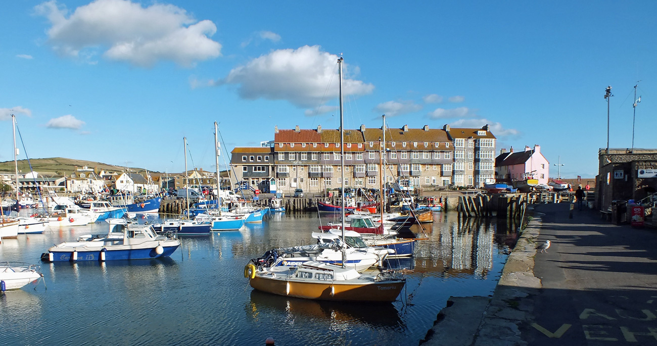
West Bay
Only a mile from Bridport is West Bay with its newly designed harbour, vertical sandstone cliff glowing like molten gold in the late afternoon sun and sweeping shingle beach. West bay grew up as the harbour for nearby Bridport and was Thomas Hardy’s “Port Bredy”. More recently it was the location of the TV drama ‘Broadchurch’. Brightly coloured fishing boats bob in the harbour, fishermen line the harbour walls or the edge of the surf, and cute wooden shacks and kiosks line the harbour walk where you can buy fish and chips, fish stews, ice-creams. We stopped for dessert – a cone of delicious Purbeck fig and honey ice-cream.
Fishing Boat
West Bay – west
West Bay – east
Cottages
Kiosks
Lyme Regis
The main attraction in Lyme is the historic medieval harbour known as The Cobb featured in the ‘French Lieutenant’s Woman’. Known as the gateway to the Dorset Jurassic Coast, Lyme Regis provides a good base for visiting walkers. The town has long inspired artistic and literary visitors including, Tolkien, Tennyson and Jane Austen who set the novel ‘Persuasion here. There are excellent facilities with plenty of restaurants, pubs and cafés as well as an interesting selection of galleries and shops to explore in the old town which dates from the 14th century.
Ammonites
Beach Huts
Anchor
The Cobb
The Cobb
As always on my holidays there were trips to the coast and visits to gardens. Not a lot of chances to visit historical places at this time of year and with the nights closing in, the days are shorter, but we had a wonderful time and hope it won’t be decades before we return.
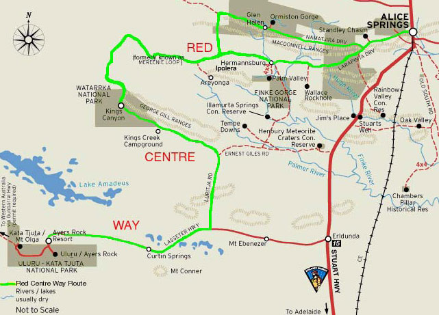
It was August 2003. We were in what felt like the middle of nowhere in the thriving, spirited outback centre of Alice Springs.
Some of you may know Alice from the 1950 novel by Nevil Shute or the subsequent film ‘A Town Like Alice’. We were there to set off on an adventure into the deep centre – to the Uluṟu-Kata Tjuṯa National Park about 463 kms direct by road from Alice in the Northern Territory of Australia.
It is one of those iconic places that you fear will not live up to the hype. That you will arrive and be disappointed. And it was a long drive to be disappointed at the end of it.
Setting out in our hired Toyota Land cruiser (a giant beast that was total overkill as there was only the two of us, but the smaller Rav4 was unavailable) we headed for our first stop in Kings Canyon.
Feeling adventurous I decided that we would travel west through the West MacDonnell Ranges to Glen Helen, along the Mereenie Loop Road which is unsealed most of the way but passes incredible places along the way like Standley Chasm, Palm Valley and the Glen Helen Outback resort (all of which we had explored during the two previous days.) Nowadays I believe you need to purchase a permit to travel along part of this route, but then it was not required. And it is now known as the Red Centre Way. You cannot travel on an unsealed road in Australia in an ordinary hire car so make sure if you want to follow this route that you book a 4WD. All you have to deal with are pretty bad corrugations in places which take some adjustment in finding the optimum speed where you are not shaking the teeth out of your head, nor going so slow that you feel every bump! It is a lovely drive through some beautiful desert country, certainly more appealing than the much longer detour along the sealed highway.
If you don’t make any stops along the route the drive to the Kings Canyon resort is around 3 1/2 hours. There you will find 300 metre sheer cliff faces and a palm-fringed swimming hole and you can take the Kings Canyon Rim Walk for breathtaking views over the red landscape. We stayed in a basic cabin and enjoyed a walk in the valley before heading to the restaurant for barbecued steaks and a live country music band who invited people to get up and dance. Of course things will have changed since this trip and you can now have an ‘Under a Desert Moon Fine Dining Experience‘ which will more than likely set you back a whole lot more than what we paid for the entire trip!
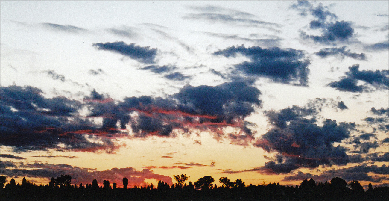
Sunset in the Outback
Leaving Kings Canyon the following day (though I would recommend spending two nights at the resort if you can as there is much to see) we continued south along the Luritja highway for 300km to Uluru which is a huge monolith created some 600 million years ago. As we reached the Lasseter Highway we could see the third largest monolith in the distance – Mount Connor – (located 100 kms east of Uluru) which never gets much of a mention, but is quite a sight, rising up in the middle of the desert. You can book a 4WD day trip from the Ayers Rock resort which includes dinner at the Curtin Springs Station’ homestead and provides you with a quintessential Aussie Outback experience.
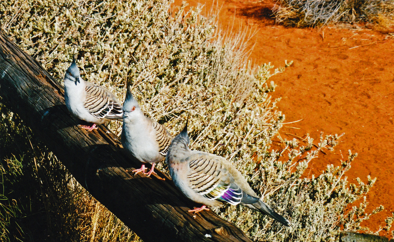
Three Crested Pigeons
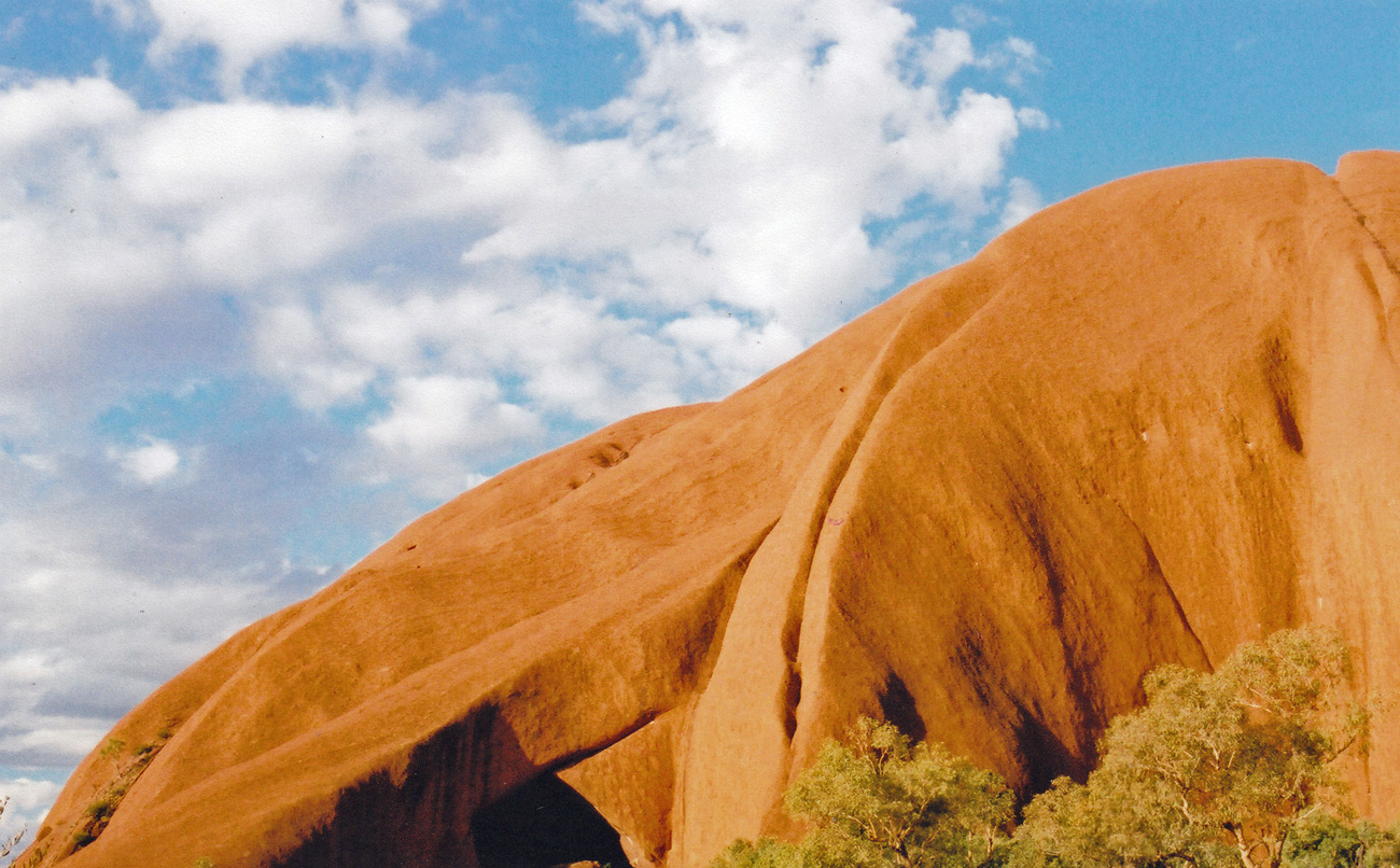
So on to the main event – Uluru. If I had thought that Mount Connor looked impressive I was totally astounded by this rock which is accepted as the largest Monolith in Australia and claims to be the largest monolith in the world. After dropping off bags in our accommodation in the Outback Pioneer Hotel and Lodge, we set off for the base of the monolith to have a walk and then to get into position to see the sunset.
Uluru
You don’t have to spend a fortune when visiting this part of the world (which is now rated to be the third most expensive resort to visit) as you can camp or stay in cabins and drive around yourself taking in the views and the park, and walk around the base (9 km) or in Kata-Tutja. Of course if you want 5* luxury spa hotels, flights over the rock, rides on camels or Harley Davidsons and dine outside under the stars with gourmet dining, then you can. But we didn’t.
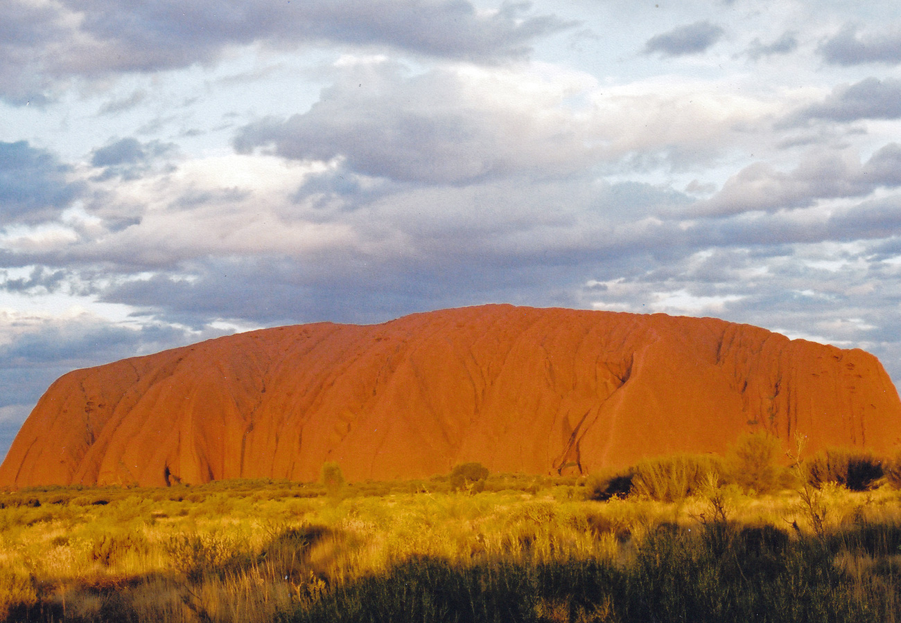
Uluru
The next day we got up early to watch the sun rise. The rock really does glow and there is something very magical about it. Its history, its significance in Aboriginal culture, its location, the peacefulness. Even with the crowds it still feels special. We carried on to the Kata Tjuta (The Olgas) which are further on into the park and where there are two walks open to everyone: The Valley of the Winds, a 7 km beauty that makes a loop to two spectacular lookout points, takes about three hours and is easy-going. Do it in the early morning to avoid the crowds and the Walpa Gorge Walk, an easier 2.6 km stroll that takes in a nice representative of the native wildlife and plants of the park.
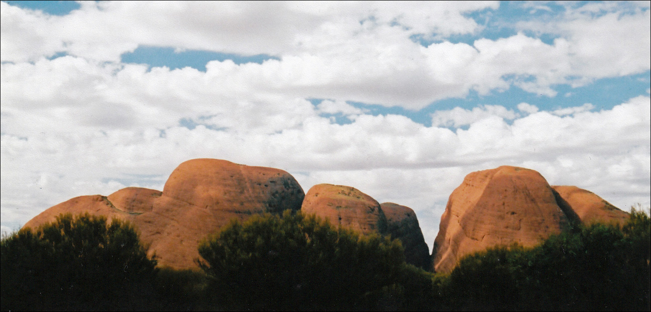
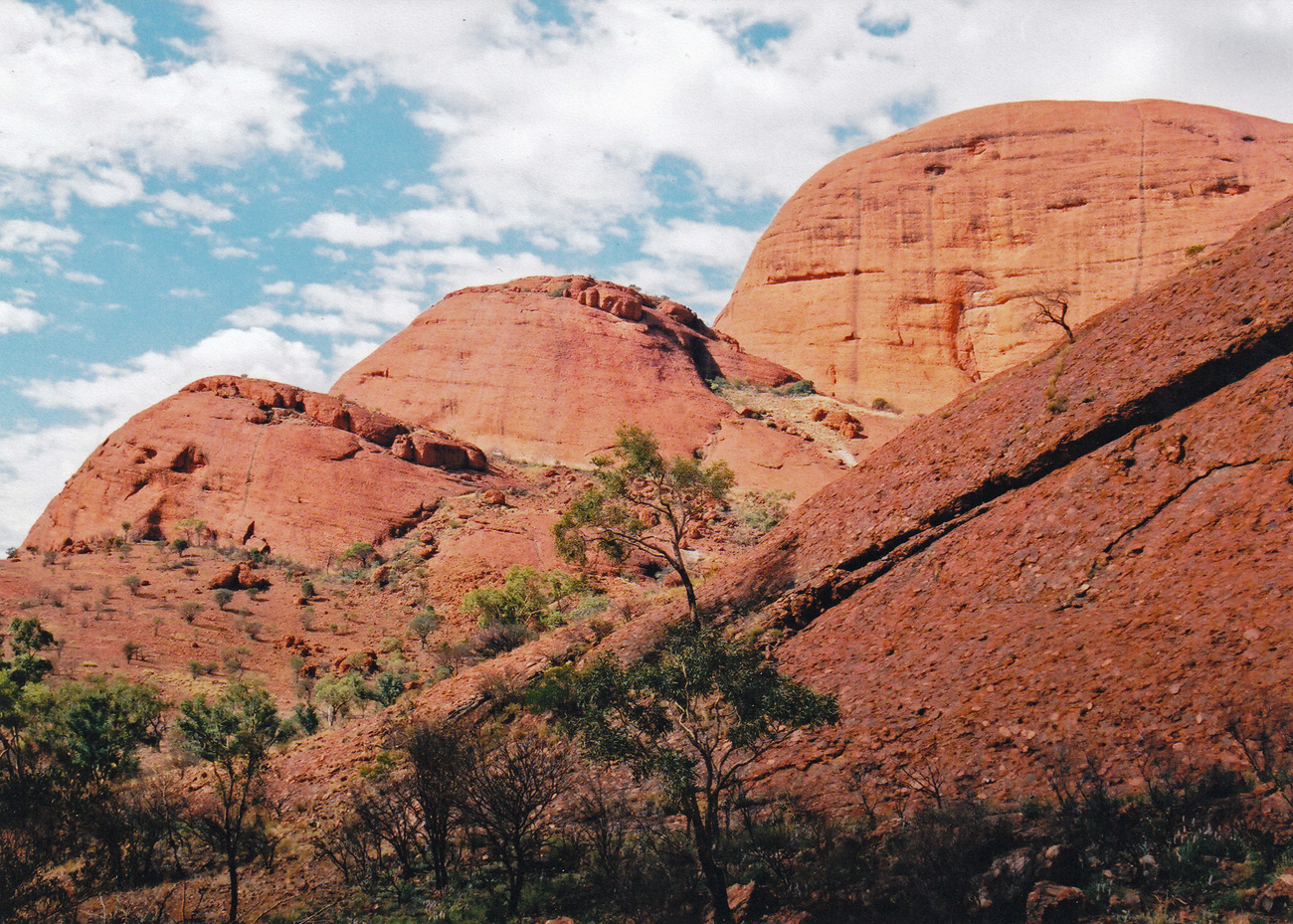
Kata Tjuṯa, also known as The Olgas and officially gazetted as Kata Tjuta / Mount Olga, is a group of large, domed rock formations or bornhardts located about 360 km southwest of Alice Springs.
I can’t recall which trail we followed, but walking between the steep walls of red sandstone, listening to flocks of finches, looking at the wild flora, and above all, the feeling of space and no crowds of people, was my favourite part of the trip. Like Uluru, these rock formations are most spectacular at sunrise and sunset when the light seems to give them a magical red glow.
Kata Tjuṯa, also known as The Olgas
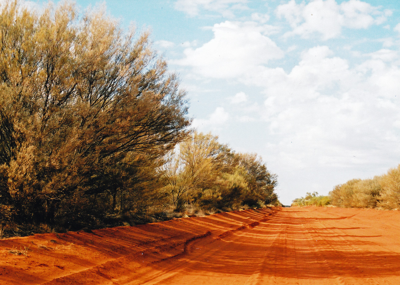
Returning to Alice along the Luritja Road we turned off onto Ernest Giles Road (unsealed for about 70 km) for a ride on a rich red and dusty road – take care though, as this is the one and only time that I literally took off! Driving too fast over a hidden dip, the land cruiser flew through the air before landing somewhat shakily on the other side, after that I took things a little more slowly.
Ernest Giles Road
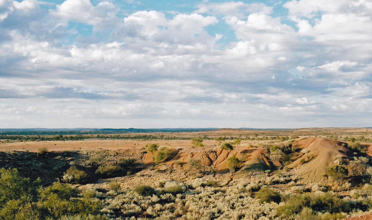
A few kilometres before the road joins the Stuart Highway leading back to Alice we passed the Henbury Meteorite Conservation reserve where we stopped for a stretch of legs and a walk around this unusual site. Henbury Meteorites Conservation Reserve contains 12 craters which were formed when a meteor hit the earth’s surface 4,700 years ago. The Henbury Meteor, weighing several tonnes and accelerating to over 40,000 km per hour, disintegrated before impact and the fragments formed the craters.
Henbury Meteorite Conservation reserve
Uluru was even better than I had imagined, despite the amount of tourism (and I suspect it has increased over the past 10 years) and unexpectedly the walk in Kata Tjuta and the drives on those mystical red dusty roads through the Outback were additional highlights for me.
Have you visited an iconic site? And if so did it live up to your expectations or were you left feeling a little bit cheated?