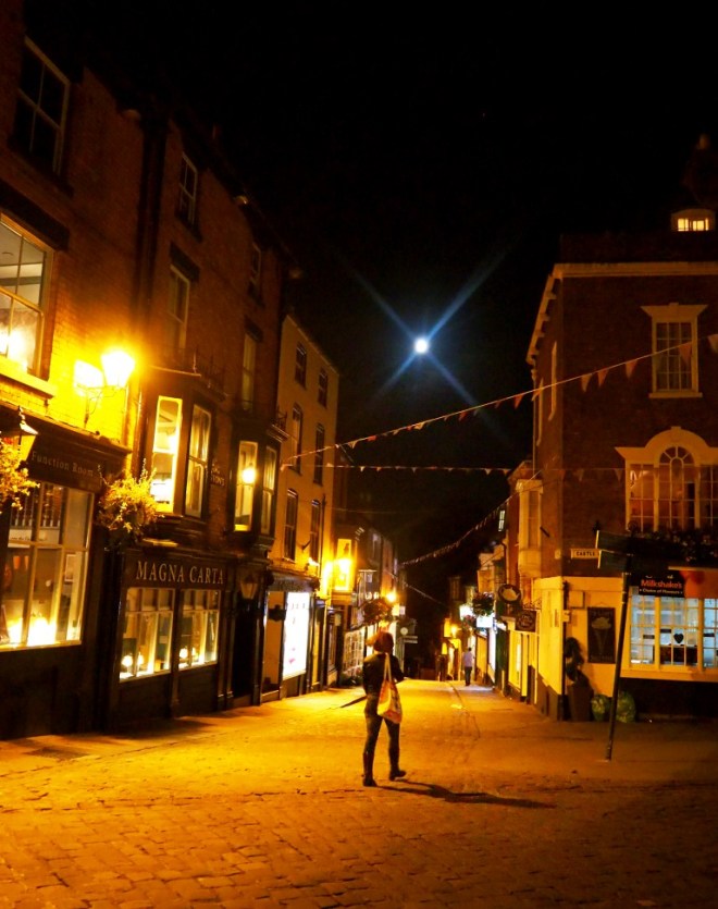
Our arrival in Lincoln was rather fraught, after a road closure in the centre of town disrupted our route to the Castle Hotel up in the Cathedral Quarter. Fortunately the SatNav (AKA Florence II ) got us out of difficulty and we arrived in plenty of time to have a stroll around the neighbourhood and choose a restaurant for the evening.
Westgate
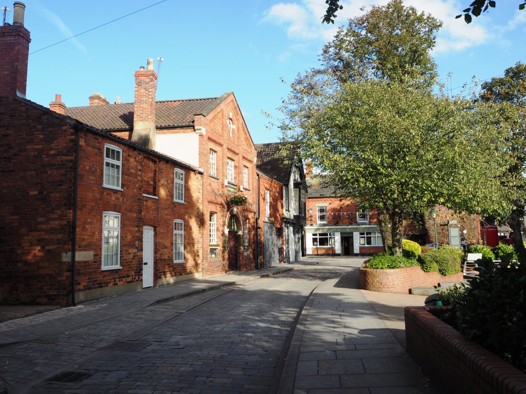
From directly outside the hotel, where we had booked a ground floor room in the former stables block, we had a glimpse of both the cathedral and the castle.
CathedralCastle walls
And a five minute stroll took us to Exchequer Gate (header image) and Castle Hill the medieval space which forms the setting across which the Cathedral and Castle face each other, dating from 1072 and 1068 respectively.
Bailgate
Top of Steep Hill
There is something I find so appealing about towns and cities where the streets have names such as Bailgate, Eastgate, Westgate, Pottergate, Michaelgate; you just know you are in a place steeped in history. Continue reading Historic Uphill Lincoln
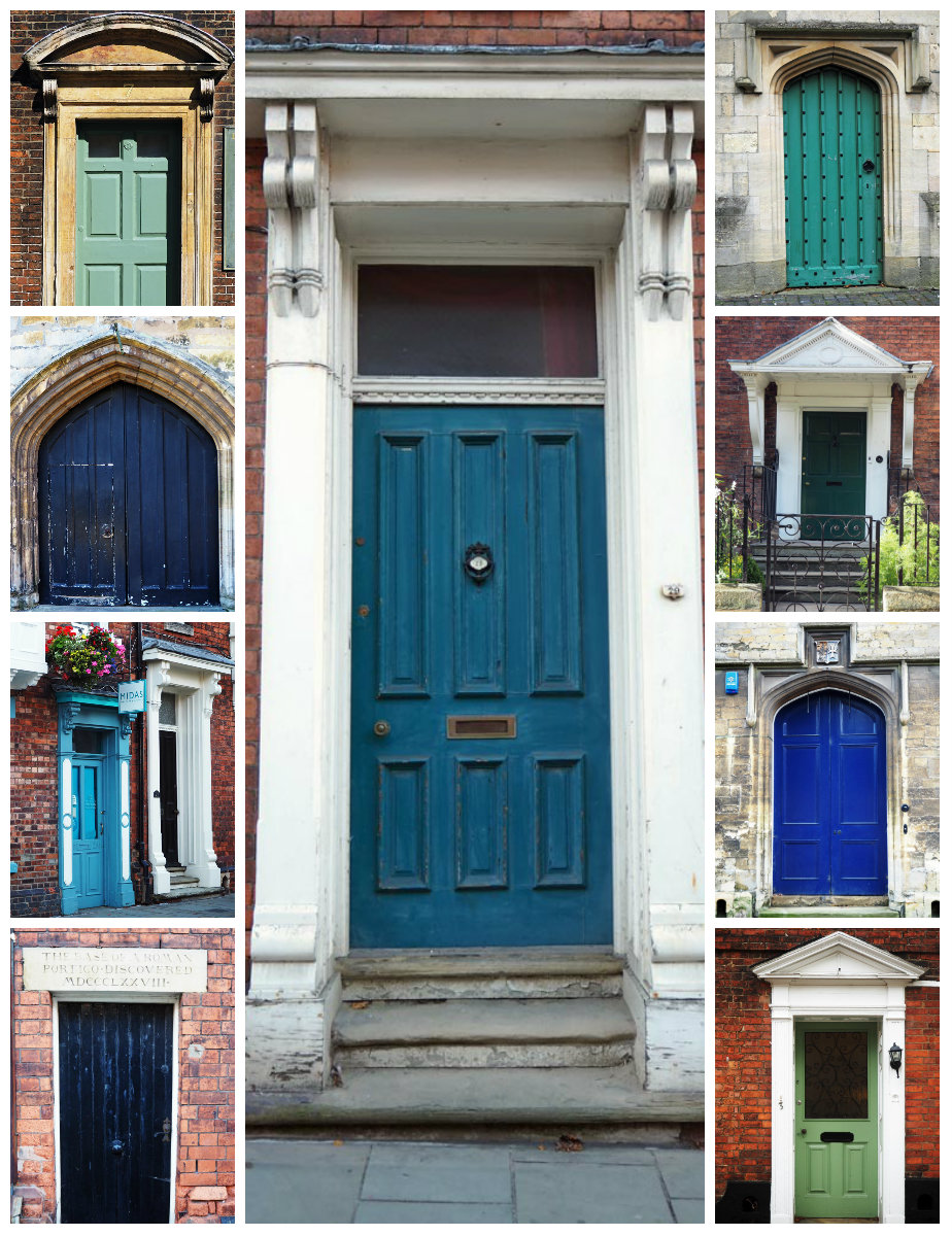
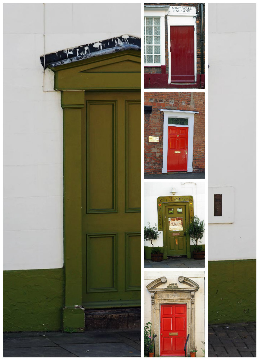
It was like being back in Ludlow. All the beautiful doors of Lincoln’s Cathedral Quarter beckoned. Often wonky, scuffed and peeling paint, elaborate stonework, fancy fanlights or just brightly coloured wooden doors. Each with oodles of character.
Leaving Norwich behind the next stage of our journey was northwards to Lincoln where we would stay a couple of nights and explore the Cathedral area. As the journey was quite short and we couldn’t check in until after 3 pm I decided to make a couple of detours en route.
Driving through the flat landscape with polytunnels stretching far on either side of the road, you realise that this is the agricultural heart of England. The distinct whiff of cabbages was all too familiar.
The first stop was to see the windmill at Heckington. The second stop was in nearby Sleaford to have a look at the Navigation Wharf and have a bite to eat. We parked up in the market place where you find an imposing church and a large war memorial. Being a Sunday there was no market and the parking was free. Always good.
I haven’t been to Lincolnshire for a long while. But the red brick houses and quiet streets and even the market place, immediately took me back to my childhood when I lived in Nottinghamshire and Lincolnshire before returning to the county of my birth when I was ten.
Slipping around the corner we made our way to the Navigation Wharf, originally the terminus of the Sleaford Navigation. Goods shipped on the Navigation were stored at Quayside House to await collection or dispatch. Navigation House was the Sleaford Navigation Company office, built in 1838 and now is now a small museum explaining the early development of the River Slea and the story of the Navigation. We had a quick look inside and then went to the National Centre for Craft and Design to have a look at the exhibitions.
A pretty chair – this would look nice in my bedroom
And also the view over the town from the roof-top gallery.
A short walk takes you on a circular route along a section of the River Slea to Cogglesford Mill and back to Navigation Wharf. We were hoping to get a coffee and sandwich at the Mill, but were sadly disappointed.
Alongside Payne’s Wharf
Footbridge which opens for vessels to pass beyond
River Slea
After crossing the footbridge (originally built in 1962) replaced in 2008 the path follows alongside the East Banks towards the Leisure Centre. Three interesting mosaics have been laid in the pathway.
Just past the Leisure Centre is a footbridge and a sluice gate which marks the splitting of the river into two channels; the New Slea and the Old Slea which used to be the most important channel but is now mostly used as an overflow. Original Iron Age and Roman settlements at Old Sleaford were founded on a ford at this point. The New Slea was straightened when it became the Navigation in 1790 and it may have been the site of several Anglo-Saxon watermills.
FootbridgeSluice Gate
We continued along the East Banks until we reached the mill pond and tilting weir (1961) where we turned left over the lock and mill headrace to Cogglesford Watermill.
Weir
Mill Pond
West Banks
The mill dates back to Saxon times and is thought to be the only Sheriff’s watermill still in operation in England. The present mill was built in the early †18C and still produces flour on milling days which take place from April to December.
Cogglesford Watermill
We were disappointed not to find a tea-room here, only a vending machine, and since we weren’t in the market to buy any flour, continued to head back to town on the opposite bank.
On the right-hand side of the river is Lollycocks Field, a 5.5 acre nature reserve. The unusual name is thought to derive from the fact that it was once used for raising turkeys (lollycocks). The pond was added in 1960 and is a lovely quiet spot for local fishermen.
River Slea
Payne’s Wharf in the distance
Black and White duck
Crossing the footbridge near the sluice gate we returned to the Navigation Wharf via the East Banks and were pleased to find a proper coffee machine in the licensed café in the National Centre for Design and Craft where we sat in the sunshine, enjoying a piece of cake and a decent flat white. Always nice to end a walk with cake!