The best-known landmark in Shropshire is the Wrekin, at only 1,335 feet it has attracted a lot of attention given its modest size. Those of you who have passed Shrewsbury on the M54 heading to mid-Wales will have noticed this volcanic-looking lump by the side of the road and from the Cressage side (south of Shrewsbury) which is my usual approach these days, it looks like a sleeping dragon with the tree-line resembling scales along its backbone. From the top you can supposedly see 15 counties.
The pink cooling towers at Buildwas in the Severn Gorge
Whenever I drove around Shrewsbury when I first came to the county in 2002 I used to say to the OH that I could never get lost if I could see the Wrekin – I just headed straight for it – so I was amused to find this saying “a Shropshire mon is nivver lost if he con see the Wrekin” Apparently I wasn’t the first to think of it though naturally being from Yorkshire I’d never pronounce it like THAT!
I remember my mother referring to a circuitous route as “going all around the houses”, here in Shropshire it is “going all around the Wrekin”.
There, somewhere, nor-nor-east from me
Was Shropshire, where I longed to be
Ercall and Mynd, Severn and Wrekin, you and me
The word Stiperstones comes from “stripped-stone” an effect caused during the last Ice-Age, a geological abnormality that is unique to Britain.” ~ Michael Raven
(Y Carneddau Tuon – The Dark Rocks)
The Stiperstones is a wild ridge of Quartzite tors surrounded by a sea of heather located south-west of the county town of Shrewsbury and offers panoramic views of the Shropshire Hills Area of Outstanding Natural Beauty. But the mystery and fear generated by the serrated skyline led to some sinister associations in the past.
Shropshire has more than its fair share of giants. There is a Giant’s Chair on Titterstone Clee, but the feature with the same name found on the Stiperstones has become known as the Devil’s Chair.
The story is that the devil came over from Ireland with a leather apron full of stones either to block the Hell Gutter, a ravine on the side of the hill, or to dam the River Severn. He sat down to rest on what became the Devil’s Chair and when he got up his apron strings broke and the great stones were scattered all around.
Whenever he can, the devil flops into the chair so that his weight can help push down the Stiperstones since he believes that if they sink into the earth, England, a country he hates, will perish. If anyone else dares to sit in his chair a thunderstorm will immediately erupt.
Mary Webb (author 1881-1927) wrote in her book ‘The Golden Arrow’
Nothing ever altered its look. …it remained inviolable, taciturn, evil. It glowered darkly in the dawn, it came through the snow like jagged bones through flesh…
source: The Folklore of Shropshire by Roy Plamer, printed by Logaston Press
BTW Google spell-check wants to replace Stiperstones with superstitions – how spooky is that?
Dawn of “The Day After” runs a monthly architecture challenge as well as her windows, I haven’t joined in for a while, but thought it would be a good opportunity to share some photos of Tintern Abbey. Long since abandoned.
exterior view from across the road
the Cistercian abbey of Tintern is one of the greatest monastic ruins of Wales. It was only the second Cistercian foundation in Britain, and the first in Wales, and was founded on 9 May 1131 by Walter de Clare, lord of Chepstow.
Exterior view from the south
In the 1500s monastic life in England and Wales was brought to an abrupt end by the political actions of King Henry VIII. The Dissolution of the Monasteries was part of the king’s policy to establish total control over the church in his realm.
Nave’s west window
Tintern Abbey was surrendered to the king’s visitors on 3 September 1536. With the roofs gone and windows smashed it was destined to fall into decay, but was rediscovered in the late 18th century and became a fashionable place to visit by many people wanting to discover a wild and romantic place including the artist JMW Turner and the poet William Wordsworth.
north transept
monk’s refectory windows
ornate windows – sexfoil tracery
Since the early twentieth century the abandoned ruin has been cared for and restored so that it will remain the perfect ruined abbey for many years to come. If you would like to read more about the abbey then please visit Castle Wales.
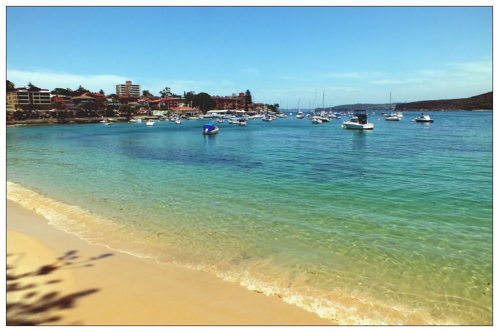
Manly is named after the Aboriginal people first encountered on the shores of Port Jackson in 1788. Due to its remoteness from Sydney it was not developed by Europeans until the mid-nineteenth century when a ferry service was introduced. Over the subsequent years Manly has undergone countless changes in its environment. Fortunately there are many fascinating buildings and parks that have been retained and the Heritage trails have been created to take visitors from the harbour beaches into the centre to appreciate Manly’s history.
I started on this trail from the East Esplanade on a very hot day in November. Under a large Moreton Bay fig tree is an interesting plaque that informs you about the first inhabitants of the Manly area who were the Aborigines known as the Kayimai. They lived as hunter-gatherers, roaming according to the seasonal availability of food and trading with other clans. They moved around, making shelter as needed from branches and fronds or using the many sandstone caves in the area.
Manly Cove Launch Club
Sailing and Rowing Club
Aboriginal Art
Following the path around the corner you find the Manly Cove Launch Club, established in 1937. Next to it stands the heritage-listed Manly Rowing and Sailing Club Boatshed. Established in 1875, this was one of the earliest waterside clubs in NSW. Carry on up the steps and right on East Esplanade to the corner of Stuart Street. Walk up Stuart Street to the junction with Addison Road, the second road to your right.
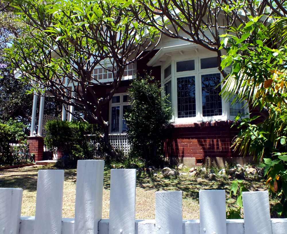
Addison Road Architecture
The road has been planted with an avenue of Norfolk Island Pines and mixed with Port Jackson Fig trees (smaller than the Moreton Bay fig) and was first planted in 1882. It provided the most welcoming shade on this hot day as I wandered down the road peering over fences to look at the homes.
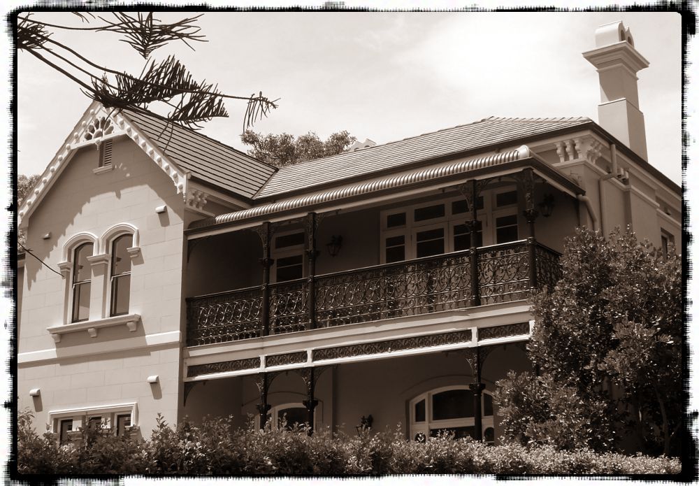
Here are some excellent examples of different styles and periods of architecture. There are Italianate, Victorian Villa, Federation, Interwar Spanish Mission, Old English, Californian Bungalow, Post-war International, Late Twentieth Century, and Post-modern architectural styles! I’m not expert enough to be able to identify them, but I do know that there are several very interesting features that I admire.
Could this be an example of Post-war International?
Federation Style, maybe?
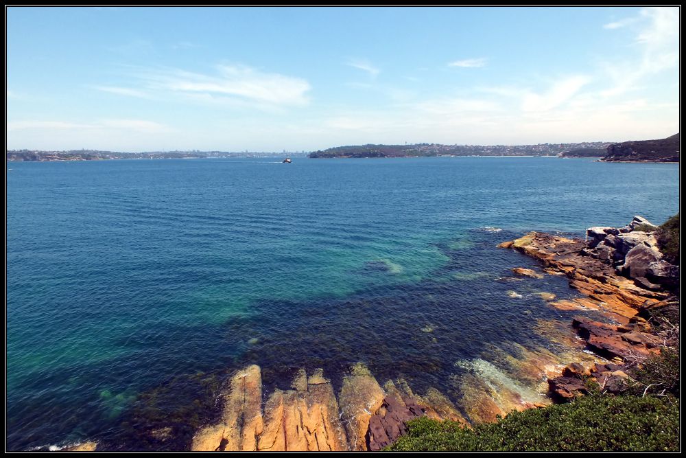
At the end of Addison is a path onto Manly Point ‘Peace Park’, an area now a Little Penguin Critical Habitat. A plaque close by reads:
“World peace begins in the hearts and minds of each individual – may we each seek harmony and peace in our daily lives. “
A couple of metal benches provide a resting place with a view over to the Quarantine Station and across the bay to Middle and South Head and where I sat and watched the Manly ferries pass by. Even if you are not interested in architecture it is still worth walking to the end of this road for the views.
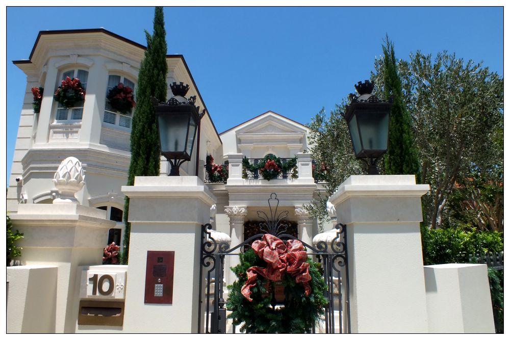
Retracing my steps I passed this imposing white building which was dressed for Christmas with beautifully designer wreaths and ribbons.
The grey and white decoration on this house (California Bungalow?) is perfectly framed by this wonderful gum tree with its peeling grey bark revealing a chalk-white trunk. Even the white lilies match. And just look at that fretwork above the windows!
And this one has interesting gables and windows. Lots of straight lines going on here.
I’d love to see inside some of these houses.
Returning to Stuart Street I turned right, then right again into Craig Avenue for Little Manly Beach. Here I walked along the beach to the Kiosk where I could get a much-needed drink, and decide where I went from here. My intention was to continue to Little Manly Point and follow the trail around Spring Cove to Collins Beach and possibly visit the Old Quarantine Station, but given the soaring temperature and the fact that storm clouds were fast appearing on the horizon, I decided to cut across Marshall Street (this area of Manly reminds me of San Francisco with all the steep hills).
Observe the chimney pots on this house on Marshall Street and the lovely 3D bargeboard on the gable end. Not to mention that wonderfully scrolled wrought-iron balcony and the arched windows.
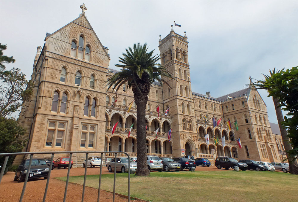
I cut through the grounds of St Patrick’s (the International College of Management, Sydney is now located in the former St Patrick’s Seminary)and down several sets of steps which brought me out onto College Street.
The ICMS building – formerly St Patrick’s Seminary
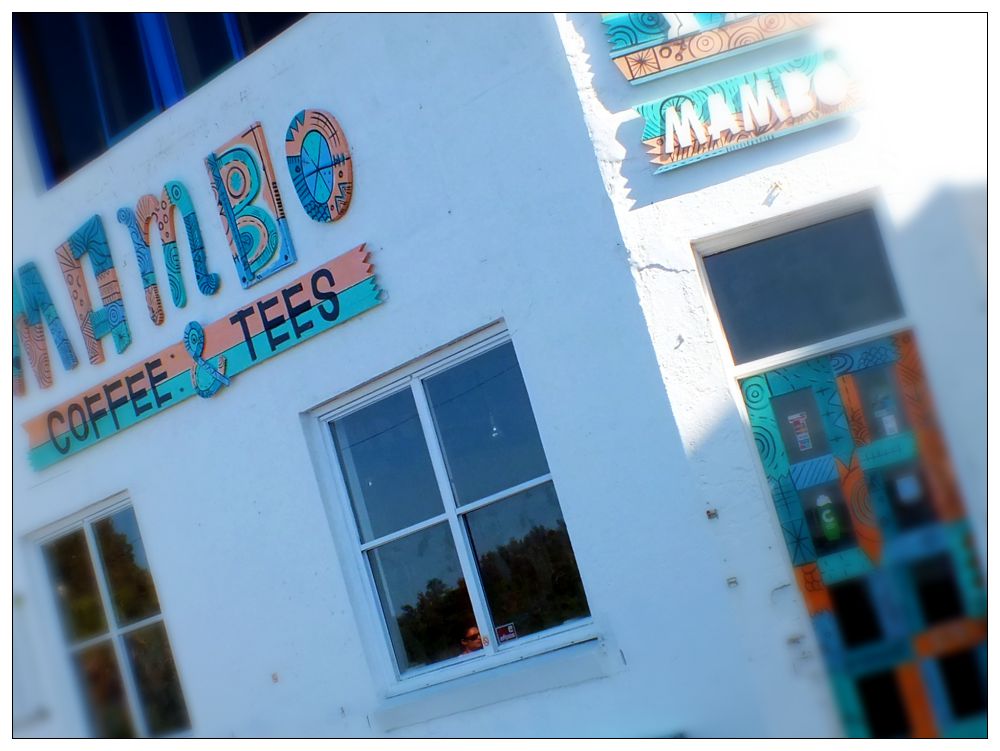
From there it was an easy stroll down Bower Lane to Marine Parade near the swimming pool and Mambo Coffee shop and make my way back to the esplanade. Just before the storm broke!
Mambo
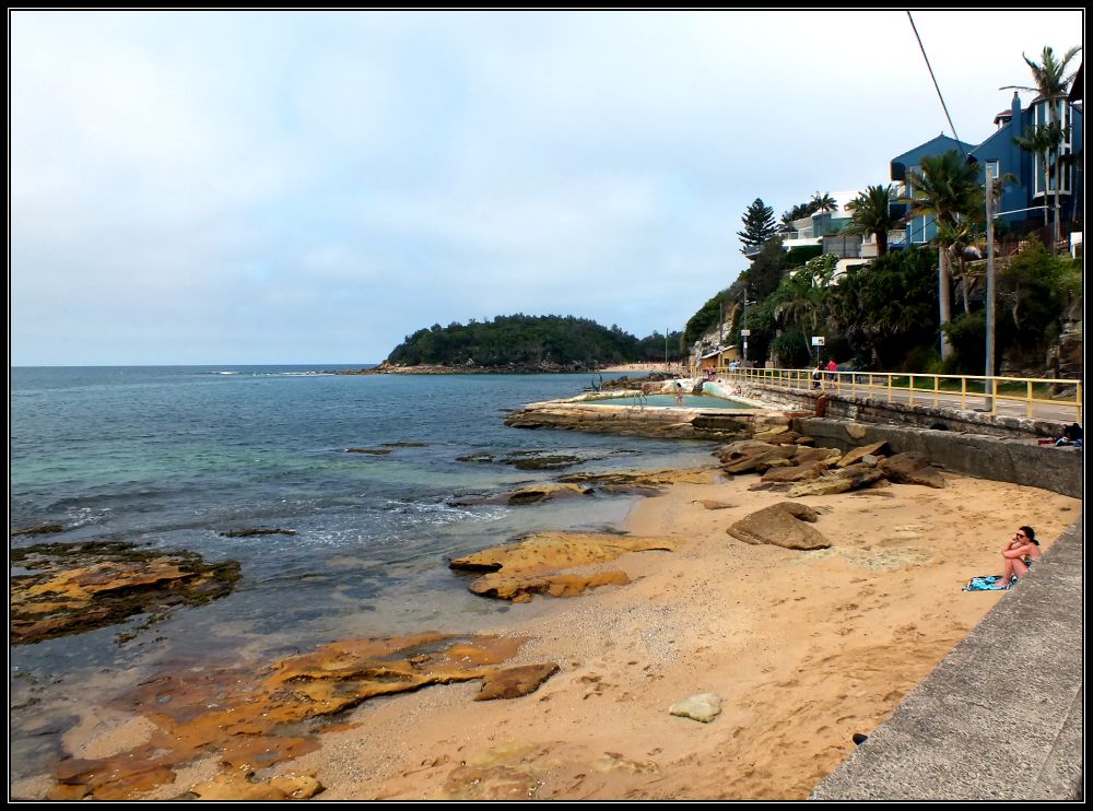
This blue house (below right) overlooking Cabbage Tree Bay and in spitting distance of Shelly Beach is my dream house. Location, location, location!!
Marine ParadeA better view
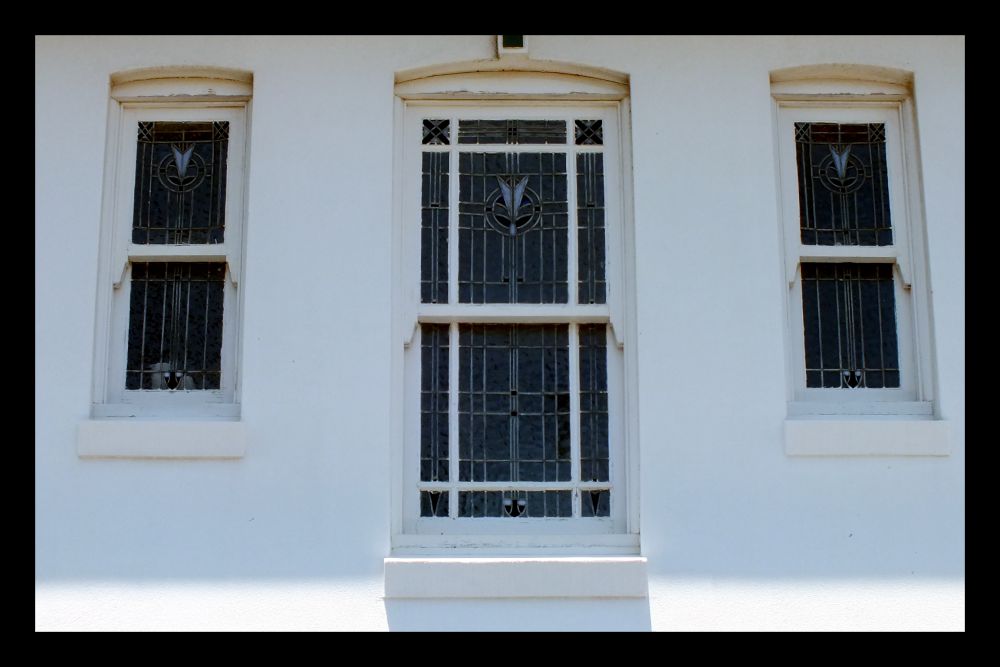
I noticed some very interesting windows along this route:
Leaded windows with stained glass
Exquisite leaded windows
Stained Glass
More leaded windows
When walking an historical trail like this one it is important to pay attention to the details you see along the way. That might be a picket-fence post, a barge-board, a colourful tile, an interestingly shaped window, or some stained glass or gable ends.
Picket Fence
Decorative Gable end
Interesting shape
Gorgeous tiled stairs
Lovely balcony
Window design
Balcony
Federation Style?
Scrolled Bargeboard
…and maybe there are some Australians (or architects) out there who can help me to identify the different styles.
A quick weekend visit to Wiltshire to visit family gave me the opportunity to finally revisit Stonehenge after many, many years. I was one of the fortunate people who was able to run around the stones back in the 1960s. Since 1978 the stones have been fenced off and the experience of viewing them through wire did not appeal to me, even though I have passed the site often on my way to the South-West.
The whole site has been much improved by the removal of the old A344, a major road that ran up the north edge of the stones. You now approach from the west, either on foot or using the shuttle bus, and make your way clockwise around the monument which allows you to see all the stones above ground.
What you see probably originates from around 2500 BC and took 800 years to build. Obviously the site has changed over the centuries, but it seems that the larger sarsen stones were constructed then and do not appear to have been moved, whereas the smaller bluestones may have been rearranged several times.
Stonehenge has an ‘axis’ – an alignment that runs north-east to south-west up the final straight line of the Avenue. This alignment works for the summer and winter solstices and there is growing evidence that the winter solstice was the most important.
It was a cold, raw windy winter’s day, but at least the sun shone casting black shadows over the bright-green grass and providing a striking contrast to the darkening clouds forming overhead.
I’ll let the pictures speak for themselves and if you are ever in the area I do recommend a visit to this extraordinary site. Barrows and monuments in the landscape can be explored on foot over the uneven grass.


 I remember my mother referring to a circuitous route as “going all around the houses”, here in Shropshire it is “going all around the Wrekin”.