The Cardinal has decided to have a photo project going throughout 2015 – a blogging event, a monthly photo challenge. Find a location near your home, take somewhere between 5-20 photos and post them in a gallery in your blog. Continue to do this every month. The idea is to capture all the changes: the seasons, the weather, different times of the day, some night photography perhaps?
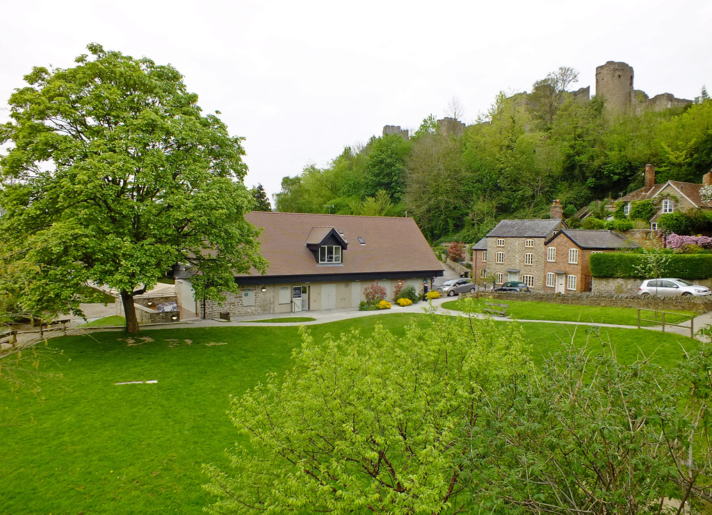
Sounds right up my street and I shall be interested to record the changes in my neighbourhood. Some of these locations have been posted before, but this is a circular route from my front door around the River Teme, taking in the castle, some interesting houses, trees on Whitcliffe Common and some of the floral offerings on Ludlow’s streets.
Date: January 19 2015 Weather: sunshine and cloud Temperature: Cold (2°C) Time: 2 – 3 pm
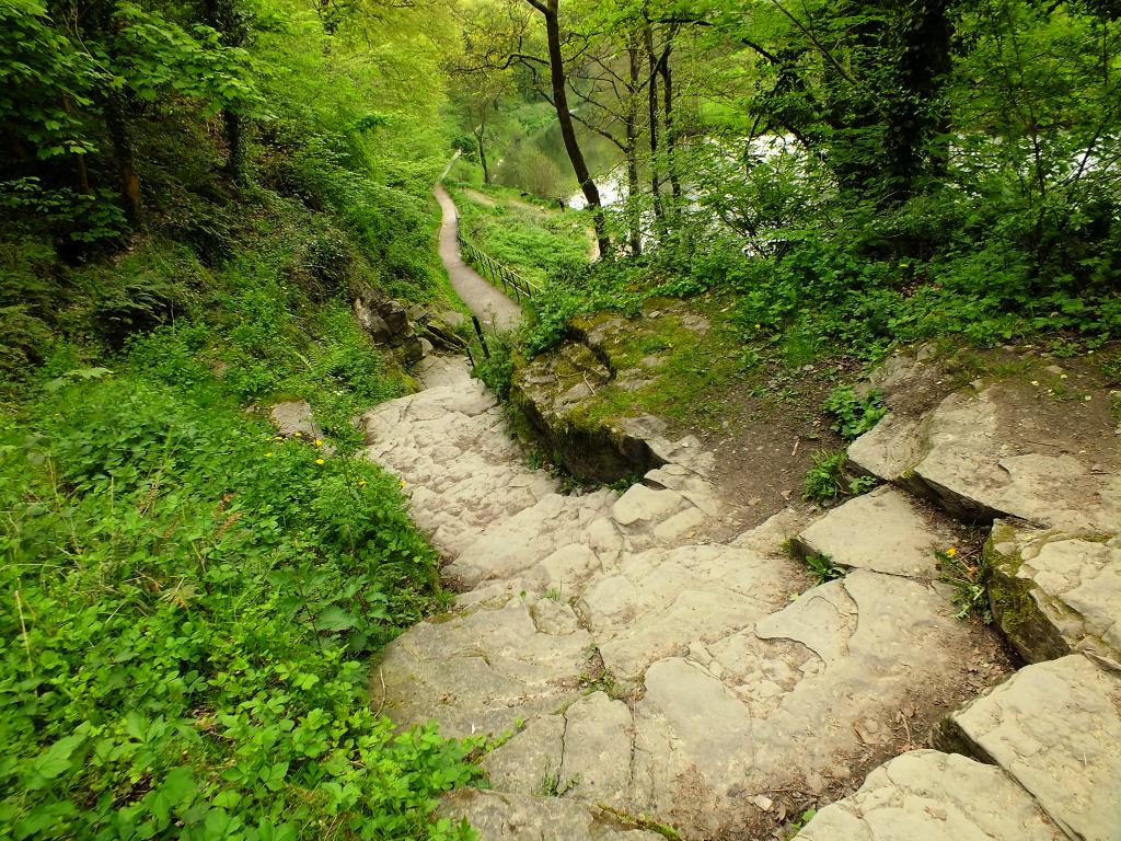
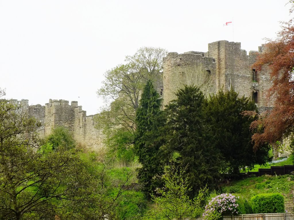
After taking some photos around the castle garden on Dinham with the pollarded lime trees, it’s time to walk down to Dinham Bridge and capture a few shots of the castle and the river which is in full spate after the rain in Wales.
Dinham Brick Cottages
St John’s Chapel
Stone Cottages
Catkins (Jan)
View from Dinham Brisge
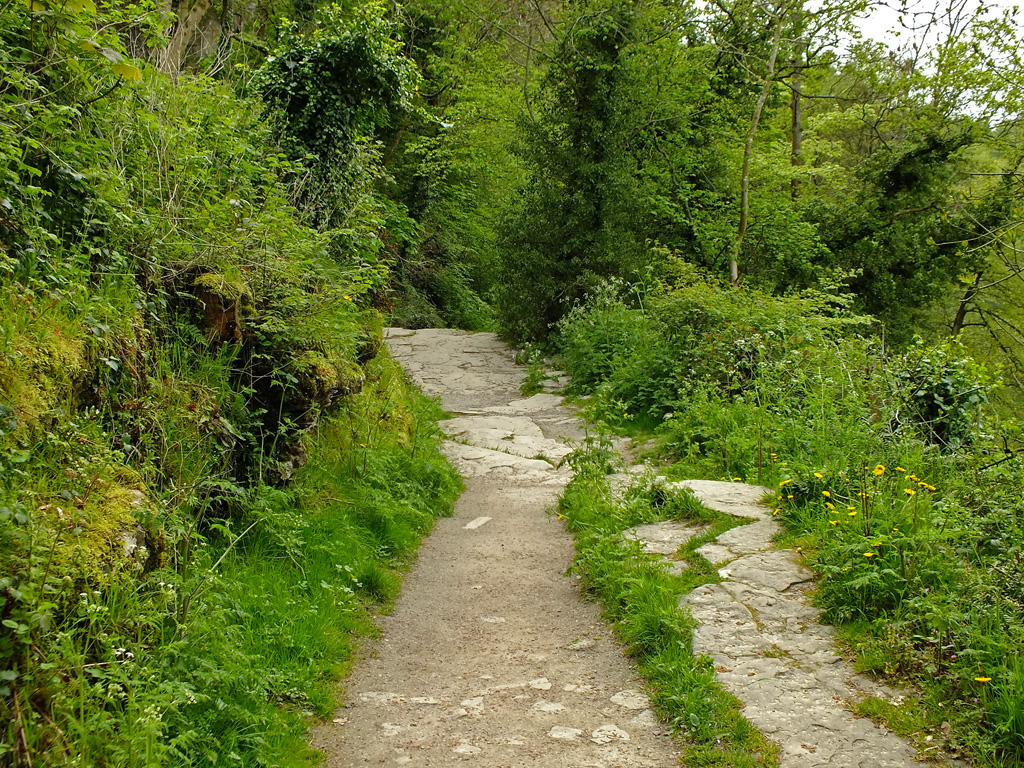
View from along the Breadwalk
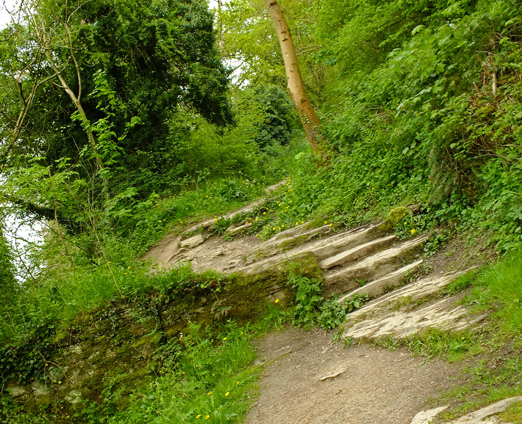
Continue along the Breadwalk, taking great care as the path is frozen at this point and notice the Donkey Steps to the left. Swans feed at the edges and naked trees are reflected in the water.
The Donkey Steps
Waterfall
New Growth
Ludlow Bone Bed
Swans swimming
Copper leaves (Jan)
The Mill Weir
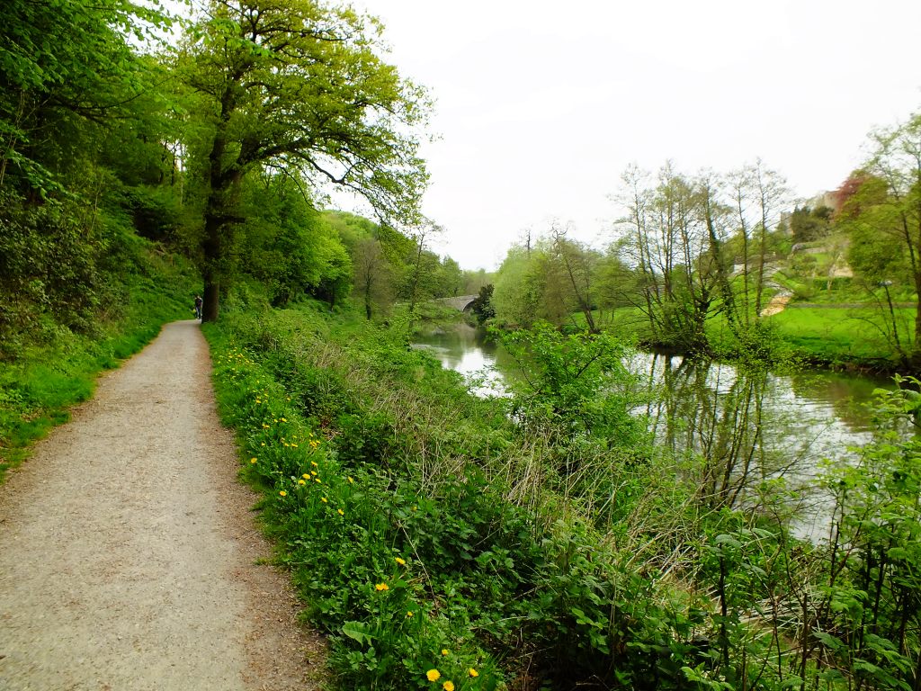
The Teme at Ludham Bridge
Leaving the river behind, my final stretch is along Lower Broad Street where the lack of outside space does not prevent the owners of the ancient cottages from displaying one of the towns best ‘gardens’.
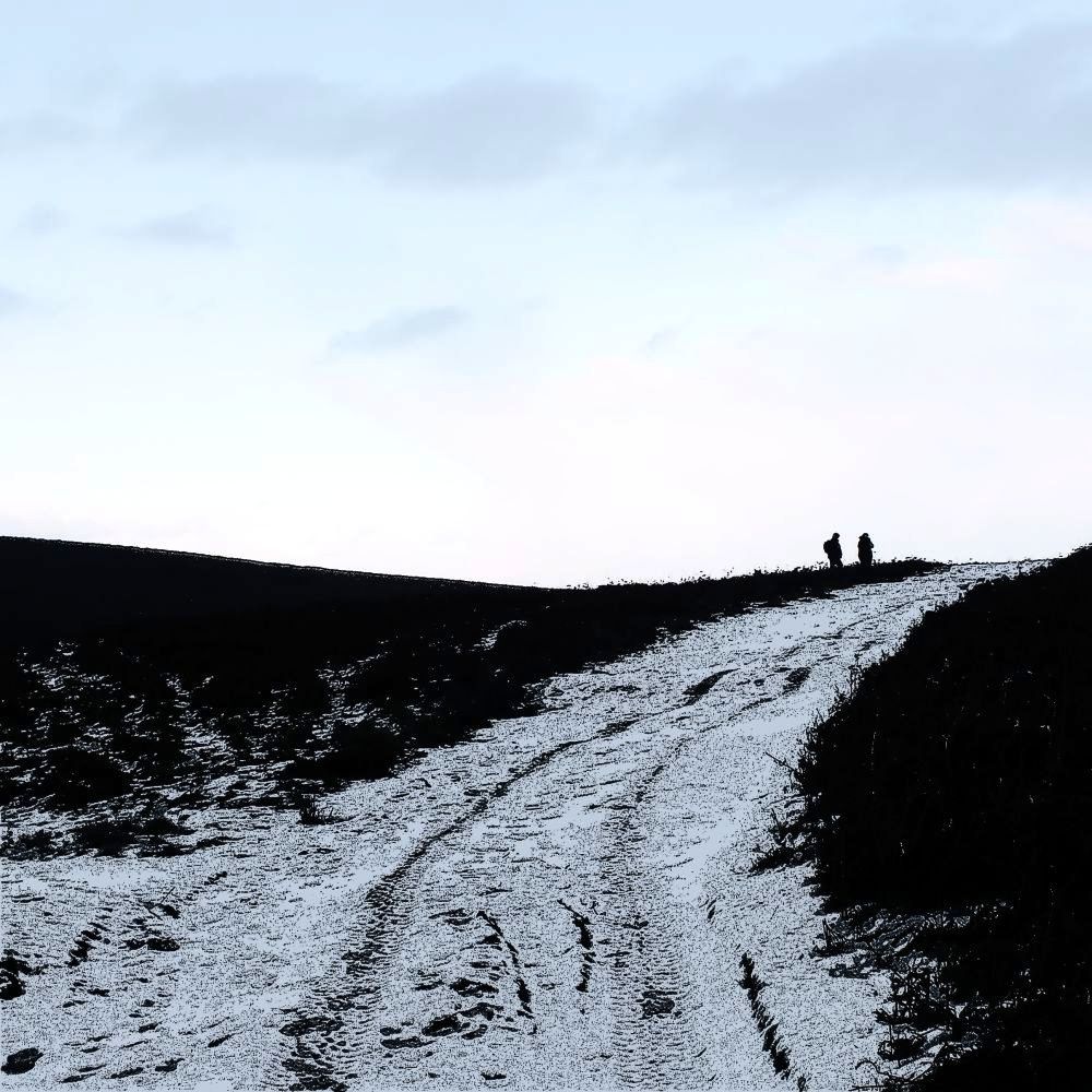
Following a thread posted on my visit to Stonehenge I noticed that I had commented on my Avebury post that I still had to have a look at a local stone circle in Shropshire: Mitchell’s Fold Stones. That comment was made in March 2014.
Yes that is snow on the lens…
So on Saturday, in bright sunshine I decided to take the shortish drive (25 miles) to find these stones. As we turned off the road and approached White Grit (Powys) the covering of snow on the lane alerted me to the fact that maybe this was not such a good idea.
I need a vehicle like this one!
Continuing up the lane to the car park with the ice/skid light illuminating on my dashboard I hoped that I would be able to turn around at the end. Reversing down this track was not really an option. The sun was still shining, though there was an ominous black cloud in my rear mirror.
As with many prehistoric sites Mitchell’s Fold is subject of legend. It is said that a fairy gave a magic cow in times of famine which produced an endless supply of milk. An evil witch tried to milk her into a sieve, and realising the trick the cow disappeared. The witch was turned into a stone and a circle of stones was built to ensure she could not escape.
The stone circle is not too far from the parking area, but the temperature was somewhere around 2°C and the wind was raw. The landscape (that which was still visible) looked amazing. Wrapping up in scarves and gloves and hiking boots we headed up towards the stones, which were sadly hidden in the blizzard that then hit us!
I tried – honest I did, but I can’t say that this was my best photographic venture despite risking frostbite.
Oh, well, I will try again in the summer – this vista is well-worth exploring, stones or no stones! And there are barrows and cairns in the area too.
(This stone circle was constructed in the Bronze Age, over 3,000 years ago, using dolerite stones from Stapeley Hill. Today there are 15 stones arranged in a rough circle, but there may have been as many as 30).
If you enjoy a walk, long or short, then have a look at Jo’s site where you are welcome to join in.
…when people from miles around converge on this beautiful little Medieval market town for the Ludlow Food Festival. They come to attend numerous workshops and tastings, visit local producers, hit the sausage trail or try the pudding tastings, listen to top chefs deliver talks and demonstrations in the castle grounds or learn knife skills and attend Egyptian Masterclasses. This town of 10,000 people will double its population over the coming weekend.
On Sunday there will be a Local Producers’ Market with over 40 small, local food and drink exhibitors on the Market Square.
And, as usual, there is a Window Dressing Competition. So I took the camera around the town today (before the hoards arrive) to see what merchandise I could find.
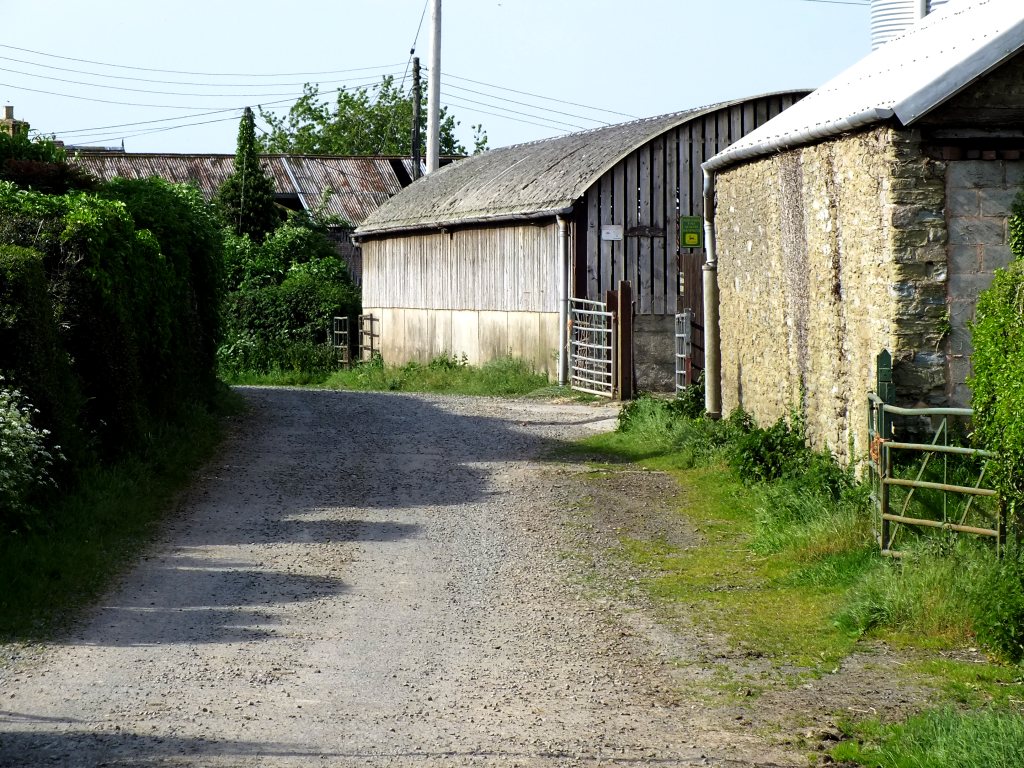
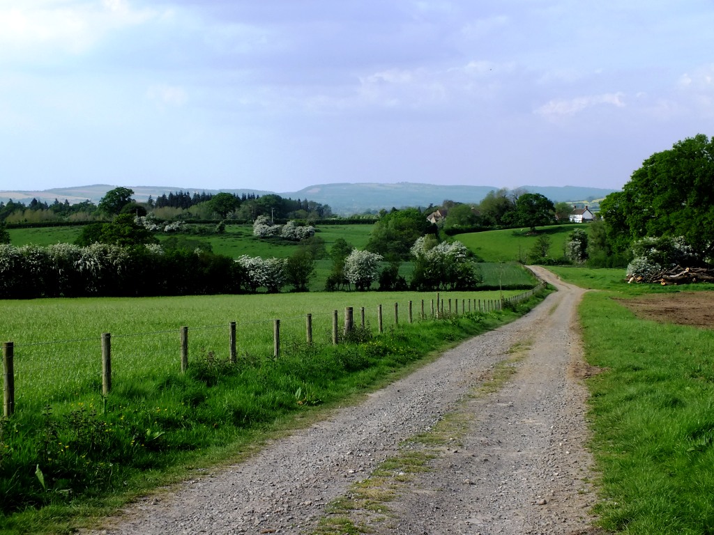
With the recent good weather I have been trying to get out for a daily walk. Last Sunday we set off towards Priors Halton farm, about a mile or so outside of Ludlow. It is one of the few flattish walks around here, as Ludlow is surrounded by hills.
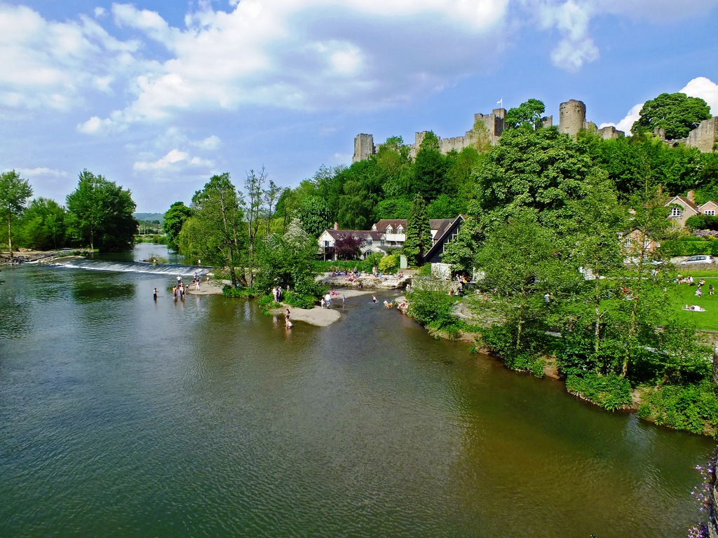
Most walks in and around Ludlow begin with crossing a bridge. This time Dinham, with a glance at ‘Ludlow Beach’, as locals name the area on the Teme where it is often safe to paddle. Repairs are being made to the weir (including a by-pass to allow salmon moving 50 miles upstream to spawn an easier way through the river ) has meant changes to the ‘beach’ too. And today there are many more youths than usual. It is a hot day, though they are a bit big to swim in the extremely shallow waters – amazing to think how high the water level was only a couple of months ago.
Instead of heading left along the Bread Walk or ahead up the Donkey Steps onto Whitcliffe Common, today we are continuing along the road towards Priors Halton. The road ends at Priors Halton farm, but you can continue on foot or bicycle to Lady Halton or Oakly Park and even Bromfield where you will find Ludlow Food Centre, a café and restaurant.
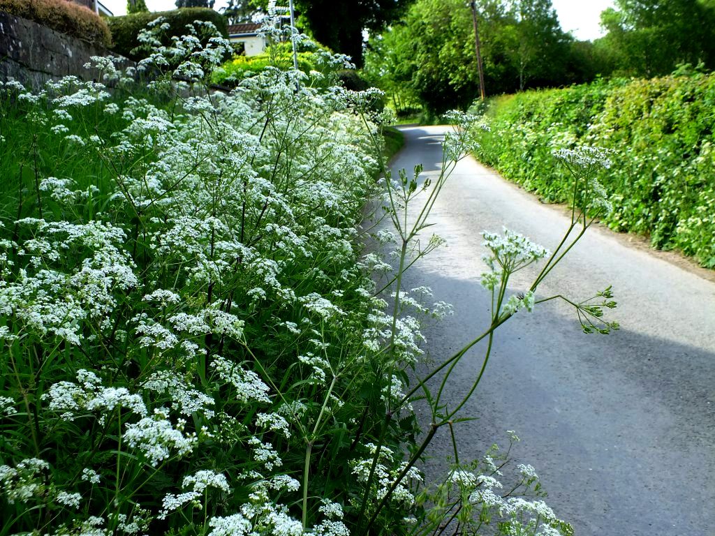
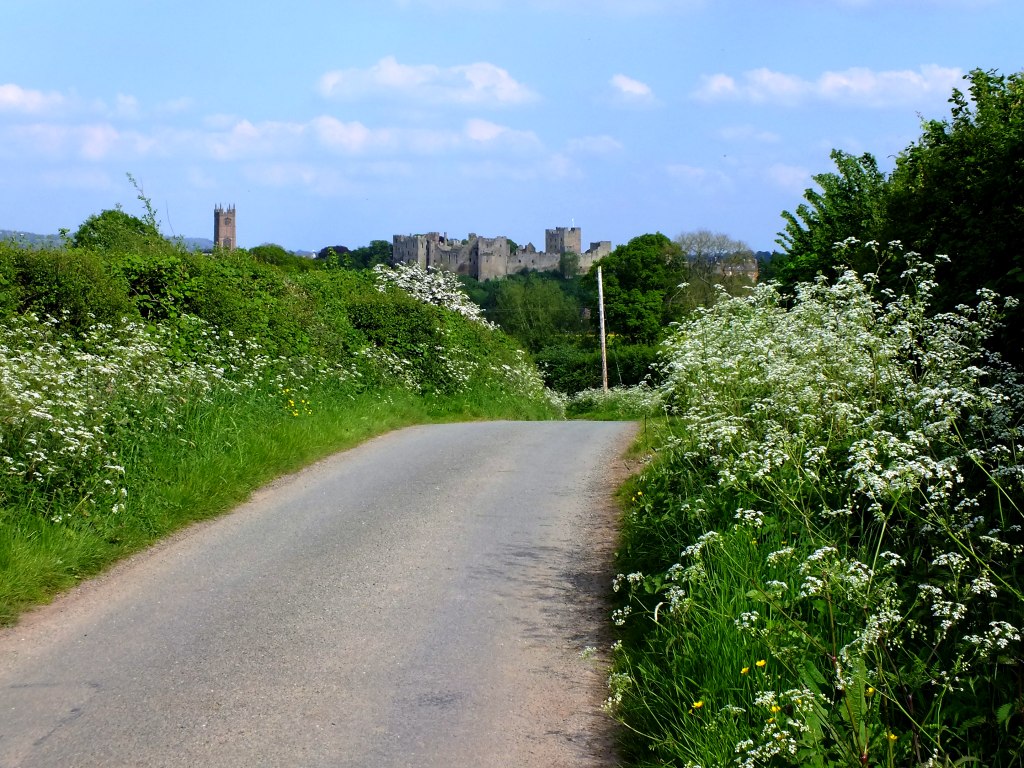
Lots of wild flowers in the hedgerow hidden amongst the clouds of cow parsley and May trees are flowering.
Knapweed
Hawthorn blossom
Stitchwort
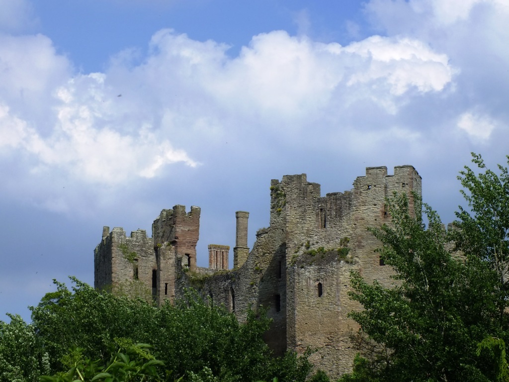
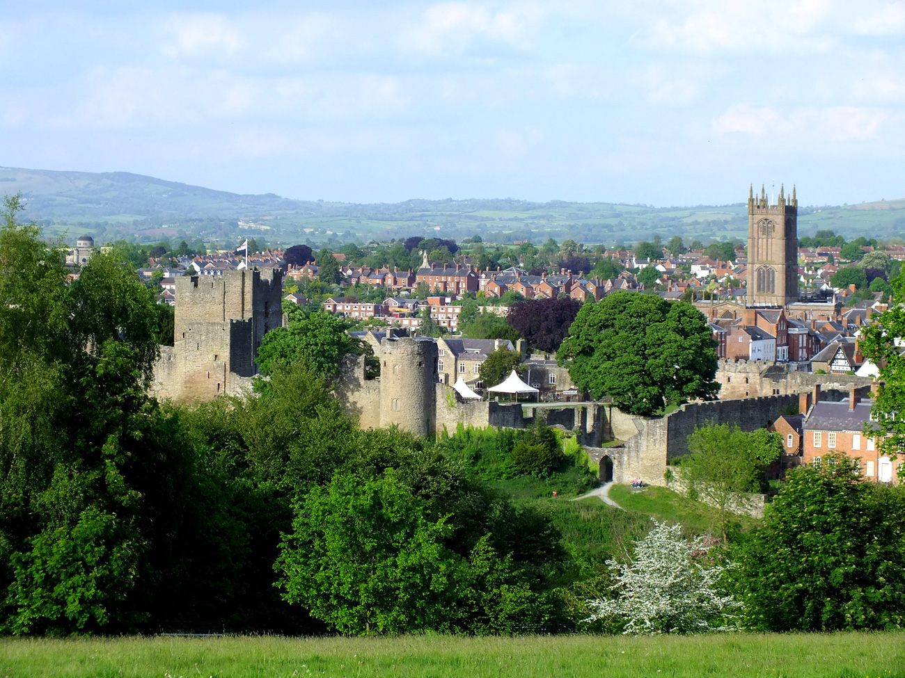
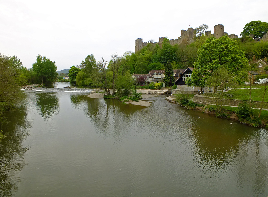
Look back and you’ll be rewarded with a dramatic view of the castle in its commanding position, chosen by Norman builder, Roger de Lacy in 1085.
It’s amazing that only half a mile away from the town you feel deep in the heart of English countryside. The only sound is that of birds…
Which Way?
Lilac tree and hill of Clee
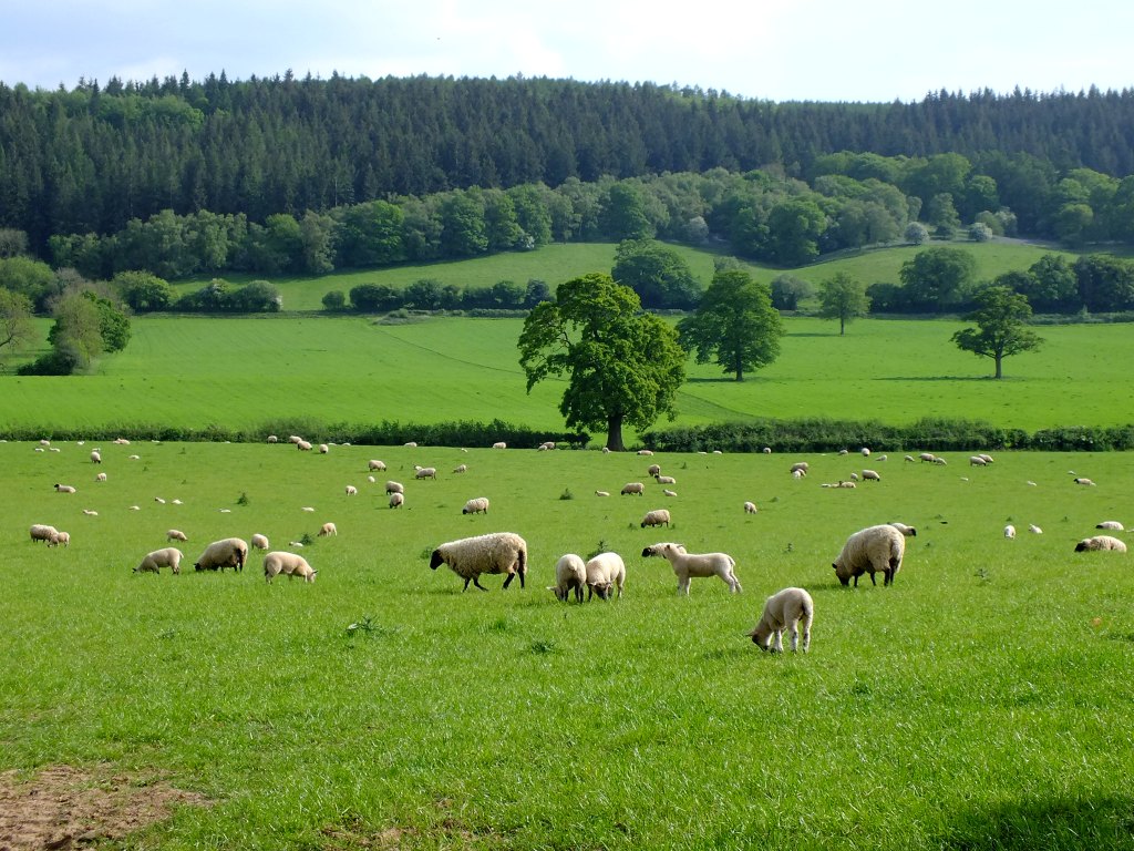
Cows in the meadow
Along the road
Rich earth
and sheep bleating…
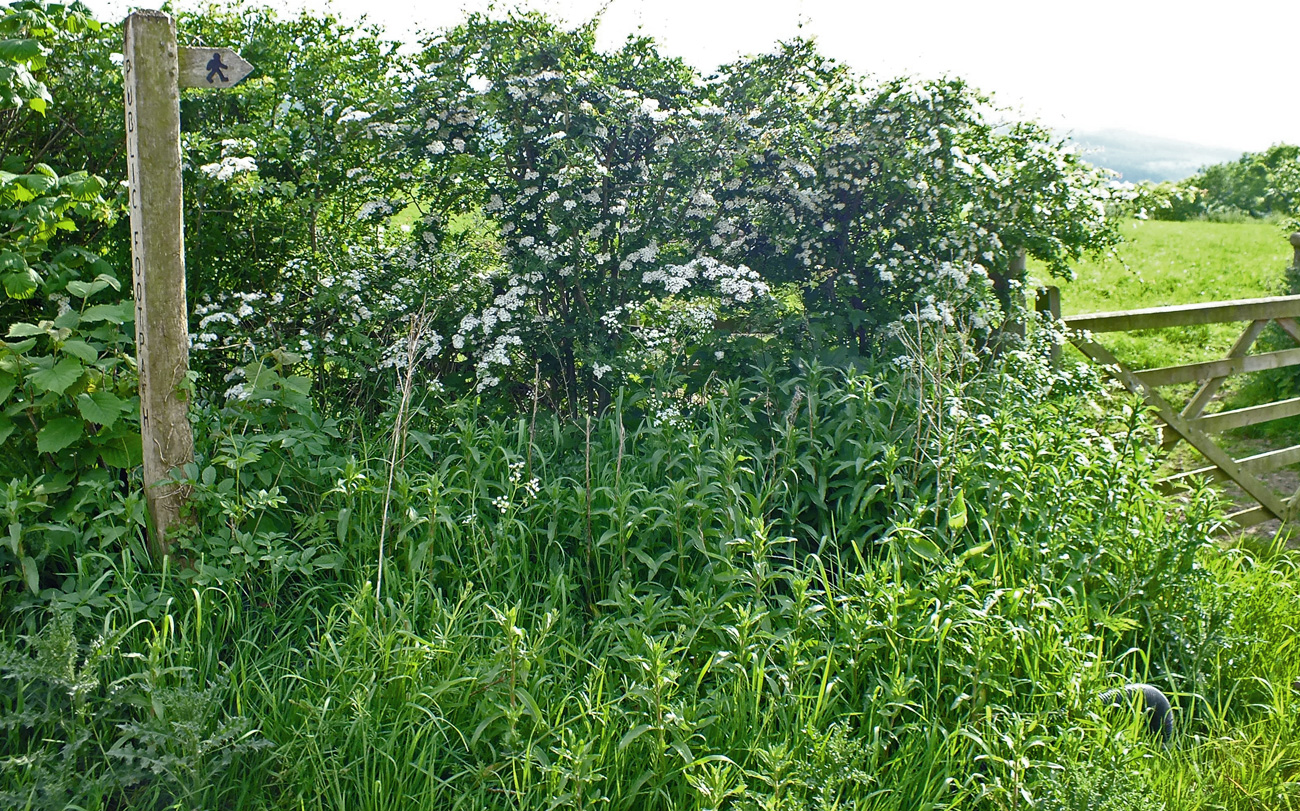
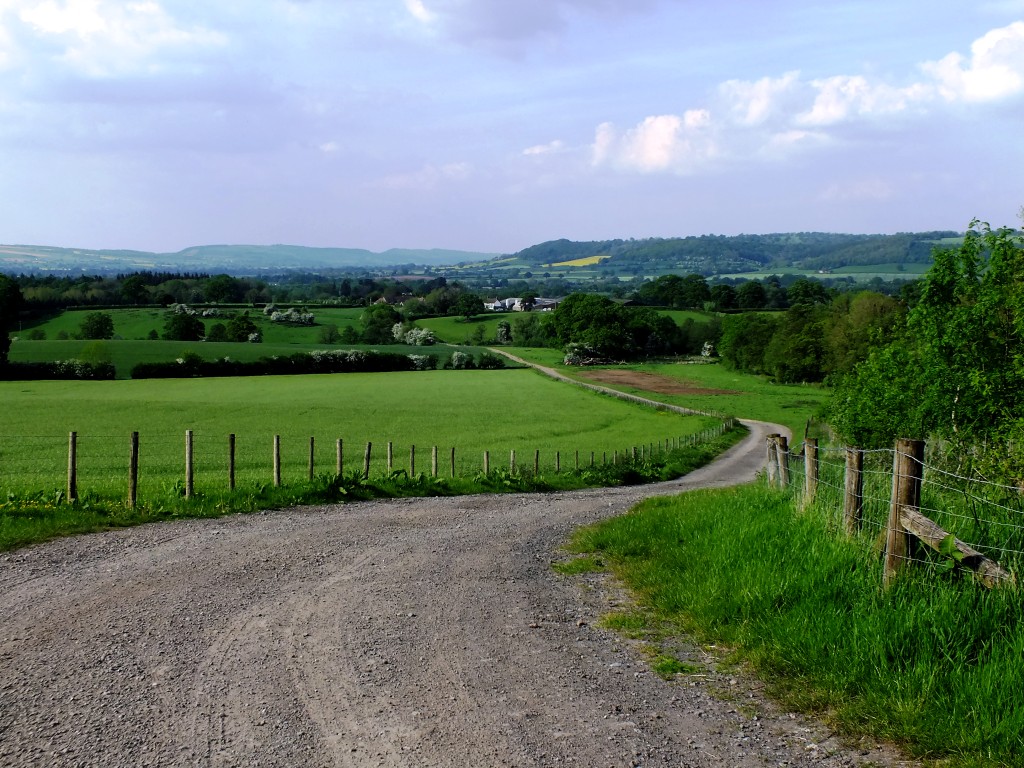
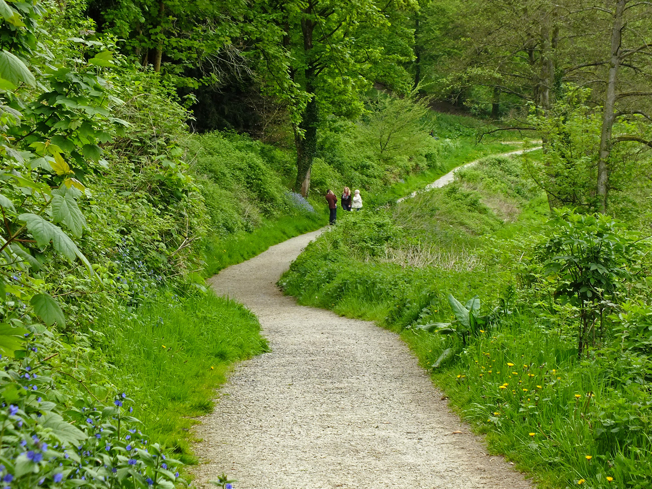
At the farm we decided to return to Ludlow via one of the public footpaths, thus shortening the walk to around 3 miles instead of a 5 mile loop.
A public footpath which during this dry weather, is easy to walk on. This is not always the case as, unlike the lane, this route is unpaved and gets very churned up and muddy.
May trees
Oak tree
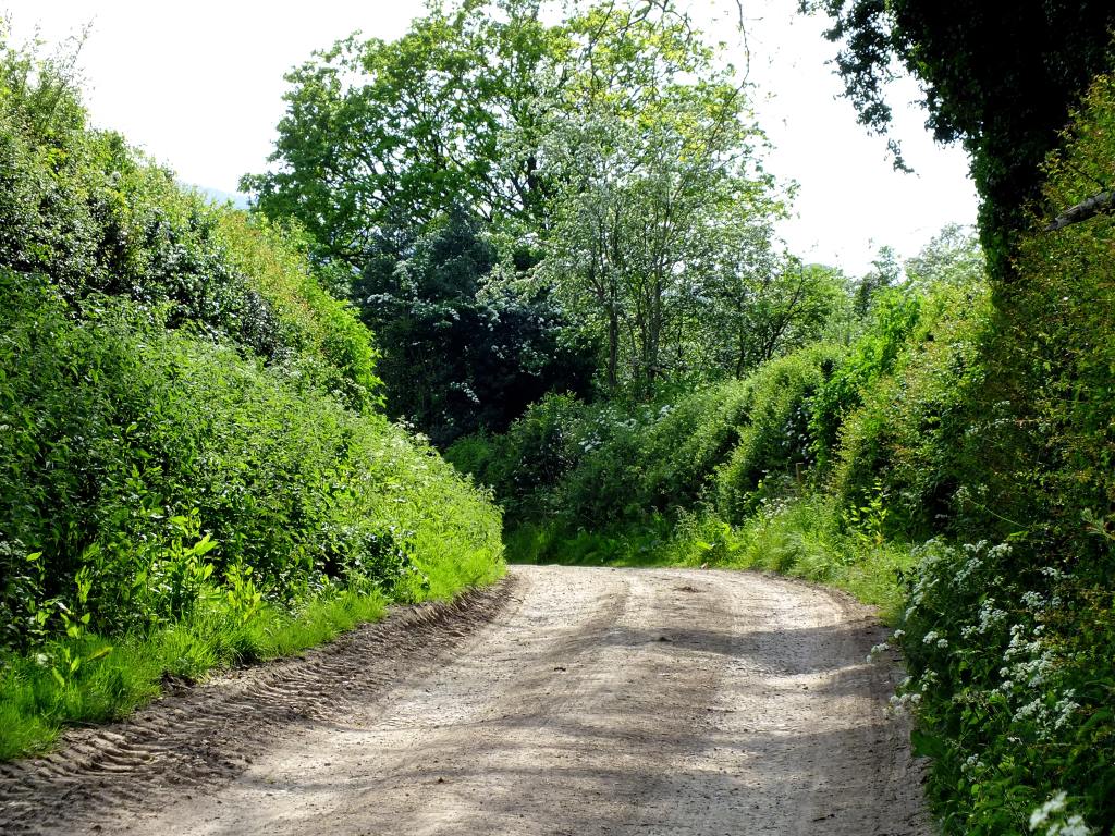
Another public footpath leads to Lady Halton alongside the farmer’s field, but we’ll continue along this track today, heading towards Mortimer Forest. It is slightly uphill but a gentle climb.
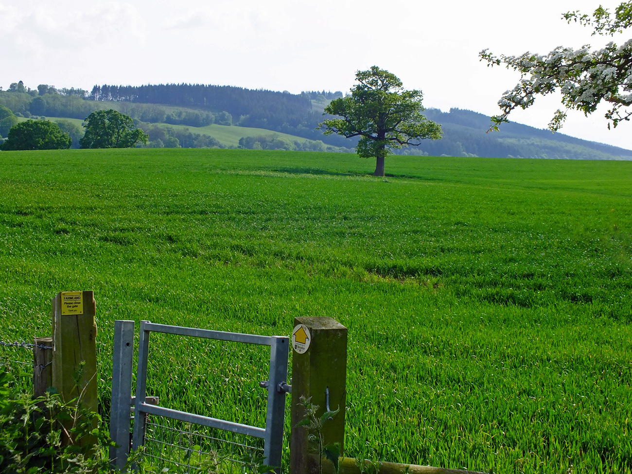
The views are good now that we are out of the high hedgerows. Look back towards Priors Halton and you can see the farmhouse and also the south Shropshire hills in the background.
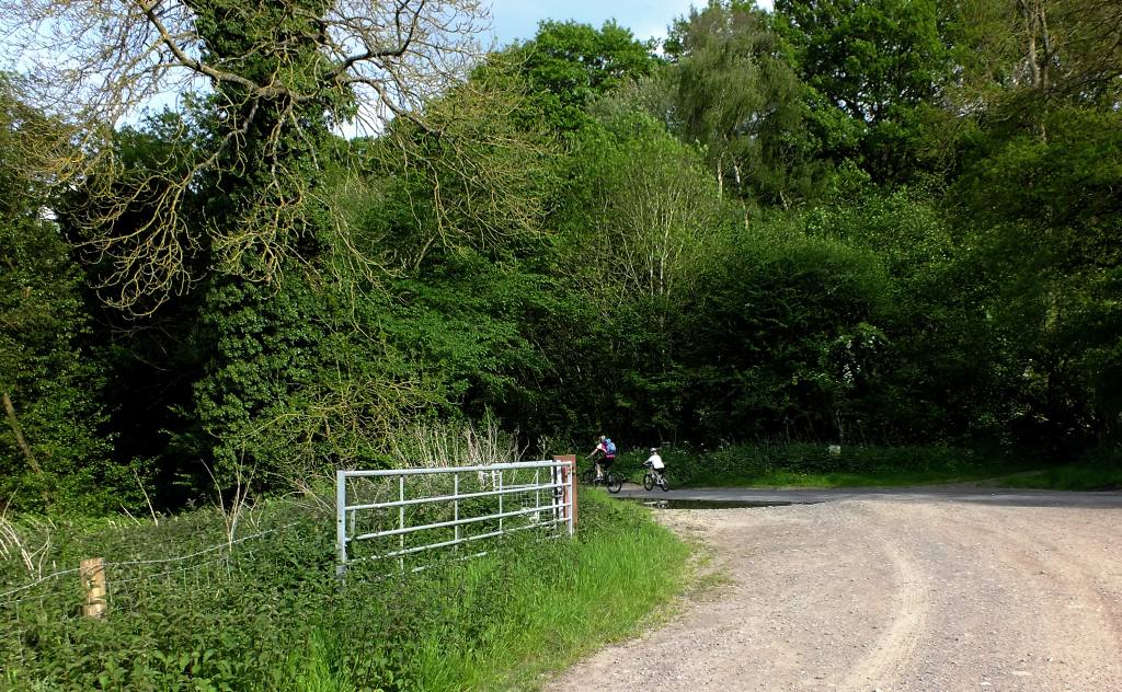
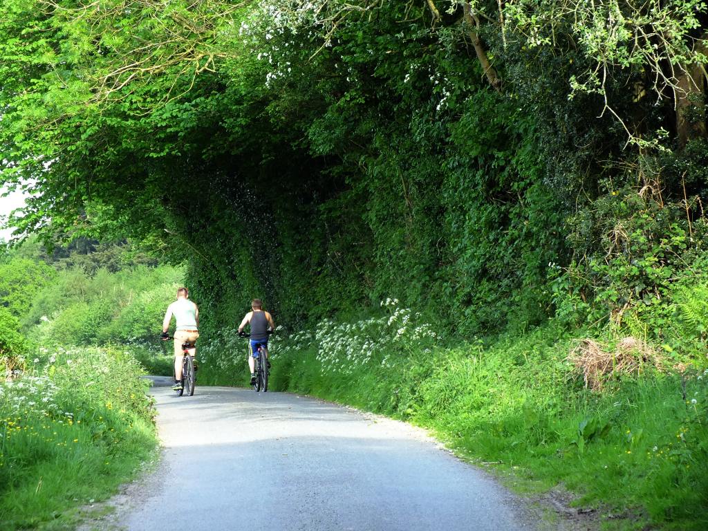
We reach Middle Wood Road and turn left back to Ludlow.
Watch out for speeding cyclists!
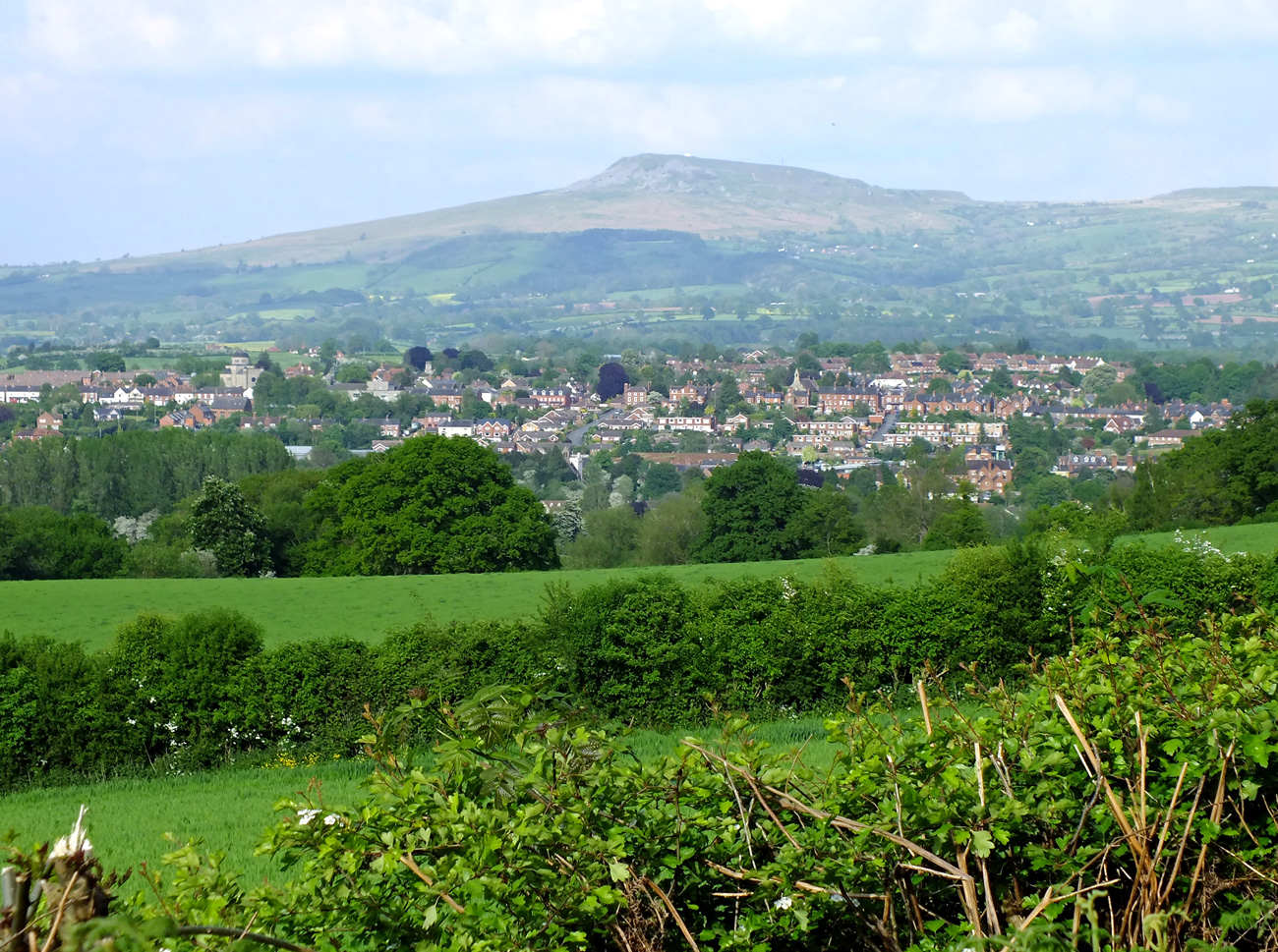
It is lovely and shady along this road as we walk along the edge of the woodland. Ludlow can be seen in the distance, crouching beneath Titterstone Clee Hill, which is about seven miles distant.
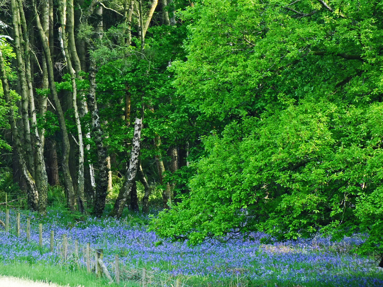
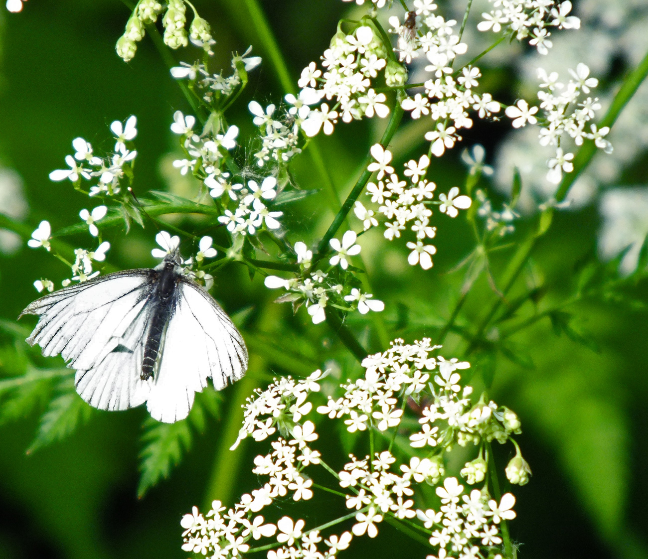
And we are accompanied by orange-tipped butterflies flitting along the hedge, but never stopping for a photograph. Bluebells can be spotted up in the woodland, cow parsley appears again
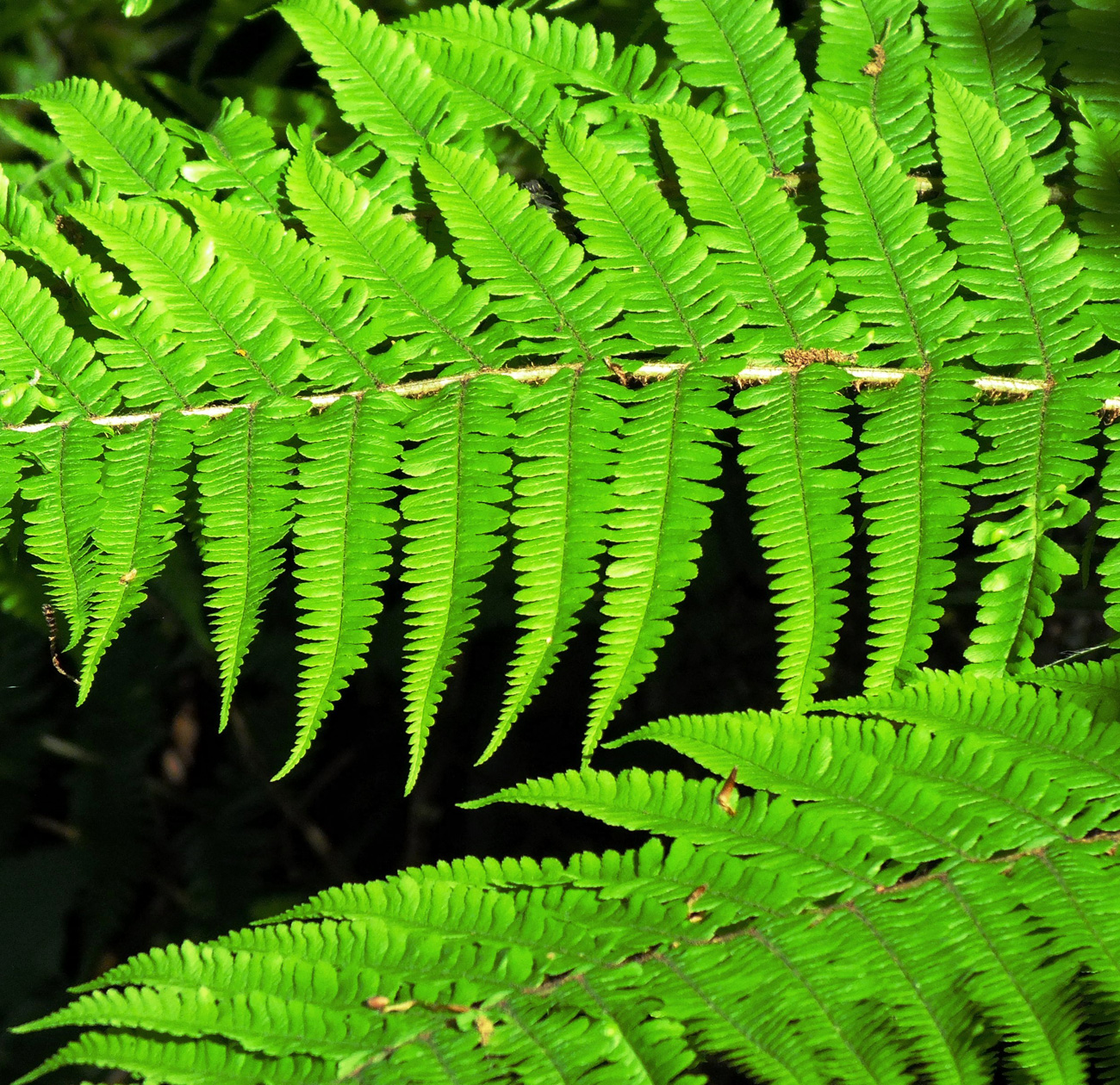
and we did get a shot of this little fellow, who may be a Wood White butterfly and some lovely new ferns.
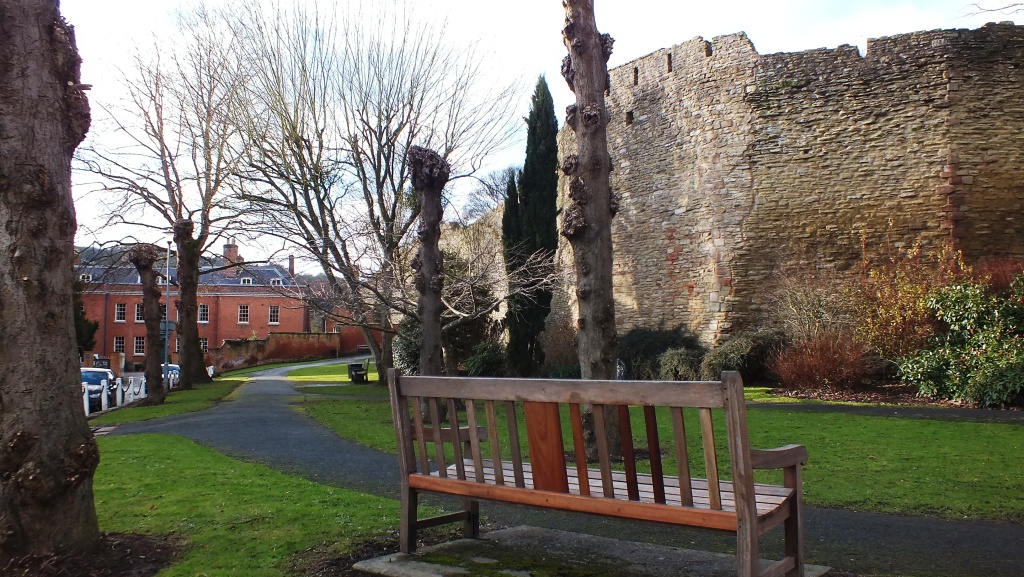
Finally we reach Lower Road and Whitcliffe Common, where we found a bench to rest and enjoy the view of Ludow and the castle where a couple are enjoying their view from the bench next to the archway, which I mentioned on my Castle Walk.
If you enjoy a walk, short or long, then you may enjoy visiting Jo’s Monday Walk where you are in for a treat.
“May comes sweet and complete in every detail.
Along every lane and hedgerow bank
spring a thousand small and seldom
considered things – Nature’s embroidery,
to finish off her festal robe to perfection…
Such hedgerows in May are everybody’s garden…”
~ Flora Thompson in A Country Calendar
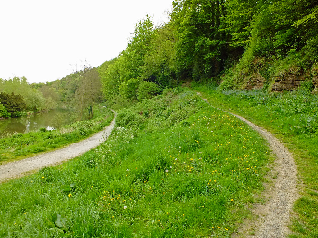
On Sunday when the sun was shining I thought I’d grab the camera and go for a walk along the Bread Walk, which is a walk alongside the River Teme, here in Ludlow. After the pavements of London it made a nice change to have the earth beneath my feet again, well not literally of course, though I do like bare-foot walking on grass or sand.
I have mentioned the Bread Walk before in my first ‘Guide to Ludlow‘ and basically it was an early form of the dole, where unemployed men were paid in bread and blankets to re-build the pathway, destroyed by flood, so they wouldn’t drink away all their wages in the inns on their way home.
We’ll start by walking through the Broadgate, the only surviving gate in the town (there were seven) and have a nosy at the container flowers grown outside the cottages in Lower Broadgate – they are kind of rivals in the Ludlow in Bloom competition held each year. I have to say they are looking good. But judging isn’t until June so these beauties will be long gone by then.
Cherry Blossom
Aquilegia
Tulips
Tulips
Now across the Ludford bridge, past the Charlton Arms, no stopping for a pint just yet, and round the corner, up the steps to Whitcliffe Common. The steps are very dry, which is unusual because I thought there had been rain whilst I was away. Anyway, dry is good as they can be slippery when wet with all the mud and leaves.
Onto flat ground and time for a breather as we admire, yet again, the view over the town. I don’t think I shall ever tire of this view. And today there is something different about it as the May Fair is in town and you can just about make out something on the horizon called the ‘Explosion’ which swings people around like a giant mixer.
From here you can continue on the flat and across to Whitcliffe Common, and through the woodland, but we have done part of that walk before. Today I’m going down more uneven steps onto the path beside the Teme.
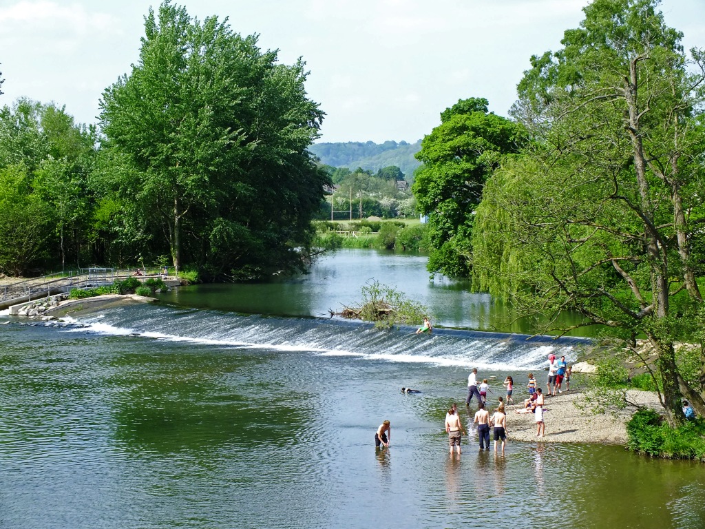
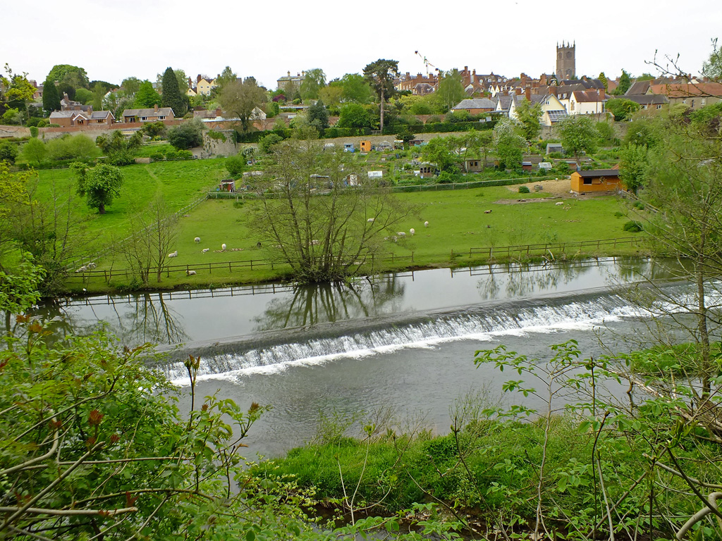
There’s always something different to see along this walk, wild flowers, birds, ducks, dogs swimming, sheep across the river in the paddock now with their lambs, reflections in the still water and the sound of birds trilling in the trees trying to make themselves heard above the rush of the mill weir.
The Mill Weir
Labrador Swimming
Treacle
Today there is some debris caught at the top of the weir, and two Labradors enjoying a swim. Looking up to the top of the cliff everything is a vivid new green – ferns and trees unfurling their spring shoots.
If you look ahead you can just glimpse the castle and Dinham bridge where the walk ends. It is a very short walk. Dandelions line the path here, but further on we’ll find some different wild flowers.
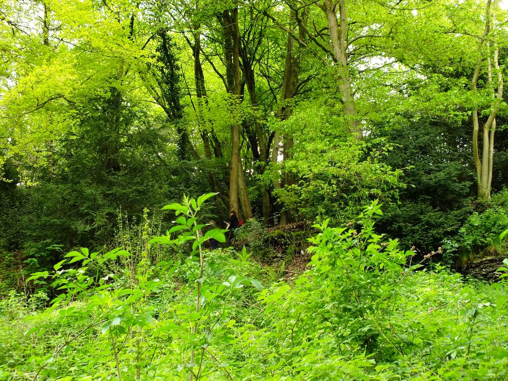
Above us is another path leading up to the common through the broadleaf woodland. The foliage is so lush at the moment it is difficult to see anyone. But look carefully.
The path curves around past clumps of forget-me-nots and alkanet (both members of the Boraginacae tribe) and patches of wild garlic amongst nettles and dock leaves and blackberry brambles.
Forget-Me-Not
Wild Garlic
Alkanet (Borage)
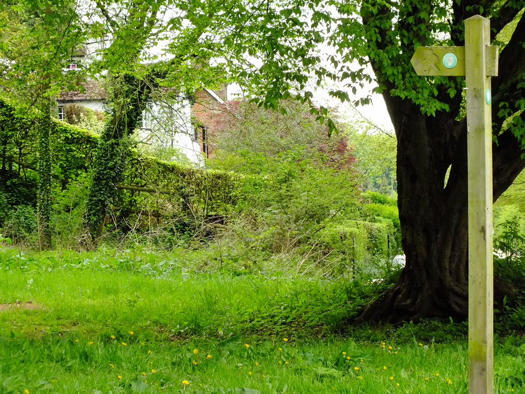
As we reach the end of the walk there are two pathways leading up to Whitcliffe common. Packhorse Path known locally as the Donkey Steps, climbs steeply ahead of you through the woods. So called from the long-established folk tradition that it was used by packhorses to carry ore from the Clee Hills to the ironworks at Burrington.
Packhorse Path
The Mortimer Trail which is signed through the woods to your right is a long-distance footpath established in 1996. It runs for 30 miles from Ludlow castle to the centre of Kington in Herefordshire.
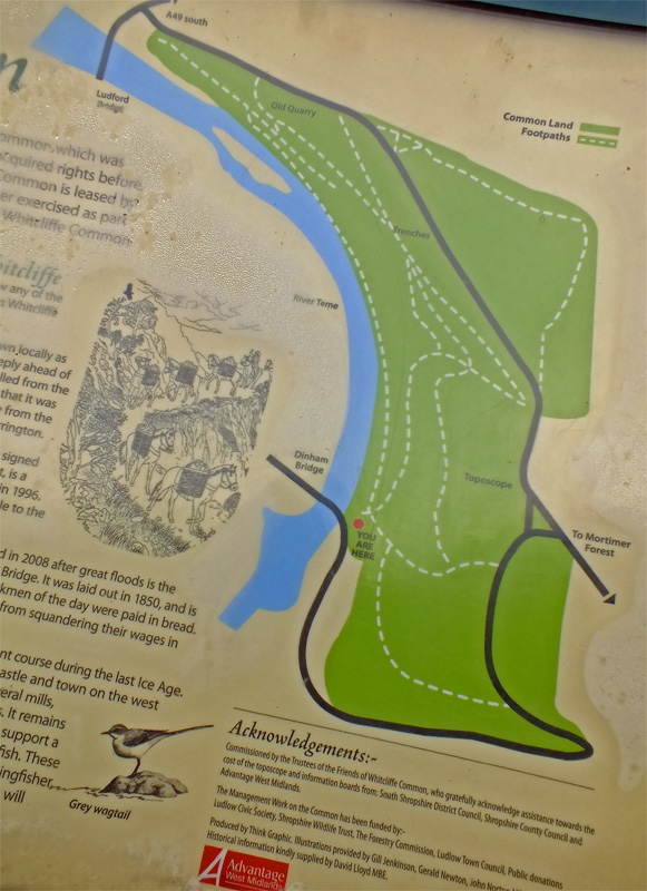
The River Teme powered several mills in the past controlled by a series of weirs. It remains a clean river, clear well-aerated waters support a healthy population of fish and aquatic insects. These are fed upon in turn by birds such as kingfisher, dipper, grey wagtail and heron which will sometimes be seen from the Bread Walk.
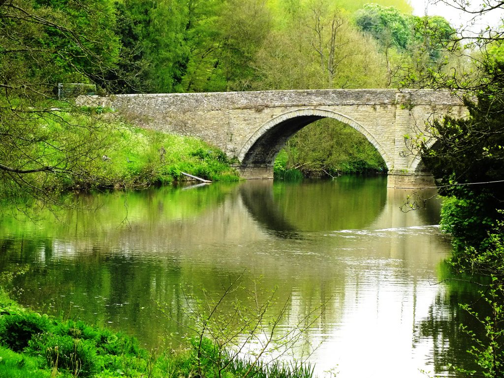
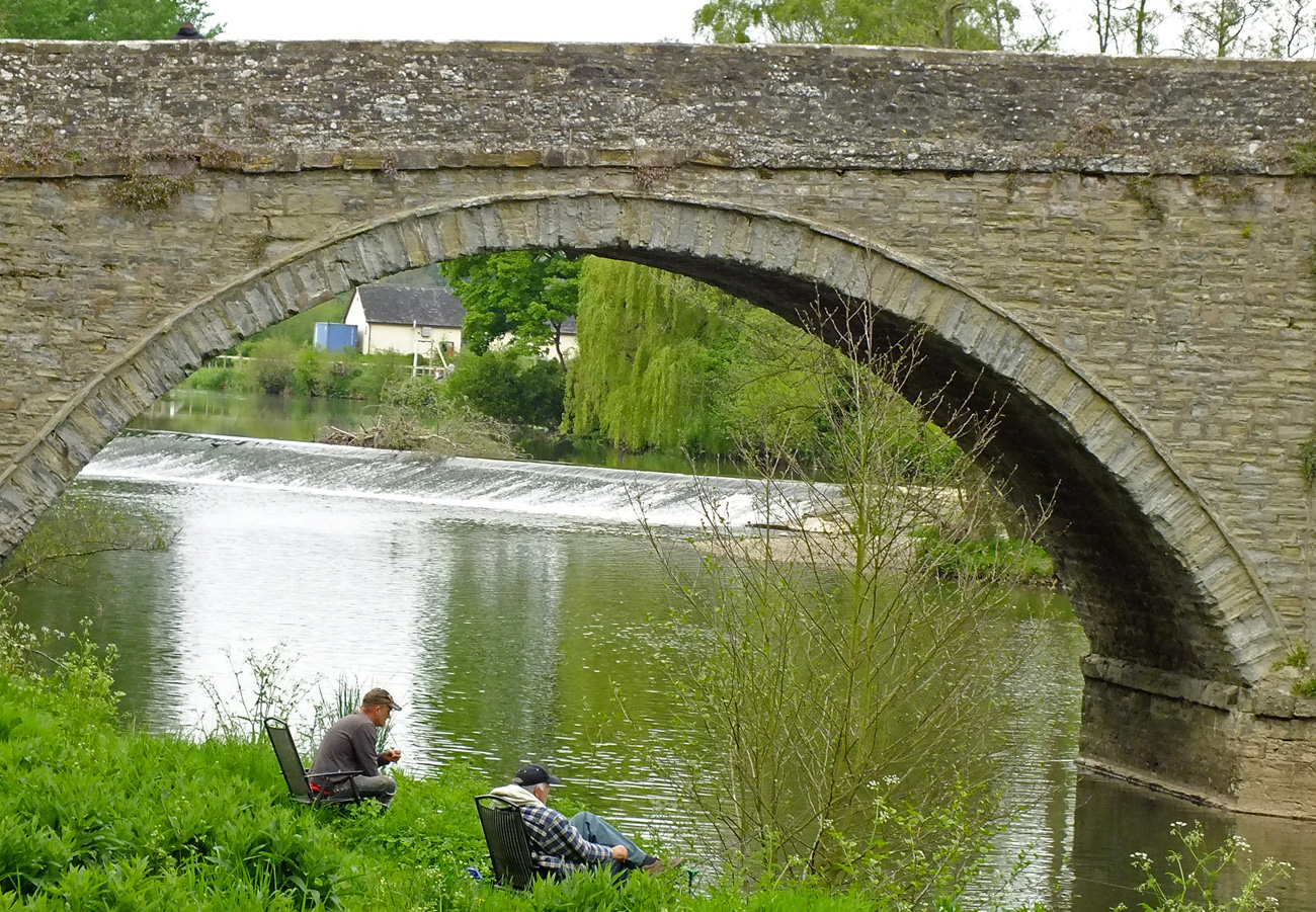
We are now at the end (or beginning) of the Bread Walk and to return to the centre of town you need to cross the Dinham Bridge.
Where you will get the classic Ludlow view of the castle and the Dinham Weir, which is the only place where I have seen a heron.
And if it is open, the Green Café on the Millennium Green serves a good lunch, but sadly not today.
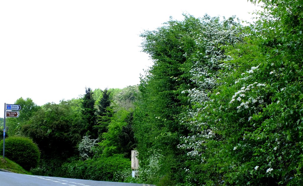
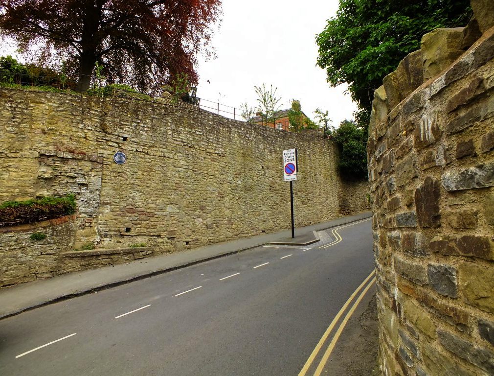
Now head up Dinham where the Dinham Gate (demolished in 1786), a medieval postern gate with a chamber over an arched entrance through the town wall, faced towards Wigmore and Wales. Look out for a hedgerow of lovely fragrant lilac and then follow the old town wall back to the castle square.
Lilac Blooming
A Living Wall
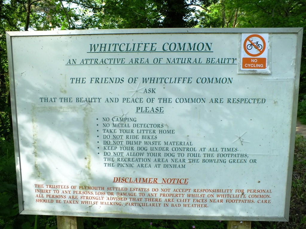
The Walk:Source of information from the Ludlow Civic Society blue plaque (Dinham Gate) and the information board commissioned by the Trustees of the Friends of Whitcliffe Common (Whitcliffe Common)
I’m combining Cee’s Which Way Challenge with Jo’s Monday Walk again this week as they complement each other.


 After taking some photos around the castle garden on Dinham with the pollarded lime trees, it’s time to walk down to Dinham Bridge and capture a few shots of the castle and the river which is in full spate after the rain in Wales.