I have been wanting to get up and take a photograph of the sunrise this week, but the weather has not been playing ball. Each morning that I have struggled to be awake this early (and those of you who have read my previous post for this project will understand that I am so NOT a morning person) it has been misty and the sky a total white-out. Not even a glimmer of colour in the east.
Light in the east?
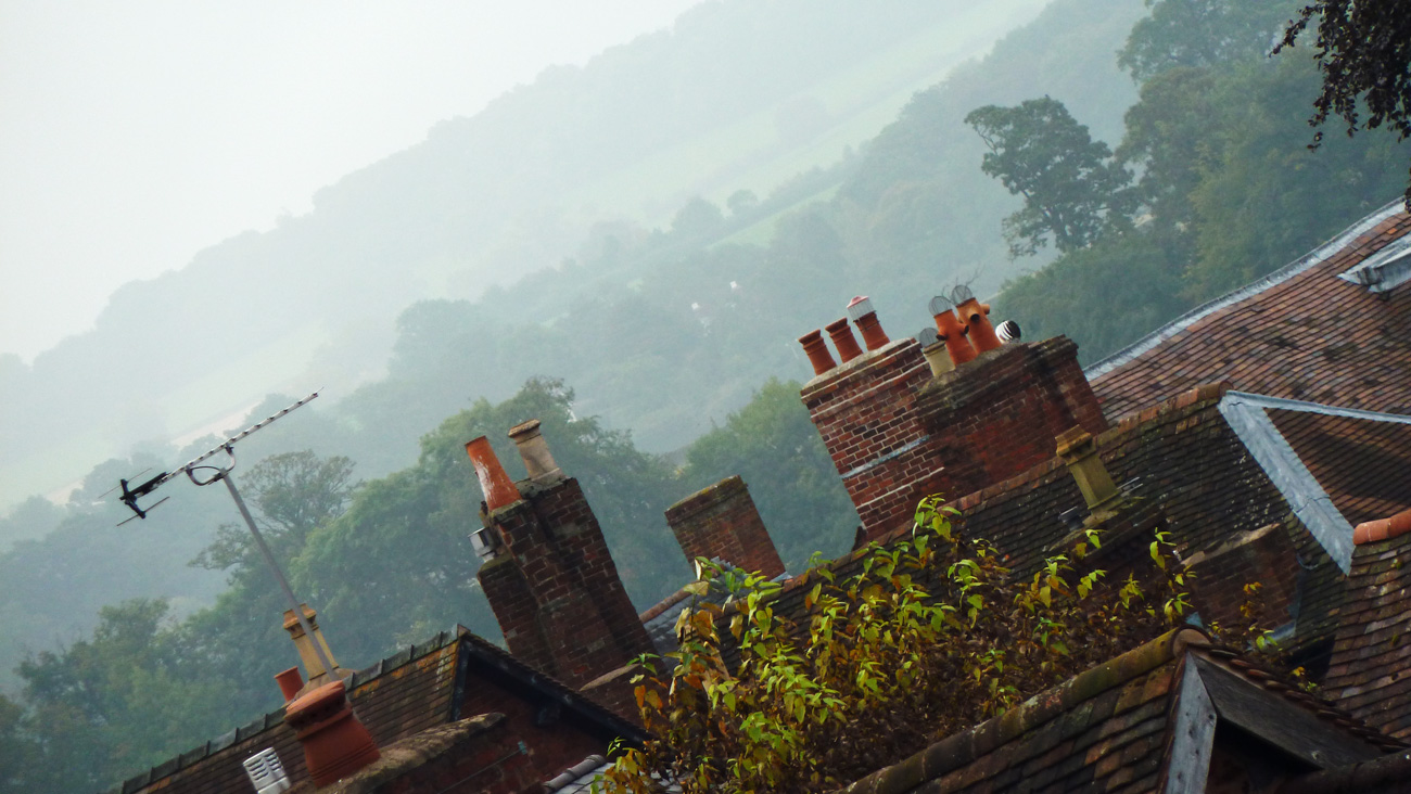
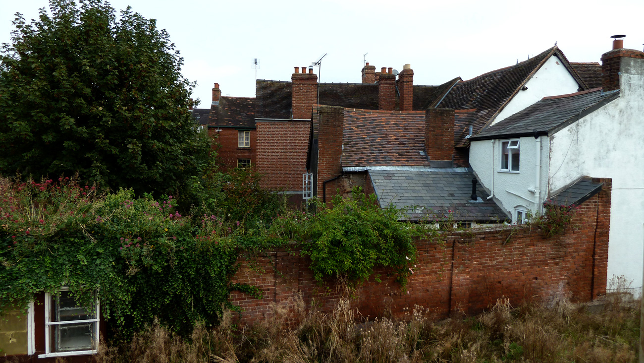
As we are coming to the end of this time-frame, and I am already awake, I’m going to show you a bit of the area behind my house as well as the usual glimpse of in front. I live in a very quiet area in the old town of Ludlow and surrounded by quite a few holiday homes, so a lot of the time the houses nearby are empty.
At the back and not many straight lines here
Until a year ago there was a fully functioning pub to the left of me which was run by the Royal British Legion and the home of the RoyalAntediluvianOrder of Buffaloes‘ Lodge and things weren’t always quite as quiet then what with live music and noisy punters; talking (why do people talk so much louder when drinking alcohol? An interesting correlation between the volume of liquid consumed and volume of speech), arguing and sometimes screaming, who were outside in the smoking zone that was practically beneath my bedroom window – that wasn’t great. But there was also a well-tended allotment with runner beans, cabbages, onions etc. and a sweet little home-made lean-to potting shed against the red-brick wall which was rather nice. Sadly this year with the closure of the pub the allotment has been unused and nature has taken over. This has meant poppies have flourished and all matter of weeds wild-flowers have grown.
Wild flowers flourish
Nature reclaims
The demise of the potting-shed
When I started entering this project it was May and the blossom was just beginning and it was the time of the Spring Fair, now it is autumn and colours are fading and we have just had the Autumn Food Festival – where has the summer gone?
Lisa of the blog NorthWest Frame of Mind has decided to run a different project over the next 24 weeks. To try to show what is happening in different parts of the world (if you all join in) at a particular time of day. If you would like to participate you have until next Saturday midnight to post a photo or write about what is happening in your part of the world. This week is between 07:00 – 08:00. I hope you’ll join in! See links for more details.
In the south-eastern corner of England you can find several impressive castles – Hever, Leeds, Dover, Rochester, Deal and Bodiam amongst them. Historically the region has always been vulnerable to attack from foreign shores.
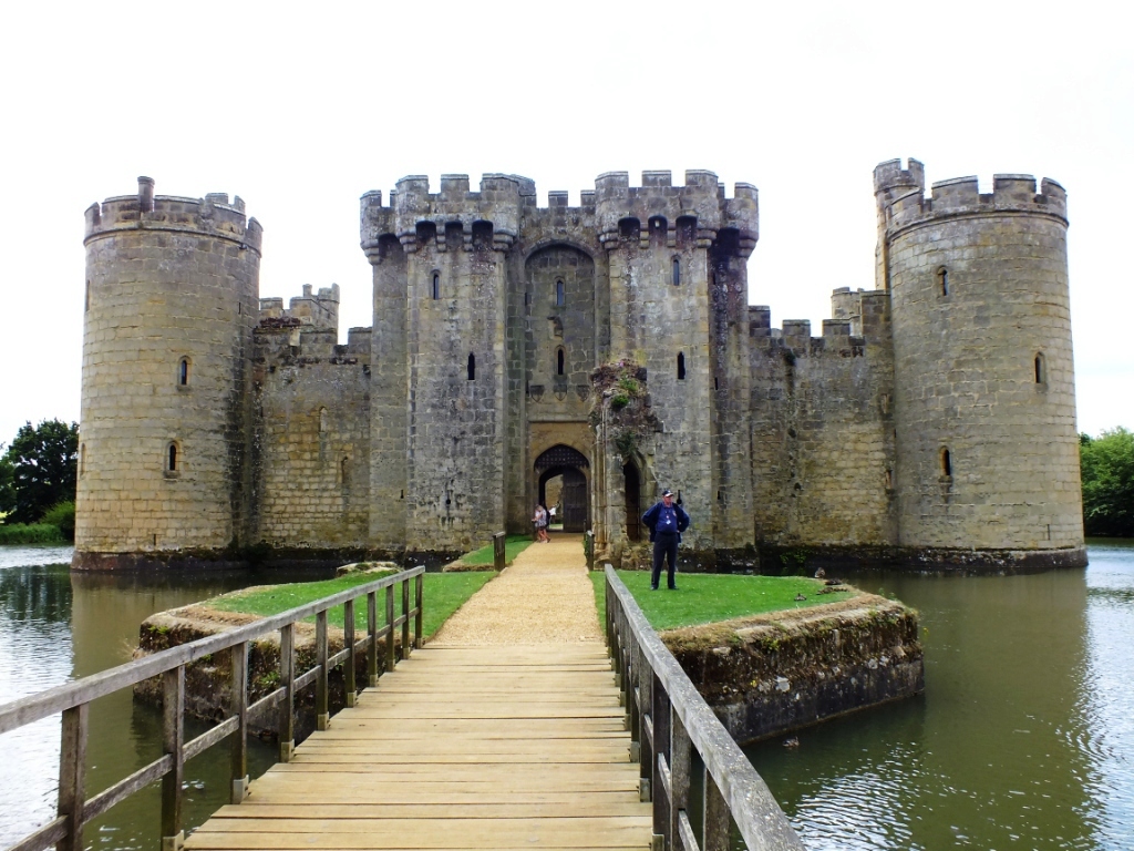
As we were staying in the Weald of Kent for a few days, which is on the East Sussex border, we decided to take the historic steam train from Tenterden to Bodiam and walk to the moated castle, often glimpsed from the road when passing by. We could have driven there in about 10 minutes, but sometimes it is nice to take things slowly and enjoy the journey as much as the destination.
In 1377 French ships raided the Sussex coast, causing widespread damage and panic among the local population which led to the building of nearby Scotney Castle. The French later raided nearby Winchelsea in 1380, so when a new French invasion threatened in 1385 Sir Edward Dalyngrigge (one of Edward III’s knights) applied to King Richard II for a license to fortify and strengthen the existing hall he lived in.
Having been granted permission he decided to build a new sandstone fortress near the River Rother, which at that time was navigable to the coast. Though its primary aim was defense, Dalyngrigge made sure that Bodiam was also a comfortable abode, as much a fortified residence as a military stronghold. And of course a visual symbol of his wealth.
Bodiam Castle is considered to be the finest example of medieval, moated, military architecture in Britain.
Postern Tower
Chapel
The Servants Kitchen
In the Buttery and Pantry
Gate and Portcullis
Murder Holes
North-east tower
The East Tower
A gargoyle
Read This!!
Carved face
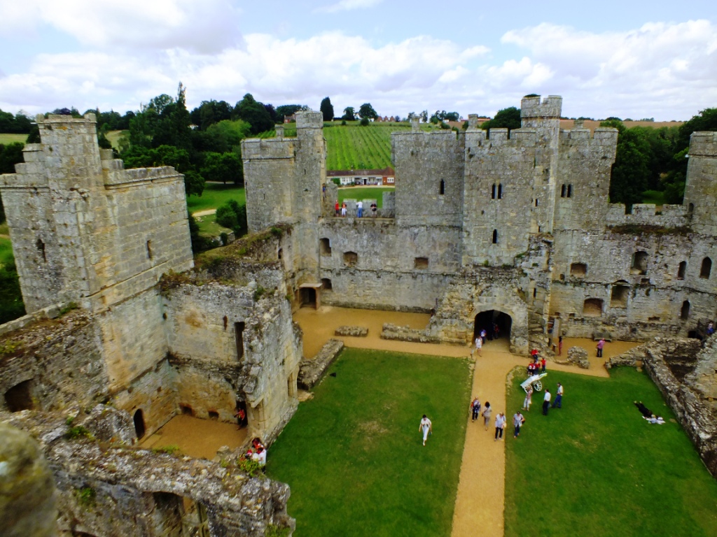
The interior from the Postern Tower
The French invasion never took place, and Bodiam’s impressive defenses were never tested until 1484 when the castle fell to a siege by Richard III.
…when people from miles around converge on this beautiful little Medieval market town for the Ludlow Food Festival. They come to attend numerous workshops and tastings, visit local producers, hit the sausage trail or try the pudding tastings, listen to top chefs deliver talks and demonstrations in the castle grounds or learn knife skills and attend Egyptian Masterclasses. This town of 10,000 people will double its population over the coming weekend.
On Sunday there will be a Local Producers’ Market with over 40 small, local food and drink exhibitors on the Market Square.
And, as usual, there is a Window Dressing Competition. So I took the camera around the town today (before the hoards arrive) to see what merchandise I could find.
It was August 2003. We were in what felt like the middle of nowhere in the thriving, spirited outback centre of Alice Springs.
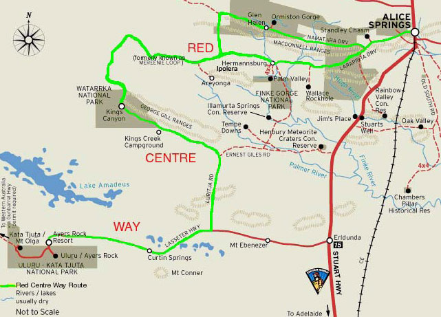
Some of you may know Alice from the 1950 novel by Nevil Shute or the subsequent film ‘A Town Like Alice’. We were there to set off on an adventure into the deep centre – to the Uluṟu-Kata Tjuṯa National Park about 463 kms direct by road from Alice in the Northern Territory of Australia.
It is one of those iconic places that you fear will not live up to the hype. That you will arrive and be disappointed. And it was a long drive to be disappointed at the end of it.
Setting out in our hired Toyota Land cruiser (a giant beast that was total overkill as there was only the two of us, but the smaller Rav4 was unavailable) we headed for our first stop in Kings Canyon.
Feeling adventurous I decided that we would travel west through the West MacDonnell Ranges to Glen Helen, along the Mereenie Loop Road which is unsealed most of the way but passes incredible places along the way like Standley Chasm, Palm Valley and the Glen Helen Outback resort (all of which we had explored during the two previous days.) Nowadays I believe you need to purchase a permit to travel along part of this route, but then it was not required. And it is now known as the Red Centre Way. You cannot travel on an unsealed road in Australia in an ordinary hire car so make sure if you want to follow this route that you book a 4WD. All you have to deal with are pretty bad corrugations in places which take some adjustment in finding the optimum speed where you are not shaking the teeth out of your head, nor going so slow that you feel every bump! It is a lovely drive through some beautiful desert country, certainly more appealing than the much longer detour along the sealed highway.
If you don’t make any stops along the route the drive to the Kings Canyon resort is around 3 1/2 hours. There you will find 300 metre sheer cliff faces and a palm-fringed swimming hole and you can take the Kings Canyon Rim Walk for breathtaking views over the red landscape. We stayed in a basic cabin and enjoyed a walk in the valley before heading to the restaurant for barbecued steaks and a live country music band who invited people to get up and dance. Of course things will have changed since this trip and you can now have an ‘Under a Desert Moon Fine Dining Experience‘ which will more than likely set you back a whole lot more than what we paid for the entire trip!
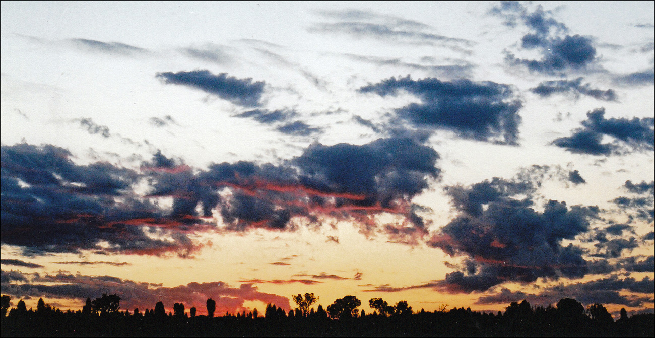
Sunset in the Outback
Leaving Kings Canyon the following day (though I would recommend spending two nights at the resort if you can as there is much to see) we continued south along the Luritja highway for 300km to Uluru which is a huge monolith created some 600 million years ago. As we reached the Lasseter Highway we could see the third largest monolith in the distance – Mount Connor – (located 100 kms east of Uluru) which never gets much of a mention, but is quite a sight, rising up in the middle of the desert. You can book a 4WD day trip from the Ayers Rock resort which includes dinner at the Curtin Springs Station’ homestead and provides you with a quintessential Aussie Outback experience.
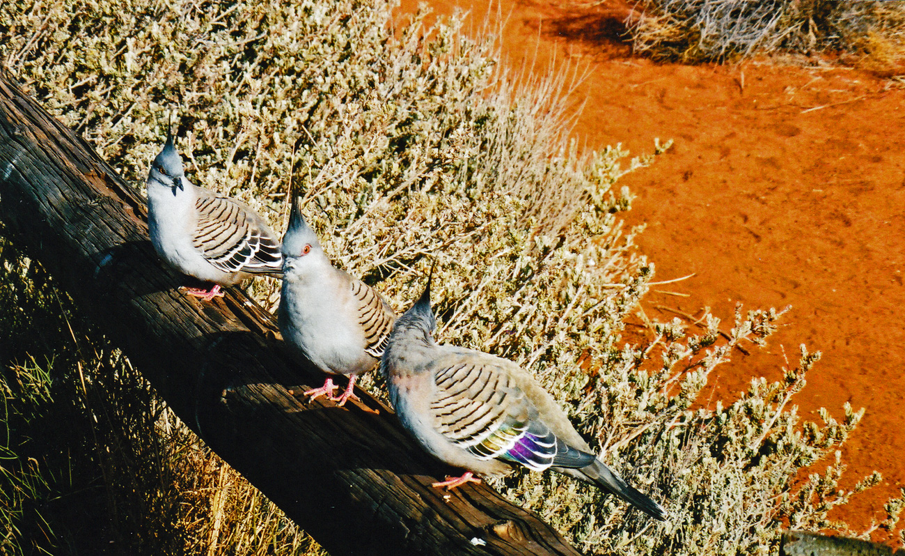
Three Crested Pigeons
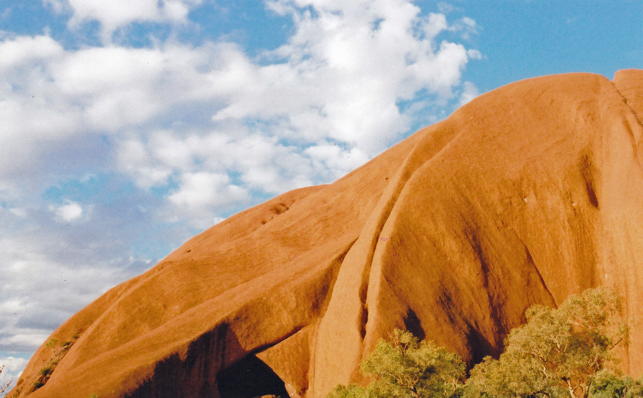
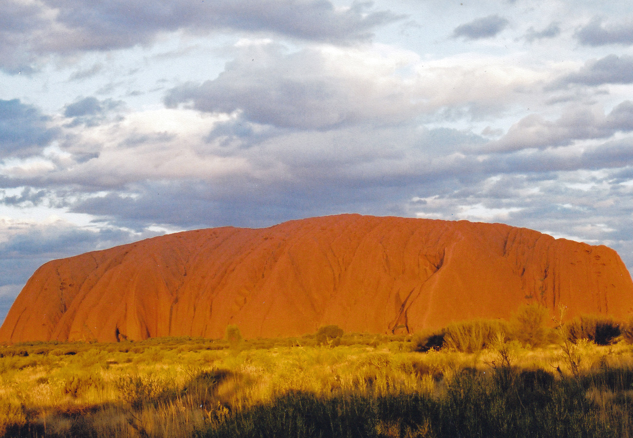
So on to the main event – Uluru. If I had thought that Mount Connor looked impressive I was totally astounded by this rock which is accepted as the largest Monolith in Australia and claims to be the largest monolith in the world. After dropping off bags in our accommodation in the Outback Pioneer Hotel and Lodge, we set off for the base of the monolith to have a walk and then to get into position to see the sunset.
Uluru
You don’t have to spend a fortune when visiting this part of the world (which is now rated to be the third most expensive resort to visit) as you can camp or stay in cabins and drive around yourself taking in the views and the park, and walk around the base (9 km) or in Kata-Tutja. Of course if you want 5* luxury spa hotels, flights over the rock, rides on camels or Harley Davidsons and dine outside under the stars with gourmet dining, then you can. But we didn’t.
Uluru
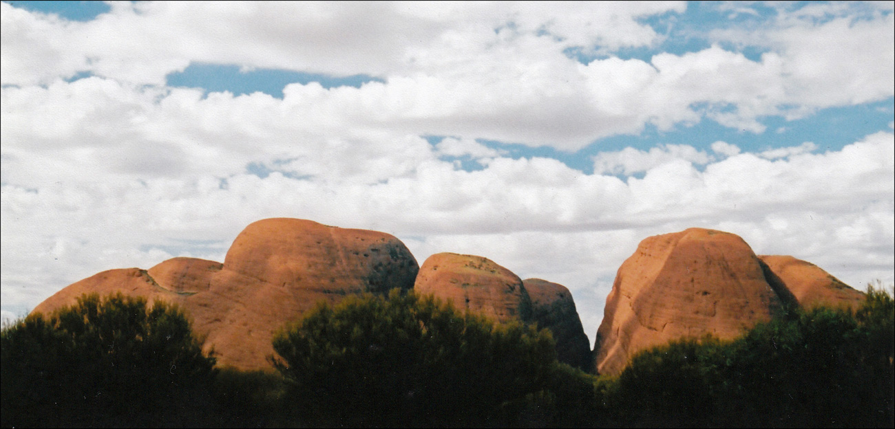
The next day we got up early to watch the sun rise. The rock really does glow and there is something very magical about it. Its history, its significance in Aboriginal culture, its location, the peacefulness. Even with the crowds it still feels special. We carried on to the Kata Tjuta (The Olgas) which are further on into the park and where there are two walks open to everyone: The Valley of the Winds, a 7 km beauty that makes a loop to two spectacular lookout points, takes about three hours and is easy-going. Do it in the early morning to avoid the crowds and the Walpa Gorge Walk, an easier 2.6 km stroll that takes in a nice representative of the native wildlife and plants of the park.
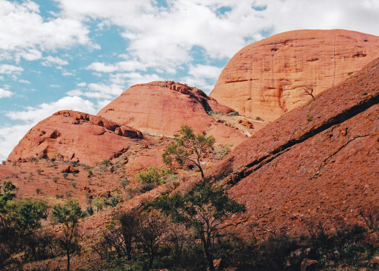
Kata Tjuṯa, also known as The Olgas and officially gazetted as Kata Tjuta / Mount Olga, is a group of large, domed rock formations or bornhardts located about 360 km southwest of Alice Springs.
I can’t recall which trail we followed, but walking between the steep walls of red sandstone, listening to flocks of finches, looking at the wild flora, and above all, the feeling of space and no crowds of people, was my favourite part of the trip. Like Uluru, these rock formations are most spectacular at sunrise and sunset when the light seems to give them a magical red glow.
Kata Tjuṯa, also known as The Olgas
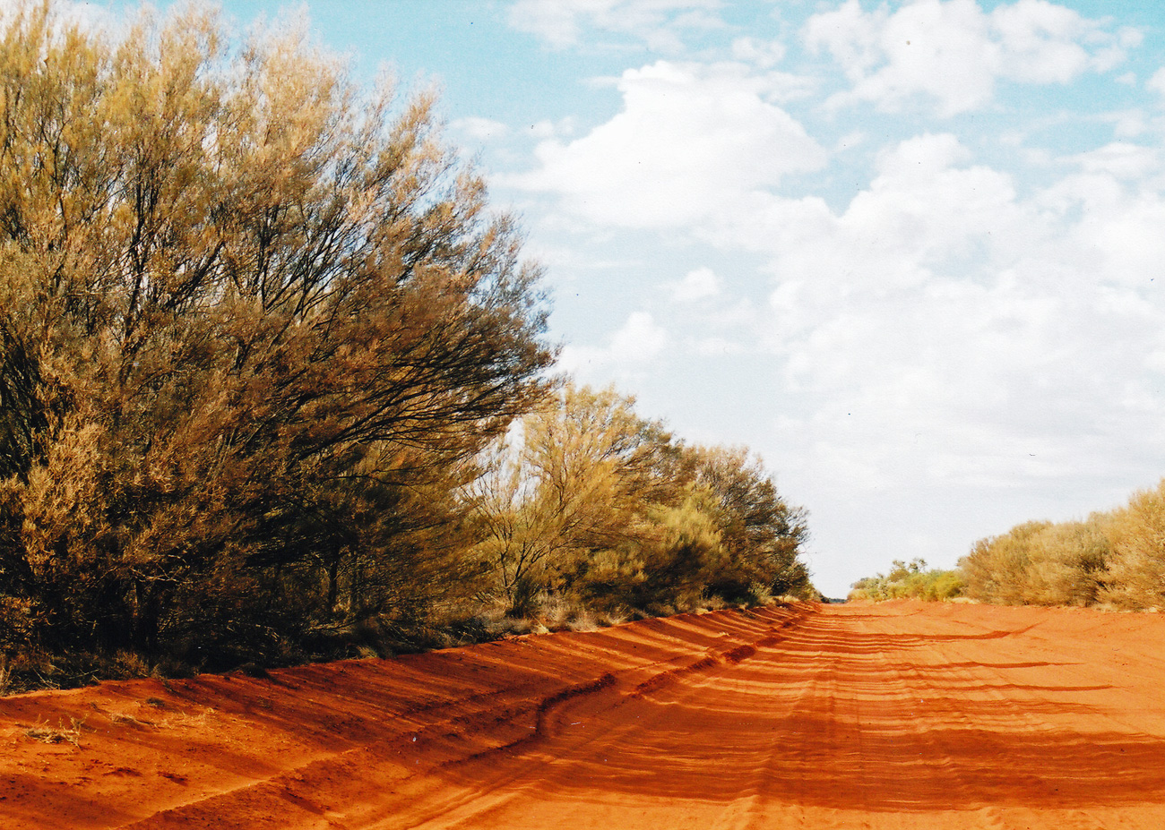
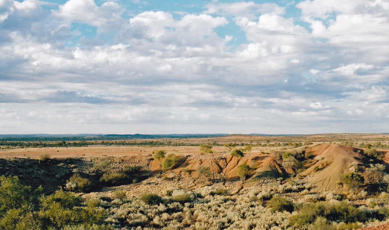
Returning to Alice along the Luritja Road we turned off onto Ernest Giles Road (unsealed for about 70 km) for a ride on a rich red and dusty road – take care though, as this is the one and only time that I literally took off! Driving too fast over a hidden dip, the land cruiser flew through the air before landing somewhat shakily on the other side, after that I took things a little more slowly.
Ernest Giles Road
A few kilometres before the road joins the Stuart Highway leading back to Alice we passed the Henbury Meteorite Conservation reserve where we stopped for a stretch of legs and a walk around this unusual site. Henbury Meteorites Conservation Reserve contains 12 craters which were formed when a meteor hit the earth’s surface 4,700 years ago. The Henbury Meteor, weighing several tonnes and accelerating to over 40,000 km per hour, disintegrated before impact and the fragments formed the craters.
Henbury Meteorite Conservation reserve
Uluru was even better than I had imagined, despite the amount of tourism (and I suspect it has increased over the past 10 years) and unexpectedly the walk in Kata Tjuta and the drives on those mystical red dusty roads through the Outback were additional highlights for me.
Have you visited an iconic site? And if so did it live up to your expectations or were you left feeling a little bit cheated?