Just Back From… Laugharne

…and some like myself, just came one day, for a day, and never left; got off the bus, and forgot to get on again…”

~ Dylan Thomas

Laugharne (pronounced Larn) is probably most famous for being the last place where renowned Welsh poet Dylan Thomas lived, wrote, drank and is laid to rest; he died in New York.

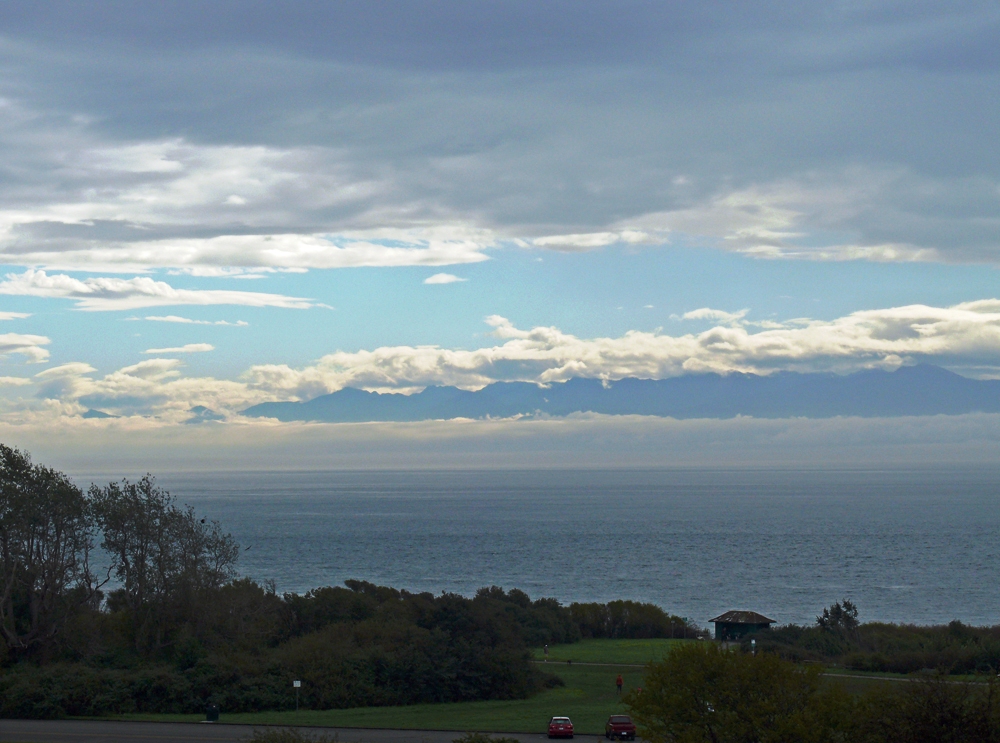
His Boathouse and Writing Shed overlooking the wide Tâf estuary draw in the crowds and you can even get a cup of tea at the Boathouse, though not when we visited as it was closed for filming a new film about Dylan Thomas’s fourth and final reading tour of America which is being made to mark next year’s centenary of his birth. The play “Under Milkwood” and “Poem on his Birthday” were written here. There is even a ‘Birthday Walk’, which if done on your birthday entitles you to a complimentary birthday gift. Climb up Sir John’s Hill for mind-blowing views across three estuaries (River Tâf, Towey and the Gwendraeth) and over the bay to the Gower Peninsula.

It’s not all about Dylan though, there is also a ruined castle built in the thirteenth century with more spectacular views of the estuary and out to Carmarthen Bay, an interesting clock tower on the town hall, and a unique Tin Shed Experience – a quirky 1930s – 1940s museum. It is also one of the oldest  self-governing townships in Britain, presided over by the Portreeve wearing his traditional chain of gold cockleshells.

Close to Laugharne is the seven mile beach known as Pendine Sands which was used to set world land speed records as it has a wide, flat and firm surface. Several generations of the Campbell family have raced there and there is a Museum of Speed. And if you travel a little further west you will discover the turquoise waters of Amroth, reminiscent of neighbouring Saundersfoot and Tenby in Pembrokeshire.

Carmarthenshire is often overlooked by people rushing through to the beautiful Pembrokeshire coastline, but it has much to offer itself with a new Coast Path which passes through a range of habitats including fresh water marshes, salt marshes, sand dunes and pine forests.

Telegraph Cove

On our first visit to Vancouver Island, way back in 2005, we moved northwards after spending a week in the Comox Valley area to spend a few days in Alert Bay, a small settlement on the Cormorant Island which lies off the northeast corner of the Island in the Inside Passage, a 40 minute ferry ride from Port McNeil. (See the map on the Victoria 1 post). Our main reason for going there was to go on a boat trip to look for killer whales (Orcas – the lovely black and white ones).

Before we reached Port McNeil though we decided to branch off at the Nimpkish Lake to the small community of Telegraph Cove which is about 130 miles northwest of Campbell River. Historic Telegraph Cove is British Columbia’s last boardwalk community. It grew out of a one-room station at the northern terminus of the Campbell River telegraph line in 1911 into a chum salmon saltery and later a small sawmill. It hasn’t changed much over the years. Its history is well-remembered and the homes reflect the original era. The sawmill closed in the mid 1980s and the only future seemed in tourism. Today its economy is primarily based on tourism with its proximity to the Robson Bight ecological reserve.

Whale watching, grizzly bear viewing excursions and kayaking are popular activities on the Johnstone Strait and Knight Inlet and most of the cabins on the picturesque boardwalk are holiday rentals or tourist shops and cafés. The Johnstone Strait and Broughton Archipelago are home to a bounty of nature’s magnificence including humpback whales, Steller sea lions, dolphins, porpoises, bald eagles and so much more. The sheltered cove and the chance to see a pod of killer whales have attracted many people to this delightful boardwalk village.

When we visited we encountered the Telegraph Cove Road Improvement project and had an interesting drive on gravel and unpaved diversions past logging yards and sawmills to reach the unique boardwalk resort. Now you will be pleased to hear it is a wide, realigned and paved road all the way. Although I actually quite liked the adventure of “off-roading”.

So here are a few pictures of Telegraph Cove and I will follow with a few posts about Alert Bay as it really is a gem of a find.

The Butchart Gardens

Although we didn’t visit the Butchart Gardens on this trip, it would be remiss of me not to mention it as it is possibly the most spectacular floral display on the continent. It began as a limestone quarry in 1904 established by Robert and Jennie Butchart. They created a family home nearby with sweetpeas and rose bushes. As Mr. Butchart exhausted the limestone deposits his wife began to create a sunken garden in the abandoned quarry and went on to develop other areas such as the Italianate, Japanese and Rose gardens. Successive generations of the family have cared for the gardens which attract  a million people annually. Continue reading The Butchart Gardens

Victoria IV: Arts and Crafts

Cutting back through the park we arrived at Fairfield and Cook Street Village. Fairfield is a picturesque neighbourhood with tree-lined streets and you can take a self-guided walking tour which describes some of the buildings of interest along the route. Housing styles typical to the area are Edwardian Vernacular Arts & Crafts (1904 – 1914) British Arts & Crafts (1905 – 1930), Foursquare (1900 – 1920) and Californian Bungalow (1900 – 1929). Needless to say this occupied a good deal of our day, though we found time to browse in a couple of second-hand book stores (always a dangerous pastime) and have a bowl of soup in a cute retro American Diner complete with pictures of Betty Boop. Continue reading Victoria IV: Arts and Crafts

Victoria III: Beacon Hill

Victoria has a selection of self-guided walks around the city, available from the Tourist Information Office on the Waterfront, they are a good way to explore the city at your own pace.

After our hour or so of culture we needed some exercise so made our way via Thunderbird Park and the totem poles through to Beacon Hill Park, spotting a great blue heron at the top of a tree near the lake and several peacocks –we couldn’t persuade a single one to open its tail, but managed to get pretty close – before arriving at the lookout where you have wonderful views (on a clear day) across the Juan de Fuca Straits.

We shared a bench with an elderly gentleman – yes, even older than us – who proceeded to entertain us with stories of the area and of the people who once lived here such as the fact that the seemingly random rocks on the hill were in fact burial markers and it wasn’t until a load of them had been moved that this fact came to light – too late then to put them back where they belonged.

Aboriginal burial cairns were often located on prominent hillsides and above defensive sites. Beacon Hill fits that pattern. Finlayson Point, directly below the hill, was the location of a small native village and defensive site. The presence of human graves on Beacon Hill and evidence found at the Point–including house remains, a defensive trench and midden contents indicates the village was “a more permanent settlement rather than a short-term camp.” “People lived in a village on Finlayson Point beginning about 800 or 900 years before the founding of Fort Victoria.” (Grant Keddie, Curator of Archaeology at the Royal B. C. Museum)

I love it when we meet people like him who have so many tales to tell, it’s a shame it happens less frequently when you travel as a couple.

View to Mount Olympus Washington