I have lived in the UK for most of my life, but when young I definitely had wanderlust and even ended up living in South Africa for several years which was a wonderful experience. I now look forward to a long and leisurely retirement doing what I like most - gardening, photography, walking and travelling.
In a post created specifically for this challenge, share a photo that captures the threshold.
threshold (n) an entrance or doorway
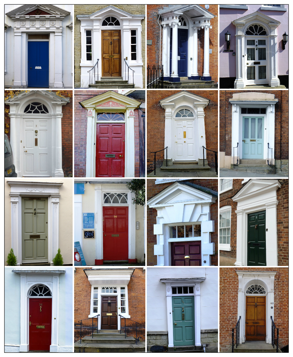
Ludlow has a fine collection of Georgian doorways of many different and unusual styles from simply elegant neo-classical to ornate porches and fancy fanlights. (click image to enlarge)
Which one is your favourite?
If you would like to see what others have come up with for this challenge then go to the Daily Post @ WordPress Weekly Photo Challenge
On Monday we left Page to drive to Bryce Canyon and our next stop. First we had a look at the Glen Canyon Dam which was the reason for the town of Page as it originated from housing the workers of the dam when construction started in 1957.
Bridge over the Glen Canyon Dam
Then we stopped at Lake Powell which is the largest lake in Arizona/Utah and famed for its water sports, fishing, hiking and boat trips to Rainbow Bridge (the world’s largest natural stone bridge).
Lake Powell with Tower Butte and Navajo Mountain in the background
Lake Powell is arguably the most scenic lake in America, situated in some of Southern Utah’s finest red-rock desert country.
The River runs through us
Above: The Hydroelectric Project (Glen Canyon) and the Navajo Generating Station. Why are two power stations so close? The reason is the river. The availability of water at lake Powell, the proximity of a source of coal and a worker base in the city of Page determined the location.
Lake Powell
Sparkling clear, blue water laps against towering, sheer, red-rock canyon walls and sandy beaches. Lake Powell has more coastline than the entire west coast and you need a water craft to access the majority of the canyons as access is limited because there are few roads.
Highway 89
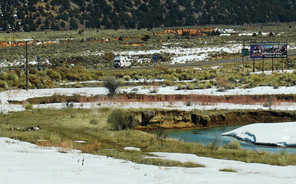
Moving on we crossed the border into Utah which is only about ten miles from Page. Utah’s southwest corner is often called “Colour Country” and has a dry, hot climate and Highway 89 is a Heritage Highway because of the wealth of history along its route.
Cockscomb
Driving past Paria Canyon and the Vermilion Cliffs Wilderness you then pass Cottonwood Canyon Scenic Backway with rugged peaks called the Cockscomb. Next is an area called Telegraph Flat named in 1876 when Western Telegraph opened an office here. It is now a ghost town.
Driving to Kanab
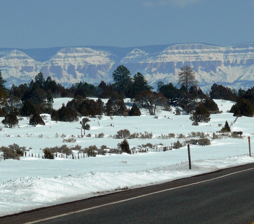
The biggest town along the route is Kanab, famous for the Western Legends Roundup and Western Film Festival an annual event that is a tribute to the area’s rich movie history. Nearby is the Coral Pink Sand Dunes State Park (covered in snow as we passed ) where the rare plant, Welsh’s Milkweed, grows.
Coral Pink Sand Dunes
The United Order experiment was instituted in 1874 for a communal lifestyle at the direction of Brigham Young. Eighty families moved here from Mount Carmel where the co-operative had failed.
It existed until the 1880s when it started to fall apart, though it had grown to more than 700. The families lived in apartments which were identical, they all ate in a common dining hall and wore uniforms. Private property did not exist.
The next town is Mount Carmel Junction where Highway 9 to Zion National Park intersects with the 89 (and which we would be taking tomorrow as we retraced the next stage of our trip), a few miles on we drove through the unusually named Orderville.
Mount Carmel Junction was first settled by Dr Priddy Meeks in 1864 as part of Brigham Young’s plan to settle all of Utah’s territory. It was later named after a mountain in Israel.
John Wesley Powell first visited in 1872; he was the first white man to descend the East Fork of the Virgin River and who named the canyon “Parunuweap” from the Paiute word meaning roaring water canyon.
(source: wikipedia)
Coral Pink Sand DunesOn to Highway 12Heading to Bryce Canyon
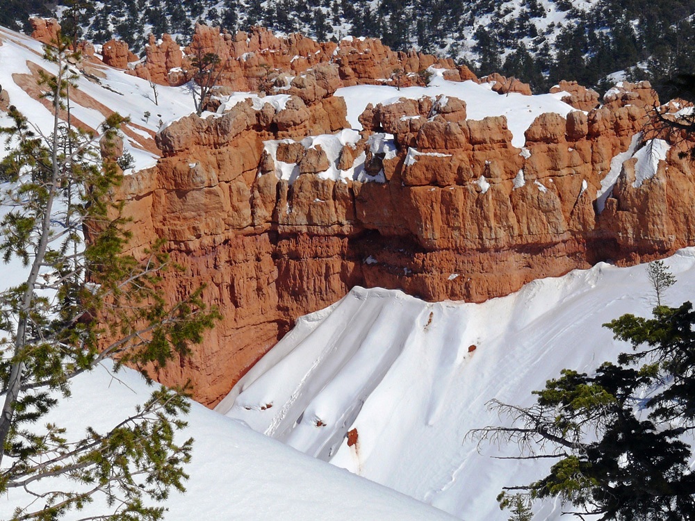
Just before Panguitch (another town with an interesting tale, which I will tell you about in my next post) you take a turn to the right on State Route 12, another of the All American Roads, which winds 124 miles through some of the most unique geology on earth. Almost immediately you hit Red Canyon, a section of the Dixie National Forest, with red hillsides dotted with ponderosa pines and hoodoos.
The Red Canyon Tunnels
(Click an image to enlarge and for further information)
Red Canyon
Tunnel
Ponderosa Pines cling to Cap Rock
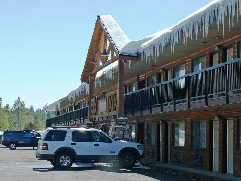
After 14 miles we took another right turn and headed back south on Highway 63 to Bryce Canyon National Park, so named after Ebenezer Bryce a Mormon pioneer. We were staying in the Best Western Ruby’s Inn which is a short distance from the park entrance.
Ruby’s Lakeview Lodge
“Before there were any Indians the Legend people, To-When-an-ung-wa, lived in that place. There were so many of them. They were of many kinds – birds, animals, lizards and such things – but they looked like people…
For some reason the Legend People in that place were bad. Because they were bad Coyote turned them into rocks; some standing in rows, some sitting down, some holding onto others. You can see their faces with paint on them just as they were before they became rocks…”
~ a Paiute Indian Legend
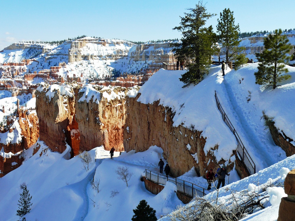
After checking in and dropping our luggage in the Lakeview Lodge we headed off into the park to have a look at the incredible hoodoos that are concentrated in a horse-shoe shaped amphitheatres that provide amazing spots to watch the sun rise and set.
A perfect spot for star-gazing as there is no light pollution.
AmphitheatreViews
The 3 feet of snow that had fallen over the weekend meant that several of the pathways were under snow and walking was quite treacherous. It didn’t seem to put off some people though as we saw them climbing over fences to approach the end of a lookout point – oblivious to the fact that you couldn’t see the edge. I even saw two lads carrying a mate in a wheelchair to the edge of one viewpoint.
Snow in BryceA lone coneNavajo Loop note the steep, icy trail
From Sunset Point this trail takes you down onto the floor of the canyon and amongst the hoodoos. Not to be ventured on except by people in stout boots with walking poles, or idiots in fashion boots complete with high heels!!
Hoodoos
We ate at Ruby’s that night, there isn’t really a lot of choice, but the food was reasonable – I can’t say that we’ve eaten any remarkable meals during this trip so far. It had been a long day with lots of interesting scenery along the way. There was a lot of snow all around and it was very cold, but thank goodness the roads were cleared and driving was a breeze. Tomorrow should be another interesting day.
Ailsa of “Where’s My Backpack?” likes to linger in the MIST this week. If you would like to join in with her challenge then please do. Everyone is welcome.
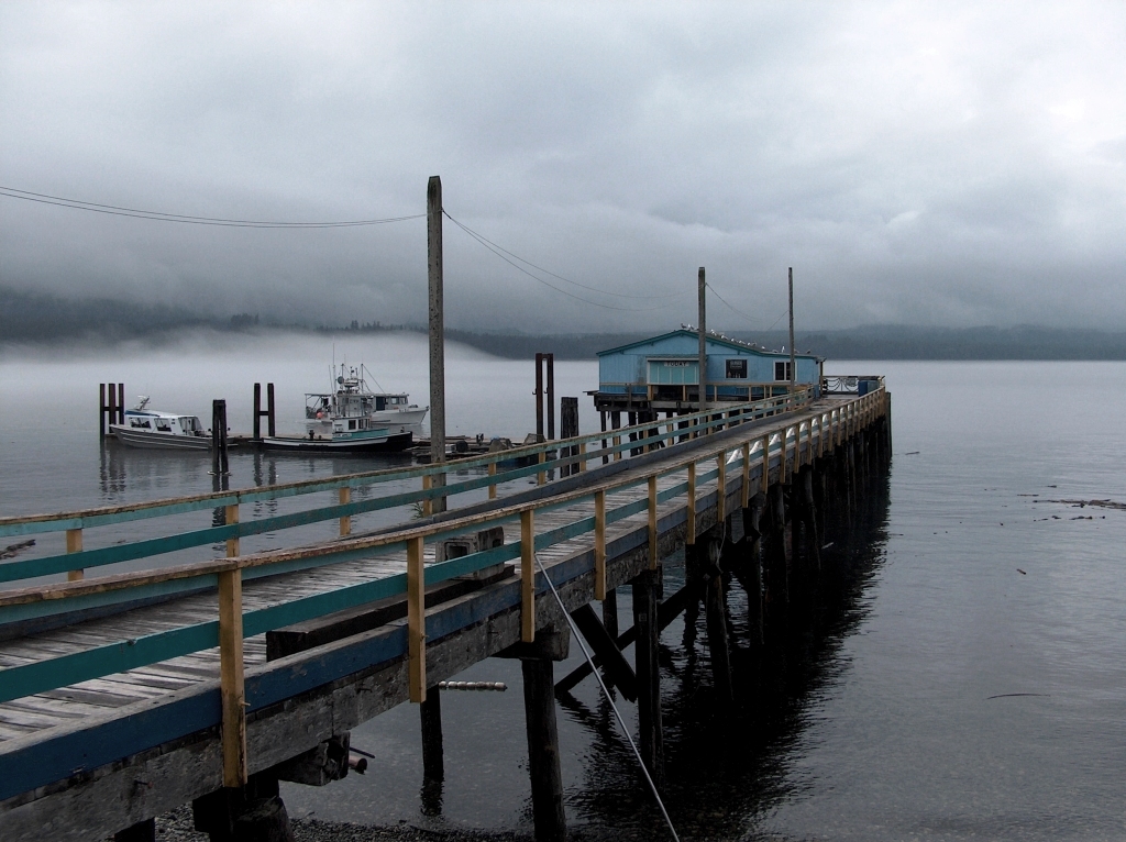
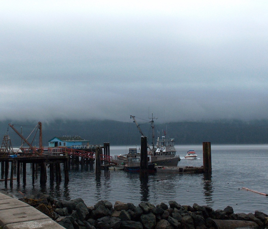
Thinking of misty times takes me back to my first visit to Canada in 2005 and more specifically to Vancouver Island. Way up north on Cormorant Island in the Queen Charlotte Strait lies the historical village of Alert Bay. Home of the ‘Namgis First Nation a former thriving fishing community and now a centre of Native art and culture as well as orca whale watching tours and fishing.
Although it was still August here the weather was distinctly autumnal with its “SEASON of mists and mellow fruitfulness!”
As the cloud descended over the far shore and the fog rose above the ocean that encircles the island we took to beach-combing along the shore and hiking in the ecological park, our eyes forever drawn to the grey mantle over the sea.
Every week Sue from ‘A Word in Your Ear’ dips into her English Oxford dictionary and picks a word on the page that it falls open at. The challenge is to post a photograph, poem, story – whatever the genre you like best to describe what that word means to you.
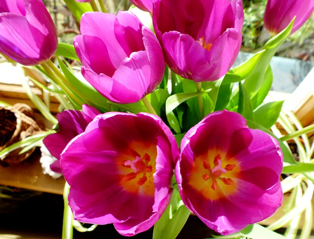
This week’s challenge is C O N T R A S T(click to join in with the challenge)
On the colour wheel you can see which colours contrast with each other as they lie opposite on the wheel e.g. magenta and lime, blue and yellow .
And it just so happens that this week I bought myself a bunch of lovely purple tulips with a contrasting yellow centre. Perfect for this challenge I thought 🙂
Originally cultivated in the Ottoman Empire (Turkey) Tulips were imported into Holland in the sixteenth century. Each year, theTulip Festival is organized in the Noordoostpolder. Held in the middle of the tulip fields, this flower festival runs from late April to early May.
The word tulip is probably derived from the Persian for turban because of a perceived resemblance of the shape of a tulip flower to that of a turban.
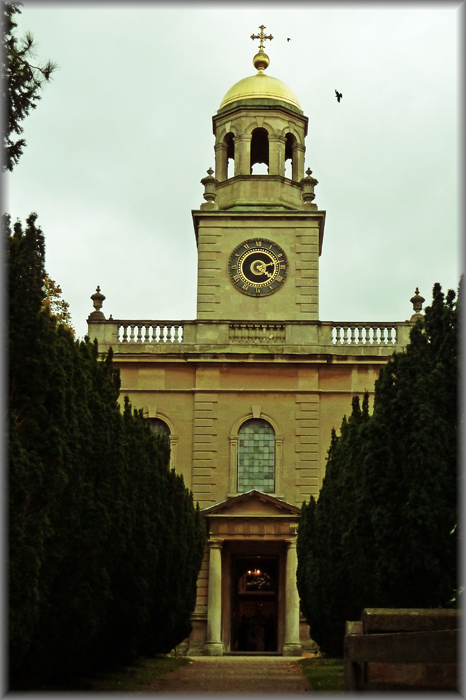
Following on from last week’s post about Witley Court today I am showing you the windows from the local parish church for Great and Little Witley. A more elaborate church on such a small scale I have never seen; thank goodness this didn’t burn down at the same time as the house. It is a very small church as you can see from the header photo above!
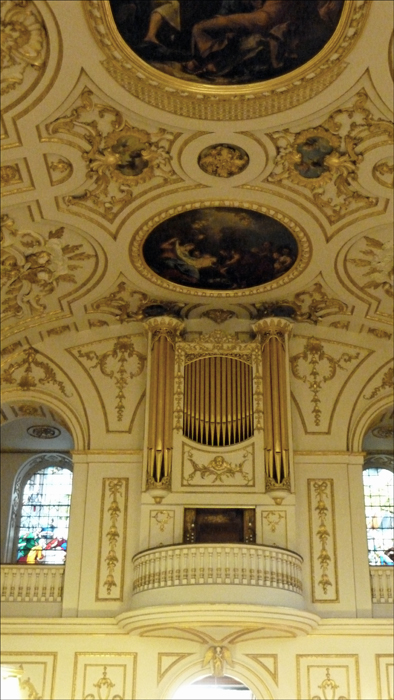
Nine of the ten windows made from stained and enamelled glass by Joshua Price in 1719 and 1721 from designs by an Italian artist are scenes from the New Testament. I’ll let you try and work out what they depict.
(click an image to enlarge)
The pictures on the ceiling are painted by the Italian artist Antonio Bellucci (1654 -1726) and are oil on canvas.
This delectable baroque style church is St. Michael and All Angels Church, Great Witley.