I’ll let Jo explain: “It’s not a challenge, you see. Walking is one of the great pleasures of my life. Ever since I began my blog I have enjoyed introducing people to new places, and the walks are another way to do it. Many of them are local and well known to me in my north east of England home. Others are a bit more exotic. So, how does it work? Every week I will publish a walk on a Monday. If for any reason I can’t make it, I will let you know. When the walk is published, anyone is welcome to leave a link in my Comments, to any walk that they have taken. It doesn’t have to be on a Monday. It can be at any time and of any duration. The amount of detail/photos, etc. is up to you. Free and easy, you see?”
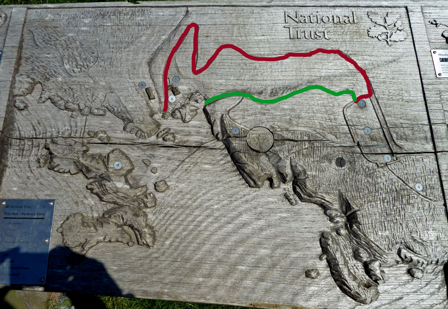
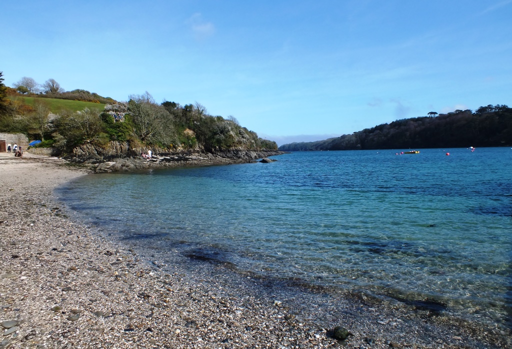
Kynance beach is probably one of the most beautiful in Cornwall set in an area of outstanding natural beauty AONB. In fact I have seen it voted as being one of the most beautiful in the world. It is certainly one of the most remote as it is practically at the end of the Lizard peninsula (the Lizard is Britain’s most southerly mainland point) and it is not a beach that you can drive up to. Oh no, getting there involves a short (10 – 15 mins green route) hike down a fairly steep narrow trail , littered with loose rocks and steep steps at the end, or a longer, winding (20 – 30 mins red route) stroll along an uneven track with exposed bedrock and slightly loose stone surface which brings you out at the back of the cove near the toilets and tea-room. We opted for the longer route suitable for wheelchairs and pushchairs without any steps.
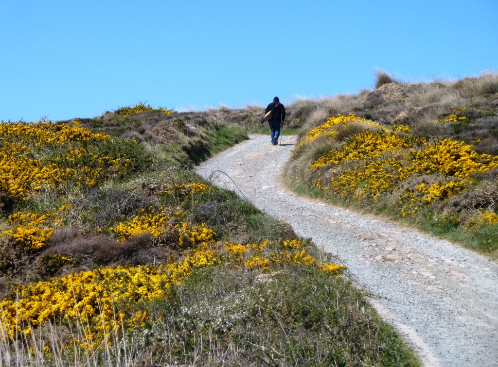
The trail winds itself down the cliffs to the beach passing through swathes of golden gorse and outcrops of rocks, some covered in the deep egg-yolk yellow lichens. The views over the bay are stunning.
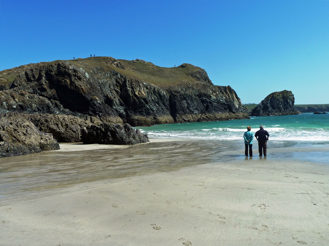
At low tide the white sands are revealed contrasting with the dark green and red serpentine rocks and the incredibly clear turquoise water. It is probably the most photographed and painted spot in the county. You can explore the towering rocks stacks and the caves with names such as The Parlour and The Drawing Room.
There is an excellent tea-room serving pasties and cream teas as well as sandwiches, drinks and beach stuff. We stopped for coffee and a cream tea and sat mesmerised by the colour of the sea whilst chaffinches hopped around our feet. I felt as though I had stepped back to New Zealand for a while.
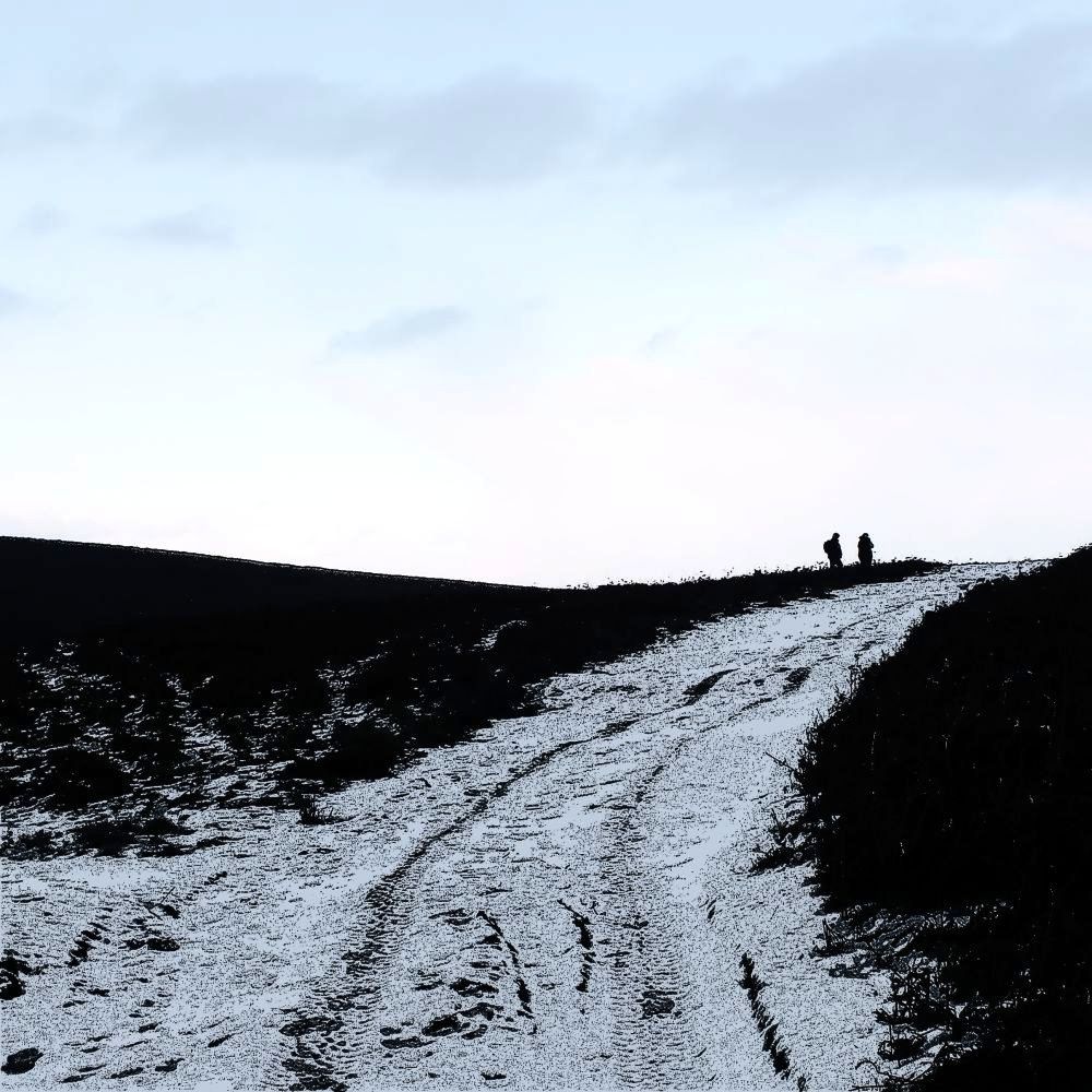
From Kynance there is a fantastic 2 mile scenic walk around the coast to Lizard Point, but as the OH is not a cliff-top walker we drove there instead. I’ll show you what that looks like in another post 🙂
If you enjoy a walk, long or short, then have a look at Jo’s site where you are welcome to join in.
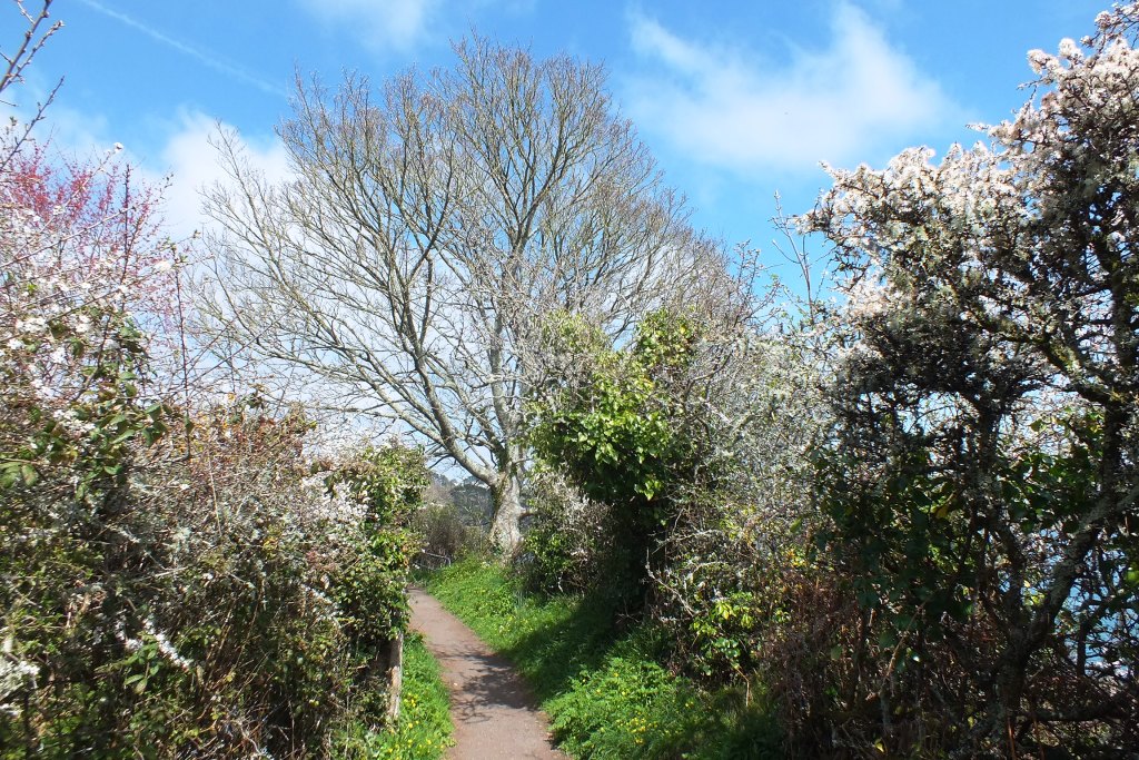
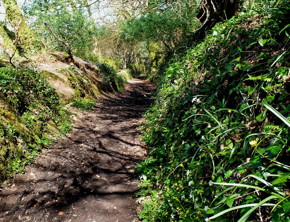
A narrow lane lined with hedgerows of a ghostly white mist (the delicate blossom of the blackthorn) leads from the ferry point into the village. Finches flit from one side of the lane to the other, others sing merrily in the bushes and all the while the warmth of the sun intensifies the coconut fragrance of the deep yellow gorse flowers.
A pretty white-washed, thatched cottages, cute welcoming pub, type of Cornish village greets you, with even a General Stores! If only all Cornwall’s villages were this pretty.
Walking around the village only takes a few minutes – it isn’t big. But you can stroll through woodland, at this time of year delightfully sunny, wild primroses, violets, wild angelica and early ransomes with their light garlic fragrance, line the banks. Periwinkle in shades from white through palest lavender to deepest purple clamber over the dry stone walls, and red and white campion, yellow celandine and the common daisy are raising their heads to the sun.
Periwinkle
Wild Angelica
Primroses
Best wear good walking boots…
A circular walk takes you to Kestle Barton which has a cultural centre (closed on a Monday) and on towards Frenchman’s Creek. Now anyone who is a fan of Daphne du Maurier will have heard of this place and I had to have a closer look, despite it involving a steep walk down (and naturally back up) a rather steep track.
Steps and a gate
Countryside views
Blackthorn hedge
A pretty house
Cornish walls
Frenchmans Creek
Aqua
Almost there…
Wild violets
Fresh eggs?
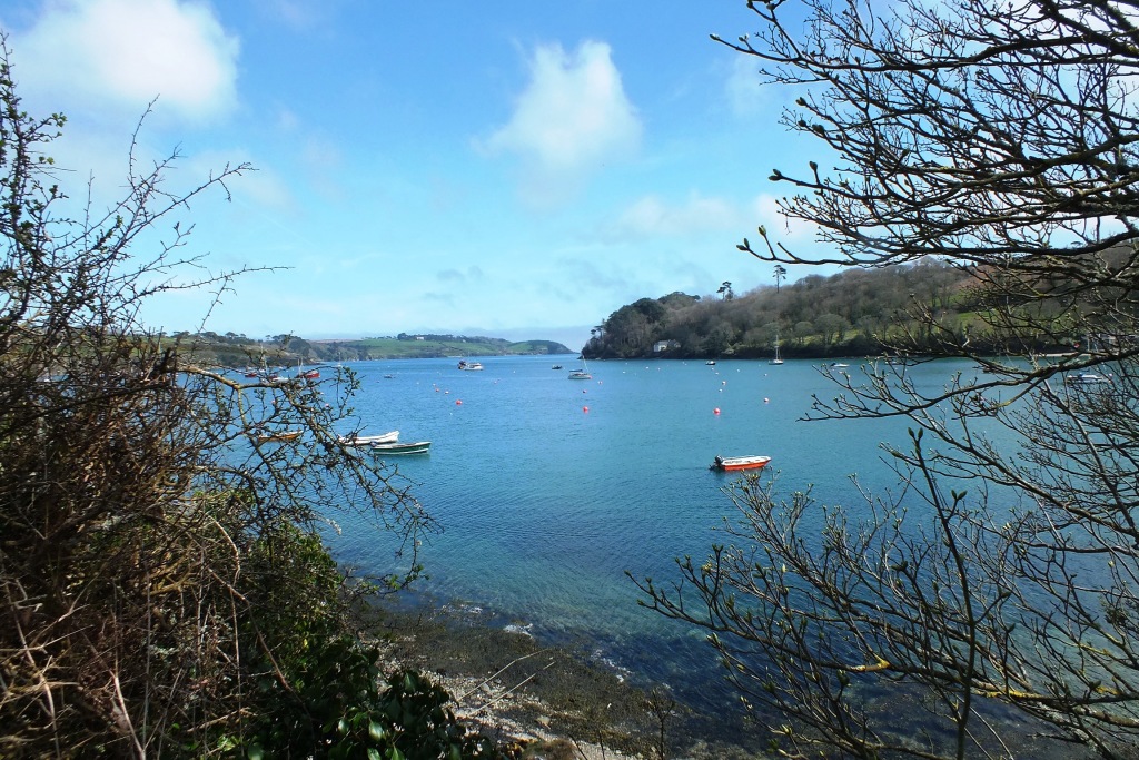
Finding the creek though was magic. Especially as there were several white egrets feeding there. Of course as soon as I appeared with camera in hand, they flew away. But I enjoyed a short walk alongside the water with its tantalisingly flashes of blue and green appearing to me between the trees. I could have continued around the headland back to Helford, but as I had left the OH on a particularly lovely granite bench at the top of the track I had to head back the way I had come.
Returning to the village on a higher level
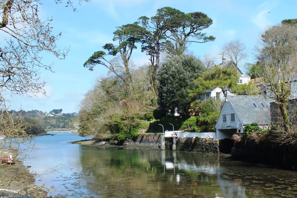
Back to the other side of the river we spent a pleasant hour or two at the Ferryboat Inn, supping ginger beer with ice and lime slices and watching hardy children play in the water and the fog rolling in from the south. An agreeable way to spend the afternoon.
If you enjoy a walk, long or short, then have a look at Jo’s site where you are welcome to join in. And I am sure she will forgive me using a boat on part of this walk as I know Jo is extremely partial to boats and water 🙂
Apparently this is on 30 March, so make sure you get outdoors on Monday 🙂
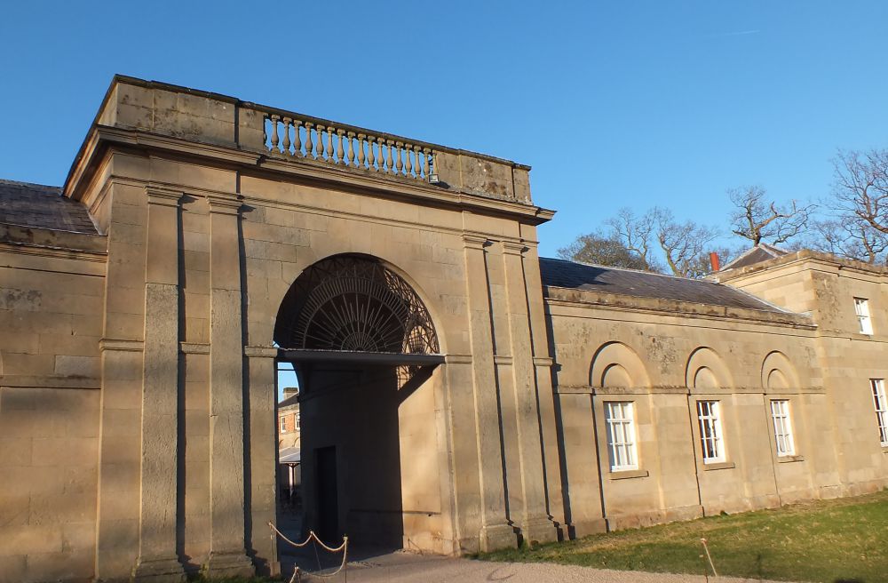
Attingham Park is a popular place to visit as it is very close to Shrewsbury. Famous for snowdrops and the deer park, we popped in for for a brisk walk in the early spring sun a couple of weeks ago.
Through the stable yard
Carpet of snowdrops
Snowdrops in silk
First stop, the walled garden. Work-in-progress as they have only recently begun to renovate this area. The aim is to re-create a productive kitchen garden with organic fruit and vegetables. It is a lovely sheltered spot to sit and bask in the sun.
Manly is named after the Aboriginal people first encountered on the shores of Port Jackson in 1788. Due to its remoteness from Sydney it was not developed by Europeans until the mid-nineteenth century when a ferry service was introduced. Over the subsequent years Manly has undergone countless changes in its environment. Fortunately there are many fascinating buildings and parks that have been retained and the Heritage trails have been created to take visitors from the harbour beaches into the centre to appreciate Manly’s history.
I started on this trail from the East Esplanade on a very hot day in November. Under a large Moreton Bay fig tree is an interesting plaque that informs you about the first inhabitants of the Manly area who were the Aborigines known as the Kayimai. They lived as hunter-gatherers, roaming according to the seasonal availability of food and trading with other clans. They moved around, making shelter as needed from branches and fronds or using the many sandstone caves in the area.
Manly Cove Launch Club
Sailing and Rowing Club
Aboriginal Art
Following the path around the corner you find the Manly Cove Launch Club, established in 1937. Next to it stands the heritage-listed Manly Rowing and Sailing Club Boatshed. Established in 1875, this was one of the earliest waterside clubs in NSW. Carry on up the steps and right on East Esplanade to the corner of Stuart Street. Walk up Stuart Street to the junction with Addison Road, the second road to your right.
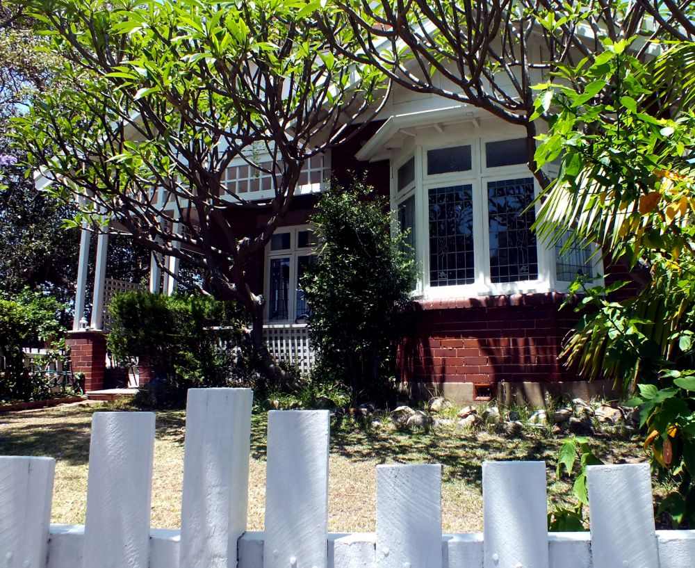
Addison Road Architecture
The road has been planted with an avenue of Norfolk Island Pines and mixed with Port Jackson Fig trees (smaller than the Moreton Bay fig) and was first planted in 1882. It provided the most welcoming shade on this hot day as I wandered down the road peering over fences to look at the homes.
Here are some excellent examples of different styles and periods of architecture. There are Italianate, Victorian Villa, Federation, Interwar Spanish Mission, Old English, Californian Bungalow, Post-war International, Late Twentieth Century, and Post-modern architectural styles! I’m not expert enough to be able to identify them, but I do know that there are several very interesting features that I admire.
Could this be an example of Post-war International?
Federation Style, maybe?
At the end of Addison is a path onto Manly Point ‘Peace Park’, an area now a Little Penguin Critical Habitat. A plaque close by reads:
“World peace begins in the hearts and minds of each individual – may we each seek harmony and peace in our daily lives. “
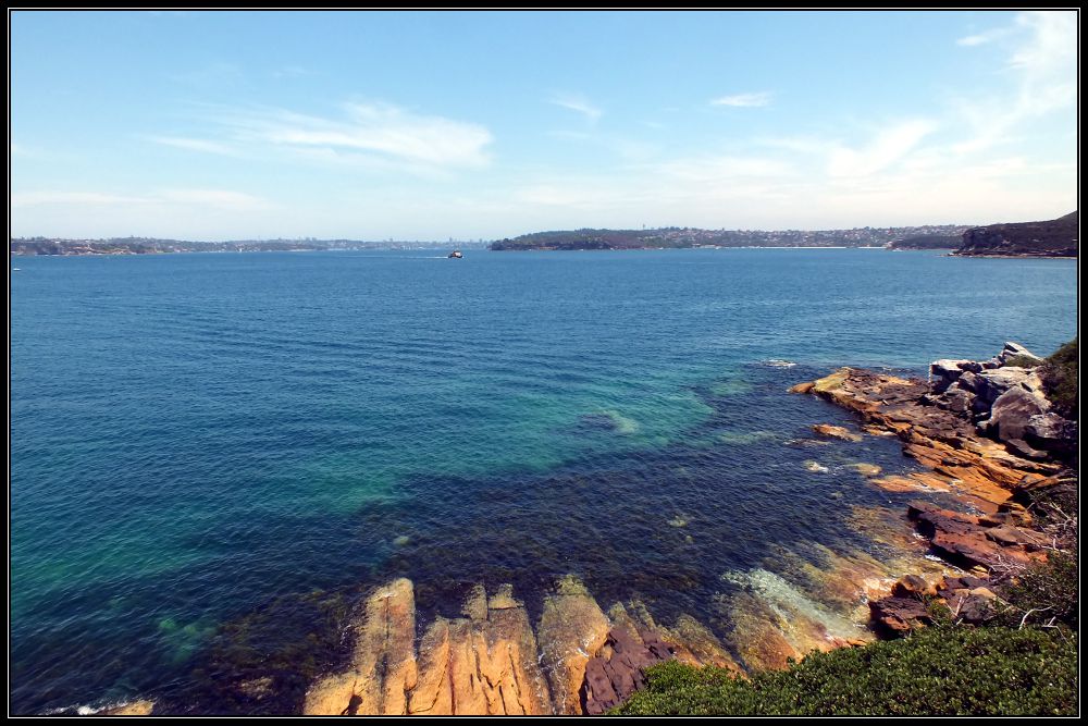
A couple of metal benches provide a resting place with a view over to the Quarantine Station and across the bay to Middle and South Head and where I sat and watched the Manly ferries pass by. Even if you are not interested in architecture it is still worth walking to the end of this road for the views.
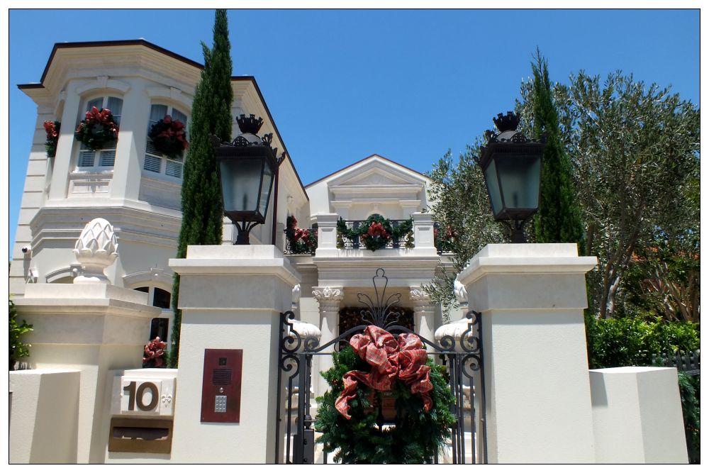
Retracing my steps I passed this imposing white building which was dressed for Christmas with beautifully designer wreaths and ribbons.
The grey and white decoration on this house (California Bungalow?) is perfectly framed by this wonderful gum tree with its peeling grey bark revealing a chalk-white trunk. Even the white lilies match. And just look at that fretwork above the windows!
And this one has interesting gables and windows. Lots of straight lines going on here.
I’d love to see inside some of these houses.
Returning to Stuart Street I turned right, then right again into Craig Avenue for Little Manly Beach. Here I walked along the beach to the Kiosk where I could get a much-needed drink, and decide where I went from here. My intention was to continue to Little Manly Point and follow the trail around Spring Cove to Collins Beach and possibly visit the Old Quarantine Station, but given the soaring temperature and the fact that storm clouds were fast appearing on the horizon, I decided to cut across Marshall Street (this area of Manly reminds me of San Francisco with all the steep hills).
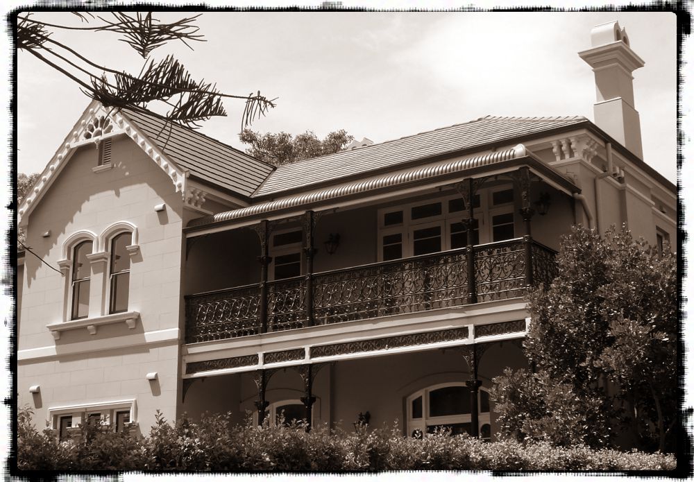
Observe the chimney pots on this house on Marshall Street and the lovely 3D bargeboard on the gable end. Not to mention that wonderfully scrolled wrought-iron balcony and the arched windows.
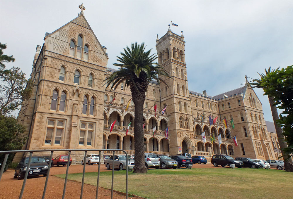
I cut through the grounds of St Patrick’s (the International College of Management, Sydney is now located in the former St Patrick’s Seminary)and down several sets of steps which brought me out onto College Street.
The ICMS building – formerly St Patrick’s Seminary
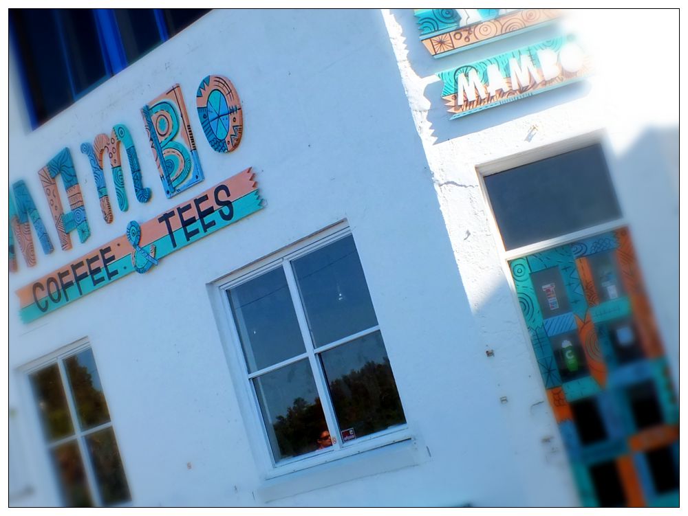
From there it was an easy stroll down Bower Lane to Marine Parade near the swimming pool and Mambo Coffee shop and make my way back to the esplanade. Just before the storm broke!
Mambo
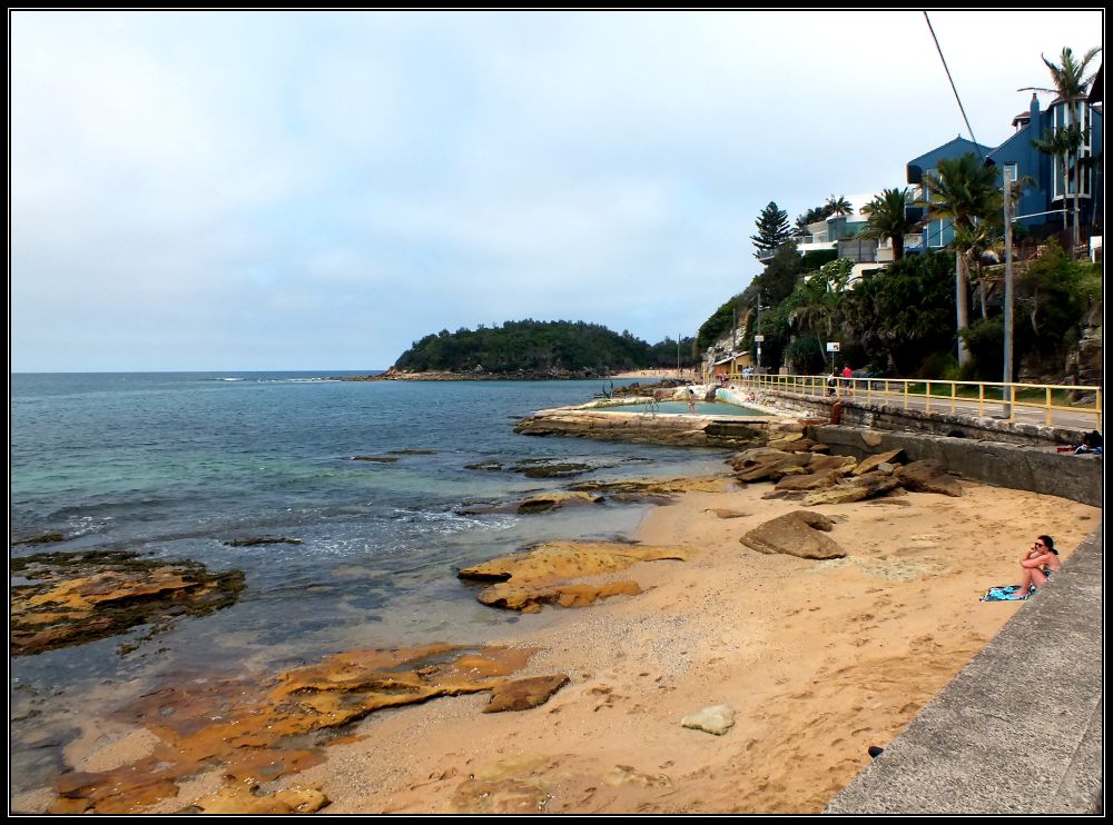
This blue house (below right) overlooking Cabbage Tree Bay and in spitting distance of Shelly Beach is my dream house. Location, location, location!!
Marine ParadeA better view
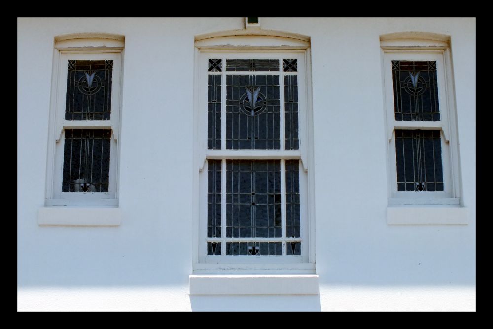
I noticed some very interesting windows along this route:
Leaded windows with stained glass
Exquisite leaded windows
Stained Glass
More leaded windows
When walking an historical trail like this one it is important to pay attention to the details you see along the way. That might be a picket-fence post, a barge-board, a colourful tile, an interestingly shaped window, or some stained glass or gable ends.
Picket Fence
Decorative Gable end
Interesting shape
Gorgeous tiled stairs
Lovely balcony
Window design
Balcony
Federation Style?
Scrolled Bargeboard
…and maybe there are some Australians (or architects) out there who can help me to identify the different styles.
Following a thread posted on my visit to Stonehenge I noticed that I had commented on my Avebury post that I still had to have a look at a local stone circle in Shropshire: Mitchell’s Fold Stones. That comment was made in March 2014.
Yes that is snow on the lens…
So on Saturday, in bright sunshine I decided to take the shortish drive (25 miles) to find these stones. As we turned off the road and approached White Grit (Powys) the covering of snow on the lane alerted me to the fact that maybe this was not such a good idea.
I need a vehicle like this one!
Continuing up the lane to the car park with the ice/skid light illuminating on my dashboard I hoped that I would be able to turn around at the end. Reversing down this track was not really an option. The sun was still shining, though there was an ominous black cloud in my rear mirror.
As with many prehistoric sites Mitchell’s Fold is subject of legend. It is said that a fairy gave a magic cow in times of famine which produced an endless supply of milk. An evil witch tried to milk her into a sieve, and realising the trick the cow disappeared. The witch was turned into a stone and a circle of stones was built to ensure she could not escape.
The stone circle is not too far from the parking area, but the temperature was somewhere around 2°C and the wind was raw. The landscape (that which was still visible) looked amazing. Wrapping up in scarves and gloves and hiking boots we headed up towards the stones, which were sadly hidden in the blizzard that then hit us!
I tried – honest I did, but I can’t say that this was my best photographic venture despite risking frostbite.
Oh, well, I will try again in the summer – this vista is well-worth exploring, stones or no stones! And there are barrows and cairns in the area too.
(This stone circle was constructed in the Bronze Age, over 3,000 years ago, using dolerite stones from Stapeley Hill. Today there are 15 stones arranged in a rough circle, but there may have been as many as 30).
If you enjoy a walk, long or short, then have a look at Jo’s site where you are welcome to join in.